Another altered ride report, another explanation.
This ride, in its original state, was a "tracking the tracks" ride down US 51, a grand old road, from Arcola to Hammond and then back up to Tangipohoa because I took a different route back to base camp from "51". This one cuts off Hammond because it became too specialized and confusing. I'll concentrate on the smaller towns in this version.
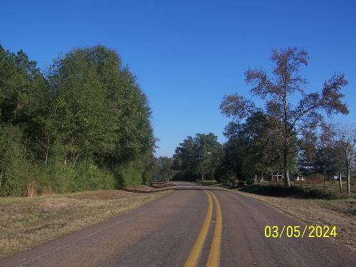
In 2006 and 2009, I'd done long rides up from Folsom, La. north and then down the rails along old US 51 and the route of the City of New Orleans passenger train on the Illinois Central line. The road, pictured below, is not the route up there, but similar and a good example of what you will find in the northern "Florida Parishes". That term is a historical one. I'll leave the pictures from the most resent ride on 51 as I meld the old pictures with the new ones and those Virgil, an adopted native of the area, has donated to the cause.


If you are reading this, it is not the finished product but
a chance for Virgil to look it over and fine tune anything
he has contributed. Or it may be finished at this point?
Obvious pictures will not be labeled. No one reads them anyway.
Horses in a field.

If I know nothing about a shot, I will not make something up.
The horses' names are Sue and Mary.
Jefferson Davis and his wife were married here last week.

Sorry, I lost the coordinates of Booty Rd. Please stop the requests.


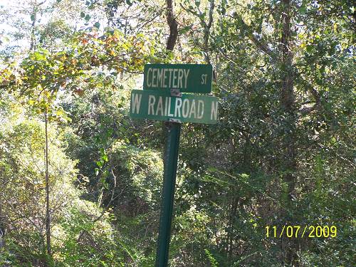
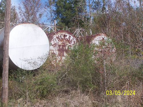
That road brings you to Chatawa, Mississippi.


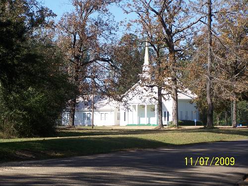
St. Mary's is located there. Virgil, check out the water tower.
In this version of the write you will see me talking to Virgil.
This is a draft and that's the easiest way I can call attention
to questions and points of interest I need to discuss with him.
St. Mary's may be a nunnery or seminary or both. As many
times as I've been to Chatawa, for obvious reasons, I should know.
It is a gorgeous place.


The old house had fallen into disrepair. I think the last owner may be gone.
I was once in contact with a Bentz family X relative. My correspondence
with him is below.

Things had changed in 4 years. I wonder about "now".
The sign was gone.

An old correspondence with the X.:
The grandparents were Bentz's and the town was Chatawa, just outside of Osyka. They still had the old wood burning range in the kitchen and an upright piano in the living room. This was during my younger, foolish years.
(The next paragraph is a little confusing)
How many times have I been up to that place? My ex-wife's grandparents lived near Osyka and ran an old-time service station/grocery store during the "olden days". I sent her a link to the website so she could check it out and asked her to contribute anything she could remember.
One of the computer map programs I use is Delorme' Street Atlas. It has an interesting map feature that is a help when locating undocumented historical areas. It shows a little cross at every cemetery. The area you have been poking around lately has tons of them. There is another hot spot that I want to check out that is NE of Bassfield which is near Hattiesburg. The place is covered in them.
(That is true of most of rural Mississippi)
Here's you piece of little known Mississippi history for today:
During the Civil War, Jones County (Laurel) tried to succeed from the Confederacy. While it is true that there were few slaves there (the place was too poor), the main reason was that various outlaw bands, deserters, and other criminals had moved into the area and taken it over. They called it the Free State of Jones.
Below is the Tangipahoa River which skirts the "Chatawa Hill"
on its western side.

Again.

The bridge is in the background.

The Chatawa post office is too the right down that road you see
across the tracks. The limestone may have been contributed by
the railroad. These old pictures continuously boil up new revelations.

I have chosen to follow the rails south from Chatawa on this
one. Including all the Mississippi towns above that I did in the
previous writes would make this page too long and really
put you to sleep. As mentioned, Hammond is now on a separate
page where you can read it or not. Start it off in a high state
of interested, because if not a rail head, you may sink.

Below is the artesian well mentioned somewhere. It is near the sand
pit where the man is buried under the sand rock, mentioned
below, next to somewhere.

The track side "road" was tempting.

From a reader regarding the mystery tub there.
"Regarding your write up on Chatawa, I have lived here all of my adult life. My family has been here for 4 generations before me. The last pics of Kramer (the location of the mysterious "tub" is my sisters place, the sand rock deal (pictured in the old write) was an old BBQ pit. The house was remodeled and is lived in. You may have missed the artesian well at the foot of the hill by the tub. It was a man-made pond that had the well piped into it. All that remains is a pipe about 6 ft high with flowing water. You mentioned old grave sites, yes there are many, some with only sand rocks as markers, I know where most of them are. As far as the Chatawa monster (also in the old write), my grandfather passed when I was 9 back in 1979. The story he told us was that an old carnival train derailed, all the animals escaped into the woods and were never caught. Maybe a few wild monkeys, and all, started up the rumors until they died out. When you were at the post office at “the well”, up that drive way by the metal gate was an old gravel pit they got dirt from while building the railroad. A huge sand rock came out of the hill and landed on a man. The rock was about 12’ high and 15’ long and too big too move so the man was left there in that grave. Stories mention that at times you can see a white figure on top of the rock. It’s not that spooky during the day but I would challenge you if you’re ever able to go there at night and walk the curvy road to do it. I once walked that road at night but I was a teenager going to see a girl so I had some motivation to get through the road".
The next town south is Osyka, MS.


Kentwood, is the next stop. The Fleur de Lis on the town sign is a mystery.
The classy pink part of the sign is well known.
At about this point, Virgil starts hamming in.
 '
'
Hopefully, 11/07/09 was a Sunday in Kentwood.

Seeing the fake stone siding dates these buildings to the
point they became a POI. They were near the tracks in
south Kentwood.

Below is the old freight platform at the location of the
Kentwood depot. (that statement would prove untrue)
It is the foundation for the depot.

Virgil, let me know how I should credit this picture or if that's required.

Below is from the old ride. Check it out. What I am calling
the freight platform was the foundation for the depot. The
building has been removed from it. What an Epiphany!!!!
If you are not excited about this discovery, maybe you should just
get off the bus, Gus. This was an Indiana Jones moment for me.
Yea, the whip came down hard on this one.
OK, maybe I'm a bit zealous. I make no excuses.
The green cutouts are from the old write. You can see
how my writing has improved. (now there's dry humor
for you dry humor appreciators).

I hadn't seen the bend yet. if I take a picture it gets
published. During the ride I took it for a reason. I may
forget the reason and remember later. The reason may
have been important.

"Retracktion", more dry humor?
Look at the ramp. They are the same. The rails curve
around it just as in the old picture. Spacing between the
rails and ramp is identical. I'm soaking this one for
all it's got. I dare you to find one more instance of this knowledge.

The sidetrack to the depot starts on the south side next
to the "Side Track" business.

Below was my false assumption. I was looking at the depot.
During this reread, I have, maybe, harped on this too much.

Virgil sent this from the newspaper.
See attached link to a story on our website:
"The Kentwood depot is long, long gone".
Me: Not completely.
The old picture of the depot came from there.
Below I have quoted the article piecemeal from the newspaper.
I live for etiquette and quoting correctness, so if a problem, let me know, V.
Local Lore & Legend: Down at the Depot...
by Irene Morris
2 days 8 hrs ago | 119 views | 0 0 comments | 0 0 recommendations | email to a friend | print
Me: I see that it can be printed, so I guess it's all right to print it here, eh?
Remember, this is a piecemeal copy. Parts were left out and parts were changed to flow better with what I'm getting at. If you want the real thing, go to it before I lose patience.
The Kentwood Depot, near the cotton gin. Lewiston and St. Helena folks probably brought in the last cotton to be ginned into bales in Kentwood. Lewiston and St. Helena folks probably brought in the last cotton to be ginned into bales in Kentwood. VERNON SIMS’ car is parked at the south end of the Kentwood depot in this 1947 picture. It points across the railroad tracks to bales of cotton waiting to be shipped.
The cotton gin was behind Rogers Grocery Company, across from today’s Co-op store, on the east side of the railroad double tracks.
[Notice the] tall row of telegraph poles following the railroad.
Loads of cotton entered from “Second Street” and lined up to wait their turn under a roof covered lane up to the gin, giving shade and shielding from rain.
The "hard railroad bricks” from the depot platform have made a patio out east of the river after the depot was torn down in 19?? Photo from the Irene Morris Collection.
Me: "Hard railroad bricks" will be seen later.
To read the complete article go to: Tangilena.com -
Next, I crossed the tracks south of Kentwood and found this at a place
called Kirksville. There was nothing more there.


Below Kirksville is Camp Moore.


Tangipahoa, La.
I think the shot below was at Tangipahoa, but maybe it
was back at Camp Moore. Anyway, I believed I was taking
a shot of the location of the depot, whichever, wherever.


Here's the Tangipahoa Post Office. There is nothing special
about it besides locating the mystery across and up the street.
Whoa, there may be post office employees in the audience that
may find this post office mention the most exciting part of this ride.
Claiborne and Railroad is the corner where it may be visited for
your Tangipahoa cancellation stamp.


Below is the mystery. It is located just north of and across the
street from the Post Office. I also know people that collect
zip codes and the number is legible in the one above. I was
going to seen out a big howdy to them but thought better
since one is a CIA agent.
Now, the mystery. It is between the street and next to the
rails. Virgil, if you don't know, please find out. This is
a major find. I'm thinking it was like the depot at Kentwood,
leveled but had a substantial raised foundation. It was
massive. But maybe not. An industry? It doesn't take an
Indiana Jones to see this one.


I see in the distance a historical marker I missed. Hum?
Anyway, you can see how substantial the foundation is.


Virgil added this about the cement:
I'll have to check on that concrete foundation. Somewhere I've
seen pics of a substantial depot at Tangipahoa in days gone by.
This may be the foundation for it.
seen pics of a substantial depot at Tangipahoa in days gone by.
This may be the foundation for it.
Virgil and I, on another occasion, were discussing Spur Stations.
I'm guessing the "i" fell off or was not available. The sign says the
DJ is BO. I wonder if that's our President BO? If so, this fills in a
missing blank in his past. He even supplied an ATM to pay him.
Evidently he was taxing the working man even then. I'm holding
my powder to keep this ride from getting ugly.

Evidently a Spur Station was a central landmark as two
businesses include it in their names. If doing nothing on
Thursday night, you might consider Tangipahoa as a destination.
If tiring of the Karaoke, you can stroll across the street and
check out the mystery concrete. Please take caution when
crossing the tracks. Hopefully, BO will be returning to his
old job after the election. He could do a little rapping if he
had a teleprompter.

Below is Virgil's past comment on Spur Stations:
"The fuel station/distributorship brings to mind the old Spur gas stations. I'm also interested in old filling/service stations and a couple years ago did some internet research on them. Apparently, most places were right by a railroad spur where a tank car or 2 could be spotted and drained into the station's tanks. Hence the "Spur" name. They also carried bulk oil, kerosene, etc".
This is Virgil's latest Spur comment:
Spur Station: I'm pretty sure it was a Spur filling station at one time. Basically just a bar now. Whether or not it had a rail siding to it, no idea. Doesn't look like it from what I recall of the area. Such sidings usually left "sign" of being there, as long as someone doesn't bulldoze the evidence away.
Below Tangipahoa is Fluker. The name is interesting. Was
being here just a fluke?

Once famous for more, it is now famous as a sign location.
I included this shot because there are signagers among us.

This is the Kent property. Virgil, do you have any info on this?
Sorry, I didn't mean to yell.
Virgil replied with a bunch of info.
Fluker: I believe Fluker was settled by descendants of Amos Kent, founder of Kentwood. All those huge homes are owned by Kent progeny. That business there is also owned by the Kent family. Fluker had a depot at one time. I believe it's been moved to Amite, on private property but I need to confirm that. The deceased owner of the property told me he had the old Fluker depot, before he passed away. But I've seen the depot listed on "surviving depot lists" as the Arcola depot. Was the old man confused and mistaken? No way to ask him now. There is one other local authority I can check with. I'll let you know about that. (And yes, I have pix, not good ones, of that depot; it's in a residential area of Amite and you have to know where to look). As an aside, and not really relevant to the ride anyway, the deceased was a partner in a gravel operation that bought out the Spence gravel pits after Spence's death; he gave me some info on that as well. See how turning one stone sometimes reveals more than you expect?
Me: oh yes!!
Me: oh yes!!

South of Kent.
Virgil's words:
The first part of your ride, To Arcola:
You have the Purina plant at Arcola. A few miles north of that was, I believe, one of Paulsen Spences' gravel pits (not the famous one below Amite). Don't know who owns it now, but I'm pretty sure the switch and rails are no longer there. Might be a locked gate or something. That's where your map shows "missed opportunity".
That map below:

Missed Opportunity above Arcola (gravel pit) I believe this was one of Spence's gravel pits purchased by the deceased man referenced under Fluker.

Now I'm going back to the original ride down from Arcola to Hammond.
I will add in Virgil's and my additions as they come along.
At US 51, a Canadian National RR work truck sat by the crossing.
My excitement meter was redlining. I sensed that the exploration
would be successful. I knew I was in the groove and the trip down
US 51 would be a fruitful one.
Below are homes in the Arcola area which I missed on the
most recent ride, or I did not feel comfortable taking them
this time around, but yet I feel OK posting them.

This one I had noted as having a "German style" very similar
to what you find around Crowley, La.

The work truck and sitting crew sat and continued sitting.

I really don't know what this rail side industry was.
Virgil said it was a Purina plant. I thought it was a
hidden NASA facility, one that our president didn't
discard in his decision to put our space program in
Russian hands.

I am sure these are rocket fuel carrying cars. I know the
non-believers' corrections are forthcoming.

My next comment was a flat joke. It has been discarded.
Whatever, I want one.

Virgil continues:
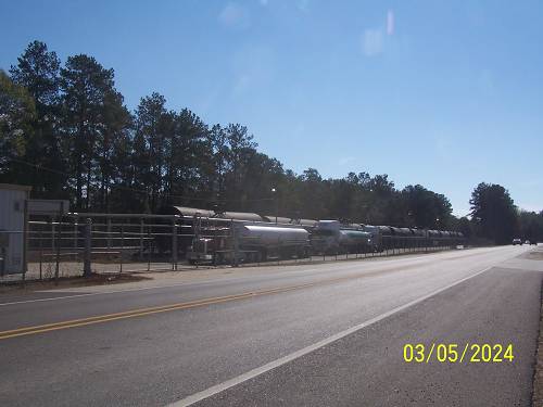
Just south of the Purina plant at Arcola, you saw the siding with all the tank cars. That's the Smitty's Supply siding. Across the road is the huge growing plant of Smitty's Supply. This is actually a booming business; they buy lubricants in bulk and repackage them. Google "Smitty's Supply". It's a local homegrown business, and growing all the time (they are currently expanding and will probably hire more local people).
The Smitty's siding is relatively new, only a few years old. Before that, the railroad would park the tank cars, obviously fewer in number, at the siding in Amite near the Episcopal Church you feature further down. Oils were drained into trucks and trucked up the road to Smittys. It's much more efficient now. (They may have parked the tank cars at other local sidings as well. But I remember seeing the tank cars parked there sometimes before the new Smitty's siding was built)
Me: Virgil has found pictures of that siding in Amite. They are very old pictures.
Back to the original write:
Below you can see La.10 intersecting with US 51
at Arcola. "Crew" represents the CNRR work car
I saw there. Later, on the return trip, I'd go north.
One of the missions of this ride was to find sand
and gravel pits. My maps are old and the roads
may no longer exist, but the holes in the ground,
now mostly filled with water, do. I missed this one.
Going south from Arcola, I hoped to find the lost
gravel operations that Spencer operated. I think I
did later on. (nope) The abundance of railroad ties surely
supported where he kept his railroad collection.
That is one of the carrots I'm hanging before you.
Well, it wasn't Spencer's place. Virgil's guiding
explanations are now your new carrot.
Remember, from above, that Virgil feels that "Missed
Opportunity" was one of Spencer's pits.
South of Arcola, the next place I'd investigate was
Roseland. There was stuff at Roseland. Be careful
of the man dressed in black riding a mufflerless
high powered four wheeler. Don't stop him because
he doesn't know anything. Just let him be.

Before we go further in Roseland, here's Virgil:
Roseland: Your picture of the northern end of
Roseland, with the gate, I believe was a pulpwood
loading yard some years back. To the best of my
knowledge there was not a gravel pit there,
but it's possible.
Me: Below is the picture of the place called "Gate".
It was not ''after hours" so I didn't feel comfortable calling
Mike or Willie.
Now, the question, "Where did that gate come from?" Was
it a rail barrier gate?
You did see the spur at the "Gate"? This had no doubt been
a sand and gravel pit with rail access.
Evidently not, thanks to Virgil's ID.

This is looking deeper, but not deep enough. I should have
hopped that gate and looked for rails. This I count as another
missed opportunity. Added: Yes, it had a spur.


South of the gate, between the rails and the road, was this (above).
It was here the last time I came by a couple of years back.
Its size has not diminished. Evidently, the number of rail enthusiast
is small or non existent around here.
If I'd had a truck I would have brought the whole pile home.

This picture shows that there was a piece of tar paper
on the pile. You may think that useless information. It
isn't. Tar paper is often used as an environmental barrier
where liquids can be spilled. Where this piece came from
remains a mystery.

I use these shots for mile markers and possible restroom
stops if the doors are open. Open doors remain illusive.

Looking at the map, this is the collection of "lakes" that
I call "Lake Land". I had to check out every gravel pit
I could find.

I rode all the way over there.

Heading back to US 51, I traveled south to the Roseland city limits.

See that culvert above? There's a road that led to what
I found below. I would bet this is a much used sidetrack
where the crews change and it is also a "passing siding",
explained later by Virgil.

Beyond it, I could see this. That is a house foundation with steps.
Had it been a depot? Notice that there was a spur here (on the map
below). I should have jumped the tracks and checked the area
out. Again, this was a missed opportunity, but a great planning ride
for next time.
Notice that there was a spur at the "Gate", and at "City Limits/Sidetrack".
Virgil continues:
You probably saw what looked like abandoned big industry in Roseland. Most of these small towns along the tracks had industries, such as box factories, that eventually petered out. Roseland is no exception. I'll have to do some digging to see what else was in Roseland.
Me: Remember that Virgil's insertions are from emails and not finely tuned prose, such as mine.
From time to time incomplete sentences expedited the flow of information. To expedite this writing, which is eating my lunch, I will quote directly, in most cases, directly from his email notes. So, grammar police, go suck an egg.
Virgil continues:
South of Roseland, near the city limits, there was a side track (right) that served a defunct lumber yard. I believe it was the Conway Guiteau Lumber Co., which was a pretty large installation. (Guiteau also has a lumber yard, still going I believe, between Arcola and Fluker but it does not have a rail siding, and is on the west side of Hwy 51)
Me: Below is the house foundation I mentioned way up there.

This was really a big lumber yard.

From the Lake Land road I had seen this. I think what
I was seeing was part of this lumber company or its predecessor.
Mike's and Willie's numbers were not included. (from the "Gate")

I'll post that map one more time. Without a doubt, they
were the same. "City Limits/Sidetrack" marks the spot.
Being in touch with where you are keeps you moving on.
It you get out of sync, you just spin. I could list a number
of spinning experiences, but let's move on for goodness sake.
Virgil updating me:
Just south of where the defunct lumber company was, you should have passed a junction, with a side road going east. I don't see it on your maps but there's a huge metal building there. (How'd you miss that - metal building?)
Me: Mais duh, it wasn't on my map.
Me again: I guess with all this help I should accept a bit of chastisement. In my defense, possibly, also, I was behind this house being moved down 51. Big houses on your road are an attention robber.
V continues:
It's the old Amite Foundry, now run by an Australian company, Bradken. The foundry went bust years ago, but in recent years Bradken got it going again. Some of the steel from the 9/11 twin towers was melted down here and recycled into steel that went into one of the Navy's newest warships. Usually in the area you can smell the hot metal, if the wind is right. There used to be a rail siding for it but no more. I believe there is what looks like a "passing siding" in the immediate area. A passing siding, if I'm not mistaken, is where one train parks while another with priority goes by. I used to see lots of rail cars "parked" along there.
Here's your boat, V.

USS New York, made from the World Trade Center.
Quoted from a forwarded E-mail message:
"It was built with 24 tons of scrap steel from the World Trade Center".
"It is the fifth in a new class of warship - designed for missions that include special operations against terrorists. It will carry a crew of 360 sailors and 700 combat-ready Marines to be delivered ashore by helicopters and assault craft".
"Steel from the World Trade Center was melted down in a foundry in Amite, LA to cast the ship's bow section. When it was poured into the molds on Sept 9, 2003, 'those big rough steelworkers treated it with total reverence,' recalled Navy Capt. Kevin Wensing, who was there. 'It was a spiritual moment for everybody there".
"Junior Chavers, foundry operations manager, said that when the trade center steel first arrived, he touched it with his hand and the 'hair on my neck stood up.' 'It had a big meaning to it for all of us,' he said. 'They knocked us down. They can't keep us down. We're going to be back".
"The ship's motto? 'Never Forget'"
Me: Mr. Chavers understands that we are still in a war against Moslem terrorist and he is proud to be in that fight. Americans, or some loosely self proclaimed Americans, seem to forget what happened a short while back and want change, change, change. Better think twice about what "change" encompasses. What good are all those "give me" programs the Democrats offer if they are dusted with Moslem terrorist supplied radiation? Better cover your butts before you stick your head in the refrigerator looking for some more free pie.
On to Amite...
First, I'd tried to find Virgil's office.
"Where I work is right across the street from the police station. . Previous owners of the two story had a life size pic of Elvis in the 2nd floor window. I think the new tenants took it down. Pity. I think it lent an air of class".
Me: Some folks you really don't know from email exchanges, LOL.
More Virgil comments to follow. He sent about 40 pictures and I already had about 40 from a previous write he'd contributed. So, here goes about 75 pictures, including mine, of Amite, past and present. This will be somewhat a mess with all those pictures and commentary.
Oh, the numbers don't add up? Where have we seen that out of Washington?
Virgil always has interesting tidbits. Let's start slowly with one on Amite:
By the way, Amite has 3 murals. One is of a huge steam locomotive pulling up to the depot, one showing an oyster boat (b/c of Amite's Oyster Festival) and one representing the old logging days (albeit with oxen pulling a log wagon rather than a logging railroad).
Me: Unbelievably, I don't have that shot, V.
Virgil: Amite murals: I'll have to find my shots of those murals and send to you.
Amite's Oyster Festival has more to do with the fact that there was a huge oyster processing plant in Amite, than any closeness to oyster beds. I think the nearest oyster beds are down toward Buras. La. (far below New Orleans)
More on oysters:
Here's something you might get a laugh out of. Some years back, a local bank had a calendar printed up with pictures of Louisiana. One month's featured photo showed a commercial oyster boat with a caption about it traveling up the river to Amite to unload its catch. I got a huge laugh out of that one. The Tangipahoa River, though deep in places, is just barely navigable by canoe. The oysters were brought many miles by truck over Louisiana highways to Amite for processing, NOT by boat. I guess the caption writer wasn't familiar with the landscape or the facts. Still, it was a howler.
Here are some previously donated shots of Amite.
The one below will come into play when the water works
is featured. Virgil likes old SERVICE stations. So do I.

Below is what you get today. The water tower is now gone, also.
By the way, that water tower design is classic and was very common.

I've decided to do the waterworks pictures now since
the water tower was just mentioned.
Here's V's explanation:
Attached is a picture of the water tank, torn down a couple of years ago. I took the picture in 2006. The red garage building used to be part of Brumfield Ford, which was across the street. Brumfield Ford is now the location of Carretta's Mexican Restaurant.
Me: I just got hungry.
Looking at the pictures below, I'm turning this over to Virgil:
The white/gray building next to the red building is the Amite Community Center.
The next pictures are of the old municipal waterworks building, which is right behind the Community Center. Those pictures were taken in 2009 after the water tank was dismantled. The front of the waterworks building faces the railroad tracks. One picture is an enlargement of the cornerstone, with construction date and names of prominent citizens. Those names live on today in descendants all over town.
This little brick building is a real gem. I'd love to see the inside of it but I suspect the old machinery, and pumps and valves, are long gone.
Somewhere I have seen an old photo of this building, sometime in the late 1920's, with workers manning a huge valve in front of it and spraying a huge stream of water across the railroad tracks. If I ever find that piture I'll make a copy and send you one.
On one picture you can see portions of the chain link fence in the back, and the berm. The foundations of the water tank were inside that berm. If the water tank had not been dismantled, it would be in the rear of the waterworks building.
OK, this is a redo of the explanation. Since I'm brain dead, I'm going to let you figure it out. And I'm removing all labels so I will not influence your decisions.
ME: I got the labeling all wrong and he wrote back with corrections so I took off the labels and will let you labeling them yourself.
Amite Waterworks: The shot of the huge red brick building with the water tank in back is not the waterworks, it was the body shop for the now defunct Ford dealership. It's on Chestnut St, across the street from La Carretta mexican restaurant.
The building I referred to, is the Waterworks building, around the corner from the body shop on SW Central (parallels the railroad, you went down this street to Factory Street and saw the ruins of Gullett Gin Co.)
The Waterworks building has a smaller brick building behind it. Behind that was the berm (raised earth dike, often used around chemical or oil tanks), which was surrounded by the chain link fence. Probably hard to see in my photos. The water tank stood inside the berm. Nothing there but the old leg foundations now. Hope that clarifies it, sorry if my original text was not clear.
Me: I'm sure it was clear, just not to a dead head.
The shots are below.


More historic Amite:
From Virgil:
A wall side "Coke" mural has recently been painted on
a refurbished building downtown. Below: Coke signs in the
past.
From V:
Black & white pic with Coke sign: Not the Coke sign I was referring to. This is an old shot from 1940's. I must have sent it to you, or you pulled it from our website?
Me:?
Me:?
Me: In the following, I may have the comments and buildings.
I did.

Virgil:
I'm sure you noticed that the downtown area of Amite is starting to
perk up a little. It used to be nothing but boarded-up, empty
storefronts and fleeting junk shops.
Here are a couple of shots of revitalized
Amite downtown buildings.
The current tenant is opening a new business, Amite Mercantile Co. Not sure what kind of business but his storefront sign is very, very retro. Looks like something from a century ago.
This building formerly housed the local sporting goods establishment, before Wal Mart and Academy put him out of business.
The new owners or tenants have remodeled the building; I have no idea what business is opening up in there. The painted on sign on the front is quite retro. It looks like similar signage from 100 years ago and older

Notice the retro Coca Cola sign at the top of one building? (below) That was painted just recently.
Recent addition:
Virgil: Amite Mer. Co. LTD: This is the building with the Coke mural sign on the west side, referenced in second photo.
I love the retro Coca Cola sign, just wish it was easier to see. The buildings west of it, though smaller, block a good bit of the view.

The same building has that Coca Cola advertisement mural on its west side. It was done within the past couple of months but has the flavor of similar advertisements done on the side of buildings 1900 - 1960, as the old "wall dogs" traveled the country and painted those things all over towns for whoever was paying them. I love the mural, just wish it was easier to see up close. The adjacent buildings make it hard to see except at a distance. My shot was taken almost a block awa


Virgil, is the building below in Amite? I have a horrible
feeling a building from Mississippi might have migrated
into my Amite folder. If so, it is a good example of how
Amite is getting back on her feet as this one displays
a fallen down image. Remember, 2006 was not long after
2005, the year of Katrina. Amite, though not in the direct
path, was in it.

OK, here comes the fun stuff, the Amite RR Depot and surroundings.


Virgil wrote, and sure enough he had the pictures:
Somewhere I'm pretty sure I've seen a photo of wagons lined up on the street where I now work, of course it was dirt then, ready to load cotton or something onto boxcars parked behind the depot. Folks today don't understand how important the railroad was to commerce just a few short generations ago.
Me: "Folks today" are lacking in a lot of knowledge. It is
estimated that half of the registered voters have no clue
of what is going on in Washington. Hopefully, they will
stay home as ignorance at the polls got where we are today.
If you are put off by my intermittent points of view, go
such an egg with those who were not excited about the
Kentwood Epiphany. These writes are not free. Nothing is.

{I}Finally found those old pix of the depot in Amite. Priceless!!
I took these awhile back, at a local glass/radiator shop.
Note one pic shows that there were actually 2 side tracks behind the depot!
Not sure what's being loaded but I'd guess strawberries or similar perishable produce, as they are being loaded onto refrigerator cars. Note open hatches on top, that's where they dropped ice in at an "icing platform" back in the days before mechanical reefers (reefers with mechanical refrigeration systems). At one time, Tangipahoa Parish was a huge supplier of strawberries; the IC would ship them north on long strings of reefer cars.
These photos were taken between 1910 and 1925, judging from the autos in the pix. Photographer unknown.
The glare in the sky on one photo was my camera flash reflecting off the frame glass.
PS notice the "family look" of the depot when you compare it to the pic of Kentwood depot. Railroads used those "cookie cutter" designs a lot.

The shot below were taken from the depot across US 51.
Virgil on them:
Shot taken across from depot across US 51: That's the historic Old Royal Hotel. Huey Long is supposed to have spoke to Amite citizens from its balcony once. Check our website for more info on the Royal Hotel; saving and restoring the building has been an ongoing project and source of conflict in Amite for awhile now.

I remember him saying that these two buildings had been
a restaurant. Earlier, the pink one had been a bank.

Virgil on the two buildings above:
The pink building next to the brownish brick building. Both of these were at one time Cabby's Restaurant, a favorite spot for Amite for many years. In the 1990s and early 2000's, Cabby's became a gathering spot for motorcycle riders who frequented Tangipahoa Parish on weekends. (No, not the Hells Angels… the "posers" who are white collar workers during the week and motorcyclists on the weekend LOL). Nice folks, look scary in all that black leather but they spent a lot of $$$ in Amite. Cabby's closed, the weekend warriors now head to the BBQ Station in Indpendence. (If you missed the BBQ station, you missed an old Conoco station, southwest architecture, restored into a restaurant. If you don't have pix, I'll try to get some for you.) The pink building was the original courthouse in Amite! Awfully tiny for a courthouse. They must have just tried 'em, then took 'em out back and hung 'em. No appeals. No prison sentences. (I'm kidding… I hope.)
Virgil:
The blue house, just south of the police station/old depot, houses a real estate business. It was moved there some 15 years ago. Raised hell with the "historical district" people but they couldn't do anything about it. There was nothing there but part of a siding, years ago, which ran "behind" the depot. In fact, it was the same siding that I referred to earlier, up near the Episcopal church. It extended all the way to the "grocery warehouse" south of the Ponder Hotel. Most of the rails are still there, buried in the dirt or under pavement.

Back to my ride.
Here we go.
While touring Amite I ran into two funeral processions.
The locations are marked on the map. The Amite
Police coordination of these separate events seemed
unplanned. I've heard of "Surprise Birthday Parties",
but, "Surprise Funerals", I haven't. They successfully
closed down a US Highway for 30 minutes, then
determined that Funeral 1 was not going to cross it.
Yes, I sat there and witnessed the whole grueling ordeal.

The Ponder Hotel
I think the curved edges of the building reflect an art deco style.
When in need of naming a style, I usually call on "art deco".

Virgil, Wednesday night, on the Ponder Hotel:
The Ponder Hotel, like you said, was built in 1947. Ponder family operated it. Current descendant, Lynn Ponder, has an attorney office in a corner of the building. For a while after Katrina, folks were living in the hotel. Not sure they still are. It didn't really function as a hotel, more like a "apartment complex".
Used to be a pool on the rooftop, and years ago they had dances up there.
Virgil, Thursday night, on the Ponder Hotel:
I already see one confusing comment on my last night write... about the Ponder Hotel. I wrote that it was more like an apartment complex than a hotel; I should clarify that. I meant that when folks were staying in it after Katrina, it was like an apartment building. It actually was a hotel from the late '40s to sometime in the '60s. I recall it being vacant for many years before Katrina, except the occasional businesses that rented offices on the first floor. The Ponder family maintained several offices on the first floor as part of their attorney/notary business; they are now down to just one office on the south side of the building.
Below are a few shots of US 51 which weaves through town,
unaligned and heavily lighted in an untimely sort of way .
Amite should just take down all their lights and use four way
stops. Besides the energy savings, traffic would actually move.
It works over here although the learning process was painful.


Look, there's a stop sign. I may have misspoke.

Here is a log truck making one of the 90 degree turns.

I took this shot because it locates some of the pictures that
were taken, possibly the ones below. If not, then other
pictures were taken here.

Below is the "grocery" warehouse which Virgil mentioned the rails serving it.
Below is more from V:
The old Smith-Rogers Grocery warehouse (below), south of the Ponder Hotel, had a rail siding, like I mentioned. I used to work in that building, which is owned by my former employer Britt Kennedy Signs. It has a brick vault with a heavy bank-type metal vault door inside. I understand that in the days before Winn Dixie, Canal Villere and Schwegmanns, everyone got their groceries from mom & pop grocery stores. Well, mom and pop got their groceries wholesale from Smith-Rogers and similar wholesalers. Smith-Rogers got their groceries by the boxcar or reefer carload. Winn Dixie & Schwegmanns put mom and pop, and hence Smith-Rogers, out of business.


Heading back northeast. The "Church Area" is just that,
lots of churches. Some/most, old. I've been in the Episcopalian, below.

The red brick one is Baptist. Both the Episcopal and Baptist
have distinctive, identifiable designs.

I'm not sure about this one, but I thought it was interesting.
The neighborhood is all you'd expect of a Southern small town.

Virgil on the above building.
The church-like building that you were not sure about, was actually a church at one time, I can't recall what denomination. Then someone had a restaurant in it. In recent years it was a church again. Not sure if it still is. Tenants come and go.
Me: Here is a house and building which are in the vicinity, if not mistaken.
Virgil on the building:
Below the churches, house and building: The brick building houses the local drivers license office. Right across street from Amite Post Office. Check the old metal shutters on the windows.

A nice house.

Back out near 51 is this old building which is a dentist office now,
if not mistaken.

This was an interesting commemorative plaque. Click to read.

I thought of displaying more Amite pictures, but I won't since
there is a lot more to see down the road. Virgil changed my mind.
Back to "SERVICE stations".
This was a City Service station in Amite.

Virgil:
This one is a real gem. Former Cities Service station in Amite. When I moved to Amite in 1985, this place was no longer selling gas. Over the years, various businesses have rented it. Currently it's being used by someone selling balloon bouquets, balloon-o-grams, you get the idea. It is on the corner of Hwy 51 and Chestnut St., across the street from the Catholic Church.
It is surrounded on the north and east side by the metal building of Husser Glass and Radiator.
Looks like someone took the "globe" off the top of an old style gas pump (remember those?) and mounted it in the "attic window" under the peak. Adds a touch of class, no?
This style of gas station was called "cottage-style" when it first started coming out in the 1920's as the automobile started becoming popular. The idea was that it would "blend in" with neighborhoods instead of sticking out like an ugly industrial/commercial monstrosity. No attached garage like you saw in later conventional service stations. I think some operators would have a place next to it, ramps or whatever, that a vehicle could be driven up onto for servicing (oil changes & such). Others may have added a shed or garage on to the back of theirs for vehicle servicing work.
Me:
I have seen the building design before.

I went south along the rails, seen below. I discovered a
huge mill complex south of Factory Rd.


Where Central St. ended and met Factory Rd., I saw this
slab. It was just a hint of what was to come.

I don't know anything about the factory, so I'll just display
some shots I took while riding around it.

The tracks housed modern cars.
Virgil comes to the rescue and identifies everything:
The "huge factory complex" near the south end of town is what remains of the old Gullett Gin Company. It was a major industry founded after the Civil War, employed an awful lot of Amite folk, and actually had its own railroad station on the Illinois Central. The area was called Gullett. The Gullett company manufactured cotton gins. The company actually produced anti-aircraft shell casings for the Army during WWII. Gullett Gin went out of business in the '60s, probably about the time our textile industry started moving to third world countries. The Kennedy family (of Britt Kennedy Signs) bought the property and had their sign business there for many years until a disastrous fire in 1995 leveled the place. After the fire, BK Signs moved into the Smith-Rogers building and continued the business. I started working with the Kennedys in 1988; I remember working in the old Gullett buildings and they were fascinating. I was so sorry to see them gone.
The metal building in the pictures, east of the old Gullett remains, may have been part of the Gullett company. I don't know for sure. I do know that at one time someone ran a feed and seed business out of it. I did not know the siding for it was still there. Apparently it is.


The map below notes the locations like a map should.
And, this is the office I found when I rode to the other side of
the tracks.
Virgil:
The buildings and office at the Story Road area are what's left of Clemons Bros Lumber co. Another local business that went out of business. I suspect the railroad dumped the old ties there after maintenance and replacement on the mainline. Someone will come along sooner or later and gather them up and haul them off. I believe I've heard of places that burn them for fuel, after grinding them up into chunks.

Panning around from the parking lot:


There sure were a lot of railroad ties.

They were scattered everywhere.


There was a scale and what looks like the remnants of a
weighing house.

I was at the end of Story Rd. What was the story here?
Had I found Spence's place? No.

There was another "Missed Opportunity" down Factory Rd.
Actually, it seems that when I crossed 51 and proceeded south, I
missed another one below Shiloh.

Refer to the map above as you read below.
Again, Virgil to the rescue:
Below Story Road, in the Shiloh area, your maps show two sidings. If my info is correct, both sidings were part of Paulsen Spence's famous operation. The northernmost siding is no longer there, although I believe I found part of the old roadbed one time, exploring back in there some years back. I could only go so far, the rest of it was fenced and gated, part of the Sheriff's Dept. shooting range. The southernmost siding is still there, used by the Diamond B construction co. They specialize in road construction, and that operation is designed to heat up asphalt mix and dump it into trucks to haul to road construction sites. Someone told me that behind the Diamond B area, possibly between the two sidings, there was a "railroad yard" where Spence parked all his steam engines and other rolling stock.
Spence owned more than one pit. Gravel was a big business back in the '50s when this country was pouring concrete like mad in the post WWII construction boom that turned this country into the envy of the rest of the world.
Same map below.
The next point of interest is marked "Sinclair".

It was a Sinclair Oil depot. I am sure that it's proximity
to the tracks was a factor in its location.
Virgil added:
I love that old Sinclair oil warehouse. I have some pix taken of it a few years ago, before the sign fell off.
As far as I can tell there was no sidetrack directly supplying the business, but it's quite possible that there was a siding on the mainline. They could have piped from tank cars over to the tanks. I will be using the Sinclair warehouse as inspiration for a similar track side industry on my model railroad when I get it built. I'll find the pix and send to you if you like.
The ones without the futuristic date are his.

This was so cool.
This is looking back from where I crossed the tracks.

Look at the loading dock. It looks to be for trucks. Maybe not.
I should have found the rail dock.

I watch "Pickers" on the History Channel. When I first
saw the sign I was thinking big bucks. It was too fragile having been
cooked by the sun. I didn't touch it for fear of breaking it up.

I did remove some of the grass for a better shot.

Now for Virgil's older shots:
Most of these pictures were taken in 2006.
Here's my shots of the Sinclair oil depot. At the time the sign had not fallen off yet. It's cool and will inspire a similar industry on my model railroad, albeit with a railroad siding.


I questioned the uneven dock.
His reply:
I suspect it was built that way. Maybe to facilitate loading/unloading 55 gal drums or cases of oil cans (remember those?) or whatever, from two different levels of truck? I.e., the lower deck for local good old boy's pickup trucks, the higher deck for 18 wheeler or similar cargo hauler?

Me:
I have a picture of an old Sinclair station at Elizabeth, La.
It is priceless. Speaking of, just south of the Sinclair depot
was this old store. Note the Italian name. This area is
Little Italy.

Virgil:
Here's my pic of Capace's from Feb. 2006. Late in day and light was getting bad. I intended to come back and take better shots in better light. Like many good intentions, it never happened.
Note that overhang on front has just recently fallen, I believe from Katrina's winds a few months before. Note also what appears to be a tarp on the roof.
Memory doesn't work as well as it did but I'm reasonably sure the building was in use up until Katrina. Possibly as a residence, not a store.

He adds:
Capace's Grocery was one of those mom & pop stores that probably got their supplies from Smith-Rogers in Amite. It's in sad shape now. Used to have a overhang on the front of the building. I can picture someone sitting on the stoop, drinking a RC Cola and eating a Moon Pie.
Next email will have pix of a "hidden gem" across the road from Capace's.
Here's the "next email":
Here are pictures of Ware's Courts, across Hwy 51 from Capace's.
Not much left. Looks to have been one of those mom & pop motor courts or motels that sprang up all over the country on US Highways before the chains (Holiday Inn, Red Roof, etc) and the Interstate Highways put them out of business.
There's a house on the property that's a residence - I did not take a photo since it didn't match the rest of the buildings. The remaining buildings show the motel had some kind of "southwest" looking architecture - stucco with tile on the tops of the walls.
Me: I remember a similar "tourist court" call the Alamo Plaza Courts.
He continues:
The sign is pure neon retro Googie. (Googie Architecture) Used to see signs like that all over when I was a kid. I miss them sometimes. The sign is getting hard to see as the trees are gradually swallowing it.
Apparently the motel had a gas station or whatever next to it, possibly part of it. All that's left is the pump island. I presume the tall pipe is what the gas brand sign was mounted on.
I'll be going thru the rest of my flash drive and may be sending more pix, if you can stand them.


Me: I found this in the Federal Writer Project: Louisiana

It says, above, "Complete accommodations at short intervals".
Tourist courts served that purpose. Wards was one of the links in the chain.
Next, it was on into Independence.
I had thought this rail side park was where the depot once stood.

No, it was standing on the park's south end.

Again, it is being used by "the city".

From the front of the depot/police station, I took a picture
of Independence's downtown along the west side of the tracks.
Independence may be the home of the "Italian Festival". One
of these 51 towns is. I was correct. Click Here to learn more
about the area's Italian heritage.

Here's a track side view of the station. These are such fine buildings.

La.40 comes through town. I'd take it east to avoid a huge
house being moved very slowly south on US 51 and there was
no other alternative.

Next is one of Virgil's finds in Independence.
Virgil:
Another little gem, this time from Independence.
This is behind a restaurant that faces the tracks, near the depot.
It sits in an area that appears to be the foundation, all that's left,
of some building. No idea what business was there.
In the past, many industries, businesses, and hotels, had versions of these in a back building or the basement. The boiler supplied hot water and/or steam for a variety of purposes.
Remember the old "steam radiators" from years ago? They would have gotten their steam heat from one of these.
Note the manufacturer's plate on the front, "The Economical Boiler".
Also note the door beneath the boiler, almost obscured by foliage, where someone would feed fuel, either coal or firewood.
I have a few other shots of this boiler, different angles, if you want them.


It was an "Economical".

The next pictures are of the "Chappel", correctly misspelled
that I found out on La.40, a wonderful road east of Folsom.

I cannot make out the name but "chapel" is spelled correctly.


Louisiana is great for these little surprises. I found a tiny
chapel once north of Grand Isle. There was nowhere to
hide from this horrible storm and it appeared. I was its
newest pilgrim and glad to be there.
I'm done for today. Tickfaw, the train, Hammond's Diamond
Area, and the ride out into uselessness, are next.
Page 2 of my recent ride report.
Waiting....waiting.....waiting.....waiting
The long awaited conclusion to this ride is almost upon you.
It now begins. The wait is over. Hop on the back and let's go.
After visiting the small chapel ("Chappel" on the map),
I entered Tickfaw, the same name as the creek, river
and state park in Livingston Parish.
On queue , a Canadian National train appeared.
I had lost a little voltage roaming away from the tracks.
The train's appearance recharged my batteries.

What a welcomed sight. This was possibly the first time
I'd seen a real train on this route. "Real"? I'm not explaining
that.

I have been to the CN yard in Baton Rouge. That was a
very nice experience. Inner urban Baton Rouge is as real
as you ever want to get.

I again took a shot of the old store and home combo on
La.442. It is for sale. You could live in it, have a store or
shop and watch trains go by in a small community very
close to a big one. Nirvana. I may get my realtor's license.

My early picture.

The sign is now gone. Are you seeing the Italian dominance?

This little house, next to the tracks, probably goes with it.

Earlier picture:

This is the address.

I do believe, across the road, is/was the location of the Tickfaw depot.
The Ticfaw Christmas Pageant has located there.

While I was looking, Santa pulled up, looked at me and parked closer
to the building.

Not wanting to make Nick nervous, I waved and headed south.
By now you realize the gray w/ white spotted line is me, appropriately.

West of Tickfaw is this cemetery. I will argue the "Italian"
point no further. I wonder if there are any volcanoes near?


The next POI was "Hammond". Due to just too much
information, even by my standards, I cut it off. Plus, Virgil
quit. I haven't heard from him since. V, if you are reading
this, thanks for all the help and information.
If you want to dive into Hammond, it is listed in the list.
It might be in Part II, also. I do these things and hate
to go back and fool with them. This has been an exception.
Adding more.Page
Tickfaw to Hammond, the Original write.
Waiting....waiting.....waiting.....waiting
The long awaited conclusion to this ride is almost upon you.
It now begins. The wait is over. Hop on the back and let's go.
After visiting the small chapel ("Chappel" on the map),
I entered Tickfaw, the same name as the creek, river
and state park in Livingston Parish.
On queue , a Canadian National train appeared.
I had lost a little voltage roaming away from the tracks.
The train's appearance recharged my batteries.
What a welcomed sight. This was possibly the first time
I'd seen a real train on this route. "Real"? I'm not explaining
that.
I have been to the CN yard in Baton Rouge. That was a
very nice experience. Inner urban Baton Rouge is as real
as you ever want to get.
I again took a shot of the old store and home combo on
La.442. It is for sale. You could live in it, have a store or
shop and watch trains go by in a small community very
close to a big one. Nirvana. I may get my realtor's license.
This little house, next to the tracks, probably goes with it.
Dang, I see a railroad camp. I'd have to turn it facing the tracks.
This is the address.
I do believe, across the road, is/was the location of the Tickfaw depot.
The Ticfaw Christmas Pageant has located there.
While I was looking, Santa pulled up, looked at me and parked closer
to the building.
Not wanting to make Nick nervous, I waved and headed south.
By now you realize the gray w/ white spotted line is me, appropriately.
I pulled into Hammond expecting to be in a ghetto along
the tracks. Well, it happens a lot so that's what I expect
and prepare for. Nope. I was in the middle of coed bicycle
riding Southeastern Louisiana University. I may be old,
but I ain't dead. I would have taken pictures but my wife
reads these things sometimes and the inclusion of coed
bicycle rider pictures might lead to a certain sort of death.
Ya know what I mean, Darryl?
To keep my train on track, I took a few church shots. Hammond
had a church neighborhood just like Amite did. Sorry, there were
too many to show all here. If your denomination is not featured,
maybe next time.
I have no idea, but I'll go with "Catholic" on this one.

Below:
The steeple probably gives this one away but I'm not
an authority on steeples. I wonder if the deal on top is
suppose to be that way? I know that in Port Gibson there
is a hand on the peak of the steeple. I'm not sure what
it means, but anything less than "Hi", or "Good Going",
would not be a good idea.
Ok, this must be the Episcopalian, mentioned below.

This one is old, but not that old. The old ones I've seen
in central and south La., as well as Mississippi were consecrated
by General /Bishop Leonidas Polk. He got around.

Then I moved on to a few shots of the old downtown trying
to exclude the railroad . That's hard to do in these old towns
because their centerpiece was commonly the railroad. Many
towns, well most, if they had a railroad, were there because of it.

Case in point:

Just across the tracks from the main drag is the depot.
That side of town was the location of the church area and
the neighborhood. Just to the north were the coeds, uh,
the university.

OK, let's shift gears. It's time to man talk diamonds.
Below is off my old Garmin map. It does not show all the rails. I will
attempt to cover most from the evidence I found and maps taken
from my new toy, the Flight DeVille. These are the easy to find
POI's on the "diamond", meaning, "junction configuration" for
normal people.
I'll slide down and tell you what the numbers represent.

1 is the feeder from the north/south bound (where I came from) to
the west bound that heads to Baton Rouge. (of course these tracks
work in both directions, like e/w and n/s, dig?)
2 is incoming/outgoing mainline from the north.
3 fed the east/west railroad at one time. Now it feeds the
old rails that go to some industry to the east and stops.
Virgil's going to ID that RR for me, I know.
4 is the feeder south to east or east to south.
5 goes to Baton Rouge or comes from it.
6 is where I took a bunch of shots. I boldly crossed a set of rails on
my bike to avoid taking a picture of the CN RR's dumpster. Hey
you Canucks, your area was an eyesore. The rest of downtown
Hammond was postcard quality. Out of towners?
Here I was at 6 and still clipped the dumpster.
That is what Amtrak visitors see, CN, your mess.
Notice the rails between me and the mainline.
I'll harp on them later.

This was the back of the station (street side). It is a working
Amtrak depot serving the City of New Orleans and one other,
I do believe.

I take these for the potty box collectors. This one had AC.
That is cool.

Get ready, this gets silly, but it's what I do. I follow rails
in hopes of understanding what the designers were trying
to accomplish and then lie about it.
This is the top of the diamond from the west side.

This is looking north. You can see the two sides of the
diamond diverging west and east, west to Baton Rouge,
east to the industry and in the direction of Covington where
I'm sure they connected at one time. I've been out on the
rail bridge at Robert. That was an experience.
The non mainline rails parallel the main line southward.
The harp begins.
I think they were another railroad's (the one from Covington)
route to the depot. Then it could back up and cross the n/s
line and proceed west. Or, coming from the east, back down
to the depot area? Whatever. That was a century ago.
Some people "plain don't care", huh, Virgil?

Two speculative lines are below. The first is the dark line
on the right, coming south paralleling the green main line.
Oops, that's the one I harp about.
Forget about it crossing the e/w line. I blew that off. It, as
seen above, joined the e/w line. Well, don't completely write
it off crossing the e/w. It might have.
The second speculative line is the purple line that cuts across
the diamond e/w. If trains, coming from the east or west wanted
to continue on there east/west route, they would have to cross
the diamond or back up onto a feeder to the n/s main line and take a feeder
to cross it, but I'm no pro on driving trains. The yellow lines exist.
The inner one feeds the "yard" and had a small car on it. It may
have been the depot rails for RR "X", the one from Covington.
Keep reading and don't think too much or you'll end up with one too many
rails and call me down on it. You'll see the map in a minute and it will
workout.
The outer one is still plainly there and feeds the industry to the east
from the south. Orange and inner yellow would belong to the RR "X".
That redis (harp) line did not make it all the way to the red/green/orange ones.
A picture will fix you up.

Then there's this one. This is looking into the CN property
which lies inside the outer orange line which is yellow above.
Ok, from here out I'll try to keep my colors straight.
You see my speculative purple (harp) line next to the rails? The thin one.
Ah, it has 2 small cars on it. OK, I'm good with that speculative line.
I'll still harp on it some more.

There are the yellow rails (above) below.

We are now going to back away from the CN offices.
I should have shot those cars. But, my Flight DeVille's
light said" low fuel .... consumption way too fast ......
Better get on home 'foyuh run out of gas," so I had
to land at the Canal Station.

Count the buildings, they are in order. When shooting rails,
always keep landmarks in the shot or they are useless, unlike these.

Now you see, I didn't have a transition shot between the
last shot and this one. I lost my cool when I was doing so well.
It happens, even to us pros.
This may be redundant, but some of you need redundancies, I do.
Taken from my brand new Flight DeVille before the light came on.


In the one below you can see the blue line going from south
to northeast to east.

This is the blue line.

Below is the blue line coming from redish "harp" line. Remnants
of the yellow line must meet it above the switch to the redish line.
Notice the rails bordering the cement. Also notice the stop sign in
the distance at the next street crossing.

The rails below are seen above but from the south instead
of my shot(above) which is taken from the north.

The rails below would be going southeast next to that rusted
tin roofed building.

The rails bordering the cement continue to the next stop
sign where they may have ended, but I doubt it. There is
a parking lot there now. See the car by the tracks, in the
distance, above.

Here is where the yellow line meets the green line, the mainline.
I know, I'm tired of this, too, and I've been there and I should be
all excited. It ain't happening.

Looking back north from the switch above. Now it's getting cool.
There is no visual evidence in the shot below of what I have
drawn with the inner yellow line joining the live rails to the right,
but I know it did.

Here's the proof. See the line from the railroad yard (yellow)
joining the north-east feeder that went through the "C" in "Cates".
By the way, Cates was a pretty important cat around here.
Drop the "e" and that will make sense. Seriously, any descent
history of Hammond mentions Cates.
The north-east feeder probably crossed the rails next to
cement, also.

There they all are, then some.
This is the grand climax.

If you can't read south to north, I included, yet again, the
rails to the south of the picture above the picture above.

Just to prove the purple line, there they are in front of the
main line. Again, I have a feeling of deja vu, again. Yes, I already made
that point, sorry.

Here's the south end of the Depot rail district, for lack of a
better name.
What are a few more areal shots from the Flight DeVille.


So, what about the rails going east toward Baton Rouge?
Here they are coming off the red line from the green north
line. This is looking east toward the station. Remember the
"speculative" purple line, the one that crossed the diamond
going east-west? There would be a switch near the curve
in the distance for these rails to continue straight instead of
bending northward.

This is looking westward through the university neighborhood
headed to Baton Rouge. It is quite a pretty lane.

That's it for today, the return trip north tomorrow. It willbe a
short one, straight forward and as easy to understand as this one.
Now a little poetry, "You Cant Catch Me", by Chuck Berry.
Comments below...
I bought a brand new airmobile
It was custom made
It was a Flight DeVille
With a (powerful) motor
And some hideaway wings
Push in on the button and you can hear her sing
Now you can't catch me
No, baby, you can't catch me
'Cause if you get too close
You know I'm gone like a cool breeze
New Jersey Turnpike in the wee wee hours
I was rolling slowly 'cause of drizzlin' showers
Up come a flattop he was movin' up with me
Then come sailin' goodbye
In a little old suped up mini
I put my foot in my tank and I begin to roll
Moanin' sirens, was the state patrol
So I get out my wings and then I blew my horn
Bye-bye New Jersey I become airborne
Now you can't catch me
No, baby you can't catch me
'Cause if you get too close
You know I'm gone like a cool breeze
Flyin' with my baby last Saturday night
Wasn't no gray cloud floatin' in sight
Big full moon shinin' up above
Cuddle up honey be my love
Sweetest little thing that I ever seen
I'm gonna name you Mabelline
Flyin' with all the things set on flight control
Radio tuned to rock 'n' roll
Two, three hours passin' by
Altitude dropped to 505
Fuel consumption way too fast
Let's get on home before we run out of gas
Now you can't catch me
No baby, you can't catch me
'Cause if you get too close
You know I'm gone like a cool breeze
Comments:
Of course the reference to "Mabeline" is an easy one.
One that is not so easy is the altitude of "505". The
Stones "studied" Berry and his style of playing is
a cornerstone of early Stones, and even later Stones music.
Back to "505". The Stones wrote a song titled, "Flight 505".
"505" is the altitude Chuck was running out gas.
"Flight 505" ends with these words:
"They put the plane down in the sea.
The end of flight number 505".
Maybe a connection, maybe not. I say there is.
That's it, more trivial pursuits tomorrow.
3 Page Hammond Augmented but Redundant
CUT HERE
I cut this off the wherever to wherever ride because my
Hammond rail explanation was way too confusing for most.
If you want a little look at Hammond and attempt to understand
my explanation of the Hammond rail exchange area, read on,
but you've been warned.
Enjoy
Back to my ride:
I pulled into Hammond expecting to be in a ghetto along
the tracks. Well, it happens a lot so that's what I expect
and prepare for. Nope. I was in the middle of coed bicycle
riding Southeastern Louisiana University.
To keep my train on track, I took a few church shots. Hammond
had a church neighborhood just like Amite did. Sorry, there were
too many to show all here. If your denomination is not featured,
maybe next time.
I have no idea, but I'll go with "Catholic" on this one.
Below:
The steeple probably gives this one away but I'm not
an authority on steeples. I wonder if the deal on top is
suppose to be that way?
Ok, this must be the Episcopalian, mentioned below.
This one is old, but not that old. The old ones I've seen
in central and south La., as well as Mississippi were consecrated
by General /Bishop Leonidas Polk. He got around.
Then I moved on to a few shots of the old downtown trying
to exclude the railroad . That's hard to do in these old towns
because their centerpiece was commonly the railroad. Many
towns, well most, if they had a railroad, were there because of it.
Case in point:
Just across the tracks from the main drag is the depot.
That side of town was the location of the church area and
the neighborhood.
OK, let's shift gears. It's time to man talk diamonds.
Hammond's rail semi diamond exchange.
This gets thick and cannot be digested by most people that
have contacted me speaking in a very dizzy manner.
Below is off my old Garmin map. It does not show all the rails. I will
attempt to cover most from the evidence I found and maps taken
from above. These are the easy to find POI's on the "diamond",
meaning, "junction configuration" for normal people.
I'll slide down and tell you what the numbers represent.
1 is the feeder from the north/south bound (where I came from) to
the west bound that heads to Baton Rouge. (of course these tracks
work in both directions, like e/w and n/s, dig?)
2 is incoming/outgoing mainline from the north.
3 fed the east/west railroad at one time. Now it feeds the
old rails that go to some industry to the east and stops.
Virgil's going to ID that RR for me, I know.
4 is the feeder south to east or east to south.
5 goes to Baton Rouge or comes from it.
6 is where I took a bunch of shots. I boldly crossed a set of rails on
my bike to avoid taking a picture of the CN RR's dumpster. Hey
you Canucks, your area was an eyesore. The rest of downtown
Hammond was postcard quality. Out of towners?
Here I was at "6" and still clipped the dumpster.
That is what Amtrak visitors see, CN, your mess.
Notice the rails between me and the mainline.
I'll harp on them later.
This was the back of the station (street side). It is a working
Amtrak depot serving the City of New Orleans and one other,
I do believe. Now, more information. I almost printed it twice.
In 1854, the New Orleans, Jackson & Great Northern Railroad (later the Illinois Central Railroad, now Canadian National Railway) came through the area, launching the city's emergence as a commercial and transport center. The point where the railroad met Peter's trail to Springfield was at first known as Hammond's Crossing.
The current Amtrak station in Hammond was built by the Illinois Central Railroad in 1912 and designed by the railroad’s in-house architects. The depot is listed on the National Register of Historic Places as a component of the Hammond Historic district. Built of deep brown-red brick, the station is in the Queen Anne revival style, with a dominant octagonal tower and elaborate molding and archways and boasts the original cove molded ceiling.
The station complex is currently owned by the Hammond Chamber of Commerce. It was renovated for the Chamber’s use by Holly & Smith Architects in 2008. The main station building houses the chamber, the former restaurant houses a Court Clerk, and the former freight house, extensively remodeled, houses the current Amtrak waiting room and ticketing facilities. Holly & Smith received the 2008 AIA New Orleans Award of Merit for Historic Preservation/ Restoration/Rehabilitation for its work on the station.
In 1854 the New Orleans, Jackson and Great Northern Railroad reached Hammond, establishing “Hammond Crossing”, a flag stop a block away from the current depot. The railroad immediately began to bring economic benefits to Hammond, prompting Peter Hammond to sign a contract with the railroad requiring that all trains passing through Hammond call on the station.
This is a 2003 news clip about the restaurant.
From AP Wire:
May 29, 2003 00:01 EDT
Hammond businessman aims to revamp old train depot
DEON ROBERTS
HAMMOND, La. (AP) _ Train tracks have been a fixture here for decades
and a reality for anyone who has walked or driven the city's streets.
Likewise, architectural remnants of the railroad heyday _ from the
middle of the 19th century until about the middle of the 20th century _
still exist downtown.
One of those buildings, an old freight depot, might soon be put back
into commerce and placed on the Historic Register if a local
businessman's vision becomes a reality.
John Wong, a restaurateur who owns Trey Yuen Chinese restaurant and
other buildings in Hammond, is behind a project to covert the old depot
into a seafood restaurant. He also would like the building to be put on
the Historic Register, a move that would grant him a 20 percent tax
credit on the renovation expenses.
Wong's son, his brother and his nephew are also collaborating on the
project. Some ideas include a seafood buffet and sushi and oyster bar.
The restaurant would seat about 450 people, including about 200 in a
banquet room.
Restoring train tracks and placing old rail cars on them is another
concept that is still being developed. The cars could be part of a
railroad museum.
City officials are excited about the building being renovated, because
the part of town in which it exists is not well_traveled by pedestrians
or shoppers. The restaurant could provide an anchor that would draw
people to the area, bringing it to life and possibly attracting other
businesses.
``This is going to be a major anchor,'' said Marco Monoc, executive
director of the Downtown Development District.
The freight depot did not always exist where it is today. Sometime in
the 19th century, a combination passenger and freight depot existed on
the east side of the tracks, near where the parking malls are today,
said Tom Davidson, a local historian and train enthusiast.
Then, in 1911, a passenger depot was built on Railroad Avenue, where
the current Chamber of Commerce is housed. That left the freight depot
alone until 1922, when a work order was made to move it to its current
location.
It cost $9,115 to move the depot and expand it, with the work being
done by the Illinois Central railroad company, Davidson said.
Four years later, on Nov. 29, 1926, the depot caught fire and burned
to the ground. At the time, the damage was estimated at $50,000. In no
time at all, a temporary depot was built next to the ashes and was
standing in December of the same year, he said.
Although he didn't have a documented cause, Davidson believes the
depot caught fire when a passing train threw a cinder, a theory based on
the fact that between 20 to 30 freight trains were passing each day. On
average, eight passenger trains passed each day.
The temporary depot was replaced in 1927 for $15,486. It operated
until 1962, when the railroad consolidated its operations to the depot
on Railroad Avenue. Since then, it has been abandoned. >
Wong bought the property this year. Officials with the Baton
Rouge_based Louisiana Division of Historic Preservation visited the site
in May, asking Wong and his brother about their intentions for the
building.
The National Park Service would have to approve his plans, but the
state division can help Wong prepare the applications and go through the
process, officials said.
Louisiana has about 30 historic depots left. But only 19 Louisiana
depots are listed on the Register, said Donna Fricker, state coordinator
of the National Register.
It takes about six months to get on the Register, during which time a
state review committee goes over the application at a quarterly meeting.
If the building gets a favorable recommendation from the committee and
approval from the state historic preservation officer, the nomination is
forwarded to Washington, D.C., where the Department of the Interior
reviews it.
The Keeper of the National Register in the Department of the Interior
makes the final decision. So far, it looks like Wong's proposal might
make the cut, said Jonathan Fricker of the state division. ``This has a
good case. Old train depots are now quite rare,'' he said.
Wong wants to leave the building as authentic as possible. Some things
will have to change, though, like the bathrooms, which would not comply
with contemporary code.
He wants to put a deck around the approximately 9,000_square_foot
building, also.
Some parts of the ceiling beams will have to be altered because of
fire damage, Wong said.
The building is mostly cypress and hard pine. Wong wants to leave as
much of the original wood as possible.
=================================
The Railroad Station Historical Society maintains a database of existing
railroad structures at: http://www.rrshs.org
Here's Virgil's thoughts on the above.
The brick building next to the railroad, now used by the Hammond Chamber, and also an Amtrak stop, was the passenger depot. As far as I know, only the City of New Orleans stops there, no other passenger trains come thru. I think CNO stops twice a day; once on the way to NO, and again when it heads back to Chicago.
The building referenced in your article was the freight depot, as I'm sure you noticed (no I didn't)
Small towns usually combined the passenger/freight into one building. Larger towns, or cities, usually had separate facilities. Can't have Aunt Martha flapping around those crates and barrels looking for Cousin It. Obviously at one time Hammond rated separate facilities.
I haven't been that way in awhile but last time I recall passing that way and noticing the freight depot, someone had turned it into a bar or something. No old rail cars next to it that I recall. I think they did paint one side of it to "resemble" a railroad car or train, cutesy graphics. I have mixed feelings about cutesy rebuilds like that. The purist in me would prefer an accurate restoration, with actual railroad cars parked next to it.
I suspect the Wong family gave up on that depot and sold it to someone else, who opened the bar or nightclub or whatever in it.
Get ready, this gets silly, but it's what I do. I follow rails
in hopes of understanding what the designers were trying
to accomplish and then lie about it. Here's the same map
as above. The explanation follows.
1 is the feeder from the north/south bound (where I came from) to
the west bound that heads to Baton Rouge. (of course these tracks
work in both directions, like e/w and n/s, dig?)
2 is incoming/outgoing mainline from the north.
3 fed the east/west railroad at one time. Now it feeds the
old rails that go to some industry to the east and stops.
Virgil's going to ID that RR for me, I know.
4 is the feeder south to east or east to south.
5 goes to Baton Rouge or comes from it.
6 is where I took a bunch of shots.
Now to attempt to relate the maps to what was on the ground.
This is the top of the diamond from the west side.
---------------------------------------------------------
This is looking north. You can see the two sides of the
diamond diverging west and east, west to Baton Rouge,
east to the industry and in the direction of Covington where
I'm sure they connected at one time. I've been out on the
rail bridge at Robert. That was an experience.
The non mainline rails parallel the main line southward.
The harp begins.
I think they were another railroad's (the one from Covington?)
route to the depot. Then it could back up and cross the n/s
line and proceed west. Or, coming from the east, back down
to the depot area? Whatever. That was a century ago.
----------------------------------------------------------
Two speculative lines are below. The first is the dark line
on the right, coming south paralleling the green main line.
Oops, that's the one I harp about.
Forget about it crossing the e/w line. I blew that off. It, as
seen above, joined the e/w line. Well, don't completely write
it off crossing the e/w. It might have.
The second speculative line is the purple line that cuts across
the diamond e/w. If trains, coming from the east or west wanted
to continue on there east/west route, they would have to cross
the diamond or back up onto a feeder to the n/s main line and take a feeder
to cross it, but I'm no pro on driving trains. The yellow lines exist.
The inner one feeds the "yard" and had a small car on it. It may
have been the depot rails for RR "X", the one from Covington.
Keep reading and don't think too much or you'll end up with one too many
rails and call me down on it. You'll see the map in a minute and it will
workout.
The outer one is still plainly there and feeds the industry to the east
from the south. Orange and inner yellow would belong to the RR "X".
That red to the right of the green line did not make it all the way to
the red/green/orange ones, but veered off and met the orange.
Later, a picture will fix you up.
Then there's this one. This is looking into the CN property
which lies inside the outer orange line which is yellow above.
Ok, from here out I'll try to keep my colors straight.
You see my speculative purple line next to the rails? The thin one.
There are the yellow rails (above) below.
We are now going to back away from the CN offices.
Count the buildings, they are in order. When shooting rails,
always keep landmarks in the shot or they are useless, unlike these.
Now you see, I didn't have a transition shot between the
last shot and this one. I lost my cool when I was doing so well.
This may be redundant, but some of us need redundancies, I do.
In the one below you can see the blue line going from south
to northeast to east.
This is the blue line.
Below is the blue line coming from redish "harp" line. Remnants
of the yellow line must meet it above the switch to the redish line.
Notice the rails bordering the cement. Also notice the stop sign in
the distance at the next street crossing.
The rails below are seen above but from the south instead
of my shot(above) which is taken from the north.
The rails below would be going southeast next to that rusted
tin roofed building.
The rails bordering the cement continue to the next stop
sign where they may have ended, but I doubt it. There is
a parking lot there now. See the car by the tracks, in the
distance, above.
Here is where the yellow line meets the green line, the mainline.
I know, I'm tired of this, too, and I've been there and I should be
all excited. It ain't happening.
Looking back north from the switch above. Now it's getting cool.
There is no visual evidence in the shot below of what I have
drawn with the inner yellow line joining the live rails to the right,
but I know it did.
Here's the proof. See the line from the railroad yard (yellow)
joining the north-east feeder that went through the "C" in "Cates".
By the way, Cates was a pretty important cat around here.
Drop the "e" and that will make sense. Seriously, any descent
history of Hammond mentions Cates.
The north-east feeder probably crossed the rails next to
cement, also.
There they all are, then some.
This is the grand climax.
If you can't read south to north, I included, yet again, the
rails to the south of the picture above the picture above.
Just to prove the purple line, there they are in front of the
main line. Again, I have a feeling of deja vu, again. Yes, I already made
that point, sorry.
Here's the south end of the Depot rail district, for lack of a
better name.
So, what about the rails going east toward Baton Rouge?
Here they are coming off the red line from the green north
line. This is looking east toward the station. Remember the
"speculative" purple line, the one that crossed the diamond
going east-west? There would be a switch near the curve
in the distance for these rails to continue straight instead of
bending northward.
This is looking westward through the university neighborhood
headed to Baton Rouge. It is quite a pretty lane.
Virgil remarked:
There used to be a railroad that ran from BR to Covington and on to Slidell. I think the name of that railroad was the Baton Rouge, Hammond and Eastern, will check and verify. I believe I've seen old maps of Hammond that show a real diamond (where two tracks actually cross each other) north of the depot. (That is what I suggested with the purple line) I believe the current alignment, where the westbound trackage swings north to connect to the northbound trackage, was there to allow interchanging between the two railroads. The original diamond, if it was there, is gone. But you knew that.
The old BRH&E trackage only runs as far east as just short of the Hammond airport, serving some industry there, I need to check on exactly what. The tracks between there and Covington were torn up in the '60s if I remember correctly. You've seen the trestle pilings and the old bridge at Robert; that's a remnant of the BRH&E. There's a similar bridge near Covington, hard to see because it's buried in foliage. Another railroad ran from Covington to Slidell, it underwent two different alignments over a century. The rails once ran from Covington to Pearl River, thru Abita Springs. At some point the rails were realigned and went from Abita to Mandeville, and thence to Slidel; the line from Abita to Pearl was abandoned.
GM&O eventually got most of this trackage; it became part of the Illinois Central when GM&O merged with it. As you know, Illinois Central is now Canadian National. Another piece of U.S. industry now owned by foreigners.
The old BRH&E trackage from BR to Hammond was IC, now CN. It's still in use by CN.
Below is a map of the approximate line between Covington and Hammond.
Click it and it gets bigger.

I left Hammond and went looking for another old railroad. That
was a "pipe dream".
Northwest of Hammond
I may have found a bit of it here.

Most of the ride was rolling back road subdivisions in the
Louisiana style.

I finally crossed back over into 51 country at Tickfaw.
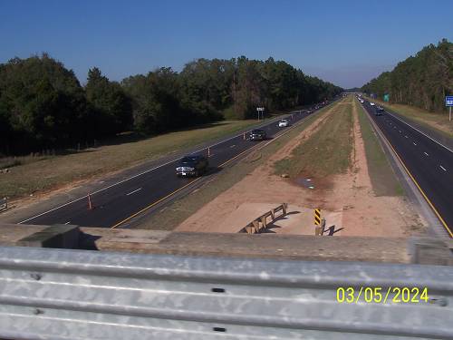
Thanks to Virgil for his layers of contributions.