Looking Around Opelousas for Clues
I have been sidestepping my responsibilities as chief historical railroad editor for a prestigious online rag so I better write fast because management is getting furious. I didn't mean this outing to be a partial fulfillment of those obligations, but it turned out to be, so here goes. There's no way for me to connect these pictures to one another, so I won't try. They are each a part of a different story, some you've been exposed to and the others are to come.
I left the house and felt like visiting the cross track (if there was one) of the ancient Atchafalaya Basin route of the Southern Pacific RR and the New Iberia to Port Barre route belonging to the Missouri Pacific or it was probably called the New Iberia etc, etc RR at that time. The story of the Atchafalaya route is in the making and I wanted to contribute. I have been promising Mark, a co-contributor, that I could open the doors to the ultimate pictorial portion of that story and have not. I was going to Ramah but figured it fruitless without preplanning and I hadn't preplanned as I had promised. So, the cross track had to do. He did go to Ramah and I've yet to hear that story, though I did get a email exclaiming that the trestle was still there. Yea!
.jpg)
The Atchafalaya route went that a way. I never start with my
best pictures. I call this portion of the write the "weeding out"
part. I usually shuck most heathens by the second picture leaving
the good stuff for the truly appreciative.
Having gotten my cross track fix, it was time to move on up the line.
Next, being in Arnaudville, I thought it appropriate that
I shoot the grain operation that once sat next to the Missouri
Pacific (Iberia, etc, etc) tracks thinking that by chance I had
never done so. Fat chance. I shoot everything 10x and forget
I did.
.jpg)
Reaching US 190, east of Port Barre, I looked down the tracks
toward Opelousas. I knew that I've only touched on all there
is to see in that historical town. I knew it was time for more.
.jpg)
The place to start is the wonderful historical park just west of
I-49 on US 190, accessible from east or west bound lanes of
US 190. It's called the Jim Bowie something or other.
I pulled in to look at the Opelousas Depot.
.jpg)
Seems some money is being spent here.
.jpg)
It appears they still have a lot of the same stuff. Where
did the rails come from? I think I have an idea.
.jpg)
I'd been here six or seven years ago. I had to look twice,
but, this is the same depot and the same engine.We'll look
at her new face in a bit. This was the scene years ago.

That is what it looked like. The pile of stuff was larger. Shamefully,
I did not get a full shot of the old depot back when she
was obviously in original colors and condition. The new version
might be dainty, but she's lost originality. Something happens
when you remodel. Restoration should only go so far, then......
When you smell new paint instead of the embedded cigar smoke
of old, history has been lost. I know, compromise has to be tolerated.


The "Orphan Train" story is a poignant one. Google it.
Here's the little engine all spiffed up.
.jpg)
.jpg)
.jpg)
She still has the whack in the back. I guess knocking that out
would be a chore. Her name is Mary Jane, ah, Sweet Jane.
Now I'm humming Lou Reed melodies.
Here's the pile of stuff. An old fire extinguisher is to the left and
some kind of press is to the right.
.jpg)
Rails and plates. My restraint was tried.
.jpg)
Here are 2 more shots of this idyllic place. It has a museum
which lends a lot of space to Jim Bowie, former resident of
Opelousas and the Boeuf Valley. By the way, during the
Civil War, Opelousas was the state capital for a while.
.jpg)
.jpg)
This place needs to be seen. The buildings have been moved
in from the surrounding area and they are a realistic look back.
I see a store here and an old home or school there, still surviving
out in the country. No where do I see this many assembled in one spot.
Possibly Vermilionville has an equal collection. I haven't been
there in a while. I don't think they have a depot or old engine.
Much more of Opelousas on the next page. Yes, I found the
the route of the Opelousas and Gulf Railroad and spoke to a man that
remembers it. I also evoked two trains to come by. My power
has returned.
Mark, a lifetime resident of the area sent this:
Mary Jane used to be on display at the courthouse square ever since I was a very young boy, across from the Delta theater. The Depot was relocated from South Railroad Ave. a few years ago. One of the buildings at the "town" at the tourist center was Doctor N.C. Lafleur's office, relocated from Prairie Ronde just north of Octave Fontenot's store on La.103, you have a picture of his home. I use to see this old time country doctor in the days when a doc was a doc and didn't need umpteen tests to tell him you had a fever!
Back to South Railroad Ave. by the depot...when I was young, my dad had a tractor implement store, St.Landry Tractor Co. All the tractors, combines and International trucks would come by rail. I would tag along with "Ben" to reload them on a flat bed bob tail truck. Ben was an old black fellow who worked for the family his whole life. He was my hero, he could roll a cigarette from a bag of Kite Tobacco with one hand while he drove with the other....NO BULL!
Then Andy added this about the Jim Bowie connection:
I think it was in '94 that two friends of mine and I went to Washington , Arkansas to find and check out Black's Blacksmith. This place was one of the ones that developed the Bowie Knife for Jim. They had a roadhouse duplicate of where the travelers used to stay when coming through. Really neat. What was funny was that we were trying to find this place in Washington and ask at a local convenience store and the girl working there didn't have a clue about who Jim Bowie was, or where Black's or the roadhouse were.
We met the guy running and restoring the blacksmith place and it was very interesting hearing about the history of the knife. He even brought out some he had made for show (2000 bucks a hit). I never did ask him what it would cost for a common one. He asked where we were from and what kind of work we did. When I told him I was offshore Louisiana, all he wanted to talk about then was a few charter fishing trips he had done. I got evil looks from my 2 buds after that. Have not been back that way since so need to check it out on one of my excursions up there.
Thanks for bringing back some old memories!
Leaving the museum /park, I crossed 190 and headed for the Union Pacific tracks. History can be found around rivers, bayous and railroad tracks. Opelousas was founded in the early 1700's without the aid of direct water travel. This left me with only one sure source, the tracks.
The tracks have been here since 1882. That would be a giant leap forward from the founding, but they would have to do. I spent 6 hours yesterday trying to find where three of the rail depots had been. If I had tacked on another 160 years of history, research could have eaten my day. I was barely able to sneak the Saint's game in. Go Saints.
After crossing over 190, it was obvious that I was in a "mixed" neighborhood. Opelousas is a salt and pepper spill sometimes. If you made racial predominance a factor while wandering the inner city, you'd never get anywhere or see anything. Try to stay away from obvious pistol activity and it will go all right. Hitting the tanning salon prior to a run can't hurt. Don't go overboard or you might find yourself being watched in the salty areas, too. Why is life such a balancing act?
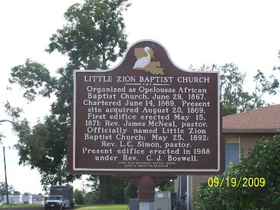
I was definitely on a pepper street. I saw a large church up ahead with a historical marker by its side. I stop at all historical markers, plus there was a young fella mowing the yard I knew could augment its information.
.jpg)
.jpg)
The young fella approached me wondering what I was doing.
I made the comment that Opelousas sure did have some history.
He replied that yes it did and that Rev. Boswell was his great
grandfather. This would be the first personal connection of the day.
There would be another. Never underestimate a potential source
of information.

Legend:
The 2 close to horizontal yellow lines at the bottom are
the east and west bound lanes of US 190. They are important.
You can see the museum and the 1st church which I just
mentioned. From there I'd move north and jag west to cross the
tracks. When crossing the tracks I saw this.
.jpg)
Sometimes I get a sense that I'm in the groove. I was overcome
with that warm and tingly feeling right about here. See the gravel
between the tracks and the "loading" platform. It is important, also.
I made the block. Do you say that where you live? I don't know
colloquialisms from generic English anymore. On the next corner
was this, an obvious neighborhood store / home of years gone by.
Opelousas is still a treasure to be discovered. Did I just say that?
.jpg)
I approached the old building from the north, got off the
bike and started jockeying for the right angle to get this
huge building in one shot. It was impossible.
.jpg)
.jpg)
.jpg)
.jpg)
There was an older fella sitting on the back steps of his house
nearby. I approached him and after introducing myself, I quickly
asked if he remembered a rail company called the "OG". That
was the local short name for the Opelousas, Gulf and Northeastern
Railroad, one that stretched from Melville on the Atchafalaya River
to Rayne and Crowley on the Old Spanish Trail, aka, US 90.
He said that sure he did and that it loaded potatoes right there at
that "potato shed". Not only had he identified the building's purpose,
he had put a location of the railroad in the inner city, a huge question
mark which Mark and I have contemplated.
Tingles were going into high gear.
I told him how much his information had added to my investigation.
I couldn't think of any more questions and I had a gold mine source
sitting there. I think I was too busy grinning. That's been my downfall
during previous opportunities of all kinds.
I crossed the tracks going south and realized that I was going too far
and turned west, then north as quickly as I could. I found myself on
US 167 headed across the tracks. I turned west at my first opportunity.
I rode a block and then turned south back toward the tracks. Upon
almost reaching them I came on this unexpected scene.
.jpg)
RR Stuff was everywhere.
.jpg)
Look Everett, a switch. The dumpster was full of ties.
.jpg)
.jpg)
I could have snagged a souvenir, but I didn't. There is
something about grandeur that makes one rise above
petty self fulfillment. I jerked my gaze from all the booty
and saw this.
Union Pacific truck with rail riding option.
.jpg)
I was at the center of the railroad world in present day
Opelousas. I started connecting the dots. This was railroad
property, obviously. There was a trailer house office on
the lot. The obvious could be assumed. I was at the
location of the Missouri Pacific Depot, probably the one that
now sits in the museum / park unless it's the T&P Depot
or the SP Depot. That question occupied the six hours of
research.
Across the street, still on the north side of the tracks was this
building, the back side of AS&S Inc. I'm sure they suffer with
those initials.
.jpg)
Between the UP property and the AS&S property was this.
.jpg)
That led to this proceeding west:
.jpg)
I think you are looking at the old "OG" rails.
I parked and took a shot back toward the UP property.
.jpg)
About this time I decided to do my train dance. That
usually summons, you guessed it, a train. Zooming way down
to US 167, I saw her coming up the hill.

The "hill" part of the last statement is important. Opelousas
sits on top of the escarpment which borders the Atchafalaya Basin.
It's down hill from here going east. The Mississippi roamed the Basin
a bunch during the past. I know the geologist out there appreciate
my exactness, so did my professors. Nevertheless, you can see the
relief lines range from 49 feet to 66 which is probably incorrect but
it says "up hill" anyway. This picture says it better.
.jpg)
.jpg)
.jpg)
I tried for a full frontal shot but couldn't click fast enough.
This sucker was moving. It either had 4 or 5 engines.
.jpg)
I shot down the alley toward N. Railroad Ave.
.jpg)
Was that stop sign for trains of the past or cars? The
tracks going to the right joined the old Southern Pacific tracks
which were headed to Washington and up La.29 to Cheneyville.
Further down, the Texas & Pacific crossed these rails headed to
Ville Platte and Bunkie. Suddenly I can hear the wheels of your
mind whirling, "Uh, they would have to cross, huh"?
Yes and I've been there. It is a magical place.
Before I left this magical place, I took one more shot which I
know will support my OG thesis, the one that says that those
unused tracks were the OG/T&P.
.jpg)
On this building you see rail loading doors with no visible rails.
I next went north and passed another historic Black church.
.jpg)
Soon, I was back on North Railroad Avenue, named so because
it followed the Southern Pacific through town.
As a final treat on this page, I'll leave you with an unofficial guess
at the locations of the Opelousas train depots. The source is below.

There is one little question. Below it says that the T&P was
on Landry and Lewis Streets. Lewis is US 190. I can't find
Landry so I'm guessing it was where I put the blue flag with
T&P Depot on it. That info came from the Federal Writer's
Project, 1943. It was the only source of this knowledge I could find
after 6 hours of looking, using every search phase I could think of.
There will be more to this ride later.
It's Later. CLICK HERE for page 3

Wednesday, I was in Prairie Ronde at 10:15 setting a new record at being "fast and furious". I'm usually leaving my driveway at that time. Here comes a J.L.Burke sentence. The morning sky was threatening with dark clouds hanging low as if a suspended fog, or was that my condition? I don't' believe the sun ever breaks through in his books. Maybe that's why I relate?
Crossing Mark's cattle guard, I was hoping to take a break having driven damn near 40 miles to get there, but no, out of the house charges Mark doing a Tonto mount onto the back of his bike. "Ready to go? Oh, here's some brown sugar from the mill, you got room?" Adding the sugar to the trunk brought its weight up to 95 lbs. I heard my rear suspension moan in disbelief.
Off we "roared". Actually both of our bikes are very quiet, a requirement for where we go. We like to see stuff and not be the center of attention. The fact that we went the wrong way on a one way street is another matter. That did solicit a bit of attention.
That's pretty much the ride report. Oh, I forgot to tell you why I was there, which may have been a purposeful oversight. My wife had asked what I was doing, like she cared. I told her I was going back to Opelousas to meet a guy and we were going to ride around the inner city looking for the route of a long gone railroad. We've been married for almost 43 years, or more, and I can still make her eyes bulge in disbelief. It's a gift. She knows better than to resist the inevitable and simply extended her wishes that I be safe and try not to get arrested this time because she was turning her cellphone off. With a warm and fuzzy feeling I pulled a 12 o'clock high wheelie slamming into my gate. It was an auspicious beginning to the day. Oh, why was I going to Opelousas, the same reason I gave my wife. Now pop your eyes back in.
Here we go:
I'm posting these shots as it's the easy way to share Mark's and my findings concerning the historical route of the Opelousas, Gulf and Northeastern Railroad as it crossed Opelousas in the early part of the 20th Century.
That railroad extended from Melville to Crowley. Mark and I know all of its route except for inner city Opelousas. That void, when you have done so much research and travel in order to understand it, was simply, "troubling". We attached the city fast and furiously.
First stop was the location of the OG depot, between
the east and west bound lanes of US190 seen on the
map on the previous page of this article.
.jpg)
This was either the depot spur or where the OG turned east
after coming up from Crowley and Rayne through Church Point.
Below is looking south at the same evidence. Those rails crossing
190 are where the T&P continued north, after buying out the OG.
The T&P would go up the back side of Louana Oil and then head
northwest to Ville Platte, eventually reaching Bunkie after crossing
the Southern Pacific which also came up from Opelousas. Pretty
dramatic picture, huh? Yea, I got tingles, too.
.jpg)
Mark and I rode around to see if we could find the continuation
of these rails further north. We didn't but we did ride up that one
way street the wrong way and were yelled at, so that portion of
the ride was not a total loss. I did the same thing up Louisiana
Ave. in Houston one time. Dude, that was a rush. It was one
old van vs. 6 lanes of manic Houston traffic. I think I experienced
what a quarterback feels when there is no protection. Both kids
and the wife screamed. it would not be the first or the last time
I'd hear that. Now I just take situations in stride. At first I though
of riding back past the person that yelled at us, then figured it
would be better to keep going. Of course as I was deciding I
was circling in the street and Mark was following me. The list
of tickets would be confusing. Back to football. I think the judge
would have thrown out the lesser penalties and only hit us with the
big one, like, maybe "endangerment".
Next we went to where I'd seen the train on the previous page.
Actually, we didn't go to the previous page, we went to the place
where the train was on the previous page. That didn't help. Forget it.
It was across the street from where the MP depot had been. Mark
noticed that the warehouse was angled away from the main line and
surmised that this might be the place where the OG changed directions.
.jpg)
We again rode around and around very slowly looking for
a grain of evidence and found none. We had no map and were
basically sifting sand looking for a button.
Mark suggested that we head for the Indian Hills Golf Club area
and see if we could pick up the rails from the east end of town since
nothing was working here in its center.
We rode out to a road right off of I-49 mysteriously named "Short Line".
In a ditch we found this. No BS, it's a trestle timber.
.jpg)
Across the way the ROW continued. We plotted the ROW
lining up known points outside of town. RR's like straight
lines where possible and that fact made finding what was next
possible. Sorry, below is not a sincere effort.
.jpg)
But, it gives you an idea of the task at hand.
There was also this mysterious cement near the trestle timber.
I was inclined not to show it. But, someone out there might know
what it is and help in this archaeological investigation.
.jpg)
Yep, buttons in a pile of sand.
Here's the part that the straight line rail projection led us to.
Mark had noticed what looked like "fill" on the edge of the
golf course.
.jpg)
He was right. We took out our shovels and began to dig.
Several grounds keepers approached and asked what we
were doing. I presented my Walmart Toy Dept. fireman's
badge and suddenly it was all "si senor, have a good day senor,
if we can help, senor". Best two bucks I ever spent. Evidently,
there had been another witness and they had called the police.
Soon there were sirens.
Below is what we uncovered. No doubt we could have uncovered
more if we hadn't had to hide.
.jpg)
Looking the other way, as we ran, the club was still using the trestle:
.jpg)
And, look what we found while laying low in the ditch.
.jpg)
No, those were not bought at the garden supply place.
I thought I had another rail plate, but it was a wooden
shim. Very interesting. I bet the shim was used to level
the rails placed under the rail plate. I should have gotten
a better picture of the pattern.
.jpg)
After being missed by several tracking dogs, I carry a can of
Dog-Away, we headed further east and went north of 190
to try to trace the line as it headed to Port Barre where a
street is named OG Line. The next pictures are of our wanderings.
Only one place is surely the line, the rest are guesses.
This is out Rachal which is near I-49. It's the "for sure" one.
.jpg)
The next one is a "pretty sure" one, location, a secret.
.jpg)
Here's a "maybe, maybe not" but still a pretty road down
a rail type cut. But, it's not straight. I'd show the lovely
lake but that would pinpoint our location.
.jpg)
That's it. I headed home, fast and furiously, just missing
the beginning of the afternoon monsoon.
One day I'll gather all the pages and information and put
it together. I can't see doing that until the final piece of the
puzzle is found. More sand, one button.
Possibly that button was found. Click Here to see what you think.
In Steps a Real Investigator
I have run the inner city 3 times. Mark has run it multiples of times. Mark's father, a mature investigator, looked once. We were so far off. These are his words.
"I did some looking on my way back from the country and I believe I saw how the OG headed East out of Opelousas. I headed North on Market St., crossed the UP tracks at Acadiana Supply, and I noticed a rise in the street up ahead. When I got there, it was called Convent St. I turned West, and the street makes a gentle turn toward the Southwest and came to a dead end. Through the trees, I could make out Lou Ana [food products business]. So, I am thinking they [the OG tracks] must have crossed the MP and SP in that area; it must have been a busy, dangerous place with all that traffic! Then I went East on Convent St. which passes just South of Roy Motors. So, you need to explore further East and see if there is evidence at the graveyard and Holy Ghost. What do you think"?

Personally, I think he center punched the route. And,
thank goodness, for many reasons. The map expands
when clicked. On the southwest, I think my drawing of the
connection with the vertical OG rails rails below the horizontal
Union Pacific rails came in as T/ type approach and bent
more to the south as you see there is plenty of room as
the second street north of the UP is dead ended to
accommodate the OG. We may have to send Mark's father out
again to get it right. I bet he wears a fedora hat and carries a
bull whip. Opelousas Jones?
OGNE Opelousas to Church Point
Noon was upon me and I knew that Friday and the weekend would be rainy. It was the first day of October and our Fall weather pattern was beginning. No matter what kind of weather you want during this period, we have it. If it's nasty, we either deal with it or wait a day for perfection. The only factor the weather would play in Thursday's ride was a fine backdrop for the outing. The recent cool front was being washed out by a light southerly breeze. The sky was blue, the warm Sun allowing for another Walmart t-shirt clad adventure.
Perfection.
+%282%29.jpg)
I stopped by Al's to see if he wanted to come but he
was in the middle of a home schooling session with his
son Alonzo. It was obviously not going well.
I left knowing Al's pain. When the green rimmed sun
glasses start appearing, it means trouble.
Clearing my head of his problems, I zoomed off to
the land on railroad mysteries, Opelousas.
My wife has recently taken to reading my ride reports.
Why the sudden interest? With my new reader came
her opinion. She does not stab with a powerful thrust
but hesitantly twists the blade with a halting push. She
starts a statement and then backs off and makes me beg
to know her cruel and cutting observation of my offerings.
Then, graveling at her feet, she lets it go, "I lose it trying
to get through all that railroad stuff. That's probably why
no one reads your website anymore. And who can relate
to a thousand pictures of overgrown fields, bumps
in a pasture and shots of rusting rails stuck in cement in
some industrial wasteland or inner city street?
No one relates to that".
As usual, she's probably right. Wanting to keep every
reader, including even her, I'll try to do better and not
share my emotional moments of discovery with you, my
fleeing and fleeting readership.
This is a vacant lot on Convent Street, once Onnibane's
Grocery. Convent Street is without a doubt the route of
the OG through Opelousas.
Is that better dear? I was thinking of you while I took it.
In the foreground is Convent Street. The cracks in the
concrete run laterally with the street. I feel the cement
was laid over the rails as patches. Convent was the OG.
.jpg)
I didn't get a shot down Convent, I know that is troubling.
I rode around to Railroad Ave. and entered Louana's
parking lot and went to the place the GPS pointed to
where Convent would have continued if it had not
stopped. A new link in the mystery chain had been solved,
at least in my mind. From that point to where the OG's
route crossed the Southern Pacific's and the Missouri
Pacific's Rails is still an unknown, but I think I have an idea.
What three great minds have deduced is this, the rails ran
on Convent Street and crossed the small bayou at its dead
end and continued, skirting or running through where LouAna
Foods now sits.
Looking through the trees at the end of Convent Street
from the Railroad St. side.
.jpg)
Here's a map:

You can see W.Convent at the top of the red "Y".
That's the OG. I think it came down and and joined the
loop under Louana Foods which was built by the T&P
as an exchange to its Ville Platte route that went to the
west side of the "Y". My configuration also allows for
a connection between the the Melville Route, Convent
Street, and the Church Point route, the bottom of the
"Y". Looking closely at the Google Earth view, bare
or lighter coloring seems to support that thesis. There
even seems to be a cut in the back of the power station
to facilitate its passage. (that may be imagined)
That's it for the page. My dog's hungry, I'm hungry and
even this page is boring me. We move out into the country
on the next page. There will be country scenes, a great
riding route, old homes, pretty roads and one or two
ditches with rotting railroad ties to enjoy.
retraced. I was retracing it in an attempt to mop up
a little more. I did not go where Mark had been verbally
attacked because my mop is useless is such circumstances.
The orange line is how I feel the Opelousas Gulf and North
East Railroad passed through Opelousas. The yellow route
is my path on Thursday. The map, like all the other images
expands when clicked.

On the previous page I promised that we were finished
with this urban part of the ride. Well almost. I send these
pages out one at a time these days because I'm old and I
never know if I will finish a whole ride report, much less a ride.
That aside, I sent out the last page and immediately got
five responses saying how much they enjoyed just what my
wife doesn't. To them I say, you live with her. Just kidding,
of course. But, they did ask if I had some good ones and to please
post them. So, I will and just not tell my wife about this page.
I had found the location of the Texas & Pacific/OG Railroad depot
listed in an old book. It was in western Opelousas on US 190
West. I looked on my GPS and saw where those rails, sitting
atop their high fill, exited Opelousas to the south, headed for
Church Point.
I was now on a mission to shoot all the rail related and dependent
buildings along the T&P/OG as it went south. Above the depot
was this beauty, still in use.
.jpg)
Just gorgeous, seriously. Those are rail loading doors where
the truck is. There was probably a siding for the business.
Next I went below 190.
Here come the distasteful to some shots. This is one block
south of the depot looking back at it.
.jpg)
This is looking the opposite direction, south.
.jpg)
I was using my "cow catcher" lens for this
shot.
This was in the road. It is now at my house. The place
where I found it is marked on the map above. That
also gives you an idea of where we are thus bringing life
to the whole experience.
.jpg)
It's a rail plate. They are used to distribute the rail's weight
onto the rail tie. The rail sits on it, it sits on the cross tie.
The spikes are driven into it with the tang coming down
on the rail. Done. This one has one guide ridge and the spike
slots on the non ridged side allows for adjustment so the
plate can be used with rails of slightly different base width. I found
a book on rail plates, unbelievable. If insomnia is your problem,
I'll lend it to you.
Two blocks away from the depot were these shots.
Again, looking back at the depot.
.jpg)
And another railroad related business.
.jpg)
I'd say it's oil field related also. Mark's dad knows.
Next, going south and approaching La. 357, the tracks crossed
a large field. In the place of those pictures I'll show the lake
that I couldn't show in the last write because it would disclose
our location. I can show you now because you are too lazy to
look back at the last write and frankly could care less.
+%282%29.jpg)
Here's looking south from the last "in town" location.
.jpg)
South of town I did this. Yellow is me. The rails are "++++".

At the first crossing I saw Mr. Goodwin had named the OG/T&P's
route after himself with absolutely no acknowledgment to
how it actually came into being. How self gratifying is that?
.jpg)
Here come some non-RR pictures I took trying to get back
to 357 where I could continue south and find other crossings.
You see, following these old rr's leads to places I'd never
go, otherwise. I used bayous and rivers for a while, then ran
out. I'm nearing running out of rr's that actually have visible
remains.
.jpg)
Sometimes these roads peter out. This one made it all the
way to the highway. You would never know it was there.
These next two were in the "community" of Dufilho. I bet
it was a flag stop.
.jpg)
See the cracks in the cement. Looking back toward Opelousas,
below.
.jpg)
I went back east a bit because I saw a road named Sugar Mill.
I'd check it out as it would bring me back to 357.
.jpg)
You don't get more pastoral.
.jpg)
.jpg)
.jpg)
.jpg)
The next road was tempting but it went away from the tracks.
I'll never find it again.
.jpg)
.jpg)
I was now running with 357 toward Lewisburg. The raised
rail bed is very visible, and in fact, I dismounted and stood
in the high grass looking down it several times. I looked both
ways just in case.
.jpg)
Nearby, I saw this place. This older couple was out cleaning
the yard and burning the twigs and such in a small fire. I
guess they were celebrating Fall even if it was in the 80's.
Simple pleasures.
In a curve above La.358 and Lewisburg was this old gas pump
which identified the concrete slab as a filling station.
.jpg)
Its back was on the railroad. I'm wondering if it was a Canal
or Spur type station whose supply came by rail?
.jpg)
After Lewisburg, I really went into an unchartered area.
Again, I would have never explored there unless led by
the railroad. They are great teachers, along with bayous
and rivers.
More between Lewisburg and Church Point later.
For the last 2 days I've been teleconferencing with the highest authorities concerning a nine mile stretch of railroad that dropped below Rayne and turned due west to intersect with Crowley. I was dealing with only a drawn depiction of this route from a 105 year old document. I had no idea how far it had dropped and if it even penetrated into southern Crowley. That story is for the next page.
On the last page we were near the settlement of Lewisburg. The station and warehouse there are unbelievable relics. I wasn't going to post a picture because it's been shown here many times and it makes me sad to see it slipping away. I know, I'm so sentimental.


I was now at La.358, I decided to go west. I've done this
route a million times and felt my interest drained. I stopped
my westward trek at La. 35 and turned south thinking
I'd ride it to the last highway before you slide into the coastal
marsh. Then I saw a road turning back east that interested me.
Of course that brought me back to the "rails".
.jpg)
On the last page I promised that this one would have some
"old rail ties in a ditch" pictures. I am not one to disappoint.
.jpg)
.jpg)
These two locations can be seen as no. 11 and no. 12 on
your map (above). Come on, did you really look? You
must be a die hard rail nut.
The road that connected them is this one.
.jpg)
Yea, and I'll ride down anything to see historical trash.
I then ended up here. I was back on La.357 going toward
Church Point. If there hadn't been a sign and I didn't have
a GPS, I would have gone the wrong way and not be here,
today. Maybe it was La. 178? I really haven't a clue.
.jpg)
Oops, wrong way, here ya go.
.jpg)
Next up was this Smithsonian level relic. You think I'm
being sarcastic? Have you seen the junk they collect?
.jpg)
I entered Church Point. The rail route through town is a
scenic one. The businesses are well kept and clean. These
historic buildings religiously retain their railroad days look .
First stop was this construction supply company at the end of
a dead end road. The road was public but I knew I was going
to get approached. True enough, when I turned around to leave,
an obvious worker and a person looking "management" waited
for me in the road. I pulled up to them and stopped. The
management guy said that his employee had said I was taking
pictures of his place of business and he wondered why.
I turned the wheel of the bike so he could see the GPS with the
old rails showing next to his store. I told him I collected pictures of
businesses that were serviced by railroads, mostly historic railroads.
I have learned not to mention "website" or "internet". "Pictures"
are accepted technology. Tourist are welcomed. Bill Gates isn't.
They both laughed as if relieved I was not with some agency or
worse. I now realize they were laughing at me, wondering what
kind of nut just fell off the tree. He told me that indeed he'd
unloaded many a box car. I asked him about what date the
tracks were pulled up but he couldn't place the date and seemed
be tiring of the moment. I told them thanks and they could rest
assured I was not with the CIA which brought a hardy laugh.
Here's his place. No, honestly I should have gotten the loading side
that was next to the tracks and I'll just let it go. The next two
exhibit that feature.
First, here's the old Texas & Pacific/ Opelousas, Gulf and
North East route through town. The old elevated warning
signals are still in place on the main drag (La.35) right in
front of the depot.

.jpg)
.jpg)
.jpg)
You see how neat!.
Next up is the depot.

And, you will have to click this explanation to read it.

Sliding out of town I took a couple of shots of interesting places.
One was probably a hometown landmark, the Ideal Garage.
.jpg)
And you know there had to be a fuel depot, "bulk plant".
.jpg)
I rode down to Branch. I decided to call the rail hunt
off as below Branch the rails ride the side of the road all the
way to Rayne and there's nothing more of interest and besides,
I'd been workin' on the railroad,
All the live long day.
I'd been workin' on the railroad,
Just to pass the time away.
Don't you hear the whistle blowing?
Rise up so early in the morn.
Don't you hear the captain shouting
"Dinah, blow your horn?"
Dinah, won't you blow,
Dinah, won't you blow,
Dinah, won't you blow your horn?
Dinah, won't you blow,
Dinah, won't you blow,
Dinah, won't you blow your horn?
Someone's in the kitchen with Dinah.
Someone's in the kitchen, I know.
Someone's in the kitchen with Dinah
Strumming on the old banjo.
Fee, fie, fiddle-e-i-o.
Fee, fie, fiddle-e-i-o-o-o-o.
Fee, fie, fiddle-e-i-o.
Strumming on the old banjo.
So, I took off on the next pretty road east.
.jpg)
Yea! It's La.1101.
Actually, it's as straight as an arrow after the sign thing.
Which let me look up.
.jpg)
No doubt it was "Led Zeppelin On Tour". Wait, we have
to sing "Communication Breakdown" as it's this site's anthem.
Hey, girl, stop what you're doin!
Hey, girl, youll drive me to ruin.
I don't know what it is that I like about you,
But I like it a lot.
Won't let me hold you,
Let me feel your lovin charms.
Communication breakdown,
It's always the same,
I'm having a nervous breakdown,
Drive me insane!
Hey, girl, I got something I think you ought to know.
Hey, babe, I wanna tell you that I love you so.
I wanna hold you in my arms, yeah!
I'm never gonna let you go,
cause I like your charms.
Whoa. "Felt a tingle up my leg", quoting Chris Mathews,
MSNBC, describing his feelings for Obama. I wonder
if Obama gets tingles for Chris? Maybe?
Closing in on home, October 1, 2009, the season starts.
.jpg)
.jpg)
"I don't care about pollution, I'm an air-conditioned gypsy
When I'm mobile, the world's my home....", The Who.
Or:
"Sugar, Sugar" by The Archies.
Have a great Monday humming that one.
Forget humming, write down the lyrics and bring
them with you, make copies and everyone
can sing along. Kick out the jam on a
Monday morning. We use to have singalongs
at the bike shop. But, that was usually late in
the day. I don't believe we ever sang
"Sugar Sugar"?
Sugar, ah honey honey
You are my candy girl
And you've got me wanting you.
Honey, ah sugar sugar
You are my candy girl
And you've got me wanting you.
I just can't believe the loveliness of loving you
(I just can't believe it's true)
I just can't believe the one to love this feeling to.
(I just can't believe it's true)
Ah sugar, ah honey honey
You are my candy girl
And you've got me wanting you.
Ah honey, ah sugar sugar
You are my candy girl
And you've got me wanting you.
When I kissed you, girl, I knew how sweet a kiss could be
(I know how sweet a kiss can be)
Like the summer sunshine pour your sweetness over me
(Pour your sweetness over me)
Sugar, pour a little sugar on it honey,
Pour a little sugar on it baby
I'm gonna make your life so sweet, yeah yeah yeah
Pour a little sugar on it oh yeah
Pour a little sugar on it honey,
Pour a little sugar on it baby
I'm gonna make your life so sweet, yeah yeah yeah
Pour a little sugar on it honey,
Ah sugar, ah honey honey
You are my candy girl
And you've got me wanting you.
Oh honey, honey, sugar sugar ..
You are my candy girl ..
That's it.
On the next page we'll visit Rayne.
Raindrops keep fallin' on my head
And just like the guy whose feet are too big for his bed
Nothin' seems to fit
Those raindrops are fallin' on my head, they keep fallin'
So I just did me some talkin' to the sun
And I said I didn't like the way he got things done
Sleepin' on the job
Those raindrops are fallin' on my head, they keep fallin'
But there's one thing I know
The blues they send to meet me won't defeat me
It won't be long till happiness steps up to greet me
Raindrops keep fallin' on my head
But that doesn't mean my eyes will soon be turnin' red
Cryin's not for me
'Cause I'm never gonna stop the rain by complainin'
Because I'm free
Nothin's worryin' me
[trumpet]
It won't be long till happiness steps up to greet me
Raindrops keep fallin' on my head
But that doesn't mean my eyes will soon be turnin' red
Cryin's not for me
'Cause I'm never gonna stop the rain by complainin'
Because I'm free
Nothin's worryin' me
By B.J. Thomas.
Later gator.