I was tidying up the computer a little and came upon this collection of shots from S.E.Louisiana. I figured they would be a good memory test so I'd go through them. Let's see now? This was taken in Warrenton or Clifton while I was chasing the GMO Railroad up to Tylertown, Mississippi. Updates will be inserted as of 2013.
.jpg)
This is Mississippi Bob. He lived just west of ... Ok, I'm stumped already.
.jpg)
This may have been in Mississippi up the back side of MS 27 when I was chasing the Pearl River. Or, it could be north of Enon, La.
.jpg)
This is south of Enon on the bluff overlooking the Bogue Chitto River Valley to the north. This is where I throw off my watch when going north.
.jpg)
Clinton. My uncle once presided here.

Below Enon, above most everything else.

Head of Island, Chinquapin Canal. Those are clouds in the water. So, stop with the negative thoughts.
Trees, too,
Trees, too,
Amite River, south of La.22. This shot was taken as I explored every landing south of Interstate 12. It was quite an adventure. There were many dogs with which to contend.

Carbota and a Chevy, south of La.40

Lee Landing, lower Tangipahoa River. This place is spooky. I expected pirates or at least river folk to come out of the woodwork at any time.

Uneedas Super Dome, La.40, west of Folsom.

Train just before crossing the Bonnet Cairre Spillway at Norco.

The Bogue Chitto out of her banks at Isabel, La.16.

Above Grangeville.

Discontented, La.445 Two days ago, those were good cars and trucks. He denied an interview.

Probably Slaughter, La.
.jpg)
This is the well at Chatawa, MS. There is always a shadowy chill at Chatawa. The Tangipahoa runs deep and narrow below a high bluff. In the woods above the river, strange happenings haunt the area. It makes one wary. Update: the well is no longer there. Littering caused the parish to remove it. The bridge is blocked and the post office, the last evidence of Chatawa, is closing.

Amite
.jpg)
Honey Island swamp. G.daughter just told me it was a trestle. It is very close to where Old US 11 crossed the Pearl River/Honey Is. Swamp and entered Mississippi.

Barn on the way to Hell, La.66(6)

Folsom beauty, deserted.

Britney, now a music judge, who'd thunk it?
.jpg)
Angie, La.

Hum along if you wish. Angie, Angie, when will those clouds all disappear? Angie, Angie, where will it lead us from here? With no loving in our souls and no money in our coats You can't say we're satisfied But Angie, Angie, you can't say we never tried Angie, you're beautiful, but ain't it time we said good-bye? Angie, I still love you, remember all those nights we cried? All the dreams we held so close seemed to all go up in smoke Let me whisper in your ear: Angie, Angie, where will it lead us from here? Oh, Angie, don't you weep, all your kisses still taste sweet I hate that sadness in your eyes But Angie, Angie, ain't it time we said good-bye? With no loving in our souls and no money in our coats You can't say we're satisfied But Angie, I still love you, baby Ev'rywhere I look I see your eyes There ain't a woman that comes close to you Come on Baby, dry your eyes But Angie, Angie, ain't it good to be alive? Angie, Angie, they can't say we never tried Oops, I drifted for a moment. Choctaw Road, you were thinking west Oklahoma, huh? This is what a Katrina will do to the landscape.

Delacroix before the big one. Bob Dylan got a job here on shrimping boat. Tangled up in blue.
.jpg)

Southwest of Bogalusa

Near Clinton Confusion.

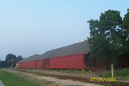
Bogalusa
Amite R. just before she hits Lake Maurapas. Tiger Bluff Landing
.jpg)
Spider where I was taking a break.
.jpg)
Fort Adams/ French Fort, Ms. Don't tell.
.jpg)
St.Francisville / New Roads Ferry.
.jpg)
Bonnet Cairre Spillway at flood, gates open.
.jpg)
Sprinfield, La. Very old.

La.22, west of Madisonville
They've invited Obama to discuss the Second Amendment.
There has been no reply from the White House.
.jpg)
Franklinton, La., before cosmetic restoration. The new do is magnificent.

French Settlement Life at an idle.
.jpg)
Franklinton Fairgrounds exhibits. Very nice.

Southeast.LA is the soul of the boot which is Louisiana east of the Mississippi. These were a few pictures from that general area. The ride is worth it.