The writer seems in a hurry. I think he wrote way too much
about the flora and geology of the region and now he feels pressed.
I know the feeling.
Green is me on my last route through here. I took a side trip
to Thibodaux.}
The reference to "T&P w.Bank" is wrong. There was
no T&P w.Bank until Nepoleonville and above. I may be
wrong there, what you want for cheap?

{You may want to click on the map to read it better?}
{The green line is my route.}
{Below is the author's homage to Thibodaux.}
Three miles northwest of Lafourche Crossing, but not visible from the railroad, is the town of Thibodaux (population 4,400), an old village of French origin, with important agricultural and commercial interests.
{That's it, out of here?}
{Nope, not us. Thibodaux is Louisiana's best kept secret. Or, at least La. kept it a secret from me for a long time. I'll use a tourist pamphlet word, "charming". If you are "charmed" by the anviance of the French Quarter's history and beauty, but not it's sordid Bourbon St. profile, Thibodaux's old town is your ticket. Plus, it sits on a lazy bayou and has a Jean Lafitte Cultural Center extension very close to where the Texas & Pacific RR crossed the bayou and the SP went to a mill. I am impressed with Thibodaux.
The author, I surmise, was solely focused on the Southern Pacific's main route. Thibodaux was a Southern Pacific and Texas & Pacific town. I don't understand the slight by way of only 3 lines he gave to this important community. Honestly, I have not done her justice either, having only made 2 short visits there, each with the promise that I'd be back. And, I will when I get those pictures around the West Bank. The best link I can offer can be accessed by CLICKING HERE.
Look at that link and then come back and take a look at my few pictures of town.}
.jpg)
{Above as seen from the Jean LaFitte Museum. The good
stuff is very central.}

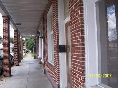
{French Quarter, no, Thibodaux.}

{Mayberry, maybe?}
.jpg)
{No, the hotel across from the courthouse where Huey P.
probably stayed while courting his wife.}
.jpg)
{Important?}
.jpg)
{Pretty much. }

{Historic?}
.jpg)
{I'd say so.}
.jpg)
{But, still Old South stately.}

{You bet.}


{And one of the best cemetery shots I've taken.}
.jpg)
{You should click the map below. I just had to change it
out as incorrect information was about to tweak the Keepers
of the Grail a bit. The S&P had a branch going north from
Thibodaux Jct. It was called the Napoleonville Branch as it ended,
sorta, at Napoleonville. I had thought both sides of the bayou
were Texas & Pacific. No, the T&P must have come south from
Donaldsonville and taken the bridge east over the bayou at Napoleonville.
I have a shot of that bridge which is now a pedestrian walk. Then the
T&P dove south stopping at the sugar mills, ending up at Thibodaux
where it jumped the bayou again. I had a pitiful picture of the
Thibodaux station at one time. I may have deleted it because it
was so bad. Feeling despondent, I found a reference to it in a La.GS book,
"The station (a test station) is on the north side of Bayou La Fourche
in the lot just west of the house of Judge Beattie. This house is
opposite the bridge from Thibodaux and near the Texas and Pacific
depot. }
{So, the depot was on the east side of the bayou which was
considered T&P country.}
I also found another write that describes the SP Napoleonville branch.
Since I've stirred this ant bed. I'll show the pictures I have . The
first is the T&P bridge at Napoleonville.}

Below is Napoleonville explained. Green is T&P, red is SP.
Where you see "1" is the bridge above. The black arrow
shows where the SP and T&P may have met way way back.
Unfortunately, the ride visiting both sides of the bayou and
showing the remnants of those rails and the mills they visited
is sleeping in my computer. Maybe I'll wake it up some day.

Below Napoleonville, at Madewood, or thereabouts, there was this
in the water. No telling?

.
On that trip, I exited town on the east, going down La.1.

{Brown is the T&P. Light green is the SP (above).
Dark green is me.} Again "T&P w.Bank" is incorrect.
It should read "SP w.Bank".
When I came into town the last time. I looked for old
industry that might have been served by the RR. Most
was gone, I presume. Here was Louisiana Cane Mfg. Inc.
It was south west of down town.
.jpg)
It was getting hot and the Lafitte Historical Museum
was a nice break, though like I said, I stayed in the parking
lot.
.jpg)
This is the view looking upstream from their river walk.
That may be a warehouse previously serviced by the
T&P over there. Dern, why didn't I check the other side?
Oh, I still needed to get to Bowie, LaFourche and Raceland.
On this ride I had aimed high at the West Bank but I
started feeling trippy at 3:30 in Thibodaux. I knew US 90
would have to be the ticket home.
.jpg)
Schriever.
Elevation 17 feet.
Population 50.*
New Orleans 56 miles.
That's next.
.jpg)
But, we'll have to go though this to get there.
Suggested Reading Click Here.
That's the write on the SP I found.
CLICK HERE for Page 4.