I've been looking through my mess and found a bunch of lost pictures. They are of some very remote spots, and as such, should be displayed to the general public as few will ever venture to these places for personal reasons or the fact that it makes no sense to go there. Below are instructions, guides and explanations to make your virtual visit go well. Bon Voyage. Open the map below in a new window. The yellow line is La. 10. It is gravel La.10 from La.77 to the Atchafalaya River where it continues west on a two car ferry with a limited schedule. Everyone knows this but may not have actually gone to see it. The orange line is a railroad built by the T&P RR or a predecessor. I have the vague application and documentation for it somewhere. The location of this stretch is common knowledge, also, but you may have not seen it either. The white line is something I saw from the air when Mark and I were doing the McNeely (sp?) Siding investigation. That got sidetracked but is still an active investigation. I say it was an earlier route. Whatever? Why was the investigation curtailed? Mark's blimp sprung a leak. You can't imagine the noise and how fast a deflating blimp can climb, then drop. The red line is highway. Below the yellow line is La.77, above the yellow line is La.10 going into Morganza, La. Morganza is where the Easy Rider boys visited the cafe. Mark has a girlfriend there. Some say two girlfriends, but I think there's only one the way he talks about her.

On with this short ride. Leaving the pavement of either La. 1o or 77, you head west over the Morganaza Spillway levee. Be careful, the shoulders of this road are rounded. Louisiana, in its dire need for funds, has started issuing licenses for sign hunting. This one has been hit a bunch but has not been officially bagged, so get yourself a license and try to bring her down. Then you can mount it for all of your friends to admire.

The levee is a big one. You would want it that way. The river carries 1/3 of the Mississippi's flow on a slow day.
.jpg)
A sign reassures you that you are not crazy or now lost. That statement may be untrue.
.jpg)
There are more reassuring green DOTD signs. You aren't over 10 tons, now? It is my guess that Texas Calvary General Tom Green came riding down this road to defeat the Yankees south of Melville at this place called Fordoche Bridge. Back to "10 tons". It's about sinking the ferry. I rode over with a huge combine one time. They had to center it like a fat guy in a canoe.

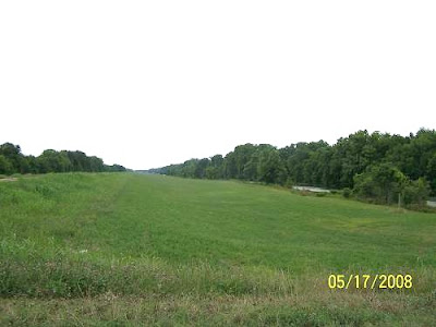
Various crops grow here. Last time was wheat.

A bayou or three inhabit this area with adjoining back swamps.
.jpg)
Eventually you will break out of the thickness. Next is a shot from the cockpit of the 2kGuzzi Jackal. I rode her today on my birthday run. More from that ride shortly.

On my GPS screen, below, green is La.10 on the east bank, orange is the railroad. The yellow lines are the T&P's historic rails running north to Simmesport and southwest to Opelousas, and ultimately to Crowley. The other green line is La.105.

Then you come to Stonehenge, Louisiana Railroad style. I parked and marveled at it. The train cannot go ground level here. Flooding would wreck the schedule. So it needs Stonehenge to support it over the threatening waters. Notice this shot is from February. Others are from June and March. I often revisit my favorite spots. In fact, I'm now feeling a need to visit here again.
.jpg)
.jpg)
There's the wheat I was talking about.
.jpg)
And a close up. I may bring a chair and wait for a shot.
.jpg)
Next, the gravel road intersects La. 973 which enjoys just a little pavement and then turns into paved La.417 headed north to Legonier. Wonder where this was taken from? BTW, La.417 is a wonderful levee ride if you can deal with the rounded shoulders.
.jpg)
Up there? These pictures were sent to me by Lawless Armont. In his note he claimed I was his long lost father. I don't know about the "father" part, but "long lost" is true.
.jpg)
He used that perch to get these. The road shot is looking toward East Krotz Springs. We are in a place called Red Cross. I think the name originated from the floods of 1927 when the Red Cross set up base here to assist the flood victims. It was high ground, maybe, or, the levee was intact on this side. It sure wasn't on the Melville side. The rail bridge eventually failed. I have a picture of it with a missing span.
.jpg)
Dang, Lawless, you got a shot of my bike. I never even saw you up there. What a coincidence!!
.jpg)
Good shots, maybe you are my son? Who's your mama?
.jpg)
.jpg)
.jpg)
Look at the wood and how it is marked. This bridge is no longer available to walkers. I'm wondering if autos ever crossed?
.jpg)
Senior EL, when these shots were aired in 2008, identified the mechanism below as a car counter. Later he amended that guess to "derailer". As a train engineer you are barreling toward the opened bridge and can't stop or you are asleep at the wheel. The derailer will derail the train, beginning with the engine, you, Mr. Engineer, and then you'll probably slide down the embankment and die. That beats going into the Atchafalaya River and being eaten by a 300 lb. catfish with revenge written all over its whiskered face. The above is speculative and not an authentic portrayal of probabilities, real or imagined. I would suppose the green thing means the derailer is not active being the bridge is closed which means it's open for business. Confusion necessitates the derailer. That's why you often see trains stopping before attempting a 110 year old draw bridge.
.jpg)
Having not been derailed or gone off the bridge, we enter Melville. These two maps show the abandoned rails going north and southwest. The yellow line is the old "OG", the Opelousas Gulf and Northeast Railroad which was absorbed by the Texas and Pacific early on, like 1907. It may have retained its name until about 1914, but the name "OG", in the minds of the inhabitants, lingered for years. I've been told that in Jeanerette, the name "Frisco" was used forever after ownership moved to the MP. I'm using abbreviations since if you are RR oriented, you all ready know what I'm talking about, and if not, you probably don't care, so I'll be economic with that understanding. These maps were taken from Mark's blimp prior to the "incident". From ground level you never notice the red orange and yellow lines.

The Yellow line going north was the Texas and Pacific's Simmesport route. I can't write on either anymore. Doing so would make my head explode because there is just so much you can know about something, then it gets ugly. Extensive orations and albums upon albums of pictures are somewhere else on this rag covering both branches.

As an added treat, I have a picture from today's outing. Al has been wanting to become a brooding fashion model since he heard about Naomi being given those blood diamonds. He asked that I take this shot to submit to Brooding Rail Watcher's Magazine. You have to hand it too him, he might have finally found his calling. Lord knows he been a searchin'. The bed is calling me, more later with the Birthday Ride, Part 2. Senior EL may recognize these tracks. A technical discussion is included in the next one. Al, while brooding, was able to figure out a tieing question and why EL is graffitied everywhere .
.jpg)
.jpg)
 On with this short ride. Leaving the pavement of either La. 1o or 77, you head west over the Morganaza Spillway levee. Be careful, the shoulders of this road are rounded. Louisiana, in its dire need for funds, has started issuing licenses for sign hunting. This one has been hit a bunch but has not been officially bagged, so get yourself a license and try to bring her down. Then you can mount it for all of your friends to admire.
  The levee is a big one. You would want it that way. The river carries 1/3 of the Mississippi's flow on a slow day.
 .jpg) A sign reassures you that you are not crazy or now lost. That statement may be untrue.
A sign reassures you that you are not crazy or now lost. That statement may be untrue. .jpg) There are more reassuring green DOTD signs. You aren't over 10 tons, now? It is my guess that Texas Calvary General Tom Green came riding down this road to defeat the Yankees south of Melville at this place called Fordoche Bridge. Back to "10 tons". It's about sinking the ferry. I rode over with a huge combine one time. They had to center it like a fat guy in a canoe.
There are more reassuring green DOTD signs. You aren't over 10 tons, now? It is my guess that Texas Calvary General Tom Green came riding down this road to defeat the Yankees south of Melville at this place called Fordoche Bridge. Back to "10 tons". It's about sinking the ferry. I rode over with a huge combine one time. They had to center it like a fat guy in a canoe.  Various crops grow here. Last time was wheat.
  A bayou or three inhabit this area with adjoining back swamps.
 .jpg) Eventually you will break out of the thickness. Next is a shot from the cockpit of the 2kGuzzi Jackal. I rode her today on my birthday run. More from that ride shortly.
Eventually you will break out of the thickness. Next is a shot from the cockpit of the 2kGuzzi Jackal. I rode her today on my birthday run. More from that ride shortly.  On my GPS screen, below, green is La.10 on the east bank, orange is the railroad. The yellow lines are the T&P's historic rails running north to Simmesport and southwest to Opelousas, and ultimately to Crowley. The other green line is La.105.
  Then you come to Stonehenge, Louisiana Railroad style. I parked and marveled at it. The train cannot go ground level here. Flooding would wreck the schedule. So it needs Stonehenge to support it over the threatening waters. Notice this shot is from February. Others are from June and March. I often revisit my favorite spots. In fact, I'm now feeling a need to visit here again.
 .jpg)
.jpg) There's the wheat I was talking about.
There's the wheat I was talking about. .jpg) And a close up. I may bring a chair and wait for a shot.
And a close up. I may bring a chair and wait for a shot. .jpg) Next, the gravel road intersects La. 973 which enjoys just a little pavement and then turns into paved La.417 headed north to Legonier. Wonder where this was taken from? BTW, La.417 is a wonderful levee ride if you can deal with the rounded shoulders.
Next, the gravel road intersects La. 973 which enjoys just a little pavement and then turns into paved La.417 headed north to Legonier. Wonder where this was taken from? BTW, La.417 is a wonderful levee ride if you can deal with the rounded shoulders. .jpg) Up there? These pictures were sent to me by Lawless Armont. In his note he claimed I was his long lost father. I don't know about the "father" part, but "long lost" is true.
Up there? These pictures were sent to me by Lawless Armont. In his note he claimed I was his long lost father. I don't know about the "father" part, but "long lost" is true. .jpg) He used that perch to get these. The road shot is looking toward East Krotz Springs. We are in a place called Red Cross. I think the name originated from the floods of 1927 when the Red Cross set up base here to assist the flood victims. It was high ground, maybe, or, the levee was intact on this side. It sure wasn't on the Melville side. The rail bridge eventually failed. I have a picture of it with a missing span.
He used that perch to get these. The road shot is looking toward East Krotz Springs. We are in a place called Red Cross. I think the name originated from the floods of 1927 when the Red Cross set up base here to assist the flood victims. It was high ground, maybe, or, the levee was intact on this side. It sure wasn't on the Melville side. The rail bridge eventually failed. I have a picture of it with a missing span. .jpg) Dang, Lawless, you got a shot of my bike. I never even saw you up there. What a coincidence!!
Dang, Lawless, you got a shot of my bike. I never even saw you up there. What a coincidence!! .jpg) Good shots, maybe you are my son? Who's your mama?
Good shots, maybe you are my son? Who's your mama? .jpg)
.jpg)
.jpg) Look at the wood and how it is marked. This bridge is no longer available to walkers. I'm wondering if autos ever crossed?
Look at the wood and how it is marked. This bridge is no longer available to walkers. I'm wondering if autos ever crossed? .jpg) Senior EL, when these shots were aired in 2008, identified the mechanism below as a car counter. Later he amended that guess to "derailer". As a train engineer you are barreling toward the opened bridge and can't stop or you are asleep at the wheel. The derailer will derail the train, beginning with the engine, you, Mr. Engineer, and then you'll probably slide down the embankment and die. That beats going into the Atchafalaya River and being eaten by a 300 lb. catfish with revenge written all over its whiskered face. The above is speculative and not an authentic portrayal of probabilities, real or imagined. I would suppose the green thing means the derailer is not active being the bridge is closed which means it's open for business. Confusion necessitates the derailer. That's why you often see trains stopping before attempting a 110 year old draw bridge.
Senior EL, when these shots were aired in 2008, identified the mechanism below as a car counter. Later he amended that guess to "derailer". As a train engineer you are barreling toward the opened bridge and can't stop or you are asleep at the wheel. The derailer will derail the train, beginning with the engine, you, Mr. Engineer, and then you'll probably slide down the embankment and die. That beats going into the Atchafalaya River and being eaten by a 300 lb. catfish with revenge written all over its whiskered face. The above is speculative and not an authentic portrayal of probabilities, real or imagined. I would suppose the green thing means the derailer is not active being the bridge is closed which means it's open for business. Confusion necessitates the derailer. That's why you often see trains stopping before attempting a 110 year old draw bridge. .jpg) Having not been derailed or gone off the bridge, we enter Melville. These two maps show the abandoned rails going north and southwest. The yellow line is the old "OG", the Opelousas Gulf and Northeast Railroad which was absorbed by the Texas and Pacific early on, like 1907. It may have retained its name until about 1914, but the name "OG", in the minds of the inhabitants, lingered for years. I've been told that in Jeanerette, the name "Frisco" was used forever after ownership moved to the MP. I'm using abbreviations since if you are RR oriented, you all ready know what I'm talking about, and if not, you probably don't care, so I'll be economic with that understanding. These maps were taken from Mark's blimp prior to the "incident". From ground level you never notice the red orange and yellow lines.
Having not been derailed or gone off the bridge, we enter Melville. These two maps show the abandoned rails going north and southwest. The yellow line is the old "OG", the Opelousas Gulf and Northeast Railroad which was absorbed by the Texas and Pacific early on, like 1907. It may have retained its name until about 1914, but the name "OG", in the minds of the inhabitants, lingered for years. I've been told that in Jeanerette, the name "Frisco" was used forever after ownership moved to the MP. I'm using abbreviations since if you are RR oriented, you all ready know what I'm talking about, and if not, you probably don't care, so I'll be economic with that understanding. These maps were taken from Mark's blimp prior to the "incident". From ground level you never notice the red orange and yellow lines.  The Yellow line going north was the Texas and Pacific's Simmesport route. I can't write on either anymore. Doing so would make my head explode because there is just so much you can know about something, then it gets ugly. Extensive orations and albums upon albums of pictures are somewhere else on this rag covering both branches.
  As an added treat, I have a picture from today's outing. Al has been wanting to become a brooding fashion model since he heard about Naomi being given those blood diamonds. He asked that I take this shot to submit to Brooding Rail Watcher's Magazine. You have to hand it too him, he might have finally found his calling. Lord knows he been a searchin'. The bed is calling me, more later with the Birthday Ride, Part 2. Senior EL may recognize these tracks. A technical discussion is included in the next one. Al, while brooding, was able to figure out a tieing question and why EL is graffitied everywhere .
 .jpg)