It is the last of the Bayou Lafourche Series. There are 4 or 5 others. The first was done as a simple exploration. The others were a mix of scenery, exploration and railroad history history. Stay tuned as I work to reload those. The first goes back to Geocities days and will be a dozy to refit. On with McCall to Schriever, La.
What got me interested in the area originally was this from the Acadiana Railway {AKDN} site:
Acadiana Railway Company Nature of Firm AKDN operates freight service from Crowley, LA to a connection with UP at Eunice (21.6 miles) and then via trackage rights over the UP to Opelousas (20.9 miles). The company continues over its own line from Opelousas to Bunkie, LA (36.1 miles). Five miles of former SP switching track at Opelousas are operated. AKDN also leases Thibodeaux Industrial Lead from McCall, LA to Lula, LA (5 miles). Traffic includes agricultural products, edible oils and general freight.
Of course, "Thibodeaux" is misspelled here and the town of Thibodaux is far to the south. Why that name, I have no idea. It may refer to another entity, like "Bob Thibodeaux".
I've been a follower of AKDN's for a while. I had to see what was over there. In the meantime I'd ride around the Atchafalaya Basin, no small feat consuming over 300 miles of tire wear.
This project will also include ? other writes I did on the area. On one I followed the abandoned Southern Pacific rails from Schriever (on La.20) up to Napoleonville and then picked up the Texas & Pacific abandoned ROW back south almost to Thibodaux. That later.
The other was not railroad inspired but followed Bayou Lafourche from LaRose down to Grand Isle along La.1, sometimes alternating with La.308. It was on another blog that no longer exists but the pages were saved.
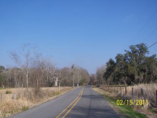
Starting this one, I've thought about including my ride from home to McCall. Thinking is over. If you are going to ride along, you'll have to go through what I did.
Wait, I just found a note that I wrote while all exited about the trip.
"I've read up on the T&P line that came down from Baton Rouge and had a branch that went to Thibodaux. Then, there was a branch of the SP that went north from Thibodaux Junction to just past Napoleonville. Someone wrote that they had "heard" that the two met where you see the brown line at Glenwood Plantation but didn't know for sure. There is a road adjacent to the suspected connection. I want to check it out. Also, the T&P had rails that went into Napoleonville that did not meet. (but seem to in another map below) They both looked to visit the same spot in Napoleonville. The last time there I was biting off a lot and didn't have time to do those spots or didn't know about them. I did catch the Napoleonville trestle across Bayou LaFourche. I don't have any other mysteries on my list, so this is next. I'll try to find the quote about the possible connection. I propose a ride when the time is right".
Failing to excite anyone about this venture, I decided to do it myself. If I couldn't excite who I attempted to excite, maybe you should get off now. If you come along, I don't want to hear any "are we there yet"s.
It was February, prime time for looking for hidden stuff in Louisiana. Our tropical foliage is dead and the snakes, hopefully, are napping. And, of course, the sugarcane has been harvested allowing unobstructed views for miles
.
.
Moving east, crossing the Atchafalaya Basin on Interstate 10, I'd take La.77 south at Grosse Tete to Plaquemine.
On what was a great winding road down Bayou Grosse Tete, I sat for a long time waiting my turn to ride down the squiggly cuts in the pavement, mud and gravel that are so pleasant on a one track vehicle. I had just done I-10 from Henderson over to Grosse Tete, something I never do as I think that 16 mile stretch is tempting fate much too much. I had survived to be here. Talking with Hilda, the flag lady, was a pleasant and calming experience. She offered to give me her flag for my bike. That changed my perspective on my situation.

Years of running the roads have taught me the shortcuts, like La.77 down to Plaquemine.
You cross the Port Allen Industrial Canal making your way there. I could have gone more
southward, but I wanted to ride the rails into Plaquemine one more time.

Here I turned northeast and followed 77 to La.1, just north of Plaquemine.

Riding 77 east to La.1.

Nearing La.1, bare sugarcane fields make one wonder where
the trees are. In growing season, trees are forgotten.

I cruised south into Plaquemine.
The old bridge is always a great shot.

Or 2

This is looking south to the depot. This was my second time here.
I still have Plaquemine and Back posted somewhere.
It's a good one. I'll give you a link later.

Or 3

I followed the rails through town. I didn't explore this time
because I've done that. Check out that old ride.

The rails down the center of the boulevard are just like New Iberia's.

I didn't have a good shot of the Plaquemine Ferry, so I did stray
from the rails. Now that the New Roads to St. Francisville
Ferry is gone, there are only a few left, maybe 3 that cross the Old Man
in Louisiana.


From there I headed south on La.1.

The Mississippi is constantly in sight. La.1 rides on the
natural levee of the Mississippi. To the west the land slants
down to the Atchafalaya Basin.

I detoured off of La.1 to check out Nottoway Plantation.
It is in the upper left side of the map which is a large one if clicked.

Moving south, at Nottoway Plantation, I approached from
the west. It seems replicas of slave quarters are being built
as Bed and Breakfast housing. I wonder what the long gone
slaves might think of that. I find it distasteful, but the old places
have to make money to stay solvent.

Nottoway was used in a James Lee Burke, Dave Robicheaux, film.

Below Nottoway, the remnants of more old sugar mills stand.


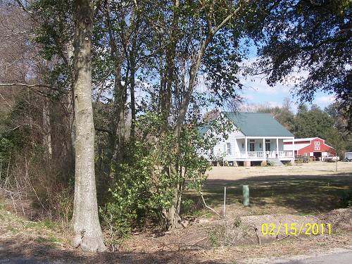
I'd never really seen White Castle, so I left the road and went "downtown".
It was a sad place. As in many, the rails cut through its center.

I was probably at the site of the depot.


Next was Evan. I was at McCall, my target, but didn't know it. See
right below where I've inserted "Evan", in small letters is "McCall".
I hear "McCall" all the time on the scanner. The knowledge that
there was such a place was also a draw for this ride.

I rode into the Evan mill. I could see where tracks had been.
on the GPS. There was activity there and I did not hang
around looking. So far from home, I constantly felt the need
to push on. I also knew that this might be the last time over
here so I tried not to rush too much.

The gray line is my first visit into the mill. The blue is my return visit
after going into Donaldsonville, a wayward trek.
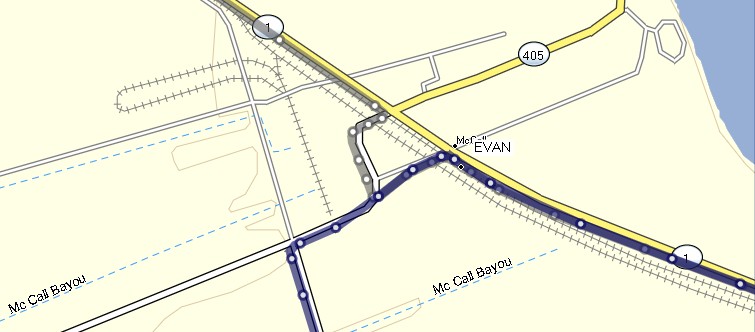
The mill is still served by the railroad but the tracks are
not in the old configuration as seen above.


Missing the tracks where you see Geary, I went into Donaldsonville.
There, I saw this huge warehouse I tried to connect to my railroad.
No, I was in the wrong place and I knew I'd missed it.
I have an ancient picture of this building. It sits on the original rails from Donalsonville to Nepoleonville.
If I'd known it, I'd been over there. It still may be a destination.
I have an ancient picture of this building. It sits on the original rails from Donalsonville to Nepoleonville.
If I'd known it, I'd been over there. It still may be a destination.

Heading back west, I saw the tracks curving south. I tried
going down this lane that paralleled them, but it ended at a ditch.
The old topographic map is so out of date this happens all the time.
Still, I would not trade it. It contains priceless history.
This is the lane I took south.

At the main line crossing, which gave me some elevation,
I shot the exiting Thibodaux branch as it crossed the cultivated
sugarcane field. You can see it as the brown line going right.
Down the tracks you can see the junction and signal box.

DONALDSONVILLE AND NAPOLEONVILLE RAILWAY. . . . Texas and Pacific Ry
Inc. in LA, December 20, 1902
15.50 mi. Donaldsonville to Napoleonville, LA, 1903
I found some other dates but they are confusing. I've given up on trying to judge.
Back to the adventure.
I turned around and caught another shot of the alley.

Green is the railroad. Blue and Gray are me. The Donaldsonville
warehouse was at the right end of the gray line and was probably
served by the railroad, at least at one time. It was not on my
mission card so I ignored it after taking its picture. I needed
to get going.
I went back to Evan and then south, turning toward the
rails on a dirt La. highway. I thought about La.10 on the
Atchafalaya. I need to check it out. It may be abandoned.

La.944 brought me through Palo Alto, a huge plantation.

Entering Palo I was cautious because of how dark and foreboding it seemed.
That happens in February to most. It happens all the time to me.

Look closely, you can see the plantation bell on the tower.

This building had new supports peers and one door. I'm
thinking it may have been the overseer's home.

These trees were planted.

Palo Alto is "1" on the map.
This is looking south from the crossing.

This is looking back north. I remember that strange tie on the ground.

For some reason I think a restoration was in the cards at one time.
The project seems to have gone flat line. The two doors tell me
it was a two family home for the workers.

The 2 wheel carts are very historic. They would sway going
down the road. Any variation in tire pressure would set the
rhythm. The greater the difference, the wider the sway.
Maybe. My great grandfather told me that.

I had to check. It is not the same gray building as above. The
supports are probably the originals. These were worker's
quarters I would guess.

This one is not a "workers quarters". It probably belonged to a
close relative of the owner.
This would be "Palo Alto", the big house.


It was at the intersection of La.944 and La1. La.1 rides alongside
Bayou Lafourche. The banks of the bayou are the highest ground.
Most "big houses" were located on these natural levees. Prior
to the railroads, the rivers were the chief means of transportation.
The roads, were, and still area, unpredictable, look at 944.
There's a excerpt of a levee study way down the page which
mentions rail and river transportation and how the competed.
It ain't much so hold your ground.

I was trying to see the rails wherever possible. Above is "2" looking north.
Below is "2", looking south.

"3" looking northeast. It was "back of" Belle Rose. We in
south La., shorten sentences where possible.

Here's the view form "3" looking south.

I was approaching Lula, the plantation mill AKDN was suppose to service.
These are the rails looking north at "4", the switch to the Lula spur.
Looking northeast from the spur back up the rails.
Looking toward Lula from the turn. The rails are still there.
They had not been used in a while. No AKDN engines were
in sight. I hadn't lost hope until this point.

I headed toward the mill following the rails which were on the
north side of the road.

I stopped and shot back toward the main line.

At the mill they had jumped the road.

You can see the diagonal lines crossing the blacktop. The
trestle is gone if there was one needed. Maybe the ditch is new.
I doubt it.

I went back to the main line switch and took a few shots.
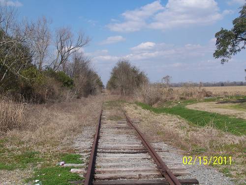
This shows that the rails were gone past the turn off to Lula.

Past there they were gone but the ROW was still easily seen.
I'd continue. Going back now was out of the question. Visits
to the rails would be time consuming.


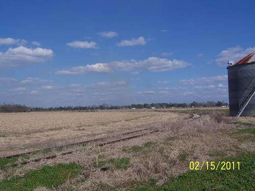
At "5".

This shot is from "6" looking out to the historic Westfield Mill.
I didn't have the time to ride out there.

I had to backtrack to La.1 to continue south.

A farm road, "6", had stolen the ROW, a common occurrence.
I didn't feel comfortable following it. You can see the trees
cut away in the distance. I should have cut across.

I went into Paincourtville and shot the church. I should have gotten more.

I worked my way south.
Probably near "7".

The map, below, I did for myself. I wanted to compare the
route I'd taken in "LaFourche Recon" with the McCall route.
The green line is the Texas and Pacific route.
The dark blue line is the McCall route. It is beneath the light
blue line which was the old "Recon" trail. It becomes lighter
when not underlain by the McCall route.
The brown line going north is the Southern Pacific's route to
Glenwood Mill. The brown line going northeast is the Southern
Pacific's route into Napoleonville from Elm Hall Junction.

The gray line more clearly shows my route this time around.
Click the map.

This map shows the Southern Pacific from Elm Hall Jct.
and the Texas & Pacific coming from a spur off its main
line at the curve going to the bayou crossing which meets
the S&P in Napoleonville. The actual curve is at the road.
The drawing seems to depict that they met. The road is
a busy one. Kids were everywhere just getting out of school
which makes for terrible sleuth mode hunting. I doubt if
any evidence was there, but it would have nice to speculate.
Looking again, rails can't do 90 degree turns. I'll back off
my guessing on the meet. This map is deceptive. Or maybe....

I've gotten ahead of myself with the Napoleonville branch supposition.
Backstroke:
The next shot was taken look from below "8" down to the
Greenwood Mill. This is the road where I'd hoped to see the
connection between the SP and the T&P.

Glenwood Plantation burned in 1955. I would bet it was
off of La.1. and the bayou. The presence of large oaks
would be evidence of that.

At the ruins of the Greenwood Mill I shot a lot of pictures.


This is looking north from the mill.

The SP tracks would border the mill on the west. It is the
brown line coming from the south.
The green line is the T&P.

This is La.1006 looking south from the curve. If the rails
had been out there, cultivation had hidden them.

I walked into the field and went to the place where the rails
would have met according to my calculations.

I panned west. I was in line with the smokestack. I say
there is evidence of a meeting here at one time. Now this
seems to dispute a meeting in town. Or, maybe both
occurred at the same or different times. Or maybe neither
occurred at any time.

I left the mill and the road to Enola did not exist. I continued south.


At Elm Hall was this building.

I believe this was the route the SP took up to Glenwood Mill.
You can see it continuing north.

Looking south from Elm Hall Jct, the ROW is clearly seen.
I had ridden from the south on it during the LaFourche Recon
ride after I'd realized what I was following. This time, having
done that, it was time to make haste home. It was February
and my light would be going away quickly.


But, first, I had to go into Napoleonville to visit the T&P
trestle over the bayou.


Looking east.

Looking west for signs of the ROW which would curve north
to meet the rails coming south from McCall and the the T&P
spur switch into Napleonville. No problem with that.

As I said, I had arrived in Napoleonville at a "bad time".
I have become careful and weigh the possibilities. I moved on.
I was on the road to Atakapas Landing. I recognized the road.
It is a beautiful ride trough the swamp but obviously the long
way around.

I eventually made it to US 90 and headed home. It had
been a very long one. I'll put together the other two rides,
"Lafourche Recon", dealing with the SP going north from
Thibodaux Jct. and then the T&P going south from Napoleonville,
if I see any interest in this one. Then I may redo the entire
Bayou Lafouche road ride down to Grand Isle. We'll see.

1903 or so.

1921

The bus had come to town.
Letting The New York Times have the last word is troubling.
Yes "omnibus" is an archaic term for a bus or wagonette, a
passenger carrying road vehicle says Wiki. Now there's an
educational morsel you can get your teeth into. This railroad
stuff may be oatmeal.
The Plaquemine and Back Ride can be read HERE.
And, I said no history was posted. I had forgotten about these notes.
These are clipping I collected. Most don't have dates but consider them form the early 20th Century.
•Donaldscnville, La.—S. Wexler, New Orleans, has submitted plans to the City Council in which he offers to build a 16-roile electric railway between Donaldsonville, White Castle and Napoleonville if the Council will grant him a franchise in Donaldsonville.
A sequel to the recent litigation regarding the right of the Leon Godchaux Co., Ltd., to run a narrow gauge railroad on the side of the Attakapas canal, made its appearance on Tuesday when an ordinance was offered by the Police Jury giving the right to the land owners paralleling the railroad to move their fences on the outside of the track, thus having the track on the inside of the fence, in the field, instead of on the public road as it has been declared by the District Court to be. The matter was carried over until the next regular meeting of the Police Jury.
Check this stuff: Click Here.
The community of McCall owes it's name to this fellow.
"Hon. Henry McCall , president of the McCall Bros. Planting and Manufacturing Company, spent the past week-end at Evan Hall, having returned to Louisiana only a few days before from a two-months' sojourn in the northern states. Mr. McCall found much improvement in the cane crop, though the weather at the time of his visit was not of the kind most desirable for this season of the year. There has been a superabundance of rain and high temperatures, whereas opposite conditions are needed to mature and sweeten the cane and facilitate fall plowing and planting".
More stuff Here from 1910.
If I do the SP ride, we'll be coming from Shriever and check some of the plantations served by that railroad.
This is more I know you'll find interesting. It was a levee study but compares river traffic with railroad. (Well, a little anyway) The typos are theirs and I'm not correcting them.
The commercial interests to be affected by an improvement of Bayon LaPonrche will be understood from the following statements. The total value of agricultural products raised along the banks of the La Fonrche during the season 1885-'8(i was about (3,200,000, of which about §2,000,000 must be ascribed to sugar and molasses, the remainder to rice, potatoes, and miscellaneous products. It may be stated with sufficient accuracy, that the Southern Pacific Railroad Company controls shipments of products from the parish of La Fourche; this parish produced crops of the value of about $1,100,000, leaving $2,100,000 for the parishes Assumption and Ascension. The railroad freight rates do not vary with the stage of the water, since at all seasons, freight transported by rail is gathered from the plantations by largo flat-boats, the running of which is rarely, if ever, interfered with by low water.
When the water in the bayou has reached a stage so low as to prevent the entrance of large steamboats from New Orleans, products seeking shipment from the upper part of the bayou are taken by flat-boat to Donaldsonville, thence by steamboat or Texas and Pacific Railroad to New Orleans. Captain Drown, secretary of the company owning the largest steamboat interest in the bayou, informs me that this flat-boat service causes an average increase of about 40 per cent, over high-water rates. The ordinary (or high-watev) rates are: one hogshead sugar, $1.50; one barrel sugar, 35 cents; one barrel molasses, 75 cents; one sack rice, 25 cents.
OK, that's it for a while.