This article has been updated twice.
Read the newest revelations.
A partial review was offered by Agent 00-L.
I will use it as a hook to get you to read this long HISTORY HUNT.
Italics {and quotes} are the Agent's words.
The Midland History Hunt
First of all let me explain the title.
Read the newest revelations.
A partial review was offered by Agent 00-L.
I will use it as a hook to get you to read this long HISTORY HUNT.
Italics {and quotes} are the Agent's words.
"I concur with you on the meaning of "BKWOYP," and I believe that "K" is clock.
There certainly wouldn't have been any need for an interlocking plant at Midland, and no turntable would have been needed with a wye present."
LTEX 2533 does not belong to AKDN. As the reporting marks prove, it belongs to Larry's Truck and Electric of McDonald, Ohio, a dealer, lessor, and scrapper of used locomotives ( http://www.ltexrail.com/ ).
"Your concrete circle on the ground is a puzzler. It is not large enough to be a turntable. A water tank would have been elevated and would have had only footings in the ground for its supports. Perhaps the circle was the foundation for a ground-level oil tank made of riveted plate iron. We know from "BKWOYP" that there was fuel oil at Midland, probably a smaller tank for fueling locos on the branches north and south. Oil would have been brought in by tank cars on the main line."
"The sensors alongside the main seem to be of two sorts. The one in a rectangular box on a post beside the track is an AEI (automatic equipment identification) reader. These communicate with passive transponders on each item of motive power and rolling stock to take the inventory of each passing train for car tracing, per-diem billing, etc. I have never seen sensors like the long low ones on both sides of the track. They might be new-fangled hot-box detectors, but all with which I'm familiar consist only of a thing smaller than a breadbox on each end of a tie."
"The Estherwood water tower is of a common old design, most likely from Chicago Bridge & Iron, the early leader in that field, . They aren't specifically railroad-related, but the availability and presence of rail transportation made them possible at most of the locations where they were installed. CB&I is still in business and still builds modern water towers as a small segment of its business. Headquartered at The Woodlands, Texas, it now specializes in large refinery-style tanks and mega construction projects like whole refineries, ports, and nuclear power plants. It isn't in Chicago, doesn't build bridges, and doesn't use iron (as opposed to steel, etc.)".
He added that I might not be so happy with his ideas on my cross track theory.
So, when you read that understand that it is an opinion.
The Midland History Hunt
First of all let me explain the title.
I chose it because I want to be No.1 in Google's hunt for the term "Midland, Louisiana" which I know must be a daily stress on Mother Goo's engines.
(that was a subtle joke)
(that was a subtle joke)
That explanation was easy. The next one will be a bit more stressful.
LZ and I have been recklessly careening from one southwestern La. rail community to another finding out what we can about each, mostly failing and moving on to the next failure. This failure, the subject of this ride report and history hunt plus a little "train chasing" seems not to be a total failure because like many pursuits ending in failure peripheral information gathered along the way makes the failure rewarding, the proverbial silver lining which failures sometime produce.
This failure started simply enough. No, let's be positive. This silver lining started simply enough. "Pictures of depots" has been the latest interest. LZ asked if I had an old picture of the Kaplan, La. depot. I had one and he showed me one that Mike Palmieri had taken later on. I sent LZ a link to my Kaplan page. But, before doing so I went through it and updated the pictures to their original uploaded size. That produced this, courtesy of Mz Donela, the Queen of Historical Preservation in Kaplan.

Then we got into a discussion on how a passenger could get to Crowley from Kaplan.
(by rail)
(by rail)

That resulted in the question, "Is there a picture of the Midland Depot?
I was under the mistaken assumption that the Midland depot had been moved to Eunice.
I was wrong.
What I thought would be a slam dunk epiphany turned out to be an embarrassing misfire similar to some posted Wiki information. I won't say to which I refer but it had something to do with "Torras".
It was back to square one. I was obsessed with Midland and I still am as failure takes a while to ripen with me and it's not ready for picking as I've discovered new avenues to travel which will make this article a "Part One ... To be Continued".
Back to the late evening search parties.
Finding a picture of the depot was fruitless. LSU didn't have one but does, it seems, have most of the Sunset Route's within Louisiana. What was the deal? Midland was the junction of the Midland / Eunice branches and the Louisiana Western / Southern Pacific trans-continental railroad. It seemed an important place in the history of Louisiana transportation. How could it be left out? It also seemed a dead zone or one forgotten because of a failure to document or preserve documentation. The searchers in the past let their failure ripen too quickly? It ain't happening this time. I am trapped within an obsessive compulsive personality and only the truth will set me free.
Let's move on before I throw a spike at the wall and break something.
I had gathered what follows when I was trying to find the Cade Depot. What I really needed was glasses. Nevertheless, this information is priceless. I found it buried in a report on rock salt in north Louisiana.
Don't you read articles on rock salt in north La.?


From the search of Google Books sprang this:


From a Southern Pacific tour article came this:

Frustration almost got to me. LZ picked up the ball and assaulted the maps to which he was privy.
Not much came of that. Then he started deciphering timetables as the picture hunt was dead and now the shift had gone to "rail configuration at the junction".
He noted that crossings were marked and he could find none at Midland.
He deduced that there was NO CROSSING.
In the early years I believe that was correct.
Two branches simply merged onto the main line. Though trains from Mamou / Eunice to New Iberia
would have to maneuver a transition. More on that later.
Below: 1935 ..


Later looking deeper into this schedule, this was discovered.
Below it reads: Length of siding in cars (counting cars)
Location of bulletin *
water and fuel stations *
standard clocks
interlocking plants
turntables
wyes and telephones *

The initials "BKWOYP 105" is under that heading for Midland.
Comparing, "BKWOYP Yard" is the one for New Iberia, a known entity.
Breaking down the initials, my guesses are these.
B = Bulletin
K=?
The possibilities for K are :
standard clocks
interlocking plants
turntables
"Standard Clocks and Interlocking Plant" (?) are possibilities.
"Turntable" probably not, but I did find something circular.
W = Water
O = Oil or fuel
Y = Wye
P = Phones
"105" = car count for yard.
All of that is a guess.
More from Schedules and Timetables.
New Iberia, Midland and Mamou 1926
Very confusing.
Very confusing.

1915 SP Mainline

1915 Schedule New Iberia to Mamou

All of that is a bit beyond my willingness to translate since
my translation would probably be wrong
and result in a failure that I ain't got time for.
That was about it on the Kaplan to Crowley "thread".
Next: I produced a map form my Garmin topo software.
I was advised that it was subject to fault but it is all I could find and I've looked.
An old satellite map produced this. I have not been able to relocate it. "91" is actually US 90.
Below it can be seen the "north of the mainline" siding tracks.
Below that is the main line.
Below that is the wye feeding the Midland Branch onto the mainline east and west.
Now comes the mystery we confronted, how did the Eunice branch connect to the Midland to New Iberia Branch. Remember, LZ could find not crossings noted on the timetables.
One suggestion was that it didn't cross without using the mainline as a switch back step.
One suggestion was that it didn't cross without using the mainline as a switch back step.
The step would be pulling onto the main and then backing to the west arm of the wye and then
proceeding south. A north bounder could pull west, back up and then go north.
The eastern connection of the north sidetrack seems to align with a curved outline above "91", actually US 90.
But then, there seems to be a line sprouting from the inside of the left wye arm.
This map was the one I needed to decipher on location. I knew that evidence would be hard to find.
On the upside, I know that Midland still held a lot of railroad history on its surface.
I would see if it would give up a little more.

This is my Garmin map's interpretation of the above.
I wish I'd looked at it closer before the ride over there.
That said, maybe it is best I went a little less prejudiced.
Update: As much as I'd like the Garmin version to be right,
OO-L shot down the multi-rail crossings.
But, the above 1990 view shows no crossings except the main line.
More on that later.

That said, maybe it is best I went a little less prejudiced.
Update: As much as I'd like the Garmin version to be right,
OO-L shot down the multi-rail crossings.
But, the above 1990 view shows no crossings except the main line.
More on that later.

Red could be the old arrangement I noted first. I call it the "switch back" theory.
Green, I had feltl certain, was the last incarnation connecting the south portion
of the Midland to the north portion.
This is what I got from Garmin.
The original map, the black and white one with the "sprout" going north from the
west arm of the wye supports my cross track theory. I don't know
how Garmin created the one below which I used as a theory until 00-L shot it down.

I stuck this in so you'd know where the ... you were.

Information buried in the map above:
Leleaux was the original home of the future residents of Kaplan. The population moved to the railroad.
Bayou Queue de Tortoues is mentioned later in a little Midland history.
The dash lines are US 90.
The Midland Branch is the one going north from Morse north across the Louisiana Western / Southern Pacific. to Egan and Iota and ultimately Eunice and Mamou.
The line coming south from Maxie to Crowley is still in use by the Acadiana Railway.
The engine that you will see in Crowley came down that route.
The SP Lake Arthur branch coming from Mallard Junction is to the west.
The Texas & Pacific / OGNE route is to the far east. It came down from Melville to Opelousas and south to Rayne and Crowley.
Enough
Break Time.
Mark and many others, I know, are shedding big old boredom tears about now.
I do realize how far I can push this stuff before having to pull the write out of the crypt of dead history.
It's time for the ride report and on location search for evidence in Midland.
Heck, I was about snoozed off myself and I love his stuff, probably because I can go to it instead of having it come to me if I worked hard at imagining it, which is what I ask of you.
The Ride to Midland Junction
I suggest No Doze to get you through this also. Sorry.
It was Friday afternoon and you know the story, Steve needed an escape.
I had the radio going and it was silent.
I rode indecisively west out US 90.
The thought of going to Midland and finding nothing after finding nothing on the internet was not appealing.
But, since it was Friday afternoon and The Limited would be speeding eastward I'd putt out that way with no expectations and enjoy the moving air though it was about 97F.
I'd rigged up a refrigerator on my bike and it was full of ice water and a couple of soft drinks plus chilled granola bars that would not be melted as they have been recently.
Arriving in Crowley.
This is how desperate I was for pictures.
Crowley .... I won't bore you with captions.
There is enough text on Crowley within this blog already.
.jpg)
.jpg)
.jpg)
.jpg)
.jpg)
Looking back east from the truck yard. This is a new shot location.
This is, I do believe, the spur to the Missouri Pacific Depot in Crowley.
.jpg)
.jpg)
What you just saw was a renter. Why it is down in Crowley I have no idea. It does not belong to AKDN.
What I found: Look hard enough and someone has shot it and posted it. Thanks Tim.

Next, I was on to Midland.
LZ wanted to know if there was a "hump" in US 90 where the Midland had crossed.
Yes.
Standing atop what I perceived to be the highpoint of the hump I shot off into a sunken field.
I've studied these pictures and compared them to Google Earth. I believe that first tree is very close to where the rails were.
Update. I believe this to be the "sprout" line coming off or the west wye.
Update. I believe this to be the "sprout" line coming off or the west wye.
.jpg)
Looking back south from the hump those cars and BNSF trailer would be useful landmarks. The driveway where the bike is sitting is also important if only because the bike is sitting there.
Those cars are on a side track that is to the south of the main line.
.jpg)
Once more looking north
.jpg)
Back on the south side of US 90, but north of the main line. I was standing near the trailer shooting across the highway. It was a dud shot but look what I found in the bottom left corner.
.jpg)
It was circular and concrete. Across the tracks can be seen the cut that defines where the "sprout" that connected the Eunice Branch came up from the south.
Those are sensors on either side of the main line. I was tempted to walk down between them but then I might glow on the way home.
Those are sensors on either side of the main line. I was tempted to walk down between them but then I might glow on the way home.
.jpg)
This was an intriguing moment. "A tank" would be the easy explanation. "A turntable" would be a reach.
OO-L joked that it was a "septic tank".
OO-L joked that it was a "septic tank".
.jpg)
Other stuff was on the ground. More cement. I should have brought my weedeater. Next time.
.jpg)
The general driver on US 90 has no idea what he / she is passing nor really do I.
.jpg)
Below the mainline I got onto the Old Spanish Trail which now has a new layer. Surprisingly the wye humps were not destroyed. This is looking east. The mainline is to the left. Notice the incline that the approach had.
.jpg)
That road before the wye is Sparrow. It parallels the west wye arm.
I think it was the main street of the community's business district.
.jpg)
.jpg)
.jpg)
At the end of Sparrow I turned north on Chester Lee. The west wye can be seen as a gentle hump ahead.
the main line of the Midland is to the east (right) Chester Lee dead ends at the OST (Old Spanish Trail).
.jpg)
I have a tie plate with 4 spikes sticking into it from this hump when the road excavation unearthed it.
It is a prize.
.jpg)
Chester Lee and the OST. .jpg)

I walked off the end of Chester Lee to check for any grade that might have continued north.
I should have walked down to the east arm but it looked impregnable.
What looked like an outhouse was to the east.


I'd pushed the "envelope" as far as I wanted.
I returned to the west wye hump area on the OST.

Looking east the smaller east hump can see seen crossing the OST.
This was take from Chester Lee. .jpg)

Parked at the west wye I could see that what I now call the "sprout" track shot right across to the trailer and the circular concrete.
But, there was another high ground route to the tracks to the left. It was the left arm of the wye.

I walked north on now believed "sprout" track.


.jpg)
Panning left (west) remnants of another side track or road could be seen. The main line is the top one.
.jpg)
I returned to the bike and walked out the driveway that was to the left. That was the west wye arm.


The same rock as seen on the "sprout" track was on the ground.
Now I have to check to see if this area which could be the depot's, could be 400 feet from "the road crossing". La.Hwy 91 crosses the tracks to the west. The west wye is 528 feet from it.
400 feet would put it here. I don't know. The descriptions are confusing. I need to plot the locations
on my gps. Triangulating all of that will nail it.
This is looking west from where the west lane came out onto the tracks.
The large building is on 91 on the north side of US 90.
.jpg)
This is looking back northeast at the route of the "sprout" that went this side of the BNSF trailer.
.jpg)
Looking back west along the tracks toward where the depot could have been.
.jpg)
Looking back at my theory, "the sprout".
.jpg)
I'd had enough. You have too.
Update:
00-L noticed a mistake I'd made in naming the allies. I had called the blue line the
"west wye arm". The yellow dots, the west ally, is actually the west wye.
The blue line is my thesis.
.jpg)
Below is my proposed route of how the southern portion of the Midland Branch
connected to the north using the "Sprout".
.jpg) LZ found a picture of the depot.
LZ found a picture of the depot.
Notice the name plate is a little askew.
The Devil seems to have clearly enlisted him.
It is actually the Baldwin Depot.
 He had said that Mr, Pigfoot, the first station manager, had a personalized license plate.
That seemed to be true.

Nothing was conclusive and remains in that state.
Update:
00-L noticed a mistake I'd made in naming the allies. I had called the blue line the
"west wye arm". The yellow dots, the west ally, is actually the west wye.
The blue line is my thesis.
connected to the north using the "Sprout".
Notice the name plate is a little askew.
The Devil seems to have clearly enlisted him.
It is actually the Baldwin Depot.

That seemed to be true.
THE TRUTH
Nothing was conclusive and remains in that state.
I went to Estherwood and stood in the sun for 45 minutes waiting on the Amtrak.
I opened the refrigerator bar and began drinking. I drank and drank and never needed to "P".
I'd been sipping all along but had lost pace with dehydration.
I never needed to "P". I was off in the danger zone but feeling much better. I walked around waving at small animals and talking to the tracks.
This place has two esthetics that I thought would augment a mundane Amtrak picture.
One is the side track along the warehouse.
The other is the Estherwood water tower, a classic design seen in many small railroad towns. I'm wondering if I just made a connection between the towers and railroads?
.jpg)
MP 173 (miles form the Mississippi River by rail)
.jpg)
Looking West
.jpg)
Looking East
.jpg)
Looking West
.jpg)
Looking West
.jpg)
Looking at the dang Amtrak.
.jpg)
.jpg)
.jpg)
Next is more research. Ready? Recess is over.
These are cuts from the Crowley Daily Signal newspaper.
I can't nail the exact date of printing but 1949 is close.
This is also where I'm bailing out.


Enlarged.


This is from their page on Iota. I cut out the part mentioning the railroad.


This from the Crowley Page. An epiphany would occur. OO-L spotted it first.


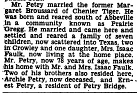
Then I found this on line by the historian scholar, ex railroader Mr. William Thibodeaux.
It is indeed the silver lining that made the whole Midland Hunt worth it.
That's it, and like I said, this is to be continued.
William Thibodeaux
Special to The Daily Advertiser
In 1914, Babe Ruth made his baseball debut pitching for the Red Sox. The most popular movie of the year was “The Perils of Pauline,” a silent film featuring Pearl White. That year also saw rail employment nearing the height of 2 million workers nationally. And it was also the year that Lafayette native Galbert P. Patin was killed in a railroad accident at Mermentau.
According to reports, Patin was employed by Southern Pacific Railroad as a locomotive fireman. He was killed at 3 p.m. Oct. 17, 1914, while switching railcars on the Mermentau wharf. Locomotive engineer James Welsh was at the throttle and received only minor injuries.
According to The Daily Advertiser, their engine was a new and larger locomotive than what they usually handled. The paper also said the accident was caused by the “weakness of the wharf track.” The condition of the track coupled with engine dynamics of a larger locomotive apparently contributed to the deadly accident.
Patin’s body was returned to Lafayette on the Oriole Express, one of several SP passenger trains during the railroad’s heyday. St. John’s Cathedral at Lafayette was filled with family, friends and members from the Woodmen of the World organization and from the Camellia lodge of the Brotherhood of Locomotive Firemen and Enginemen, which later united to form the United Transportation Union.
The wharf at Mermentau was where riverboats and railroads met to interchange goods to be sent to and from the Gulf Coast. Mermentau was the gateway to the gulf, paddle-wheelers such as the Olive and the White Lily plied the waters of the Mermentau River working the cattle and freight trade between Mermentau and Grand Chenier.
Patin’s widow continued to live in the family home, which is located on the corner of Evangeline Thruway and Third Street where AutoZone is situated now. Like many people of that era, she rented rooms to railroaders while at their away-from-home terminal. Jack, Patin’s grandson, remembered how the trainmen would simply leave money on the kitchen table before leaving, which was either 25 or 50 cents.
Due to the erratic train schedules and hours of service for trainmen, the house was never locked. “There wasn’t even a key for the back door,” recalled Madeleine, Jack’s wife.
Over the years, Jack would often ask his father,George, about the incident that took Jack’s grandfather’s life. The only thing family members had known was that Patin died at Mermentau in a train accident. With the help of UL’s Dupre Library, family members now know what took the life of Patin.
This was the wharf at the Mermentau Bridge where Fireman Patin lost his life.
