The bike started and sat idling while I considered what I knew would happen.
A certain amount of carelessness would be required.

The blue line is the Atchafalaya River. That other river is the Mississippi.
The reddish line is my route or close.

If I could avoid the two hungry cane eaters, I'd be on my way. The angrier one is the female.

Up the Teche I flew after visiting with Trooper Latchiolais in Henderson. He was worried that my bike was stolen. Yes, that happened. I felt like a little old lady getting frisked by those airport thugs. You know, there was a choice, federal or a private company. Now we have Airport Care.
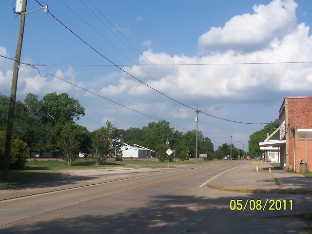
I stopped for a tin industrial picture.

I always pull over where the little church stood on Highway 359. A tornado hit it in 2006, possibly 2005, the year of Katrina and Rita.


Today

I rode over to US 71, below LeBeau.
At Lebeau, I took La.10 to Palmetto and Melville.
First, some old pictures of Palmetto:
The Budden Store and feed works.
The feed mill was once on this side of the tracks and had a spur.


I will bet these rails have been renewed to fit the new passing track.
I will have to go back and look.

30 mph or pay.
Abandoned church, now a private residence.

Abandoned high school.
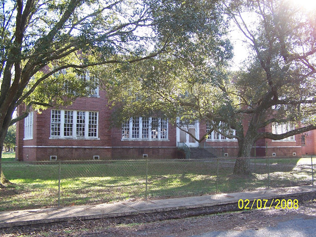
Go Pirates.

Now, lawyer's office.

The main store, still is.

I'm fairly sure this was the Palmetto Depot.


I just found the tag for the pictures. Yup!


This had to be the depot area.

The Morganza Spillway gates.
There are similar ones at Melville, a protected "island".


First, some old pictures of Palmetto:
The Budden Store and feed works.
The feed mill was once on this side of the tracks and had a spur.


I will bet these rails have been renewed to fit the new passing track.
I will have to go back and look.

30 mph or pay.

Abandoned church, now a private residence.

Abandoned high school.

Go Pirates.

Now, lawyer's office.

The main store, still is.

I'm fairly sure this was the Palmetto Depot.


I just found the tag for the pictures. Yup!


This had to be the depot area.

The Morganza Spillway gates.
There are similar ones at Melville, a protected "island".


Exiting Palmetto, I got a lucky shot of the State Canal crossing. The "State Canal" has an interesting story.
It is also called the "Company Canal". It is also called the "Bayou Des Glaises Diversion Channel.since the
bayou no longer reaches the Atchafalaya at Simmeport. I'm still looking for the "interesting story".


This is the big levee rising to the east past and bordering the Company Canal.
Getting on it will take you to the where the Texas & Pacific Railroad ran on its
route from Opelousas to Melville where it met the main T&P rails which ran between
Addis and Alexandria.

The road leans noticeably (Louisiana's soft soil) as it enters a tree cave.

Exiting the tree cave, I was able to join the railroad as they have provided this long "service road" along the
extension to the Palmetto double track. A similar double track is on the east side of the Atchafalaya, but not nearly as long so I guess it's really not similar, to be clear.
Looking toward Melville> I really think they want to put more track here.
But, maybe it will be for something else.
I'm now thinking " yard".

Looking toward Palmetto> You do realize that this is all within the Atchafalaya Basin, what there is left of it.

Next was the Hog Bayou crossing. It is not double railed. It is the beginning of the bottleneck. The rails from the La.77 crossing on the east side of the river to this place are single track..

Entering Melville, I had to shoot the old, abandoned T&P grade as it made
its triumphant entrance from the swamp.
The pilings for the bridges are still there on the outskirts of Mellville and at
Second Lake and at Lake Darbonne.
You have no idea the thrill it was not getting snake bit.
Second Lake Crossing.

At Melville.

At Bayou Darbonne

And the grade at Melville.


Moving into Melville>
Perfect framing, almost. I'll coin these water towers as "The Tin Men" for their hats.
We'll see another famous one or two, later.

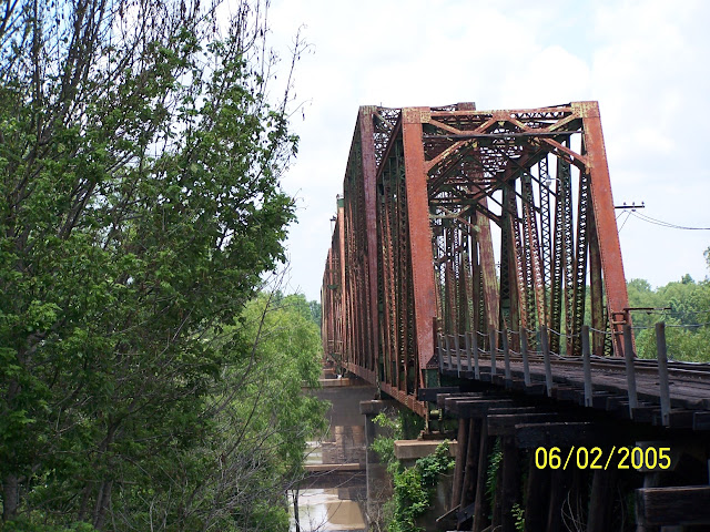
Then, once in Melville, you make the pilgrimage to the bridge.


It's time for a train story:


Lesson Learned?
In the rear view mirror I caught, after missing, the old store. It was snowing, again.
Lesson Learned?
In the rear view mirror I caught, after missing, the old store. It was snowing, again.

Exiting Melville, going up the old Melville Branch that connected Melville to Simmeport, the long way round, there are a few landmarks, but the levee overpowers most of them.
Railroad Info:

"Delana" is spelled wrong. It's "Delano". There is still a large farm there.
I have a picture of the road sign and ventured out to the bed on one of my trips.


Bayou Current

The little Presbyterian Church was a long ago discovery. It's doing fine.


Bean Harvesting.

Hay baling.

Louisiana wheat.

Beans being transferred.

There were at least 6 churches between Krotz Springs and Simmesport.
There are probably 4, now.
Nature's power is on the other side of that "hill", a facet that probably makes for a steady congregation.

Back in 2003 these guys came along and I rode with them on up to Morganza.

Hospitality was somewhat lacking and we left with no pie, going our separate ways.

I thought the above picture so good I made a postcard out of it.
You may download it and send it to your friends.
Tasteful, isn't it?
{Picture taken 2 miles north of Krotz Springs}

I didn't take any pictures of Woodside this time.
So, I'll add old ones.
The sawmill that the local yocalls could not recall.
The two I talked to actually got hostile.

This from an old write.


Woodside Today.


Odenburg, Louisiana>

This is the Odenburg schoolhouse. I was taking its picture one time and was met by
a real jerk who lives across the road.
They are everywhere. So, no hard feelings Odenburgers.

2005

I've monitored this falling down barn since 2001.

I've monitored this falling down barn since 2001.

You've seen your troubles, Odenburgers. 1927>


There was once a great honkytonk at Odenburg

Below Simmesport>
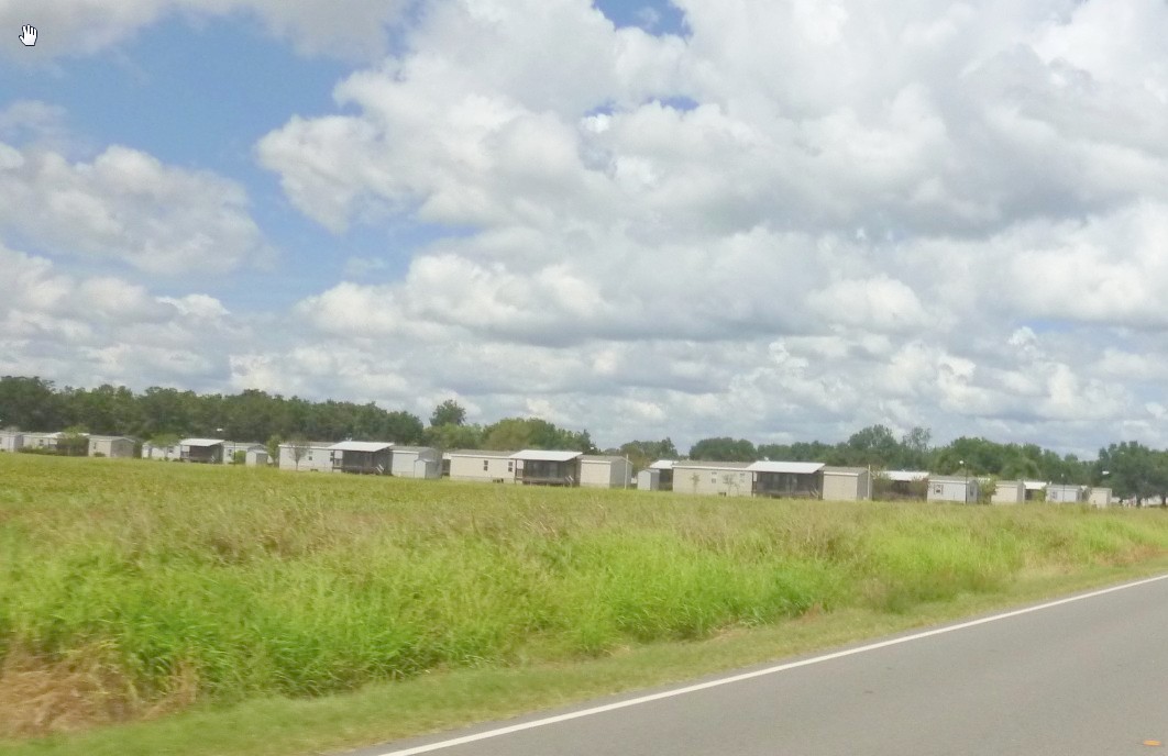
These trailers were left from Katrina. The place was built by Canada.
Back then:

I stopped at the park south of town.

I had stopped there in 2011.


The road pictured sits on the bed of the Simmsport to Melville tracks.

La. 105 does likewise as it meets La.1. But the most interesting aspect of Simmesports's rail layout
was its turntable.

I threw the camera over my shoulder and got a perfect shot of the right of way headed to Melville.The rails
sat on a high grade which was perfect for the road when it was pulled up in the mid 1950's.

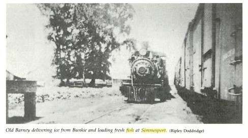
Ol' Barney had visited here, coming in on the Avoyelles Branch from Bunkie.
 But, the most visible landmark in Simmesport is the bridge.
I took a number of pictures of the bridge before security became a big issue.
From the park.

And the Turntable Area.
The depot was just down the way.
How do I know? I talked to a 75 year old woman who lived just to the left of this picture and
was born in that house. She knew stuff. I wished I'd had the questions.
She was taking groceries in and our brief visit was a gift.

Exiting Simmesport, going south on La. 1.
I took a number of pictures of the bridge before security became a big issue.

From the park.

And the Turntable Area.
The depot was just down the way.
How do I know? I talked to a 75 year old woman who lived just to the left of this picture and
was born in that house. She knew stuff. I wished I'd had the questions.
She was taking groceries in and our brief visit was a gift.

Exiting Simmesport, going south on La. 1.

Keller, La.


This is the little work yard at Keller. Looking northeast from La.15.

Better pictures were taken a while back.
The spur can be seen here.

From this map, it seems that it was not a spur, but a siding / passing track.

Here's the trestle over Bayou Lettsworth.

Bayou Lettsworth was a player up at Torras Junction.
Both the Texas & Pacific and Louisiana Railway & Navigation Co. had to contend with it.

Looking south from La. 15.

At Lettsworth, I got off the bike and looked into the foliage next to the old store.
There was another building in there. I may have a picture.

Here's the little building, probably 8 years ago.

On "The Chair Ride", I made it a point to sit on the porch". Buddy Guy was singing the "Lettsworth Blues",
down at the other end.
The old store does not have long.
I've been saying that for years.
But, I once could walk the porch.
Doing so, now, would not be a good idea.
And, it was not the depot.


Looking north to Dead Man's Curve where the troop train accident occurred.

From a long ago trip.
This is the curve

Walking across the highway.

735.70 miles from where? Remember, this was the Texas & Pacific Railroad. KCS uses it now. Might be that far to Kansas?

Looking south. The depot location was on the right.

Looking north, the crossing was far OLD lA. 1, now to a farm.

Looking south from old La.1's crossing.

Here's a better look at the depot area.

This is the depot. It had already been moved from the Store area.

This is from my visit in 2006

This is from my visit in 2006

Where to?

We won't ever see inside again.
I have pictures of all of the rooms.
Posting them all here might be viewed as presumptuous.


I thought I had a picture of the scales, seen just a bit to the left.


Looking into the freight area.

One last look at the Old Store.

We are headed south. This shot from the first crossing south of Lettsworth looking back at what
I want to call a "cotton gin".


This is the way the rails once looked at Lettsworth.
It definitely had a depot track.

The new ballast continued.south after taking a break at the crossing.,

This is the community center at Innis
Note the design. It will be seen again soon.


The Purperas had several stores in the area. I was once contacted by Smuck Purpera.

New farming on the left and on the right, the large monolith of an old mill smokestack.

La.1 once went on the left.That changed in 1958.

On the other side of the levee, La.1 continued.

Though flooded a million times, the road is near perfect. We have not gotten better at road building, only cheaper. I'd probably get shot riding down there now.
Up over the levee.

The old road can be seen below.

It continues. The Mississippi River is far to the left.

The KCS / UP RRs are to the right.


Continuing with the rail / water tower theme.

New ties lined the rails

There's that architecture again.


Leaving Morganza, I may have found more of Old La.1 north of New Roads.
'

This was a place called "Frederic Spur". I can't get a hit on Google.
But, GE clearly shows this area as paved.
I should have looked closer for a rail bed. That area to the right looks like the real deal.
It might even have embedded rails.

Yes, this old store is still there just before the corner of La.415 going to the levee.


The old Farmer's Market.

The old market is located at what looks like the beginning of the spur.

In New Roads I went by the old depot location and this warehouse.

The white building is sorta where the depot was.

A neat old house, one of hundreds, in New Roads.

Classic Senior High School named for Poydras.

Livonia.

The Stucky's on US190. Almost wrote "Smucky's" thinking of Purpera.

Krotz Springs Bridge over the State or Comapany Canal.

Another water tower / rails combo.

Another tin man.

Home by 4:00 in a pouring downpour, what I was afraid of 200 miles up the road, but,
I needed to stretch it out and this route is a good one.
Still no KCS trains, a fate I don't seem to outrun.
Sorry this one petered out.
My writing stamina isn't what it once was.