rode up into south Mississippi. That was after
about 8 years of continuously exploring the
south one third of that state when visiting
my daughter in SE Louisiana. Without going
on and on, let me say that each visit was euphoric.
Quoting ZZ Top:
"Took a jump through Mississippi
Well, muddy water turned to wine
Took a jump through Mississippi
Muddy water turned to wine",
from the song, "Jesus Just Left Chicago",
one of the finest white blues songs ever written.
From the album, "Tres Hombres" with the finest
inner cover you will ever see.
Yes, being there takes me back to "a place".
The "place" being the home of so many blues greats.
I'll start this ride report off as I have so
many done from that part of the country.
"After doing a few chores for my daughter, I
left on an adventure into the neighboring state".
S.MS has the environment that best suits my needs.
It was a Sunday morning and what traffic there was
were church goers.
 Mississippi will pull this on you all day long. Road
surfaces become interchangeable.
No problem.

I wish I'd come while the foliage was gone. History goes
back into hiding as the leaves appear.

Below is a large map when clicked. The arrows are correct.
All pictures do the same. So, if you want to download one,
click it and get the larger version.

Back to the ride:


Up the gut, between US 51 and La.27/Miss.25, the altitude
rises. US 51 rides in the Tangipahoa River valley and 27/25
rides, somewhat, in the Bogue Chitto R. valley. (both spellings
might be wrong) The important point is that what you see
below is in quantity between the two valleys. At times I was
riding above 400 feet, near nose bleed altitude for this lowlander.

My first major historical stop was at Sunny Hill Church.
From an expert I found out that the old building next to
it was not a hotel, which I had guessed, but a school. I may
republish that ride later now that Mississippi has again
become interesting.

Sand and gravel operations are everywhere.

I was on a back-roading roll.

Then, as soon as it had turned to gravel, it went
back to blacktop again.
The sun was not sufficient to highlight the azaleas.
They were everywhere.

Then I decided to turn east and go to Red Bluff and follow
the railroad south, but, I'd hang with going north for a while.

I was into Mississippi. Road signs usually tell where a road
starts and where it ends. I see it as my job to find out what
is between the terminals. The Smithburg sign was flawed, or,
I was already there.

At Mt.Herman, I was saddened to see the old house half gone.
I should post my historic picture of it here, and, maybe I will.


Up in the woods, at Silver Springs, I found this old "lodge".
Check out the "Masons".


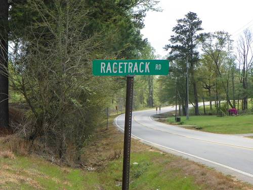
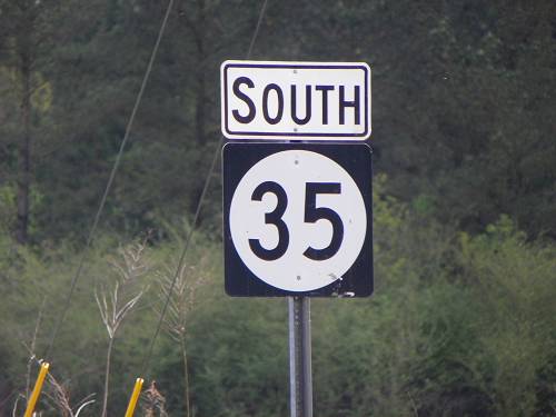
I photograph the road signs for obvious reasons.

Across from the lodge:


Louisiana is no different. Our cemeteries go back into
history as well. But, I guess it's being an interloper and
the woodsy environment that make these Mississippi
cemeteries so impressive to a city oriented person.
You never know what will be next in MS.

Or over the next hill.


Or over the next rail.


There ya go, Barto to Leggett. I may have been to
Barto, but I'm not too familiar with Leggett.


Another location locator. Or a chance to find it on your gps.
A better bet would be a church locator. "Pink Hill"
ought not be too hard to find.

There are definite landmarks I use in exploring MS.
Four lane US 98 is one. When you pop out of the
dark woods on a dirt road and this wide swath of a 4
lane highway is before you, you know you've reached
a certain latitude. MS 48 is also good landmark,
though you have to be more careful about noticing it.

Being north of 98 gave me a chance to visit Homesville once
again. The cemetery there contains the remains of a
Revolutionary War soldier. Long story short, the soldiers
were sometimes paid with the spoils of war, one "spoil" was Tory land.
In this case, Tory land in Mississippi, thus, the patriots are buried
about the state.

The polling place in Homesville has been there a while.
If I wasn't lazy I'd pull up the picture of the plaque.
My guess, 1830's. OK, I tried by can't find the shot.


Now this would be an interesting ride if not that long.

The Holmesville village store. I forgot to take a shot
of the door bread ad.

Bridges Rd.


This house is older than it appears. (Holmesville)

That's General Nathan Bedford Forrest. Do not believe Wiki's
biased account of this great man which further downgrades
my assessment of that junk encyclopedia. Click Here for better.


Sanderson Farms' partners.

Archie, Peyton, Little Brother?


They are really good dogs.

Having moved in an easterly direction, I spied at what I was aiming.

I was-a grinning. I was below Morgantown on MS 587, above
Foxworth / Columbia, Marion County. Marion is another
gent you need to meet. Click Here He is the county's namesake.

A "whistle stop"?


The depot location in Morgantown.


Once the village store.

Another

The rest of the article will be, you know, a lot of rails.
It was time to ride up to Red Bluff. I had visions of walking
down the bluff to the remains of the train wreck.


I was seeing logging ponds everywhere with rail access.

Up to the Bluff. Why? But I've seen Red Bluff, so I blew
off mingling with the multitudes. Click the shot below.

587 is an entertaining road.


Back down to Morgantown I found an unused city park.

It had amusements.

and photo opts.


Seems 4 wheelers were jumping the rails. Surely I could
climb up there. Using my "all four" tactics, I managed
quite well.


From on top, I zoomed as far north toward Red Bluff as I could.
The rails evidently turn which prevented me from seeing any
wreckage. Virgil told me he thinks the trains run 2 times a week
on these old GMO tracks, now controlled by Canadian National.


I mozied south.

I would leave the highway when required to get a rail shot.
A young fella had his car across the tracks. He backed up
when he saw me. I told him I was a railroad photographer.
He answered, "Yes Sir", respectfully.

I was nearing Foxworth.


Mississippi is very good about reverently remembering
a road's history.

This road looped behind the tracks to something I'm not quite....
Foxworth would prove interesting.

The depot location was evident.


This looking under US 98 (the same). Columbia is to the right (east)

That's the car down there and where I was.

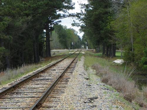
Heading south, paralleling the railroad.


I'd stop along the way. Depot locations would be obvious.
So is my "depot mania". But, alas, there are others likewise afflicted.


Sandy Hook would be likewise interesting. Seems
I've used up my supply, or nearly, of the word "interesting".
That I find interesting.

There was a sidetrack here.

And another trestle.


And what was probably a big store.

Looking north

A depot?

The beginning of MS 48, a very interesting road.
Sorry about the "lack of 'interesting' scare". I have
plenty left.

But I was headed south on....

Depot! Sidetrack!!

Then I got to Angie, La.


And a great mc/4 and 3 wheeler junkyard.


Gravel/sand/ lumber?

Did I say there was a caboose?

I headed west and got as lost in the pines as I could. I was
headed back to base camp but didn't want it to be over. Alas,
I've learned not to let the sun fall on me.


No matter the time, I had to stop at Franklinton.


Looking back into the tender.

The park is the home of the Washington Parish Fair and
a museum of old homes, farm buildings and stores.


Heading out of town, this '56 Ford beauty caught my eye.

Last shot. On a detour off La. 10, probably an old railroader
had used a switch for his mailbox stand.
That's it. There will be more MS in the future.
