That title sounds mighty highbrow for this site where history is mixed with blunderous exploration and uncertain discovery. Don't forget the mis-manufactured words.
Most ideas I get are spawned in strange ways. This one wasn't.
I travel up and down old US 90 quite frequently, especially lately since my route south on what was once US 90 has gotten a bit boring. Heading out onto the Plains is different. From 90 West I could go north or south at any time and encounter completely different ecologic and geologic systems. From 90 South, there is no way out but to keep going or turn around.
I don't know why I wrote the last paragraph. It was probably the result of post Tater Tot heartburn.
Oh, "how did this get started"? I had read about how the plains towns were spaced by the railroad when it came through back in the late 1800's and I wanted to see if they were still in place and if the statement was one hundred percent true or a loose average or just loose talk.
About half of the spacing was pretty close to the "5 miles apart" statement.
There are instances where the counters may have started over, like at a major stream of railroad junction. There is also the possibility that one counter started from the east and another started from the west. There is also the possibility that some communities predated the railroad. There is at least one case where a village moved to the newly railroad named location and left its old name behind.
The truth of the matter is this: Checking out the distances was just another rabbit to hunt, game to play or reason to ride. I can no longer justify "a ride". Rides must have reason. With gas in the mid three dollar range, there must be a purpose. Verifying the distances between towns and then comparing that distance to old railroad timetables seemed like a great reason to spend 7 bucks. You can't go to a movie for that.
They last 2 hours and this ride would go seven. Do the math.
Contribute to Hollywood communist or take a ride?
Don't use Citgo, you are giving more money to Communist Venezuela.
They last 2 hours and this ride would go seven. Do the math.
Contribute to Hollywood communist or take a ride?
Don't use Citgo, you are giving more money to Communist Venezuela.
Tuesday, early for me, I left for "Where the West Begins", Scott, La. I'd start measuring there going west.
Scott
_(640_x_480).jpg)
Then west: Entering Duson
_(640_x_480).jpg)
My guess at the depot's location in Duson.
_(640_x_480).jpg)
Rayne's Depot Park
_(640_x_480).jpg)
Those that stuck with this one on the premise that this was just going to be about counting five miles at a time have a little surprise and gift, actually a couple of gifts, coming to them and obviously you, too.
I entered Crowley and saw a light from the east but it didn't move. I was expecting the Sunset Limited passenger train. Was it "broke down"? Of course I was a day off and it was not due until four in the afternoon. What I was seeing was old AKDN 701 at the La. Rice Mill doing here dance and then she'd take her booty back up to Eunice.
701 is special. It is one of the original Acadiana Railroad fleet. I just happened to go looking for her one day.
CLICK HERE to get her stats and all that.
As echoed by others, Crowley is a great place for railing about.
701 is special. It is one of the original Acadiana Railroad fleet. I just happened to go looking for her one day.
CLICK HERE to get her stats and all that.
As echoed by others, Crowley is a great place for railing about.

There she was at La.Rice.

I love industrial shots with all kinds of stuff at different angles.
Refineries with their maze of pipes and futuristic tanks are a good example of that.
Refineries with their maze of pipes and futuristic tanks are a good example of that.
.jpg)
The little road-railiferous tug that La.Rice uses came across the tracks and headed somewhere. I could have chased it or chased 701. I opted for 701.
.jpg)
I headed down the alley which had been the rails servicing the businesses on the the north side of the main line. Old rails are still prevalent and some are still being used. AKDN parks its tug here occasionally.
The La.Rice mini tug didn't show. Now where was 701 headed?
The La.Rice mini tug didn't show. Now where was 701 headed?
.jpg)
. She was backing her grain cars off the main and onto the old MP rails which go to Eunice.
I am assuming that the rails north of the mainline were the Missouri Pacifics and those south were the Southern Pacific and Texas Pacific's.
Or, possibly the whole arrangement was an industrial park mutually owned or owned municipally.
I am assuming that the rails north of the mainline were the Missouri Pacifics and those south were the Southern Pacific and Texas Pacific's.
Or, possibly the whole arrangement was an industrial park mutually owned or owned municipally.
.jpg)
Pushing south past John N. John Trucking.
.jpg)
.jpg)
The train. being backed across US 90, required a flagman.
.jpg)
AKDN's personal have always been super friendly. I'd talked to this guy a year ago and again Tuesday.
He was confused on when the Sunset was coming, too, so I didn't feel so bad.
We'd both been in the sun a while.
He was confused on when the Sunset was coming, too, so I didn't feel so bad.
We'd both been in the sun a while.
.jpg)
At least she sounded good.
.jpg)
She left La. Rice's load in the north side yard and came back across US 90 on the south (of the main line) access rails.
_(640_x_480).jpg)
I knew where to catch the action.
This was a mill of some sorts. The rails run parallel to the main line.
This was a mill of some sorts. The rails run parallel to the main line.
_(640_x_480).jpg)
They proceed west to more warehouses and out to the rice mill seen in the distance.
_(640_x_480).jpg)
This is looking back to where I was from those mill tracks.
A reader had asked if there were still rails in Crowley.
Yes!
_(640_x_480).jpg)
Turning around and looking out to the mill on the west end of Crowley. Look closely.
_(640_x_480).jpg)
Back to my spot awaiting 701 after she crossed the highway.
I walked from my spot at the torn down old mill to where the tracks from the left (north)
came from the highway and mainline crossing.
_(640_x_480).jpg)
A Map.
The main line is yellow.
"Pictures Taken Here" will help with orientation.
The mill rails go to the southwest.
La. Rice is to the northeast.
701 was coming from the "South rail feed" to the left above the main line.
Map will enlarge if clicked.

A reader had asked if there were still rails in Crowley.
Yes!

Turning around and looking out to the mill on the west end of Crowley. Look closely.

Back to my spot awaiting 701 after she crossed the highway.
I walked from my spot at the torn down old mill to where the tracks from the left (north)
came from the highway and mainline crossing.

A Map.
The main line is yellow.
"Pictures Taken Here" will help with orientation.
The mill rails go to the southwest.
La. Rice is to the northeast.
701 was coming from the "South rail feed" to the left above the main line.
Map will enlarge if clicked.

This is looking to where she would go, "Served by AKDN".
_(640_x_480).jpg)
This is looking to the main line crossing and US 90.
_(640_x_480).jpg)
That is the cross track.
_(640_x_480).jpg)
Here she came alone.
_(640_x_480).jpg)
_(640_x_480).jpg)
And heading to "Served by AKDN".
_(640_x_480).jpg)
She is a majestic beast.
_(640_x_480).jpg)


That concrete platform caught my eye.
It appeared to be a signal stand or maybe a switch platform?

_(640_x_480).jpg)
That was a treat.
I headed west.
Crowley to Jennings.
Estherwood
_(640_x_480).jpg)
Midland's Junction.
_(640_x_480).jpg)
Quebodeaux Rd was where the next 5 miles was "up". More investigation is needed.
_(640_x_480).jpg)
_(640_x_480).jpg)
The Old Spanish Trail is alive and well from Estherwood to Mermentau.
I have no idea what its route was prior to the railroad coming through, but after that I'm sure
it stuck close and mirrored the rails.
_(640_x_480).jpg)
Jennings
First up was the Freight House.
The Morgan Star adorns the west end.
The Morgan Star adorns the west end.
.jpg)
Next up was the depot.
_(640_x_480).jpg)
_(640_x_480).jpg)
Note the stairs.
.jpg)
Looking west.
Note the elevation on the west end.
.jpg)
Seating inside.

But that had been the modern depot.
This was the old one.
Correction: D.Ellzey just checked in:
Correction: D.Ellzey just checked in:
"Steve, I would bet dollars to doughnuts that the old Jennings depot is the same as in the newer picture, roof turrets were later removed. The New Iberia depot and others of that brick style had that stuff in the early days".
Thanks D.


"Depot" can be seen in very small yellow letters.
Map is click-able.
Map is click-able.
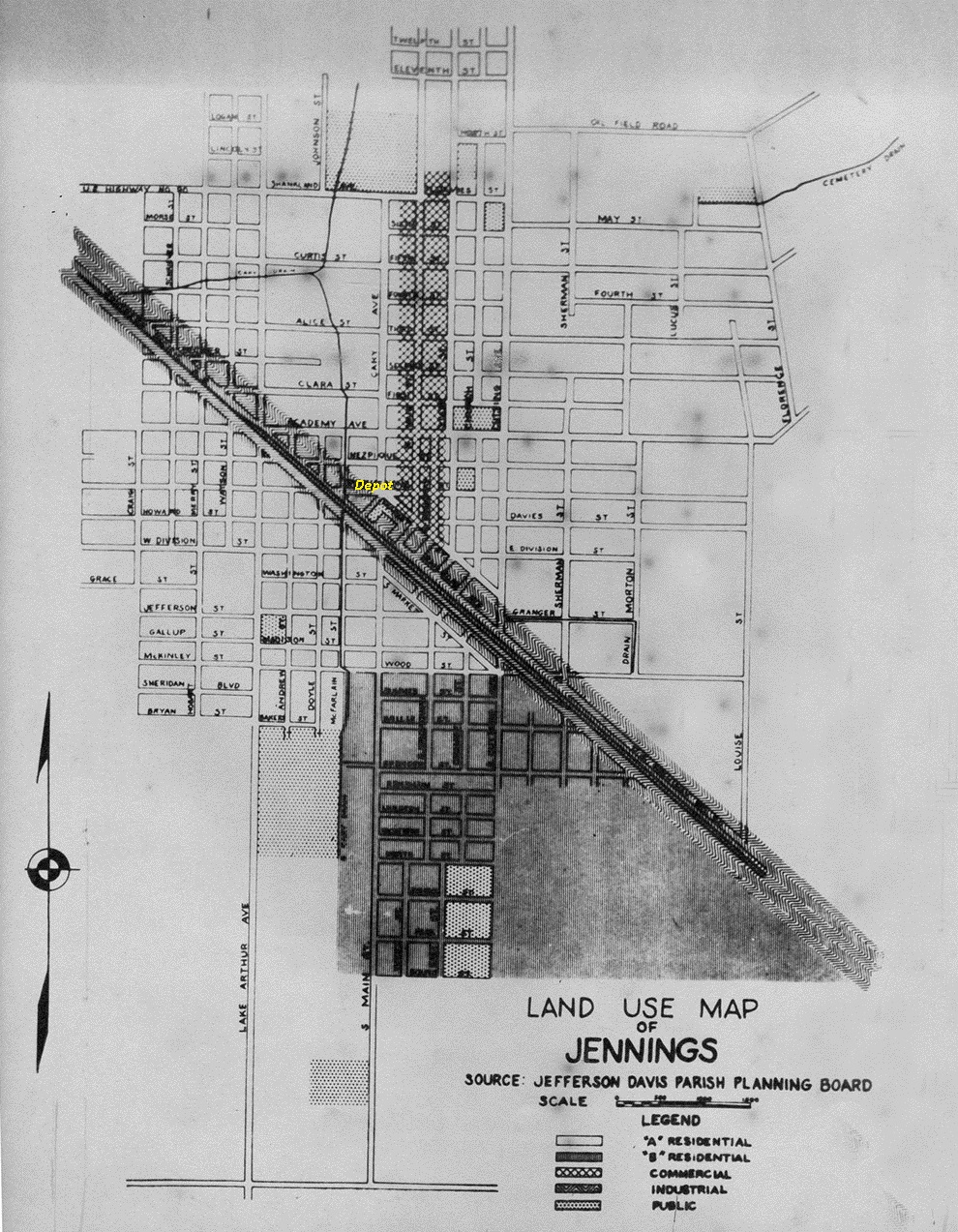
From the Federal Writer's Project: Louisiana

Jennings was not a "one horse town".
I'm saying that this is looking south toward the rails.
The elevated building could well be the depot.

On to Roanoke
Awaiting me there on the Roanoke passing track was an X-Santa Fe War Bonnet.
I love those engines (just their clothes, dear).
There was talk of a "Power Move" and problems. A supervisor was on hand and no one knew why.
I love those engines (just their clothes, dear).
There was talk of a "Power Move" and problems. A supervisor was on hand and no one knew why.
.jpg)
I waited and looked east. Had this been the depot side track?

.jpg)
I was on the appropriate street.
.jpg)
I thought I'd seen something else written on the front. No, "BNSF" was there.
.jpg)
Then this train came by, passing The Bonnet, heading east.
.jpg)
.jpg)
.jpg)
Miss B was moving in reverse. _(640_x_480).jpg)

I ran along the mill to try to catch her. _(640_x_480).jpg)

She had stopped.

I think she was "switching". I moved west and tried a shot from there.
.jpg)
Yep, I was out of there. This can go on for a while and she'd be going east and I was going west.
.jpg)
Welch would be next.
Looking east.
.jpg)
Looking west.
.jpg)
I left Welch.
I headed west and went down this dirt road to a crossing.
.jpg)
.jpg)
.jpg)
But "the pictures" were in the fields.
Rice field preparation is not just "digging a pond".
.jpg)
.jpg)
Next was historical Iowa Junction
I heard horns and I didn't know from where.
I looked east and west and there was nothing.
They were coming from the north. (Kinder, La.)
I heard horns and I didn't know from where.
I looked east and west and there was nothing.
They were coming from the north. (Kinder, La.)


Then there was one from the east.


I had a good day. It would continue.
I picked up a train in Jennings.
I picked up a train in Jennings.
The Chase Back: Jennings to Lafayette
_(640_x_480).jpg)
Approaching the Mermentau R. Bridge. I waited and tried to time a crossing shot. My timing is horrible.
_(640_x_480).jpg)
_(640_x_480).jpg)
I shot blindly at what could have been award winning photos.
_(640_x_480).jpg)
_(640_x_480).jpg)
No damn train.
_(640_x_480).jpg)
Here she came over the bridge, my consolation prize.
_(640_x_480).jpg)
Then I blew that shot.
_(640_x_480).jpg)
I had tried to get to the Rice Canal but was confronted with a road grader that gave me no quarter.
That killed the race. I caught her tail end at Crowley. She had a lead.
This was taken where the AKDN south rail lead crosses the main line. (refer to Crowley map)
_(640_x_480).jpg)
From the John N.John lot.
_(640_x_480).jpg)
La. Rice in the background.
_(640_x_480).jpg)
The Crowley SP depot location.
She was leaving me.
_(640_x_480).jpg)
I caught her at Scott.
_(640_x_480).jpg)
_(640_x_480).jpg)
She stopped at Debonaire Road just west of the Lafayette Yard. The race was over and she had won.
_(640_x_480).jpg)
_(640_x_480).jpg)
But, I'd won the day.
Below, first are my very rough measurements.
Below, first are my very rough measurements.

The map below can be clicked to enlarge. Colors correspond to the above list.
All are pictures and downloadable.
All are pictures and downloadable.

1978 Timetable
Distances are above the depot names.
Compare them all.
Knock yourself out.

1935 Timetable

That's it.