ZZ Top:
Took a jump through Mississippi, well, muddy water turned to wine.
Took a jump through Mississippi, muddy water turned to wine.
Ye..uh, yeah.
"Muddy Water Turned to Wine"
This is the tale of this weekend's wine tasting.
The first day's outing went north to Fernwood and then moved southeast..
The second day's ride made haste to the east and then back west. I had to be back for 2:30 which was a first, riding on a schedule. That won't happen again.

I started Day 1 on Dummyline Rd., 12 miles east of Arcola, La. which is on US 51.

I turned east on Mixon Rd. Fearing Extreme Cowboys I moved on. Is that "race" or "rage"?

At where I believed was Holton, I saw something. This map clipping from HERE

You can see Holton almost directly south of Wilmer. The route is drawn west of where Holton is shown so I may be wrong but I don't think so.
I saw this walk. It went to a fallen down structure. It may be of no relevance to what I saw next.

To the west of it I saw this raised bed.

You might say it was a levee for the pond. No. it was much higher than the pond. I think it was a rail bed
being used as a retaining wall by the pond.
Was it the Kentwood and Eastern RR's right of way? Dare to imagine.
Once in a while you'll be right and feel real smart.

Down the road was this Baptist church. That I'm right about.

I went north on La.445 and then turned back east on La.1061 to check out Scanlon which was on the Kentwood route.

There were several humps. The RR was in business between 1905 and 1922 so what did I expect?

There was a closed school.

Now, these and how to use them are important. Get the connection?

It was time to break out and go north. I bypassed Amite and its traffic.


Then I found the rail tie fence south of Osyka..

Notice "No fishing " sign.

It was massive.


Everything was ties.

The "No Fishing" House

At the crossing.


I had to fight these hills all day long. Poor me.

A few shots in Osyka. Some seen before, some not.


Darn hills.

Chatawa

Chatawa Lives. The bridge over the Tangipahoa is replaced.

Up Highway 51.

Arriving in Magnolia, MS.
I saw the street sign and thought it would be cute to tell you that this is where Ebay got started.
Then looking at the picture more closely I saw something else.

Was there more here than just the historic railroad station? A park? Stuff?

Magnolia.


I rode south of town to the SERS location.


Back to town. I had a feeling or felt a rumbling.

What did I say?

You do see the depot side track?


This is my first IC engine picture at age, 66. Momentous. IC is an absorbed railroad. Canadians own it now.
Better than CN = China National.

Passing the depot.

I almost forgot.... More Magnolia pictures. The depot siding.
 Looking the other way. I'd have to go down there.
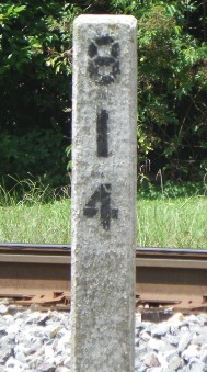
 Mile Post
Can someone ID that building's purpose.
 One more shot at the depot.
 Next, I was on to Fernwood. I love historic junkyards. I've owned or driven most of them. (During my valet years.)


Can someone ID that building's purpose.


MGB


Spock Ears?

Looks like my Dad's Dodge.

VW (comments withheld)


Flip lights, fancy.

Looks like mine after it rolled over and tried to scratch itself.

What sea?

OMGoodness

Fernwood is the home of the Fernwood and Gulf RR. I think this road led to their property. What's with "Gulf" and "Seafood"? Bubbas, you are 100 miles from any saltwater.

This one, too.

I almost forgot. I went to the South McComb CN yard for a shot. Then I went back to Fernwood Rd.
 Out Fernwood Road, because I had visions of tracking another ancient railroad without a map, I stopped by the box company to see if I'd missed something. It is next to the main line.


I think this was a rail loading area. No, the tracks had stayed close to the main line.

Oh well, maybe this ride report is mostly railroad? I get in a rut or possibly "railroaded".

Out Fernwood road I did some guessing.

The power line was the best bet.

Old maps are not very helpful. The "F&.... G" is what I was following. Maybe?

Who knows? "Pipline" Call the Pipline if you have any pips. Remember Gladys Knight and the Pips?

Lunch was at the Fire Station. It was very nice under a wonderful shade tree.

Now the murder mystery: "The House on Love Creek".


South to Blockdale. This is no ad, just a location locator.

It's kinda dark, but honest, it looked like sugarcane.

Creek picture.

Dirt road picture. MS highways do this. One minute dirt, the next, gravel, the next, back to perfect pavement.

Location picture. I think Earl is related to the general, the great general, Gen. Bedford Forrest.

Next was the Bogue Chitto River. It is a big one.


I was thinking and then I thought not. I was carrying a load up high and if it got sideways IT would be over.

Here comes a big one, Elizabeth. I was riding south on MS 27 south of Tylertown. I knew the old bed of the Gulf Mobile & Ohio RR was to my left (east). I stopped to take a peep if I could see the right of way. The road was blacktopped.

There was a hump. But ......

OH MY GOODNESS!!

There was original steel. I have never seen any GMO rails besides Bogalusa north and some at Slidell. This road had been blacktopped before they were pulled up and that preserved them.

Headed south to Franklinton.

At Warrenton. I shot this old store years ago tracking the GMO from RIO to Tylertown.

Back on 27, now 25 in La. This is old country. The Battle of New Orleans was fought in 1815 when the War of 1812 was over but the armies hadn't heard it yet. Jackson may have been denied the presidency without that mistake. I'm sure Gen. Pakenham would have preferred the news coming sooner.

The raised bed of the GMO could be seen in some places.

Entering Franklinton right next to the right of way.

I have been to the fairgrounds but never realized how easy it was to deliver the old engine. It is within spitting distance of the main line.

A kid was playing on the engine. He never tired.

I got to downtown Franklinton before the .... hit the fan. The fan was blowing at 50 mph. Only the buildings saved me. I asked a woman who was catching her garbage can where a gas station was. One was around the corner, just in time. I waited it out for 30 minutes. next to the office. Rain is OK. High wind and lightning are no-no's.

I headed back west on La.10 which splits and La.440 goes to Tangipahoa. I didn't notice and I went to Tangipahoa, also.

Dang hills and turns.

Washington Parish is the Alps of southern Louisiana. I don't think there is more relief in north La. The roads are roller coasters. The riding is wonderful. The lanes are covered cool tunnels. What a place!

Back on US 51 I made the most of it and checked out Roseland a little better.
This looked like a hotel or boarding house for railway workers.

Mike and Willie are still at your service after hours. You'll need a machete to visit them.

I've missed this little preserved store.

I should have checked the price better. I headed on back to base camp and readied myself for Day 2.
That later.

Day 2
A "followup ride" is always hard to get started, much like this report of it.
On a first day, knowing that you'll have a second day, you can paint with a wide brush and tell yourself you can come back and fill what you missed. That never happens. It wouldn't again.
The upside of disposing of old business is disposing of old business and being happy about what it produced.
I was happy about the GMO rail find and seeing an Illinois Central engine but remembered I may have seen one north of Montpelier long ago. I will find that picture if I can. I know I used it in one of my more recent ride reports. Stressing my memory always slows down an introduction. Let's move on.
The teal colored line is more or less the route.
I went to Roseland and then north.
At Tangipahoa I went east giving up on any activity on the paralleling rails.

I meandered until I got to "so pretty" I had to stop and take it in. I did not see the big water to my left. How can I find a 8 foot piece of rail stuck in ancient blacktop and not see big water? It makes me wonder what else I missed. You can't tell me to slow down, I was stopped.

Next I got directions to Physical Tranquility. An option for Mental Tranquility was not offered.
Possibly that is your own responsibility.
a.jpg)
On queue the Sunnyville church appeared.
.jpg)
That made me hungry. Unfortunately Country Delite was not open.
Possibly the weight of the spelling of "delight" was missed.
.jpg)
I had to check out the pump prices. I remember that kind of pump from the 1960's.
.jpg)
The prices were pre-Obama.
Remember the signs "Add a dollar" when the old pumps could not fathom gas in the 3 digit realm?
.jpg)
.jpg)
.jpg)
Graveling was good today. Gravel riding requires a lot of "Butt English". If you don't understand the concept ... OK, I'll give it a try. You squirm to keep the motorcycle upright, balanced and heading in the right direction while riding on large malformed marbles. That is done by slight shifts in weight. The shifting occurs on the seat if you do not stand up all the time like dirt riders that want to look like their concept of professional racers. Professional racers use Butt English or at least that is what I see Carmical doing unless he's in the air adjusting landing angle. I hope not to ever be adjusting landing angle.
.jpg)
I was trying to get to Angie. I had to check out the old GMO coming out of Bogalusa. I got turned a little wrong and ended up crossing the line. I reversed in a blur.
.jpg)
The Thomas Store, like the store in Warrenton, is an old memory.
.jpg)
Across the street was this place.
a.jpg)
.jpg)
An Angie I crossed the tracks and tried a new angle at the old depot and caboose.
a.jpg)
The depot siding was still in use. "Illinois Central Gulf" was a transitional name used after the Gulf Mobile and Ohio was absorbed by the Illinois Central. That statement may or may not be exact.
a.jpg)
a.jpg)
Hope of a train passing was hopeless. But, three work cars of the Canadian National did show up.
Had they driven from Ottawa?
.jpg)
.jpg)
I though I'd get to chase them. No. They stopped just down the line.
.jpg)
At Varnado this old building and another are about it for historical buildings that I saw.
.jpg)
.jpg)
I'm guessing that is where the depot was.
.jpg)
This building, though "modernized", is old. Was it a "service station"? I'll bet on it.
.jpg)
Heading toward Bogalusa the rails cross La.21 above town.
.jpg)
I got off the highway and followed them.
.jpg)
.jpg)
.jpg)
The route of the GMO has one great trestle after another. The line followed the Pearl River. Doing so avoided the hills to the west but exposed it to having to cross one western drainage system after another as they tried to find the Pearl. Bogalusa has some great ones.
a.jpg)

And here's the big one at the mill. Imagine being in a engine crossing these ancient trestles.
I wonder if the engineer uses "Butt English".

I stopped by the depot and warehouse. I sat on the warehouse steps, cooled off, drank a pop and ate a granola bar and thought about how all this history was going to dust.
.jpg)
.jpg)
.jpg)

I love this stain glass. I was surprised to see it not broken.

Shooting across the trestles into the mill.
.jpg)
.jpg)
Shooting back north. Are those bells on the top of the warning lights?
.jpg)
At the mill I looked for anything.
I did not go farther south as my clock was ticking and I was getting ticked off about that.
a.jpg)
Leaving. I was worried but reminded quickly that Louisiana is a small state.
.jpg)
Going up the hill out of the Pearl Valley is impressive. The view from up there is spectacular.
I was soon back in Franklinton, scene of yesterday's washout. The hump of the old GMO, RIO to Tylertown route, was ahead. Mentally it was over. I had to tuck in and get back to base camp.
a.jpg)
Driving back home I went by Livonia.
I didn't like the obstructive picture framing but the AC and the Allman Bros were pretty nice.
By the way, "Jessica" is the ultimate riding tune.
That's all folks.
.jpg)