This is a "company collection". This is all I have on the Jasper and Eastern Railroad.
Wait, a lady at the bank said her father worked on that line. More to come.
Investigating the J&E RR required, maybe five riders over into its domain. The information gained in each ride overlaps and may be confusing. Fight it.
The Oakdale Ride
Mark had taken a ride along La.10 northwest of Oakdale. He had noticed what appeared to be a rail bed alongside that route. He wrote me and told me about it. I had to investigate.
Sure enough, there had been a railroad that served Oakdale, a very famous one, although it was disguised and operated under an alias for a while.
The site historian fronted that info, "Oakdale was the end of a Santa Fe subsidiary known as the Jasper and Eastern, which was merged into the Gulf, Colorado and Santa Fe RR. Santa Fe, SP and a host of other RRs had subsidiaries with different names that were headquartered in Texas to satisfy the Texas law that any RR company doing business in Texas, had to be headquartered in TX".
Not everyone knows that.
Then I found a few websites:
Of course, these sites led to other sites and pretty soon I was succumbing to link overload. I'll deal those out as we move along.
The first target of my new lust, was Oakdale. As you read, Oakdale was at the end of the line. That worked well for my need to see it all, a precise starting point. I was familiar with Oakdale enough to feel at home wandering around. The existence of a "Santa Fe Street" helped. The fact that Sante Fe Street has been consumed by the new La.10 bypass, did not. The depot and yard area were now only open lots alongside the busy bypass.
Being that Oakdale was "the end", I'll post the pictures beginning from what I believe was the end, the old bulk plant.
.jpg)
That was looking east from 10th Street, the location of the depot.
Here's zooming in on the fuel depot at the eastern end of the line.
.jpg)
.jpg)
.jpg)
Check out the old gas pumps.
.jpg)
This is the railroad side. The rail level door is the give away.
.jpg)
.jpg)
During these ride reports/ railroad reports, I do photograph other points I find interesting.
I cannot go into these outings with blinders on.
Here's the map to guide you through the rest of this page. Click to enlarge and then squint. "Bulk Oil Plant" is to the east, Depot is in the middle, "Office", to the left, is important and so is "Rails found Here". The main point of this map is to show you what a rail Disneyland Oakdale was.Oh, sorry, the green line is La.10, sorta, or what was Santa Fe Street. Ignore its bend northward. The more or less vertical railroad is the Union Pacific or what was the Missouri Pacific RR, which runs by Glenmora and Longleaf, further north.
.jpg)
That's it for now.
After receiving overwhelming support for my new format, thanks Al, I've decided to press on with this format, that being transferring the archived write pages to email.
I know when a story is going stale so I'll inject a little zinger here.
.jpg)
That woke you up, didn't it.
I next rode around town with my printed pictures of the old pictures found on Site 1.
The first easy hit in Oakdale was the old school. It is on the east end of town.

Thinking these were the same building, I was quite surprised to find they aren't. The building I shot was built in 1923. The above building was built in 1914. What's the story?
.jpg)
This is the old depot. Unfortunately, I have no new picture of it. The depot was located on the corner of 10th and Santa Fe.
.jpg)
These pictures were taken from that approximate location.
Looking north from the depot.

These are panning shots from that location.
.jpg)
.jpg)
.jpg)
This is looking south. There appeared to be nothing left on the south side. I evidently thought not since I took no picture?

This one is taken from 5th Street which is several blocks north of the depot. I failed to update that shot. Oh well.

The railroad water tank (steam engines needed water) can be seen done at the end on the right.
Enough for now.
One more, this is looking at the Oakdale yard from the 10th Street Crossing, near the depot.

Ok, my morning chores are done and I'll throw a few more lines and pictures up.


Leaving the depot area, I decided to look for what was the mill. I wasn't very optomistic after being disappointed in downtown Oakdale. The existence of a Hardwood Mill Road was a help. The yellow track above is the route I took. A clearer map is above.
I turned onto Hardwood Mill and saw this oldish warehouse. I though, "It's old".
.jpg)
It had "Oakdale Manufacturing Inc" on it. It also had rail door on the side of it. I didn't notice that until now. Then I came to a bump in the road. It was obvious it was a rail crossing at one time. I dismounted and looked around. I didn't see much but was once a dump. Then I crossed the street and went back in the bush. I'm going to have to augment these as what I saw is not as evident in the small pictures. Looking through a chain link fence I took these.
.jpg)
.jpg)
.jpg)
And off it went into what I call the "plant". This I would later locate at the end of the wye on the maps above. On one map where I was is labeled "Bump" and the other is labeled, "Where rails found". Now you not lost, cher?
.jpg)
Oh, I almost forgot, the rails stuck out of the fence.
2.jpg)
And, this was taken "a while back" at the end of the wye, where I was, looking into the yard area, what is now behind the chain link fence.

I then went on down Hardwood Mill to River Dam Road expecting to see a river dam. I did see the very high Calcasieu River, noted on the map.
.jpg)
.jpg)
Either the dam was submerged or this is all that is left of it:
.jpg)
Feeling that this was not a hot spot for mill finding, I rode back up Hardwood Mill Road. I saw this old sign off of the road. Things had been different in the past.
.jpg)
I was right at the split where the chemical plant road, what was La.1152 at one time, and Hardwood Mill Rd diverged across from the Oakdale Cemetery.
.jpg)
There was another old building there, right behind the restaurant.
.jpg)
There was also a RR Crossing sign. The railroad was gone.
.jpg)
This map gets bigger if clicked.
It shows how the rails left the "Y" and entered the yard (where I found the rails) and met the Missouri Pacific and then returned up the Mill's railroad, the Hillyer Deutsch Edwards Inc RR. It shared the rails with the Hillyer Edwards Fuller Inc RR of Glenmora.

I stopped and looked down the right of way that led to US 165 and where they had connected.
.jpg)
There was something at the end of that red arrow that I missed when I was there.
I returned to the hump to commune with the railroad. I was sitting there, off the road on but on the hump and up rolls a sheriff's car. He asked, "What's up?". I was looking at my self made guide list and handed what I had to the cop who, much to my disbelief, was not interested. I said I was researching the old mill and railroad that served it. He said I should go to the restaurant since they had a bunch of pictures in there. I did. I talked with a young lady by the name of Edwards. Yes, her great grandfather had been an owner of the railroads. Here are a few pictures from inside.
.jpg)
The restaurant had been the mill's office building. My guess is that this picture is it. My further guess is that large building to the right is the one that was labeled as Oakdale Manufacturing.

The mill was around as late as 1957. There's a 57 Chevey in the parking lot.

It was a big place.

Here are the engines. I really messed up on shooting them. These are the best of the lot.


This may be an early picture of the mill.

This one is where the photographer was standing in the center of the wye and looking toward Oakdale. The water tank is in the distance on the north side of the tracks.

Leaving the restaurant I felt like the long ride had been a success. I went up on the new section of La.10 and looked back on what I think was the wye area. My imagination was stretched.
.jpg)
.jpg)
Oh, well.
Leaving town I saw one more treat.
It was what I think is where the Oakdale and Eastern left town bound for logs and Pine Prairie, I'm guessing.
.jpg)
You know, you may not be interested in all this old railroad stuff, I don't blame you, it gets redundant. As a person who likes riding around, it is a wonderful way to find places like this while being able to enhance the experience with the vision of old trains and the sounds of whistles, bells, and of course, some clickity-clack.
.jpg)
The Jasper and Eastern: Elizabeth
Every time I write one of these things it's a test. Before ever figuring out how to start I have to figure out if I want to start. Sometimes these reports get to be arduous.
Let me ease into this one. I had visited Oakdale, La. and found enough stuff to keep me going west on the Santa Fe Railroad, known locally as the Jasper and Eastern due to Texas laws, but that's another story. The J&E stretched from Oakdale to J&E Junction near Kirbyville, Tex. The next stop going west from Oakdale would be Elizabeth, La.
It got to be 12 noon. Seeing the day go away, I decided to tuck in and make haste to Elizabeth. Approaching Oakdale I again looked for an obvious crossing point for one of Everett's projects, the Oakdale and Eastern RR. I know I had found the line exiting Oakdale and where it entered Pine Prairie, but I was not sure of what was between since I attack all my explorations in a very nonchalant manner. I have the tools, on and off the bike, but hardly use them to their ability. I'm heard the word "astute" used, but I'll have to look it up. I don't think it applies to me. "Committed" is another one. It would only apply in a medical setting. Moving on:
The above was meant as a disclaimer of sorts. At one time I visualized my contributions as being serious guides and articles. After reading one of my postings, my wife said, "You can't be serious," so ever since, I haven't been.
What the hell was I talking about?
Oh, I was looking for an old railroad crossing. Honest, looking for something makes the ride more interesting. You could look for black dogs and achieve the same experience. Humps and bumps and cuts in the woods are my black dogs.
Here are some black dog pictures between La.13 (Barber Spur) and Oakdale on La.10. By the way, for the serious motorcycle rider, ie, one that goes places and sees things, that stretch of La.10 is a pretty fine link of highway. Going west from the intersection of La.10 and 13, it pulls you out of the Cajun Prairie into the rolling pine covered hills of Western Louisiana. It traverses the drainage coming out of the Kisatchie Highland to the north which changes the scenery. Don't expect your ears to pop. Here's those pictures I mentioned 20 minutes ago.
.jpg)
.jpg)
Then I got to Oakdale. I wanted to look for the Black's cemetery near the mill. I think I found it but I didn't shoot it since it looked like a million I've seen. I did find the south entrance to the large rail yard at the end of the Y where I had found the rails on the last outing. The rails within the yard don't seem to be messed with. I could see iron at the crossing!!! I just sensed a thousand readers sitting up and looking closely at the next picture.
.jpg)
Here's a map so you can see where it was taken. If too many crowd in there at one time to shoot this landmark, Johnny Sheriff will bust you. That's their driveway. I guess, for some reason, they feel that they need to be behind a locked fence, or maybe they are possessive about their rail booty. People are strange.

Until I get back on this you can reread about Oakdale. That will help prepare you for Elizabeth. CLICK HERE to read about Elizabeth's sister mill, the J&E, and the mill RR.
That's it for tonight. We'll get into Elizabeth tomorrow. I get nutz if I write past 10:00Pm
E.2
On the last page I ripped into myself pretty hard concerning my lack of preparation. On this ride I did a better job due to the fact that the Elizabeth mill is an extention of Oakdale's. The mills were commonly owned at one time. The difference between the two locations is that Elizabeth was a mill town, owned and operated by the mill. Let's get going.
Elizabeth is west of Oakdale, my guess, 15 miles, more or less. The mill there was quite a bit larger than the one at Oakdale. Elizabeth sported a lumber mill and paper mill. There was also a turpentine plant and other associated businesses. The lumber and paper mills were on the north side of the tracks between La.10 (then called Route 22) and the J&E tracks. The residential areas, except for the turpentine plant's Black employees, were south of the tracks. That plant and residences were on the road coming from La.10 to Main Street. You'll understand the logistics as we progress.
This next one, from what I've been able to comprehend, is looking south toward what is probably the hotel and a covered waiting area. Was this the depot? We'll get to the map later. You'll know your way around historical Elizabeth before this is all over. So don't fret.
This is the office. That could be natural gas pipe in the forefront. That reminds me to tell you a story about how natural gas became a union weapon against the mill.

The next one is the commissary. It was on the north side of the tracks. That might be a playground between it and the tracks. I think I see a slide.

This was the boarding house (White's hotel on map) and Baptist church.

This a picture taken from the east end of town on what the map calls "gravel road". It is how I came into town form La.10. You are looking at what is today the baseball field. These pictures were taken in 1921. No, I didn't take them, I didn't have my camera then. The Baptist church and hotel are in the background to the south.

Here are a few railroad pictures to bring your blood to a boil. In all these pictures notice how treeless the scenes are. This is looking west. The mill will be to the north of the track. The RR water tank is in the distance as is a tank at the mill road crossing. My guess is that the rails headed north are to the "tram exchange" because you see houses to the south and I believe those are the tanks in the distance to the right (north).

The next one, I believe to be looking east. The bulk oil tanks were on the north of the tracks and the homes to the south. The tanks were in the tram interchange with the main line, pictured.

This next one is looking from the "gravel road" I came in on, now paved. This is the entrance to the rail yard on its east end.

I got quite excited when I realized where this one was. It is the tram line crossing the main line on the east end of Elizabeth. The tanks are to the right (north) and what I think are the turpentine plant and Black's housing to the right. The road I came in on would be to the left. The puzzle is coming together.

Now that you've seen some old pictures, it's time to read a little.
Here Wiki's brief explanation:
Elizabeth is an old "mill town." It was founded in 1907 by Industrial Lumber Company and has maintained the mill-town look. When the mills were all in operation, all the homes were owned by the company, as were the commissary and medical facilities. The old hospital, now serving as the town of Elizabeth Hall and Senior Citizens Center, is now on the National Historic Register.
Since they brought up the old hospital, here it is. The application for National Register status is below the picture.
.jpg)
Describe the present and original (if known) physical appearance:
The Elizabeth Hospital Building (1924) is a two story frame structure located in a semi rural setting in the small community of Elizabeth. It has received only minor alterations since construction and hence can easily convey its historical associations.
Some controversy exists concerning the date of construction of the hospital building. A stone on the front steps bears the date 1924, but a building which looks very much like the present one appears in a March 1923 publication. Some older town residents recall that an earlier hospital was damaged or destroyed by fire and restored or rebuilt shortly thereafter (accounts differ). We are using 1924 as the official construction date.
The somewhat diluted Colonial Revival style structure is two rooms with a central corridor running from end to end. The five part facade is eleven bays wide with a central aedicule motif arched entrance under a pediment. The exterior features three different types of clapboarding, which lends a subtle textured effect. The nine over one windows are set singly and in pairs, frames are unadorned. The building is surmounted by a system of low hip roofs with exposed rafter ends. The interior is relatively plain with bungalow style panel doors and simple cornices. All of the floors are hardwood except for the operating room which has a tile floor.
Assessment of Integrity:
The Elizabeth Hospital Building is currently being renovated and the bagasse board walls are being replaced with sheet rock. This has caused only a minimal difference in appearance. The window surrounds, cornices and other historic woodwork features are being retained. In addition, a fire egress door has been cut at each end of the building (side elevations). In our opinion, these changes should be regarded as minor since they make little visual difference.
Specific dates 1924
Builder/Architect Builder: Industrial Lumber Company
Statement of Significance (in one paragraph)
Criterion A
The Elizabeth Hospital Building is locally significant in the area of industry because it best represents the community's origins and early history as a lumber company town. The sawmill town of Elizabeth was founded, owned, and operated by the Industrial Lumber Company. The company already owned two mills in nearby Oakdale and one in Vinton when in l907 it located a new mill site at Elizabeth and platted the town. The mill site and adjacent town site were in the heart of a 70,000 acre parcel of long leaf yellow pine acquired by Industrial in 1905.
The huge Elizabeth mill began operation in 1909 and had a daily capacity of 160,000 feet of lumber when operating single shift. The company s two mills in Oakdale each had a daily capacity of 75,000, The three were linked by company built railroads, with Elizabeth serving as Industrial's headquarters. Elizabeth was also the home of three smaller allied industries: Producers' Turpentine Company; Southern Wood Products Corporation (turpentine, pine oil, pine tar and charcoal); and Calcasieu Manufacturing Company (turpentine, resin, and paper from otherwise unusable stumps).
These companies, which were part of the Industrial family," enabled the parent company to boast that "the entire original crop produced by the land has been utilized without waste".
Industrial was also quite proud of its motto "Builders, not spoilers." According to a 1923 company publication, Industrial devoted considerable attention to developing suitable cut over land for agricultural use. Specific activities in Elizabeth included a colonization plan, a sweet potato curing plant, a canning plant, and experimental farms. This 1923 company publication, although obviously biased, is an invaluable pictorial and written record of Elizabeth's golden age." It even has an aerial view showing a town much larger than the present one. In addition to the large mill and allied operations, there was a company office, a large mercantile company, a hospital, a civic auditorium, several schools, hotels, six churches (three white and three black), and a movie theatre, not to mention housing for the workers, management, etc. Also, as was often the custom in company towns of the period, Industrial provided outdoor recreational facilities such as a golf course, two hashing clubs, and a park complete with an open air pavilion. Elizabeth's permanent residents numbered about 3,000 in 1923.
According to an individual who has lived in the community since 1911, Industrial shut down operations in 1940, whereupon Elizabeth became a paper mill town. (Apparently Industrial's interests were purchased by a paper mill.) As indicated previously, today s Elizabeth (at least the historic portion) is a considerably reduced and depleted version of the 1923 boom town. The mill is gone, and the only non-residential buildings remaining are the hospital, the company built Methodist
church, and a small Catholic church which may or may not have been built by Industrial. There are also 50-75 workers cottages as well as several larger fairly plain houses which were presumably for managers and other upper echelon employees.
The State Historic Preservation Office feels that, of these extant resources the hospital building best represents Elizabeth's history as a lumber company town. The staff at first thought there might be an eligible district in Elizabeth, but careful investigation revealed that the workers cottages have been altered too much (original porch columns replaced with iron columns, modern windows and doors, and side carport extensions). The handful of "big houses" and the two churches have not been seriously altered on the exterior, but they were used only by certain groups and not by the entire town the way the hospital was. In Elizabeth's heyday there were numerous public buildings and facilities used by the community as a whole, but today the hospital is the only one remaining. Also, of the extant buildings, it best represents the paternalism evident in lumber towns such as Elizabeth. In short, it illustrates that Industrial "took care of its own" in a manner no other extant resource can.
Major Bibliographical References
Stewart, Milton I. A Message of Progress: The Industrial Past and Present and its Own Home Town, Elizabeth, Louisiana. March 1923. Copy in Register file, LA State Historic Preservation Office.
Personal communication with George Laird, who has lived in Elizabeth since 1911
That sure says a lot.
Here are a few picture of the neighborhood as seen on my last trip.


Those pictures would be looking south on East Second Street toward the hospital, now the town hall. Here a section of my 1947 map (courtesy E.Lueck, Southern Forest Heritage Museum) Click these pictures and maps for larger versions.

You can see Main Street at the north end. There is a theater on the corner of Main and E.Second. The "General Office is on Main. There is a store, a park and tennis court on the north end also. A garage and fire truck are stationed at the end of north end of E.Second, also.
Today, like yesterday, there is a large park along Main and the once main line of the J&E RR.
.jpg)
Here's a little more about the town. We'll explore on the next page.

E3
Now that you've seen what I got to see before my last visit to Elizabeth, we are more or less on the same page. I'm just a little bit ahead of you. I feel you now understand the historical lay of the land. What's left is the human side of the mill and pictures of my ride in and out. I also talked to a mill worker's grandson and an older fella who told fishing stories and had the pictures to back them up.
This fella pretty much was Elizabeth during his tenure. He was the definition of a company man. The places mentioned where he was the boss are on my map of Elizabeth. The ice company was near the depot. The turpentine plant was on the north road in from La.10. The Calcasieu Manufacturing Company was in Oakdale on the mill property, right next to today's Hardwood Mill Restaurant. Yes, I have a picture of it on that page. Here's a condensed rap on him.
"Mr.'Smith', who has been identified with every phase of the lumber industry since boyhood, is general manager for the Industrial Lumber Company, with headquarters at Elizabeth, in Allen Parish, and has a number of other prominent business connections in Southwest Louisiana......... He was born near Lake Charles, in Calcasieu Parish, June 1, 1877..... Lee attended public schools in Newton County, Texas, and at the age of fourteen went to work and since then his experience has given him a knowledge of everything connected with the manufacture of lumber, beginning in the woods and continuing through the mills and business offices. His experience was in logging operations until March 1914. Since that date he has been in the service of the Industrial Lumber Company, one of the largest manufacturing Companies in the pine woods 1n the South. At Oakdale he had charge of timber cutting, was then assistant woods superintendent, and then put in entire charge of logging operations.
In 1914 he was promoted to general superintendent, and since February, 1922,
he has been general manager in charge of operations of the Industrial Lumber
Company at Elizabeth. He is also vice president and a general manager of the
Calcasieu Manufacturing Company, is a director of the Producers' Turpentine
Company, and is president of the Elizabeth Ice Company".
Of course that was copied to a degree from below. The personal stuff was removed.
A History of Louisiana, (vol. 2), p. 282, by Henry E. Chambers.
Published by The American Historical Society, Inc., Chicago and New York, 1925.
Then I found this. How progressive can you get for 1914!
Electric Tractors in 1914 in Louisiana.


The ride in pictures next. Open up that map in a new window so you can follow along.

Before going back into historic Elizabeth, I turned south off of La.10 at the flashing light and went on down to the Little General Dollar Store. Behind the Little General Dollar Store I saw this, the rightof way going into Elizabeth. Mike, you remember what you said you expected to happen to you if the broadband connection works out, well, seeing that right away had the same effect on me.
.jpg)
Doesn't that leave you breathless, wanting a cigarette and a moment of reflection?
Follow the white line from La.10 south. The bend in the road is reflective of the fact that it followed the spur that left the J&E and headed north join another spur that came from the west. Along that east spur was the turpentine plant and Black quarters. The bulk oil tanks were near where I have "Park" written. To the west of that road was this open ground, now a baseball park. The fisherman I mentioned, built it.
.jpg)
Then I turned west. I was on the tracks headed to the yard and depot. My imagination was in overload.
.jpg)
How obvious can it get.
.jpg)
.jpg)
Notice the gas line inside the fence.
My guess, this is where the ice plant was.
.jpg)
This picture was taken as a reference point. What I failed to d was to see if the trestles were still there. Duh. So far we've been east of the creek. This was where the lumber mill was, north of the tracks, office building, commissary and park. I got a reprieve from my duh moment. The tracks would not have crossed the creek, it turned west after the road bridge, whew.
.jpg)
This is the present day health clinic. It sits near one of the entrances to what I believe was the paper mill.
.jpg)
Or a landing site for extraterrestrials.
.jpg)
.jpg)
.jpg)
The mill had just been torn down last year because of asbestos poisoning within it.
.jpg)
And I believe those are the gas valve sheds for the mill.
.jpg)
.jpg)
That's it for this evening.
I'll tell you about the union war later.
Fire was a huge threat to the mills. Below are list of locations for gas valves, fire alarm boxes and directions for cutting the valves off. These were taken off a map. Click them to make them larger.


I'll add a few more pictures before I have to get to work.
The ROW stretched westward.
.jpg)
While I was standing here, a young fella pulled up and asked me if I was lost or needed help. I radiate that especially with my helmet off. On his work shirt was written "Spooky" as his name. I, seeing slightly potential information source (slightly, because of his age), I began asking questions. Asking questions elevates the interviewee to an esteemed height, one of knowing more than the interviewer. Interest in the history of the interviewee's past ingratiates the interviewer, or not sometimes. Suspicious people may think the intervieweer is a "revenuer". You can't blame them in this age of presidential revenuers. Back to Spooky.
Spooky was the grandson and son of a mill worker. He said his relatives had told him a lot about the mill. I really messed up here. I was intent on finding tracks and didn't go into detail questioning about life in Elizabeth. He did say the town was named after the owner's daughter. I asked him about the cement structures and he said he'd wondered about them too. I think I got the idea Spooky didn't know much. I asked him about where I could see the right of way. He told me 3 times and I still got it wrong. He even offered to lead me there and I turned before he motioned. Finally I got it. Click the map.

Where you see "9" on the map is where he wanted to lead me.
.jpg)
.jpg)
Looking back toward the mill.
.jpg)
Looking west on the grade and Buddy Doyle Rd. crossing.
.jpg)
This trellis work was put there as an attractive block for anyone wanting to go ROW riding. I can't imagine who would want to do that?
.jpg)
E.4
Open the map in a new window. (right click it)

Having taken 43 pictures of the exposed rail tie and patch in the road, I moved north on Buddy Doyle until I got to La.10. I took a brief ride west on 10 and then did a U-turn and headed back east, toward the La.10 portion of town. Then I saw the black cemetery shown on my 1947 map. The cemetery has an interesting name, "Canada Memorial Gardens". I visited it a few years back and I was amazed at the number of veterans interred there. The stones reflected the obvious pride these men had in defending our country. That pride and love for our country obviously still exist within our armed services. As far as the rest of our population, there is a likewise obvious faction that neither has pride in, nor loves the United States. If you can't say you are an American first and put America first, get the hell out and go back to wherever you owe allegiance. Go "change" it, asshole.
.jpg)
After leaving the cemetery, I took La.112 south, as I was thinking about going home. The GPS alerted me that 112 goes west and that would not be a good thing. I saw Main Line Road down south and decided to check it out. It had to be the "main line" for the timber operations.
.jpg)

It angles from the mill down into the depths of the pine forest which is called West Bay WMA. I believe West Bay was the original name of Oakdale. There's a story there. It may have to do with the Calcasieu River, I'll betcha.
Main line sure looked like a ROW.
Here's looking west to where it hooks up with Old Bay and the Old Oakdale Road.
.jpg)
Looking east, it is not as well traveled. Oh did it pull me. But, being by myself, I held back the urge. Damn, I'm getting old.
.jpg)
Everett added this:
Main Line Road will take you all the way to Kinder. At the south end it was the main line of the old Kinder and Northwestern RR which was owned by the same Peavy interests as Peason. They had a mill at Kinder. The north end of the road was the mainline for one of the Industrial Lumber Co Railroad spurs, and I think that they met in the middle.
Being that 112 would not work, I U-turned and headed back up the road. I decided to do one more run through. Actually, I did a couple.
This is Hampton Memorial Cemetery, south of town. I don't know if it has any connection to the mill or not.
.jpg)
Where "Entrance" is marked on the map is where the next 2 pictures were taken. It is the location, inside and out, of the paper mill fence. The gate would be on my right in this "inside" shot.
.jpg)
Outside of the gate you can see the ROW of the J&E west of the mill town, looking east.
.jpg)
West of 112, still on Main Street west of town, I found this pad. It is outside the view of either of my maps. It was something? There was a large pad with a cement road leading to it. There was also an occupied mobile home. I U-turned, quickly.
.jpg)
.jpg)
The next pictures are from La.10. I had ridden back up to 10 on 112. That cut sure did look interesting.
.jpg)
The green lined road is La.10. I turned east looking for where the rails had crossed the road. Right click, open in new window.

The old rail crossing is west of the highway creek crossing.
.jpg)
Now, do you want to see one of the engines that worked for the mill?

"This 1912 prairie Baldwin locomotive originally worked for Industrial Lumber in Louisiana as #101. It was later renumbered to #5. It was then sold to Calcasieu Paper and operated in Elizabeth, Louisiana. The last time this locomotive operated was in 1964 when a Mr. Witbeck ran it on the Calcasieu Paper Co.'s spur after the locomotive was retired. Although five years older, this is the sister locomotive to Fort Edmonton's #107 which also worked for the Calcasieu Paper Company. At some point both locomotives came to Alberta. #107 went to Fort Edmonton, while #5 was kept in a steel barn in Lougheed, Alberta and was owned by Mr. Ronald Bergseth. In the spring of 2005, Gordon Bell took ownership of the locomotive and relocated it to his railway roundhouse at Three-Valley Gap Lake Chateau and Heritage Ghost Town. While under the ownership of Mr. Bergseth, the locomotive carried the road number #69".
Photo Credit: Roman Krizek (June 25, 2007)
Location: Three Valley Gap (between Revelstoke and Craigellachie)
Type: 2-6-2
Builder: Baldwin
Number: 38219
Year Built: 1912
Weight: n/a
Current Owner: Three Valley Gap Museum
Use: logging/switching
Current Status: Static Display
This information came from HERE.
Everett, upon seeing this engine, quickly ripped his file drawer open and produced this with yet another bundle of priceless information:
The picture you show is of Calcasieu Long Leaf Lumber #69. It ended up on Rapides Gravel Co. RR and went to John Thompson in Illinois who sold it to Mr. Bergseth. My information states that Mr. Bergseth still owns the engine, but my memory tells me that he sold it but I don't remember to who. At any rate, a lot of people get these 3 engines confused on the basis of confusion between Calcasieu Long Leaf Lumber and Calcasieu Paper Co.
[This is one more of the] remaining Industrial Lumber and Calcasieu Paper engines. The information on the engines that you have is correct in most of its essentials, but I can flesh it out a bit. When Calcasieu Paper shut down, #107 was sold to a local man at Elizabeth, Mr. Harold L., who operated it on a piece of the J & E that went across his farm. He later sold it to Edmonton. It is now in operation there.
Calcasieu #5 (in his photo) is currently on display at the Ameristar Casino in K.C. Mo. It looks like this today.
.jpg)
An old ad.

A new ad.

Life goes on in the Louisiana piney woods.
I exited town, going east on La.10, always watching the ghost rails of the J&E off to the south. I saw a road that met the rails. I stopped and asked a fella that was parked there if the road was private. He said it was. We talked for an hour, him interlacing fishing and hunting stories with Elizabeth stories. Seems he is quite the native of Elizabeth and had almost been run over by the train when his pickup stalled on the tracks. He said some guy owned the whole J&E right of way from Oakdale to past Elizabeth, just the ROW. That would make a very narrow lot. He also told me that the union had blown up the gas pipeline to the mill during the riots and that he'd caught 2 huge catfish at Bundicks. One was 45 lbs and the other 48. He had the pictures. After an hours I finally insisted I had to leave. He winked and asked that we keep all that between us so I left out the good stuff.
No one reads this stuff anyway.
Below are some interesting links:
Moving West from Elizabeth
I was obsessing again.
I'd explored Oakdale and I'd explored Elizabeth. I had realized that being mill towns there would be a lot to cover and it would take some time and work to do it.
During the last write, I had longed to be rid of the heavy lifting parts of the exploration. I wanted to leisurely check out the ghost rails in the forest west of Elizabeth. I didn't want to figure anything out, just to peer down the long straights and watch the pines close in on the old right of ways. I had noticed that some of it dropped through the Vernon District of the Kisatchie National Forest. I figured that would make for some pretty riding amongst the pines. I figured right.
Then I'd have De Ridder to explore. I was hoping my route would work and it did until the end.
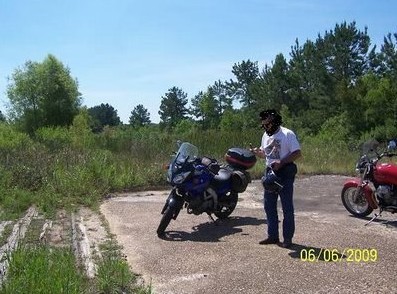
I've had a very hard day and this write is being done under the the influence of exhaustion, so hang in there, it could get ugly. I don't know where to start so here's this neat picture of my bike on a lonely dirt road south of La.10.

It says so much in that it encompasses every emotion I've ever experienced.
I left the house. I drove up some neat roads and landed in Oberlin. US 165 is bout the only way north out of Oberlin to Oakdale. There are others but I'd still be riding those dusty dirt and gravel roads. I needed to make time because I had to get to Texas going the scenic route. I cruised into the south side of Oakdale and saw this:
.jpg)
Don't start drooling on yourself expecting me to stop the ride and give you a bunch of information on this engine. You'll have to wait to the end for that. I just made a note so I won't forget. Oh, and don't try to skip ahead by looking in the page list, I'm hiding the end page in another universe.
Pumped with my discovery and packing 2 spikes found during the inspection, I hoped back on the bike and turned west atop the old J&E RR. La.10 sits on it for a brief stretch heading west from its intersection with US165 in Oakdale. Not everyone knows that.
I felt a release as I passed the Oakdale mill. I was on the hunt with new stuff to find. Soon I saw a previously missed chance to visit the ROW shortly after crossing the Calcasieu River. I guess I was still stuck in the old rides. There are those among us who live for these shots. You want those people occupied, so play along for a while. Consider it a service to your community.
.jpg)
Speaking of "those people", I wanted to show Everett where OLD Main line hooked up on the Oakdale end. Like he didn't know. I had made it to R1 and it was closing in on 12 noon or after. I'd have to hustle but I was not going to blow off my chance to see it all.

The next pictures are R2, R3, R4 and the community of Dido. Look at the road configuration. What's going on there? Looks like a subdivision but it ain't.

I was riding along and had to stop. I needed to be up on the ROW. I visualized another La.465 moment like I'd experienced on the RR&G. That was magical. This one fell a little short. It might have been the lighting.
There's the elevated ROW back 60 or more feet from the road.
.jpg)
Climbing the fill, what did I see!!
.jpg)
The ROW was overgrown so I won't waste your time. That's the road down there.
.jpg)
La.10 almost looks like a road in Arkansas or the Carolinas at this point. I love mountain streams.
.jpg)
R3! You believe that?
.jpg)
Here's the highlight of the La.10 section of this ride (past Elizabeth). Best be seated.
.jpg)
This one was taken on a road south of Dido.
.jpg)
Next stop would be Pitkin. I talked to a cute lady there who told me that what I was looking at was not an old building. She was right.

Railroad street, just off La.10, is on the south side of the J&E.
.jpg)

I forgot to ask her what that was. It was right on the rails. There was a siding in Pitkin.
.jpg)
Pitkin didn't spring up yesterday.
.jpg)
I saw something written on the front of the building. I took the shot hoping to be able to pull the letters out digitally. I failed.
After Pitkin the "rails" started dropping away from the highway. Webster Maricle would take me back down to them and give me a chance to see if I could reach Nitram (Martin spelled backwards). Oh, I don't know any Webster Maricle, I should have put Webster Maricle Road. I'm sure he is or was a good person, I just don't know him, OK? I know nothing about Nitram, either, besides that it was on the line. I was just trying to find it. Got a problem with that?
The pictures that look like old railroad right of ways, are. I perceive a little attitude problem at this point. I may have to put this aside or get an adjustment.
.jpg)
I fully expected an out of control log truck to come around the corner. This was basically a dirt road. I was probably riding it the first day the mud was gone.
.jpg)

There might be other trucks. Or bigger.
.jpg)
That farmer's road would take you to Nitram. I didn't feel like asking.
.jpg)
Where have you seen that picture before?
.jpg)
Next up would be Cravens and Sugrue. I saw nothing shoot-able south of Cravens. Down Johnson Road, I did. Again, there was a siding between Cravens and Surgue

I was now approaching the National Forest.
.jpg)
That's the ROW. There was also a no trespassing sign. I at first thought that was a National Forest sign, but it isn't.? Oilfield, maybe.
.jpg)
That was looking west, this is looking east at where the siding was.
.jpg)
The rails were dropping into the National Forest. (I think I said that already?) I was headed to Drakes Fork Cemetery near where I'd find the rails. Can you imagine the ride those guys would have? Maybe not. These trees are "new". I'll bet this place was nothing but stumps at one point or more.
.jpg)
.jpg)
When you see pictures of the bike taken from some alley, you can assume it was a pit stop. I'm only mentioning that to keep it real and to avoid stupid Guest Book questions.
.jpg)
This one was taken looking the other way. Wow!! Being there was as good as the La.465 experience. This lane was traveled by steam and diesel from the very early 1900's to the 1970's, I think the fisherman said. I was standing on some real history. Sometimes it gets spooky. As we can see, people and things leave trails, duh. But, there's more to what they leave than the obvious residue. Sometimes I don't know if what I'm looking at is real or not. Have you ever seen the movie, "Predator"? The movie makers used a technique that resembled what you see trough hot air rising. You know, the wavy looking phenomenon. The fisherman had a hat on with "Predator" written on its side. See what I mean?
.jpg)
There was some kid running a pickup fast with no mufflers up and down the road. I think he came back to check me out, but I'd hidden down the cemetery road. I didn't have time to cruise the cemetery. That's a first.
.jpg)
I retreated back to 10 and headed west to the next road. I would be leaving 10 and head through the forest.
.jpg)
This is not Obama Country. I think he'll find out that much of our country isn't.
I was headed into the NF on Marlo, aka NF402.

The rails passed Markee. I stopped below where it had been and looked up the rails, no Markee? I was now beneath the forest.
.jpg)
.jpg)
I had reached Chuchman Rd. I think I'll take a pit stop here for the night. I was hoping to make it into DeRidder, but that ain't happening. Time for popcorn and a bad old western movie. Yea, I know, I'm a party animal.
GW 2
Click any map or picture you want to see larger.
The road zigged and zagged. At Chasmore I got a few more pictures of the forest route.

I jumped a creek and took this spectacular shot.
.jpg)
And what did I find? Look, when you can get excited about finding rotted wood you've lowered your expectations which ultimately will make you a happier person. I've never written such deep bullshit.
.jpg)
I hadn't stopped in a while.
.jpg)
For large parcels? Hey B., you got one of those?
.jpg)

Here's the 2nd to last ROW ghost shot. From DeRidder on the old route is railed and in some use.
.jpg)
I was now in Beauregard Parish. Google General Beauregard. His statue is at the entrance to City Park in New Orleans. See it SOON. Assume what you will from that suggestion. Also, see the Confederate Museum on Lee Circle if it's still there. I understand it is in the vicinity of the D-Day Museum.
.jpg)
I shot up Fisher Road for this last ROW shot.
.jpg)
Here's what you see on modern maps.

Here's what I use, Garmin's old Topo maps. Above you see I've written in "Longville Railroad". More on that later.

I had again found Martin Luther King St. I rode up MLK to shoot the tracks but decided my timing was bad, again. I did take one shot of the school signs.
.jpg)
I was now in Obama Country.
Rant coming: "Body Armor" sounded like a good idea. The teachers should have a fair chance but it might step on the toes of the children wanting to kill them. The teacher's plight seems familiar. Our CIA operatives and soldiers are now dealing with the same kind of problem. They have been stabbed in the back by our government in the person of President BO. He is now disclosing our means of obtaining information from our enemies. I'm telling you this in case you don't watch a real news program but one of the government's surrogates like NBC or MSNBC or NPB. He will add to that travesty pictures of the same. No, nothing is wrong with him. He's just being himself. An obvious traitor has never been in such a high office. What is he hoping to do? He will endanger all the people who stick their heads out for our protection. He will increase our problems abroad. He is such a wimp, a nasty little wimp. He is being controlled by the far left who hates America's goodness. He apologizes to anyone he can find. He's still campaigning for president, Class President, and to the same people with the same IQ. If you voted for him, whatcha think now? Rant over and I fear the United States is also.
Back to the railroad.
I found Post Plant Road. Where you see all the tracks in a yard configuration was the mill yard. A similar yard was seen back at Oakdale, near the location of the mystery engine. See, I haven't forgotten, keep going. See the map above.
Oh boy, oh boy!! Now I'd have real rails to follow.
.jpg)
I want my location to be clear. The Longville RR was alive at this point. Picture was taken at RRX on map (lower right, blue flag).

Here's looking toward Longville.
.jpg)
The crossing was not high tech.
.jpg)
I tried to get a shot of the lower mill. I had hopes of seeing some remnants of the rail yard. I saw none, but that's not saying it wasn't there. I did see a couple of houses that were on what I guessed to be mill property, so I shot them.
.jpg)
To the right of the house might have been some yard remnants?
.jpg)
Here's the exact address of where I was.
.jpg)
I was not coming into DeRidder on the main drag, nor the scenic route.
.jpg)
Here's another map to better see the mill set up and understand this interchange. The KCS runs north and south. The J&E/Santa Fe/surrogate, comes in from the northeast and goes southwest. The Longville branch cuts across the north east end of the mill and accessed it.

.jpg)
It seems the mighty J&E now ends in a pile of sand.
The KCS passes by. I wonder if lamenting comments are spoken.
.jpg)
I had to go north and then west and then south to find the rails. Had the J&E gone through town and not stopped at a station? The KCS had a fine station. I left town perplexed. I expected to find a station. This is the KCS station.
.jpg)

Graybow followed the rails to Merryville. I was hooked up. The "Ties" weigh point is incorrect. That's later. The name "Graybow" reflects the Indian heritage of the area. An Indian sheriff's deputy approached me in Merryville. I first thought he was an old hippie, but realized his ponytail was authentic. I bored him to death and he soon left.
.jpg)
The rails crossed Palmetto Creek.
.jpg)
Then I saw another Hurricane Rita/Katrina trailer cache.
.jpg)
These rails need help.
.jpg)
.jpg)
Graybow crossed to the south side of the tracks. Here's another map. Click it to enlarge. I was at Old Airport Road if you need to ask how to get there.

Signs of rail life appeared.
.jpg)
.jpg)
Was this a-de wheeled box car or a car designed to be a storage box?
Ahead I saw a sign on the right of way. It marked Boise Cascade's property and siding, I'll guess. That is the large loop to the north and then east where it joins the KCS.
.jpg)
I know one person who is interested in these pictures. If you are not that person, seek therapy. He's beyond help.
.jpg)
.jpg)
.jpg)
.jpg)
.jpg)
These cars were on the loop north.
.jpg)
.jpg)
.jpg)
The rails going west looked like they could use some new ties.
.jpg)
.jpg)
Next we'll visit Maryville, Bon Weir,TX, come back to Merryville and look some more and then head down La.110 to Longville and look around, then on down to Ragley and US 190 to follow another railroad east. There I'll have a map that brings the routes of the various rail lines into some clarity.
All the maps can be clicked to enlarge, a necessity.
Here's the last page. It's a collection of stuff I should have included on the appropriate pages but was too lazy to do it. First, some added maps.
The J&E continues to Kirbyville. Now you know the source of the town's name. I will probably not trace the Texas portion to J&E Junction from Bon Weir. It's just too far out there. Or, maybe I will because it is too far out there. I need goals or nothing happens. Here's the added stuff.
Merryville is an interesting place. With a little research and time, there's no telling what could be discovered. I believe its history is linked to the disputed area between lands owned by France/USA and Spain.

DeQuincy is an interesting place. It has a grand old depot and the town has a yearly Railroad Festival, I think. Anyway It was a railroad center and one of the anchors of the grand design as I see it. My software shows past and present rails going into that town so I'll share what I see.

Down at Lake Charles it looks/looked like this. Everything tied together.

DeRidder was a crossroads, also. Read Block's write on Calcasieu Parish back on page 3.

Now here's the mill engine I found at Oakdale. Of course it was no secret, sitting 50 feet from US 165 in south Oakdale. E lusted after it, but being denied gave me reasons he didn't want it. I've used that rationalization with other lust. I was thinking of fast motorcycles, Gilbert.
.jpg)
.jpg)
.jpg)
.jpg)
Here's looking at the old yard. The pictures were taken from the RROAK weigh point.

And what about that "Do Not Hump" graffiti?
Several "friends of History Hunts" chimed in.
"Just in case E. hasn't gotten back to you, humping refers to a method of shunting freight cars around in a railroad yard. Many yards were built with a slight hill or hump, and the crew would run the train until the cars were on top of the hump, and uncouple them, one by one. As they were released, gravity would roll the cars through the yard, while in the tower, someone would work the levers to throw the switches so the car would roll to the correct place in the yard (this is how they would make up new trains that would later leave the yard). You might wonder why they didn't just shunt them around with an engine - too time consuming.
Obviously this is hard on cars and contents, especially if the car picks up a bit of speed rolling down the incline. The railroads had methods of slowing the cars down, but still there would be some crashing and banging, plus the risk of derailment.
Cars with delicate contents, and especially tank cars with hazardous chemicals, would be labeled "Do Not Hump" for such reasons.
I can't imagine why the railroad would have a locomotive labeled "Do Not Hump". I wondered if the phrase was spray painted on it as a joke".
That was a wonderful explanation, thanks V.
E. did get back and offered this. It has been considerably shortened due to a lack of bandwidth in the northern hemisphere.
"....now for the engine in Oakdale. It is a 4 wheel GE diesel of the type used to switch a steel mill.... but no one seems to know anything about it. [it might belong to the parish?] No one seems to know how it got there, what it is doing there, or who it belongs to. ....it could belong to International Paper because they are the people who own Arizona Chemical....."
"The Do Not Hump refers to sending the locomotive over the hump in a hump yard, where they push the cars up on an artificial hill, and when they roll down, they are navigated to the proper departure track to get to the train that they need."
He added some tick knowledge. Now there is some useful info, especially for the likes of me. Here it is: "The Louisiana Wood Tick does not carry anything bad like Rocky Mtn. Spotted Fever or Lyme disease. Get it out clean, put lots of antibiotic ointment on it and eventually all you have left is a red spot".
Of course E was the one interested in the railroad ties seen on page 2. He asked, "Do you have any idea who owns all of the ties in DeRidder?...... I think that the railroad still belongs physically to the Burlington Northern Santa Fe, but the company that operates the line is called the Timber Rock Railroad. I wonder which entity actually owns the ties, or if they are selling them somewhere? I could still use several hundred ......"
I offered a solution but he has not responded.
That's it. I hope this article has found a place on your library shelf. If not, give it to someone, sell it at a garage sale. There's bound to be someone out there that will buy it. Oh. I want to show you what Al just found at one of those garage sales for 3 bucks.
.jpg)
.jpg)
He goes to those things at 6 AM. Now I know why. Bye.
The last section: INTO TEXAS
This is the last chapter of the write on the Jasper and Eastern Railroad.
To post it here I chose to take pictures off the original pages, my easiest choice.
I make no excuses for the writing. It's pretty bad. I've inserted a few lines to help you through it.
So has our new Corrections Officer.
This shot was taken along La.104 on the way to Oakdale from Opelousas.

I've chosen to delete most of the in route shots.
Evidently I took off on some tangent. I probably hadn't
made up my mind to go to Texas.


Later, I think OO-L may have added that the building was
probably a section house and not the depot.


The J&E was definitely here.


Here the write gets a little weird. I read this stuff later
and I'm amazed at how really off the wall silly it sounds.


For some reason, at this point, I got a little belligerent,
as is my way, and turned to one of the nastier characters
I've met in my music world. Even in his laid back songs
there is an attitude of "if you don't like it, ...... ", which I,
of course, appreciate. These last few verses don't really
demonstrate what I'm talking about, but they were in the
write and I'm letting her ride.


Alright, I see a few connections. "Damned old train"
and "hanging around as long as you will let me", possibly,
who knows? My mood gets worse as these reports progress
past the point of my personal amusement.
I don't know how it happened but we flew past DeRidder
and we were approaching Longville.
OO-L had sent me a complete explanation of this operation.
I read it.
I had basically put all the parts of his explanation together previously.
But, I have not only forgotten his explanation, but what I previously
understood that jived with his.
Basically, these are old rail ties.
There is possibly a paper plant near that uses them.
If you really want to know, I have the answer as I never throw away anything 00-L sends me.
Reading this, OO-L, the site's new Augmenter-in Chief and Corrections Officer resupplied the explanation:
The mountains of ties along the Timber Rock west of De Ridder belong to a company that recycles them for BNSF. Replaced ties are constantly shipped in. They are stockpiled, then fed through a large tumbler that bangs them into each other until they're battered into splinters. The result is hauled in large tandem-trailer dump trucks to the nearby Boise newsprint mill, where they are used as boiler fuel.
The line to the right goes to the plant and DeRidder's Industrial Park. (I made the last part up)


From what is written below, I can see why OO-L tried to help.

Actually, there are no further pictures.

OO-L, as I said, is the site's new Corrections Officer. He just called me to his office.
This is what he said about the above:
"While it is true that there were no further pictures, Merryville (not Maryville) was farther west (not further west). "Further" means additional, while "farther" is a comparison of literal distance in space or time. "Further" can also be a verb meaning to advance something along a figurative progression--as in furthering your education...."
Which no doubt he is painfully trying to do.
Ladies and Gentlemen, our language is being assaulted from many different directions, including this one. It seems that there is open warfare upon it. Seriously, let us all band together to save our language as we try to save our country.


Rails. We should have looked for dates and weights.


The lines coming off the furthest away are the main line east.
These rail went to the yard.
I just got another call and red circle around "further" from
the site's new Corrections Officer (CO).
Let's see what he says this time.
See, you did it again! Don't make me make you write it 100 times. Oops. seems his patience is wearing.


I suspect this ending part was done pretty late at night.


Look at these while I run.


Back to the Ladies.


Oh, this is what I (we) found in the junk yard.


That it, the end of the old Jasper and Eastern Ride Report.
It was the first long line report I took on. I didn't do much
research but it's a fair "looking around" write. I'll tack this
one on to the end of the whole thing in a few days.
NOW, You must READ THIS. It is a great train chase on the
railroad that now controls the Kirbyville to DeRidder line.
As Elmer Fudd says, or was it Bugs Bunny, "That's all folks"!!
REPEATED ELIZABETH STUFF TO BE CHECKED.
I'm leaving it because I can't be spending time perfecting.
Read it again if you want.
Honestly, the national situation is so depressing, I can't enjoy this right now. They are even blaming their communistic changes in our country on President Bush. How will they blame the next Moslem "extremist" (can we still say that?) attach on Bush? They will.
Hey Kid Dynamite, would you use water boarding to save your children? Why won't you allow its use to protect mine?
GW 3
Now that you've seen what I got to see before my last visit to Elizabeth, we are more or less on the same page. I'm just a little bit ahead of you. I feel you now understand the historical lay of the land. What's left is the human side of the mill and pictures of my ride in and out. I also talked to a mill worker's grandson and an older fella who told fishing stories and had the pictures to back them up.
This fella pretty much was Elizabeth during his tenure. He was the definition of a company man. The places mentioned where he was the boss are on my map of Elizabeth. The ice company was near the depot. The turpentine plant was on the north road in from La.10. The Calcasieu Manufacturing Company was in Oakdale on the mill property, right next to today's Hardwood Mill Restaurant. Yes, I have a picture of it on that page. Here's a condensed rap on him.
"Mr.'Smith', who has been identified with every phase of the lumber industry since boyhood, is general manager for the Industrial Lumber Company, with headquarters at Elizabeth, in Allen Parish, and has a number of other prominent business connections in Southwest Louisiana......... He was born near Lake Charles, in Calcasieu Parish, June 1, 1877..... Lee attended public schools in Newton County, Texas, and at the age of fourteen went to work and since then his experience has given him a knowledge of everything connected with the manufacture of lumber, beginning in the woods and continuing through the mills and business offices. His experience was in logging operations until March 1914. Since that date he has been in the service of the Industrial Lumber Company, one of the largest manufacturing Companies in the pine woods 1n the South. At Oakdale he had charge of timber cutting, was then assistant woods superintendent, and then put in entire charge of logging operations.
In 1914 he was promoted to general superintendent, and since February, 1922,
he has been general manager in charge of operations of the Industrial Lumber
Company at Elizabeth. He is also vice president and a general manager of the
Calcasieu Manufacturing Company, is a director of the Producers' Turpentine
Company, and is president of the Elizabeth Ice Company".
Of course that was copied to a degree from below. The personal stuff was removed.
A History of Louisiana, (vol. 2), p. 282, by Henry E. Chambers.
Published by The American Historical Society, Inc., Chicago and New York, 1925.
Then I found this. How progressive can you get for 1914!
Electric Tractors in 1914 in Louisiana.
The ride in pictures next. Open up that map in a new window so you can follow along.
Before going back into historic Elizabeth, I turned south off of La.10 at the flashing light and went on down to the Little General Dollar Store. Behind the Little General Dollar Store I saw this, the rightof way going into Elizabeth. Mike, you remember what you said you expected to happen to you if the broadband connection works out, well, seeing that right away had the same effect on me.
Doesn't that leave you breathless, wanting a cigarette and a moment of reflection?
Follow the white line from La.10 south. The bend in the road is reflective of the fact that it followed the spur that left the J&E and headed north join another spur that came from the west. Along that east spur was the turpentine plant and Black quarters. The bulk oil tanks were near where I have "Park" written. To the west of that road was this open ground, now a baseball park. The fisherman I mentioned, built it.
Then I turned west. I was on the tracks headed to the yard and depot. My imagination was in overload.
How obvious can it get.
Notice the gas line inside the fence.
My guess, this is where the ice plant was.
This picture was taken as a reference point. What I failed to d was to see if the trestles were still there. Duh. So far we've been east of the creek. This was where the lumber mill was, north of the tracks, office building, commissary and park. I got a reprieve from my duh moment. The tracks would not have crossed the creek, it turned west after the road bridge, whew.
This is the present day health clinic. It sits near one of the entrances to what I believe was the paper mill.
Or a landing site for extraterrestrials.
The mill had just been torn down last year because of asbestos poisoning within it.
And I believe those are the gas valve sheds for the mill.
That's it for this evening.
I'll tell you about the union war later.
Fire was a huge threat to the mills. Below are list of locations for gas valves, fire alarm boxes and directions for cutting the valves off. These were taken off a map. Click them to make them larger.
I'll add a few more pictures before I have to get to work.
The ROW stretched westward.
While I was standing here, a young fella pulled up and asked me if I was lost or needed help. I radiate that especially with my helmet off. On his work shirt was written "Spooky" as his name. I, seeing slightly potential information source (slightly, because of his age), I began asking questions. Asking questions elevates the interviewee to an esteemed height, one of knowing more than the interviewer. Interest in the history of the interviewee's past ingratiates the interviewer, or not sometimes. Suspicious people may think the intervieweer is a "revenuer". You can't blame them in this age of presidential revenuers. Back to Spooky.
Spooky was the grandson and son of a mill worker. He said his relatives had told him a lot about the mill. I really messed up here. I was intent on finding tracks and didn't go into detail questioning about life in Elizabeth. He did say the town was named after the owner's daughter. I asked him about the cement structures and he said he'd wondered about them too. I think I got the idea Spooky didn't know much. I asked him about where I could see the right of way. He told me 3 times and I still got it wrong. He even offered to lead me there and I turned before he motioned. Finally I got it. Click the map.
Where you see "9" on the map is where he wanted to lead me.
Looking back toward the mill.
Looking west on the grade and Buddy Doyle Rd. crossing.
This trellis work was put there as an attractive block for anyone wanting to go ROW riding. I can't imagine who would want to do that?
gw 4