Honestly, I thought this was going to be about the Southern Pacific's route between New Orleans and Lafayette, Louisiana. I've come to learn it is really about the New Orleans, Opelousas, and Great Western Railroad, before the SP, surprise. Near an old rail bridge across Bayou LaFourche, I found this historical marker mentioning a battle during the Civil War. It spoke of the railroad. Prior to railroads guiding me around, the Civil War had. Here my interests converged. The result of such an on site epiphany is usually a lot of research. I'll touch on a few of the highlights on this page. I've wondered what that NOO&GW was all about. The story starts on the
West Bank of Greater New Orleans. New Orleanians use points on the map a lot in their location descriptions, it helps as the area is confusing directionally. There is the "Northshore", "Southshore", "Uptown", "Downtown", "Down the Bayou", lots of "Uppers and Lower's" and one real important one which isn't a direction but signifies one, "From the Parish", where they say "Slap yo Mama" a lot and you are "Dawlin" whether you want to be or not. As I was saying, the story starts from the West Bank. This old book passage says it better than I can. Algiers is on the West Bank. A map will soon be provided. Let me add a personal note right here. I spent 3 years as a very young kid riding from Houma to New Orleans on US 90. I knew about the rails on the Huey P. I never had an idea of their significance. I'm glad I'm figuring it out and I hope my excitement is contagious. You believe that? This is from some book on Algiers.


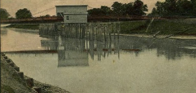
Below is a picture from the 1850's in Algiers. The shops maybe behind it. Notice that there are 2 trains.

A little history of the railroad, or a review. I want this stuff to stick.
Wake up, Al. The New Orleans, Opelousas and Great Western Railroad (NOO&GW) was chartered in 1852. Construction began at Algiers, across the Mississippi River from New Orleans, in late 1852. By 1857, the track had reached Brashear (now Morgan City) on Berwick Bay, and this remained the end of the line for over 20 years. The NOO&GW was built to the "Texas gauge" of 5 ft 6 in (1,676 mm), the only such railroad in the New Orleans area to use that gauge; the line was converted to standard gauge in 1872. (Isn't that just like Texas?) You can click these pictures and larger versions appear. Or, "ZOOM IN" with your browser settings, usually under "View". Hit your back arrow to return to this page if you open in another page. What you see below are pictures of text.


This is a picture off of one of the company's bonds. I know exactly where this was drawn. The railroad was stuck in Morgan City because of the lack of funds, I think. Bonds were sold to help raise money. Morgan got it done.

"In 1869, steamship operator Charles Morgan bought the NOO&GW and began operating it as owner. In 1878 he organized his railroad property as Morgan's Louisiana and Texas Railroad and Steamship Company, and it eventually became part of the Southern Pacific Company's main line". I know a lot of historical text is hard to stomach in large lumps without some pictures. I haven't done the photo shots between Algiers and Raceland yet, so the track maps will have to do until then. They will at least give you an idea about where I'm speaking . My ride came from the west. The rails were built from the east. I've chosen to go with them and fill in this page later. I want Al to come with me as I'll be entering a congested urban area and will need someone to watch my back. Here are the maps. They are cutups taken from the SP maps that go with the trip we'll be taking. They were made prior to the Huey P. Long bridge being built. The rails crossing the river measure over four miles, at the time a world's record. The red arrow points to the eventual location of the rail ferry. You can see the location of Algiers on the right and the large "yard" associated with the railroad. The green line are the rails going west. Shortly, we'll be taking that trip.

The green line is US 90 this time. The orange is the NOO&SW. I probably should have used a topographic map. This area is very swampy. That later.

Below, US 90 and the railroad remained the same colors, yea. The red arrow points to LaFourche, important for the CW battle that occurred there and the bridge across Bayou LaFourche you'll get to see if you hang tough. Remember, these rides are not solely about the rails, but the land and history they ran through and to which they contributed. This ride report is going to be a very long one. More, there were branches . The purple lines going south, I think, were eventual Southern Pacific rails. The red one going north to Thibodaux was the Texas and Pacific (yes, I followed it into Thib) and the one going north from Thib may have been the Missouri Pacific, but that's another story which I've lightly covered in the "
Bayou Lafourche Reconnaissance" ride. You can verify the rail owners there. Wow, what was that whish? Did you all exit at once? BTW, "Thib", say "tib", is the local nickname for Thibodaux, or Thibodeaux, the other spelling. You know someone they call "Tib", cher? He's probably a Thibodaux or Thibodeaux. Leave out the "h" sound, it's useless in South Louisiana.

Again the RR and US90 retain their pigmentation, yea. The red arrow points to the end of the line and Mr. Morgan's home for a while, thus Morgan City.


Though I don't have the date on this map, I see it as a proposed route since the crops were dated as "1853" and we know that the railroad was stuck in Morgan City until at least 1869. I had guessed 1873, or later. The red arrow is Opleousas. Gold is Vermillionville/Lafayette. Green is New Iberia. Purple is Franklin. Blue is Berwick/ Morgan City was the end of the line, at least on this page, for now.
.jpg)
I needed to get you to Morgan City so you can place this next story from the Civil War. Here is an early ride report on the railroad. This was submitted by some yankee to the yankee paper, the NYT. No prejudice from me, I lost my capital "Y". Of course, as today, bias was the name of the game and no Confederate slant was written. Possibly this was due to the paper's hostility toward people who believed in state's rights? One of the passengers was that twerp, Weitzel, locally know as Weasel Weitzel. I wish I had a picture to make my point. Read on. I'm glad he didn't get to have a blog.
NEW-ORLEANS, Friday, Aug. 14, 1863. In my last I mentioned that the New-Orleans, Opelousas and Great Western Railroad was again ready for travel, and an hour after my letter was mailed on board the Columbia, yesterday morning, I found myself, by invitation, at the Algiers Depot, one of a select party to make the first excursion trip, which was of importance enough to merit a description....... The train consisted of only one passenger car, a baggage car and an engine, the latter gaily floating the American flag. The party got together by the indefatigable Captain E.A. Morse, A.Q.M. and Superintendent of of the road -- to whom, indeed, we were indebted for the whole day's pleasure -- consisted of Brig.-Gen. GOLFREY WEITZEL, F.F.F.F, (which is understood among the initiated here as meaning "first in fight, fun or frolic.") Capt. E.A. Morse, Capt. J.W. McClure, Quartermaster; Maj. H.O. Brigham, Chief Paymaster of the Department; Maj. Nicholas Vedder, Paymaster; Maj. H.K. Lawrence, Paymaster; Capt. Chas. S. Bulkley, Superintendent of Military Telegraph; Capt. R.P. Dunham, Aid-de-Camp of Gen. Banks' Staff; Capt. A.K. Bowles, of Gen. Shepley's Staff; Lieut. E.E. Graves, of Gen. Weitzel's Staff; Lieut. H.B. Fitch, of Gen. Weitzel's Staff; Ensign Sidney S. Beck, of the gunboat Sciota; C.W. Greene, Assistant Superintendent of the road. The press was represented by Mr. Ripley, of the New-York World; Mr. Fairfax, of the New-Orleans Era, and your humble servant. By 10 o'clock the whole of the invited guests had arrived at the Algiers Depot, and a few minutes afterward the engine was whirling along one of the gladdest parties I ever saw assembled. The occasion was one of jubilee; the right men had been got together to celebrate it, -- the weather was lovely though intensely hot, and I don't know but that the latter qualification made ten times more enjoyable the piles of iced luxuries with which Capt. MORSE -- that prince of caterers -- had so bountifully supplied us. No wonder if time flew among us rapidly as the champagne corks that kept up their incessant volleys, or the screaming and bounding engine that seemed to have entered thoroughly into the sport. Such a scene of genial and untrammeled enjoyment I have seldom entered into since my schoolboy days, and it was all the more relis[???]able because partaken with men who have ever been -- and are yet -- ready, at a moment's notice, to forget all levity and serve their country at the cannon's mouth. With the brave WEITZEL as temporary "Lord of misrule," what man present could have dared or even wished to play the stoic? STATE OF THE ROAD. But our merriment did not prevent us from attending to the main object of the trip, and examination of the works on the road, and these were really of a nature to excite not only the admiration but astonishment of all present. As we successively crossed the bridges over the Bayous Alemand, Lafourche, Boeuf and Ramons -- stopping at each to examine them -- it seemed scarcely credible that so enormous an amount of labor could have been performed in so short a time. Having, in my last letter, given you the statistics of these bridges, it is unnecessary to repeat them here, but will merely state that in thirteen days, Capt. MORSE, with the aid of his assistant, Mr. C.W. GREENE, of whom he speaks most highly, has succeeded in building a total of 1,675 feet of very heavy bridging, and some thirty culverts; the lumber for all these bridges having to be hauled to the mills, sawed and prepared. One or two of these bridges are built upon, to me, an entirely new and most efficient plan -- and they all, and indeed the whole road, are now in a far more substantial condition than before the rebels paid us this last visit. We are therefore all the better for the little house-cleaning they forced upon us. BRASHEAR CITY. We arrived here a little before 1 o'clock, having made the quickest running time ever attempted on the road. At Brashear City {Morgan City}
but for the fact of having heard and read so, and but for the two or three cannon shots pointed out to me at the depot building, the telegraph station, &c., I could not have supposed that the town had gone out of and been won back to our possession since I was last there, everything seemed so precisely as I had left it. May I respond? Well, not exactly like you left it, butt breathe. Taylor's navy completely outfitted their little army with all of your supplies. Please forgive, sometimes I transition time and space. It's a gift. Another apology: Sorry, I lost the source of the info below. Give me an "F". Won't be my first. All of the New Orleans based railroads had been seized by the Federals. In 1862, shortly after the capture of New Orleans, a company of Confederate Rangers from St. Martinville captured the train at Bayou Boeuf (near Amelia). The Rangers steamed the train as far as Jefferson Station, near Avondale, tore up a portion of the tracks and returned to Berwick's Bay, burning bridges behind them. (this guy uses the term "Ranger" as if they were an organized bunch. I don't hink they were. I don't think there was much organization until Taylor rode in.) By July, the yankees resumed control of the eastern portion of the rail line, and for nearly four months the railroad operated a unique kind of joint control. The union forces operated between Algiers and Des Allemands, while the Confederates operated from Des Allemands to Berwick's Bay. The black line reflects the Rebel's portion, the red the yankee's. We use to get stuffed crabs in Des Allemonds. Germans settled here.

In November the federals sent out a train with cannons mounted on flat cars. They captured the entire rail line. The Confederates retreated, but not before destroying buildings and a bunch of stuff. Below is an excerpt from somewhere? Oh, the SP, cool.

We'll get to Lafayette, eventually. It's a shame that "Sabine" won't be there, though I do know some Sabines, whoa, their Al's friends. For the whole story of the battles that occurred around the railroad,
CLICK HERE . This is some good stuff.
.jpg)
And, I'll show you a little leg to get you to page 2, coming soon.
.jpg)
This is the rail bridge over the bayou and La.308. I have to go now. Here's the second page of my trying to fill in this old write with my pictures and commentary. I'll probably add a lot to this page later, but not now. So, while you are waiting for CSI to come on, take a look. ZOOM your browser window larger (in) to make reading this easier. It works. On this page I've chosen to leave most of the ancient history behind and jump right into the trip as howls from the readership have forced me into a corner. Actually, only one or two of the people who I consider associates cared to comment on my last effort and only they are getting this page with my good graces. So, if you are not reading this masterpiece, you know why. If you are reading it and did not comment on the last page, I consider you salvageable but not of prime quality. I found this report on line. I haven't read it yet, so I'll be taking notes and dissecting it as we go along. It is a USGS (US Geological Survey) report. What I find interesting is the railroad aspect of it. The geological stuff will bore you to tears. It was written in the 1930's which makes it appealing to me. Knowing that there is something older than myself is comforting. So, what I'm going to do is cut it down to what I find palatable. I am not picky so proceed at your own risk. I'll include the link to the full volumn so you can read the entire thing if you want. That will be when we get to Lafayette, a long, long ways away. I will augment as I can with pithy comments and a trillion pictures. After all, what's a trillion here and a trillion there, right Stinky (BO)? Below are the writer's words. What I add will be in brackets. It's easier than hitting the quote button for every paragraph. {That I found debatable. I know where the quote keys are.} Of note, the write starts in Algiers, West Bank, Greater New Orleans. There was no Huey P. Long dual purpose bridge there at the time of this writing. In 1935 there would be. Though not a part of this trip, here she is, a true wonder of t he world and it was somewhat duplicated in Baton Rouge a few years later.
_(320_x_240).jpg)
Below the author speaks of Jefferson. It is the location of Oxchner Hospital and where the "SP745" is kept. Now that's another story. Click below to read easier.


Here he goes. Imagine a 1930's railroad documentary film. HISTORY OF THE RAILROAD {The Southern Pacific's this time. Remember his viewpoint is the mid '30's.} The railroad from New Orleans to Los Angeles is part of an extensive system with many individual members, of which the Southern Pacific Co. owns all or very nearly all of the capital stock. The line from Algiers, La. to Lafayette, La., now known as Morgan's Louisiana & Texas Railroad & Steamship Co. was incorporated in 1852 as the New Orleans, Opelousas & Great Western Railroad Co. It reached Morgan City (Brashear ) in 1857 and Lafayette in 1880. It was operated by the United States during the Civil War and owned by Charles Morgan from 1870 to 1878. {This speaks of west of Lafayette, more than I am willing to deal with at this time, thought I've ridden it all.} The Louisiana & Western Railroad Co. was built from Lafayette to the Sabine River in 1881, and the Texas & New Orleans Railroad Co. was constructed from Orange to Sabine River (Echo) in 1878-81. The latter was operated as part of the Louisiana Western Railroad until 1900. The Sabine & Galveston Bay Railroad & Lumber Co., later the Texas & New Orleans Railroad Co., built a line from Houston to Liberty in 1856-60 and from Orange to Liberty in 1859-60. It was dismantled by the Confederates in 1865 and restored in 1870. {The write goes on to explain each stretch west. What follows are general statements and descriptions.} The Southern Pacific Railroad from New Orleans to Los Angeles, a distance of about 2,000 miles, passes through a region exhibiting a great variety of geographic and industrial conditions. The climate, especially the amount of precipitation, is the most influential factor in causing this variety. The low Coastal Plain of southern Louisiana and eastern Texas, with ample rainfall and thick rich soils, is a province distinct in configuration, human occupations, and products. There are extensive swamps, prairies, and wooded areas, but a large part of the land is under cultivation, with sugarcane, cotton, and rice as the principal crops. The streams are wide and slow, the winter climate is mild, and the summer heat is tempered by breezes from the Gulf of Mexico. Flourishing towns occur at short intervals, and some of them are growing rapidly. The entire region is underlain by a great thickness of sand and clay of alluvial origin. Figures given on mileposts in Louisiana indicate miles from Algiers, a Southern Pacific freight terminal on the south bank of the Mississippi River opposite New Orleans; they are about 1-1/2 miles less than the distance from the Union Station, New Orleans. {I'm cutting the flowery description here.} {The trip begins. Note the mention of the ferry and the proposed Huey P.} {This ferry was regarded as a "temporary expedient".} Leaving the Union Station, New Orleans, the Southern Pacific train uses the tracks of the Illinois Central Railroad as far as Harahan Junction, a switch station on the north side of the Mississippi River. Thence the line crosses the river flat in a southerly direction and in 2 miles reaches the levee, over which it passes on an incline. Here on the bank of the Mississippi the entire train, divided in sections, is placed on a huge steel barge (The Mastodon) to be ferried across the swift current to Avondale, on the southwest bank, a distance of nearly a mile. The floats are adjustable for different stages of the river, for there is considerable variation in the water level consequent on floods and droughts. {You can click these photo/paragraphs to see them better.}


This is the Mastodon.
.jpg)
This was the SP track and yard layout on Algiers Point. I believe the article said it was built in the late 1800's and torn town in the 1950's. I see large buildings where the green arrows point. And, I see some I missed.
.jpg)
And the guys at the roundhouse.
.jpg)
+(2).jpg)
.jpg) CLICK HERE
CLICK HERE for the Algiers site. Things were not always good.


Avondale. Elevation 8 feet. New Orleans 13 miles. {Reminder: these are distances from Algiers} At Avondale, not far south of the ferry, the train reaches the Southern Pacific tracks coming from Algiers, the terminal on the south side of the river opposite New Orleans, used only for freight. The land is low behind the levee, and most of it is too swampy for economical cultivation. In this area will be noted many cypress trees, water hyacinths, and other plants typical of the swamps and lowlands of the South. In wet places there are scattered palmettos with their clusters of fan-shaped leaves. Most of the larger trees are festooned with the parasitic Spanish moss. {Spanish Moss is not parasitic} Des Allemands. Elevation 9 feet. Population 400. New Orleans 33 miles. To the small local settlement at Boutte the railroad proceeds along the natural embankment of the river and then follows a low ridge through the woodlands to Des Allemands, where Bayou des Allemands is crossed. This name is derived from a small settlement of Germans founded in colonial days, but the population now consists mostly of people of French origin living in primitive dwellings along the water's edge. For many years there was a sawmill here which cut cypress lumber from the adjoining swamp lands; now the supply of this material is practically exhausted, and the main resources are fishing, crabbing, and the trapping of muskrat and other fur-bearing animals.

{I'm inserting a borrowed picture here as filler until I can take my own, next trip. Exploring Des Allemands and Boutee, along with Paradis, will be something new.}
.jpg)
{I'm also inserting a little Civil War here to keep Rosco Smith happy.}

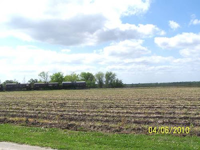
In midsummer the water bodies in this region are spangled with a beautiful growth of the purple flowers of the water hyacinth. {Some may not appreciate the plant as you do, sir.} Bayou des Allemands empties into Barataria Bay, an inlet of the Gulf of Mexico, which was at one time the headquarters of the pirate Jean Lafette. {Jean would make you walk the plank for spelling his name incorrectly. His only excuse would be to claim he was a blogger or e-mailer.} Formerly some of the district about Des Allemands was reclaimed for agriculture by ditching and pumping. Now the first signs of extensive cultivation begin near Raceland Junction, where there are fields of cane supplying the large sugar refinery at Raceland, a short distance south. This refinery, which presses about 150,000 tons of cane a season, draws part of its supply from more distant sources, some of it brought down the near-by Bayou Lafourche in barges. An interesting industrial development in the sugar industry in Louisiana is the utilization of the cane residue (bagasse) after the sugar-bearing juice has been pressed out. This material compressed into bales is shipped from many refineries to a large factory at Gretna, across the river from New Orleans, where it is pressed into sheets of building board known as celotex. In some of the cane fields at Raceland experiments are in progress to ascertain the results of using Chilean nitrates as fertilizer.
Bowie siding is in the midst of cane fields, and there is a sugar refinery not far south of it.

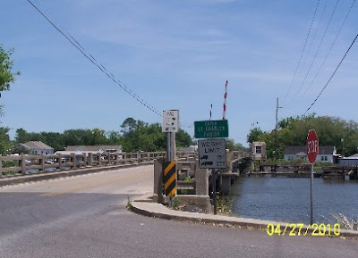
Between La.1 and La.308 is Bayou LaFourche. {The walls of our home in Houma were made of celotex Since he mentions Bowie and Raceland, lets look around. Bowie was my reason for coming here. It was a red cypress lumber mill town. It was out at the end of that road. The land tilts here away from Bayou Lafourche and toward Des Alemans.}
.jpg)
.jpg)
{Panning to the south, the sugar mill comes into view.}
.jpg)
{It is a big one.}
.jpg)
{Raceland Sugar, 1892. I don't know if Dixie Crystals are still marketed.}
.jpg)
{This the "big house" on the property.}
.jpg)
{Next, I followed the spur into Raceland. If you want to visit the location of the depot, just ask where the post office is.}
.jpg)
{Places where depots were seem to leave a scar. Some not only physically.They were the center of many communities.}
.jpg)
{Beauty is in the eye of the beholder.}
.jpg)
{The only contemporary building was this one. A passerby starred as I took its picture? I always yell, "Look there"!}
.jpg)
{I went back out to the sugar mill to check out what rails went where.}

{These tanker cars, below, are sitting in the bend south near the depot. Notice "Bowie" and the siding mentioned. I should have worked harder at getting back there, but it looked private? The mill is probably closer to town, also, inside that bend between "Depot and "3199". I've walked around on the grounds of Valentine Mill, at the end of the spur which goes down the east bank of the bayou and had no idea of the weight of the moment. Next time back I won't miss as much.} {Here's Valentine Sugar Mill (rip). (map above)}
.jpg)
{Here are the cars in the Valentine spur curve going south. The track going straight, west, would go to the Raceland depot, rip. Understanding this is terribly important to me. Do I have a dislodged since of value?}
.jpg)
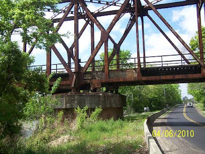
{Then he goes into a rant about Jean Lafitte but doesn't mention his name at first. Raceland Junction is where my last trip ended. This write will feature more of my pictures from this point on. I include this spiel because there is a section of the Jean Lafitte Cultural Center at Thibodaux. I was too worn out and short on time to go in. That happens way too often. Ok, here he goes.} This notorious person, {LaFitte} about whom center hundreds of colorful legends of this region, ran a blacksmith shop in New Orleans in the early days of the nineteenth century (at 810 Chartres Street, just off Canal Street). At this time privateersmen in the Caribbean Sea were preying upon the vessels of countries that were hostile to the countries that hired them, and Lafitte became the agent through whom they disposed of the captured cargoes. In time he became the leader of a fleet of licensed privateersmen and established a fortified post on Barataria Bay. He trafficked extensively in slaves, at one time selling 450 negroes at public auction. The proceeds of these sales and his piratical booty buried for safe-keeping are still the object of treasure hunts in the bayou country. For his loyalty to the American forces in the War of 1812, his earlier outlawry was overlooked. He resumed his piracy in 1817 and moved his headquarters from Barataria Bay to Galveston Bay, where his fortifications continued until he was driven out in 1821. Apparently he was finally lost at sea. {Now he's back to his present. The abrupt change in agricultural conditions at Raceland is due to the presence of a ridge of alluvium built up by sediments spread by the overflow of Bayou Lafourche. Alluvial uplands of this character are of great economic importance in many parts of the great valley of the Mississippi, for although not wide they have rich soils and are sufficiently high to afford good drainage, roadways, and places for settlement. On them are the principal farm lands in this part of Louisiana. The mound of Bayou Lafourche extends from the Mississippi River at Donaldsonville nearly to the Gulf of Mexico, a length of more than 100 miles. Its height for most of the distance is only about 15 feet, and its width is from 3 to 4 miles. Bayou Lafourche is the narrow stream crossed by the railroad just beyond Lafourche station. {A tidbit of historical info gleamed from above. Lafourche Station was on the east bank of the bayou. Want to see the bridge? I have pictures, senior. I had come down La.1 from Thibodaux on the west bank. I saw the over pass. I stopped at a gorgeous old house that was a bit away from the tracks as it offered the only safe parking. I could not get a good shot from the shore as it was too thick with brush, so I did what I do and climbed the fill. }
.jpg)
The premium members got the whole ride and what I found going over to the east bank. You just get the La.308 perspective of the bridge.
.jpg)
.jpg)
This was not the bridge in the Civil war, but the location.
.jpg)
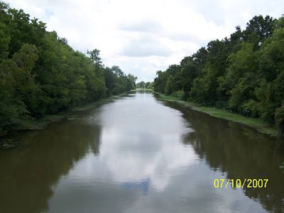
Originally this bayou was an outlet for part of the flow of the Mississippi River and was extensively utilized by freight boats, but to avoid the floods that occasionally came down the bayou, the connection at Donaldsonville was dammed off in 1903, and the navigability of Bayou Lafourche was greatly reduced. However, it is still used for traffic into the Mississippi River, with which it is connected by locks, and part of its lower course will be followed by the Intracoastal Waterway now projected across the lowlands, some distance south of the Southern Pacific lines. {Here's a look at what the bridge crossed.}
.jpg)
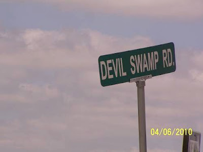
{Here's the Civil War historical marker.}
.jpg)
History insert:


{That's the other side's account, by the way. The "4 mile away depot" was probably Thibodaux.} Lafourche. Elevation 25 feet. Population 60.* New Orleans 53 miles. OK, I'll show you trainees what I found north of LaFourche Crossing.
.jpg)
.jpg)
The Davenport is in front, the Plymouth is to the rear.
.jpg)
The Dav.....
.jpg)
The Plym.......
.jpg)
Visitors were everywhere and it was a weekday. Nice place. La.308, south of Thibodaux. Laurel Valley Store (Laurel Plantation)
{Last check, I think we cleared the rail bridge over the bayou. The writer seems in a hurry. I think he wrote way too much about the flora and geology of the region and now he feels pressed. I know the feeling. Green is me on my last route through here. I took a side trip to Thibodaux.}
The reference to "T&P w.Bank" is wrong. There was no T&P w.Bank until Nepoleonville and above. I may be wrong there, what you want for cheap?

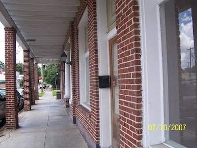
{You may want to click on the map to read it better?} {The green line is my route.} {Below is the author's homage to Thibodaux.} Three miles northwest of Lafourche Crossing, but not visible from the railroad, is the town of Thibodaux (population 4,400), an old village of French origin, with important agricultural and commercial interests. {That's it, out of here?} {Nope, not us. Thibodaux is Louisiana's best kept secret. Or, at least La. kept it a secret from me for a long time. I'll use a tourist pamphlet word, "charming". If you are "charmed" by the anviance of the French Quarter's history and beauty, but not it's sordid Bourbon St. profile, Thibodaux's old town is your ticket. Plus, it sits on a lazy bayou and has a Jean Lafitte Cultural Center extension very close to where the Texas & Pacific RR crossed the bayou and the SP went to a mill. I am impressed with Thibodaux. The author, I surmise, was solely focused on the Southern Pacific's main route. Thibodaux was a Southern Pacific and Texas & Pacific town. I don't understand the slight by way of only 3 lines he gave to this important community. Honestly, I have not done her justice either, having only made 2 short visits there, each with the promise that I'd be back. And, I will when I get those pictures around the West Bank. The best link I can offer can be accessed by
CLICKING HERE. Look at that link and then come back and take a look at my few pictures of town.}
.jpg)
{Above as seen from the Jean LaFitte Museum. The good stuff is very central.}
.jpg)
{French Quarter, no, Thibodaux.}
.jpg)
{Mayberry, maybe?}
.jpg)
{No, the hotel across from the courthouse where Huey P. probably stayed while courting his wife.}
.jpg)
{Important?}
.jpg)
{Pretty much. }
.jpg)
{Historic?}
.jpg)
{I'd say so.}
.jpg)
{But, still Old South stately.}
.jpg)
{You bet.}
.jpg)
.jpg)
.jpg)
{And one of the best cemetery shots I've taken.}
.jpg)
{You should click the map below. I just had to change it out as incorrect information was about to tweak the Keepers of the Grail a bit. The S&P had a branch going north from Thibodaux Jct. It was called the Napoleonville Branch as it ended, sorta, at Napoleonville. I had thought both sides of the bayou were Texas & Pacific. No, the T&P must have come south from Donaldsonville and taken the bridge east over the bayou at Napoleonville. I have a shot of that bridge which is now a pedestrian walk. Then the T&P dove south stopping at the sugar mills, ending up at Thibodaux where it jumped the bayou again. I had a pitiful picture of the Thibodaux station at one time. I may have deleted it because it was so bad. Feeling despondent, I found a reference to it in a La.GS book, "The station (a test station) is on the north side of Bayou La Fourche in the lot just west of the house of Judge Beattie. This house is opposite the bridge from Thibodaux and near the
Texas and Pacificdepot. } {So, the depot was on the east side of the bayou which was considered T&P country.} I also found another write that describes the SP Napoleonville branch. Since I've stirred this ant bed. I'll show the pictures I have . The first is the T&P bridge at Napoleonville.}

Below is Napoleonville explained. Green is T&P, red is SP. Where you see "1" is the bridge above. The black arrow shows where the SP and T&P may have met way way back. Unfortunately, the ride visiting both sides of the bayou and showing the remnants of those rails and the mills they visited is sleeping in my computer. Maybe I'll wake it up some day.

Below Napoleonville, at Madewood, or thereabouts, there was this in the water. No telling?

. On that trip, I exited town on the east, going down La.1.

{Brown is the T&P. Light green is the SP (above). Dark green is me.} Again "T&P w.Bank" is incorrect. It should read "SP w.Bank". When I came into town the last time. I looked for old industry that might have been served by the RR. Most was gone, I presume. Here was Louisiana Cane Mfg. Inc. It was south west of down town.
.jpg)
It was getting hot and the Lafitte Historical Museum was a nice break, though like I said, I stayed in the parking lot.
.jpg)
This is the view looking upstream from their river walk. That may be a warehouse previously serviced by the T&P over there. Dern, why didn't I check the other side? Oh, I still needed to get to Bowie, LaFourche and Raceland. On this ride I had aimed high at the West Bank but I started feeling trippy at 3:30 in Thibodaux. I knew US 90 would have to be the ticket home.
.jpg)
Schriever. Elevation 17 feet. Population 50.* New Orleans 56 miles. That's next.
.jpg)
But, we'll have to go though this to get there. Suggested Reading
Click Here. That's the write on the SP I found. {Leaving Thibodaux, it's a short 4 miles down to Schriever.} { Update note: I recently rode back over to Raceland and resumed following the tracks east. I knew this was going to be a long one, and maybe the last one in this area for a while, so I was going to be as thorough as possible with the time I had left after the long trip over. Coming up La.20, I stopped for a break and while out by the tracks I saw a light approaching. I laughed as I assumed the place to be private. Private places are scarce on the road these days. Anyway, here comes this light. Mercy me, it was the the Sunset Limited. I stumbled down the embankment and ran to Mz Guzzi, vaulted upon her back and spurred her hard. Evidently, the train had been given the reigns, also. I couldn't catch her without asking for a ticket. I am the guy that will get one as I'm a ticket magnet, so proven in my younger years. At Schriever, she stopped at the depot. Passengers were disembarking. Instead of stopping and zooming in the camera, I attempted to get closer to catch an engine shot back to the old depot. That would have been a classic. As the last passenger's foot hit the ground, she pulled out of the station. No shot. Ya can't always get what ya want, but............and we all know the rest of that line. Nevertheless, I would get what I needed all down the line. A few pictures of the rest of that ride will follow as it will be for the late comers. The premium members have already read that whole ride in full. You've been offered an opportunity to sign up for these emailed ride reports and I received zero applications which left me feeling unwanted, unloved and vindictive. So, you get the short version. Touchet, mon amis.} {The trainless depot shot on the ride before the last ride.}
.jpg)
.jpg)
{Its location in relation to Thibodaux Junction.

{Schriever was the axle for all the short branches that emanated from it. Houma was one.}

{Lockport was another.}

{Napoleonville was another. I'll have to find that one in my stash.} {And, some old business from the last page, Thibodaux was not named for Boudreaux's friend.}

{He was the Captain of the LaFourche Volunteers who fought alongside General Jackson and Jean Lafitte at the Battle of New Orleans. The dude was a dude.} {And, I found this picture of an old bridge spanning the bayou at Thibodaux.}
{I don't think it would have supported rail traffic. But, the T&P had to jump the bayou some way, and my trusty Garvin Topo said it did.} {Ah, and a teaser to go back and reread a prior page of this ride.}

{I'll tell you when that the last ride's pictures have been dissected from the group and placed in the appropriate places along the line coming out of the West Bank. They are not there yet!!} {Now, back to our 1930's tour director:} An alluvial ridge extends southward along Bayou Terrebonne through Schriever, and another, extending along Black Bayou, is followed by a branch railroad to Houma. {The author is not clear here. There was no SP railroad down Bayou Black which is west of Schriever at Gibson. The Houma branch dove due south from Schriever . It went along Quishi Bayou and Little Black Bayou into town. Back to his spiel.} At this old town {Houma} there is a large sugar refinery and an extensive business in oysters and other gulf products. Much sugarcane is raised in this part of Louisiana, and formerly there were many small sugar refineries, some of which are still visible. {the smoke stacks were left} Potatoes have lately become an important product, and considerable corn is raised. Between the alluvial ridges the land is low and swampy, but in places it can be drained by pumping; one notable reclaimed area of this kind southwest of Raceland is yielding large crops of corn. In the swamps cypress, tupelo gum, and other trees flourish. Lumbering has long been an active industry, but many years of vigorous lumbering has greatly reduced the amount of timber available. {The rape of the red cypress forest is evident. Unlike the reforestation of pine country, when it was gone, it was gone, thanks to mills like Bowie. Replacing 400 year cypress is like replacing the Sequoias.} There was formerly a sawmill at Chacaholua, and at Donner a large mill is in operation on logs brought by rail and in "booms" rafted through the great system of waterways traversing the lowlands to the north. Donner. Elevation 11 feet. Population 900.* New Orleans 65 miles. Donner is in the large lowland area that was covered by the great flood of the Mississippi River in 1927, when in the lower places the water was from 6 to 10 feet deep for several months. The flooded district extended far to the north and northwest over the lake region and the country traversed by the Grand and Atchafalaya Rivers. The bayou ridges described above (p. 14) were not covered, but the water extended far up their slopes. During the flood thousands of residents on the lower lands were driven out by the water, and there was considerable loss of crops and effects. The railroad embankment near Donner was slightly submerged, and parts of it had to be protected from the flood waters. In this region the roads are surfaced with oyster shells, which make an admirable road metal for light traffic. Shells are also burned as a source of lime. {This, I believe, is a great old "tourist court" at Donner. Donner and Chacaholua blend together. I'm assuming there was a depot here and that the court serviced those passengers. It may have been a resort for those interested in hunting and fishing. The larger building is a full service gas station of old. It is now a tire repair shop, opened only on certain days. This area was remote.
.jpg)
These places are on the rail side of the highway. Whether they predate the Great Flood, I can't say.
.jpg)
It's 3:45 am, must be time for another entry. This is the 5th page and I'm so far ahead of myself and behind on what I wanted to include it is troubling. Of all the new over used words in our vocabulary, "troubling" is the most troubling. The fact that I recognize a new vocabulary is likewise troubling. What isn't troubling is the fact that we, as a society, have eased up on "awesome". "Awesome" is usually used in expressions of happiness and glee. That may explain its demise as a commonly exercised exclamatory. Nevertheless, I'm tempted to use "awesomely troubling" to describe this morning's situation. I'm going to dedicate this page to catching us all up. I could have gone back and inserted the awesome pictures I have into their appropriate pages, but the thought of that drudgery is indeed troubling. The only way to get started is to get started. You can only sweep the garage floor so many times. You can only check your email so many times, but this time was worth it. An old friend just quoted the Kinks in an off the wall (y) comment which was pretty awesome and troubling. All right, no more A&T, back to work. I need to get the forgotten maps posted. I'm a mappy and I know that there are a few others out there. These are old. They go well with the motif here. Green line is the railroad, orange line is US 90.

Somethings drive me crazy. I do all the leg work finding stuff and then don't write down an itinerary or even enter way- points into the GPS. I go back to the maps and realize I forgot to check out my all imported points of interest, like the location of the old train ferry. That's a 300 mile mistake. I was there and blew it. The river bent to meet the road and me. How easy would that have been? I will rationalize that the spot was probably deep behind some high fence, accessible only at night with the right Mission Impossible gear, which I have used and am not afraid to use again. Despite my short falls, fate has not given up on me and she does supply. I found a road to the beginning of the rail ramp to the Huey P.Long dual purpose bridge over the Mississippi River. There was no NO TRESPASSING sign and I was completely unmolested. That would have been enough. The kicker is that there was a train in perfect position for a shot, stopped on the bridge. I was shaking knowing something would foul up, the camera would die, the train would move before I could set up, like at Schriever, something. But, no. It stayed right in that place and posed.

What purpose this little building serves I can only guess. Actually, I may have figured it out as a control for a yard which is or was past the entrance to the bridge. Or, possibly it serves no purpose now. No one came out and yelled at me which is almost an expected occurrence. I think I felt a void at its absence? You can see the "keep out" sign's edge. At this point I realized I was OK and not in jeopardy not having passed some objectionable point. If it was the bridge keeper's house, he surely must stand in high regard amongst fellow bridge keepers.

The long gone ferry was at Avondale, the location of this.

I know you are all rushing to your dictionaries. Stop. The core word is mode. All it means is that different ways of transportation are used in the same journey, ie, trucks and rails in this instance, possibly even water with the river so close by, wouldn't you think. OK, Premium Members, here come some repeats, but you know that eventually I hand over the goodies to the general public though they have done, and likely will not do anything to deserve it. Since Paradis is on this map I'll show you a little of what the PMs got to see. Paradis is much more than it's US 90 face. That face still has a few classic buildings which have served this important highway for a long time so I'm not diminishing that area. But, back streets and back roads are my gig. I haven't an idea of what this building was. I do have an idea of what the bike "was".

This is an old Episcopalian. My bet is it is very old, possibly pre-Civil War. The lines are right. You must remember, this is the Old Spanish Trail, or close to it. In Des Allemands the actual location is noted. I can only say that there is so little dry land at that point, the exact position of the old road can't be far off.

Moving west along the railroad road, you come to this gorgeous spot.

Across the rails was this one.

I'll have to close now as I am getting a bit sleepy. At this point my writing and organization becomes a little disjointed. And you say, "You must be sleepy all the time". Point taken. Whoa hoss. I forgot to download my GPS tracks, you'll find them awesome, if not troubling. Here's a look. You can click it and it does get bigger. "Yard 1" refers to the west entrance to the Intermodal Facility. "HPL" is the Huey P. Long Bridge. "Train on HPL" is where I shot the train on the HPL. Notice, it's a long way from the water. The rail bridge is 4.5 miles long with a 1.5% grade. The top is flat unlike most bridges that arc. Now you know and most don't.

Below: Heading west. I had taken the river road back as US 90 was making me crazy. Finally I figured I had escaped the worst of it and rejoined the 4 lane. My ride in would be next to the rails. The ride back would be on the big road, down and dirty and not near as fun.

{This is something new. I suddenly have more than 3 people looking at these entries. I don't know if I can handle the fame. I may have to get a manager, Al, you busy? To the new 2 I say, "welcome" and too bad you caught us in the middle of a documentary instead of an actual motorcycle ride to exotic places. Instead, I've let this guy, who I've never met, and most likely won't since he rode this route in 1935, lead us from the Wes' Bank (a real place across the Mississippi River from New Orleans), to Lafayette, where we get off as he continues westward. The last five pages can be accessed from the Start Page of this write and all pages are linked together in ascending order. If you haven't read them first, none of this will make any sense and you'll move on to the weather channel almost immediately.} {Solid ground gets narrow after Schriever. There's only one way in and one way out, the old route of US 90. Des Allemands is an outpost town built along the alluvial overflow of Bayou Des Allemands. It is a true marsh / bayou town fit for any movie or book background. I really like the place. Maybe it's time to let our guide take over. As I have said before, imagine a 1930's documentary or maybe one of those movies your teacher showed in school when she had no lesson plan. When I was teaching, I became proficient in the operation of projectors and slide machines. Actually, I had to have one of the kids set them up. And, the { }'s denote my words since this is his article. I find quotation marks mundane and I figured you could deal with a little spicing up in this one.} {Hang on, his spiel gets energized}. {Whoa, hoss, I have to add this little bit of CW history. Remember on Page 1 that I mentioned this. Sure you do. This is a reminder to the recollectionally challenged.} "September 1862 The town of Des Allemandes is the scene of numerous skirmishes resulting in capture of an entire detachment of Union soldiers on September 4. A Union train with sixty men ambushed at the Boutte station by a Confederate force of Louisiana militia and volunteers on September 4. The train escapes to New Orleans. Fourteen Union soldiers are killed and twenty-two wounded in the skirmish. " {Ah, I went looking all over Paradis for that historical marker. It was at Boutte. I guess I'm "challenged". But, I did remember there was one, so there.} {OK Rosco, the floor is yours. Orange is US 90 (old) and green is the RR.}

Des Allemands. Elevation 9 feet. Population 400.* New Orleans 33 miles. To the small local settlement at Boutte the railroad proceeds along the natural embankment of the river and then follows a low ridge through the woodlands to Des Allemands, where Bayou des Allemands is crossed. This name is derived from a small settlement of Germans founded in colonial days, but the population now consists mostly of people of French origin living in primitive dwellings along the water's edge. For many years there was a sawmill here which cut cypress lumber from the adjoining swamp lands; now the supply of this material is practically exhausted, and the main resources are fishing, crabbing, and the trapping of muskrat and other fur-bearing animals. {Primitive dwellings?, I hope that fella kept going before one of the dwellers caught him at the bar.} In midsummer the water bodies in this region are spangled with a beautiful growth of the purple flowers of the water hyacinth. Bayou des Allemands empties into Barataria Bay, an inlet of the Gulf of Mexico, which was at one time the headquarters of the pirate Jean Lafette.{sp} Formerly some of the district about Des Allemands was reclaimed for agriculture by ditching and pumping. Now the first signs of extensive cultivation begin near Raceland Junction, {Once again, he can't spell the name of a historic fig your.} {Click to enlarge. See, it's almost an ismus. Don't hear that word much these daze. Spell check freaked out. Our children know nothing but computer games.}

{The last ride report to New Orleans was done in email format. It was sent to the 3 followers of this website. If you are one of the 3, then you have seen some of the following, but not all. Brace yourself (s).}
.jpg)
{This is what the engineer sees if he has to get down off the engine and immolates my position.}
.jpg)
{If he walked over to the old US90 bridge, this would be his view.}
.jpg)
{If he fell down the fill, like I did, he'd see this.}
.jpg)
{If he looked at the below sea level underpass, this is what he'd see.}
.jpg)
{If he looked at the street sign............}
.jpg)
{If he walked out to the old highway...........}
.jpg)
{He'd know he had left Ascension Parish and entered La.Fourche and wondered what that "History Hunts" was and who the heck is that "Steve" who deserved such a nice welcoming sign.}
.jpg)
{Then he'd look at the ugly new US 90 bridge and probably think that it was ugly, too.}
.jpg)
{I'm going to cut Rosco short on this one. I have to make up my mind how to approach the next set of towns. As I have alluded, this route has been followed twice in the very near past and written up in one form or another. I have to get organized. The rest may be limited to a set of links for the two new guys. Oh, speaking of. I know this one included too many bridge pictures. That's because I, and HH, are partially funded by the OFRRBPS. Unfamiliar? It's the Old Flippin' Railroad Bridge Picture Society. They send me 5 dollars a year and some brownies. The brownies are the best part. They are really really far out good. In fact I'm eating some right now, Groovy, ladies.} {Paulette just checked in and said she'd been enjoying this little documentary. She also told me about their ride over to Alabama and the beach. They stopped at Fort Pike on which she gave a healthy report. I was glad to hear that since, I guess, my last visit there was in 2006, the year after Katrina. One side was bulging out. It was closed and the future looked bleak. Someone, or group, should get credit for fixing it. Bush? Anyway that's an update, visit there, it is awing. We are very lucky to have such a fine historical site within our borders. Pity poor Fort McComb and the Old Spanish Fort in Lake Vista. They are not as celebrated.} {And, thanks to Michael Dwayne for the great Super Bowl winners, The New Orleans mf'n Saints, team picture he sent to me and duh daughta, very nice!!} {Back to the book now that the local news is over.} Gibson. Elevation 11 feet. Population 60.* New Orleans 67 miles. {Back to me. Gibson sits at the intersection of La.182 and La.20, the road to Thibodaux. What the state now calls 182 is old US 90. Renaming the road that was wrong. There's too much long term history associated with it to make following the "trail", the OLD SPANISH TRAIL (OST), difficult for future generations. Instead of naming it stupidly, 182, why wasn't it called the OST, reverting to its earlier name while creating a tourist attraction? Because bureaucrats are dumb and don't give a .....} {I yelled about that back in 2005. I guess I can't let it go.} {Anyway, here we are at the intersection. I'll let our narrator run a few lines and then I'll come back because, though he says that there is no significant structure here, there is stuff. Extreme beauty is just a bit off the road, that is if you like lazy bayous with shrimp boats tied to the banks under sheets of Spanish moss and significant structures if you use my gage? Ok, Bernie...} Gibson is a small village on Black Bayou, a waterway of some importance. A quaint old church is about the only feature of special interest. Gibson was formerly an extensive lumber-milling community, drawing on the rich supplies, now mostly depleted, of cypress and other trees in the great swamp country to the north. This swamp vegetation is still a picturesque feature along the railroad in places, especially the drapery of Spanish moss on many of the trees. {2 points for you, Bernie, you do get it.} Spanish moss is extensively utilized for making mattresses and other cushions at moss "gins" at many places. The moss is cured by moistening and airing to decompose the living portion, then dried, carefully worked to remove dirt, sticks, and other undesirable materials, and thoroughly washed. {I feel obligated to stop here and and dredge my lake of photos for local shots. I could hang out at the gas station at Gibson and watch traffic, catch a few passing trains and absorb the aun viance of the place. That's a Fr. word? Maybe 2, spell check can't figure out.}
.jpg)
DL, still new.
.jpg)
The bridge turns to allow boat traffic through. At one time a full time employee was required. What preceded the 1946 bridge? Now there's a good question.
.jpg)

.jpg)
{Swamp, nic nic bugs., there you go George E. BTW, do you identify with Jack Nicholson while watching ER? Not that ER, Easy Rider. Is that show still on? Hopefully not. What is it with watching hospital TV? A lot of people like that stuff. I can't figure it out. Oh no, I watched Ben Casey, M.D.}
.jpg)
{What did you expect, "Johnny Lafitte's BB Marina"? He would have called it "Breaux's BB Marina", but Breaux is a common name, so he chose "Bob". Not many Bob's, no.}
.jpg)
{February in Louisiana. We have a great ice fishing season.}
.jpg)
{Mason du Masons}.
.jpg)
{Just what you'd expect to find nestled against a dark La. bayou, a beer parlor. Someone really has a sense of humor.}
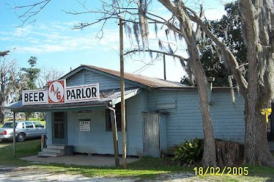.jpg)
{Back in '05 there was this rare open spot on the bayou as you approached Houma. The country is getting filled up and we are letting more and more, some that plant bombs in our largest city, into this country. Get rid of the politicians that are allowing that. They are doing it to add to their supporters at election time and to add to the dependent class where big government is the the provider and boss. Big government supplies only what it steals from us. In return they get more control over our lives and a terminal loss of our liberty.} {There is no reasoning with this arrogant tyrant and he's getting stronger with each bill passed by the likes of Charles Melancon, Pelosi's gigolo, and our own Hillary look alike, the likewise arrogant, Katrina Mary Landrieu. Over 60% of Americans thougth that "health" thing was BS and he has ignored us. That is arrogance. Same goes for our "machine" politicians that practice Chicago politics just like their northern counterparts.} {"B.O.", aka, Stinky , kiss my butt. Can I still say that?} {You better believe it."}
.jpg)
{You might click this map to make it larger. That's the railroad. You can see 20 and it taking off to Thibodaux and US 90 headed south. There is no new US90 on this map which really makes it nice. The blue lines signify swamp}

{This is now. There is no swamp, no bayou, only sterile "US 90". The railroad remains. Check out the road labeled as "Old Spanish". Continue its curve to the next road and I'll bet that's the old route. Ah, I cut it off, too bad.}

I'm cooling it for the night. That rant wore me out. The pictures are going to get thick from here on since we are now within my afternoon ride radius. Checking this outing's shots I see I didn't stop to take any in this area due to the fact that I already have them. Finding and orgainizing them are my next tricks, so hang in there. Getting through the Boeuf, Morgan City and Patterson area is going to be fun. {Leaving Gibson on old US 90, headed to Boeuf.}
_(500_x_400).jpg)
{I hated to leave Gibson.} {Moving west, click the map to get a better look. It is much larger}

{This...}
.jpg)
_(500_x_400).jpg)
.jpg)
{...was once traversed on this...}
.jpg)
{....an old piece of US 90....which ran through this and still does..... Kerr-McGee pioneered off shore oil exploration here.}
.jpg)
Boeuf. Elevation 13 feet. {not the bridge, it's higher} Population 300. New Orleans 74 miles. ...now the road rides on this....
_(500_x_400).jpg)
{Before I'm going to let Willy resume his spiel, we're going to look around. I am in no hurry to cross that bridge. Going north from US 90 and the railroad is Lake Palourde (pau lure). This is where Bayou Boeuf leaves the lake.}
.jpg)
{This may be on the Boeuf. I really like this one.}
.jpg)
{Climbing up on the bridge..............}
_(500_x_400).jpg)
_(500_x_400).jpg)
{and down...}
_(500_x_400).jpg)
{I went under it to catch some water level shots.}
_(500_x_400).jpg)
.jpg)
{Ok, Willy, take it away.} The small old settlement of Boeuf is on the bank of an outlet of Lake Palourde, one of the water bodies of the widespread swamp region to the north {The Atchafalaya Basin}. From Boeuf to Morgan City the railroad follows the north bank of Bayou Boeuf on a ridge of alluvium built up by overflows. In this general region the deposition of this material has also developed a series of islands of sufficient elevation for farming. They are not high, and in places the fields have to be protected from overflow by dikes. The soil is rich and mostly under cultivation in cane and other crops. Many scattered cypress trees remain in the swampy areas. The extensive swamp lands in the Mississippi Valley in Louisiana are mostly useless for settlement without expensive diking, but they are valuable for growing cypress and other lumber. Some areas in the midst of the swamps that are high enough for cultivation are utilized for small farms, but even these are subject to overflow at times of high water. Morgan City. Elevation 18 feet. Population 5,985. New Orleans 80-1/2 miles. Morgan City, on the right bank of a bay-like expansion of the Atchafalaya River, is a commercial and lumber center of considerable importance, as it has waterways of moderate depth into many parts of the cypress swamps as well as into the sugarcane country. The wide river here is the outlet of a series of large shallow lakes and numerous bayous occupying the area known as the Atchafalaya Basin. It receives the water of the Red River mixed with some overflow water from the Mississippi River, which joins the Red River by way of the Old River near latitude 31°, 50 miles above Baton Rouge (130 miles above New Orleans). In the great flood of 1927 a large part of Morgan City was under water for two months.
.jpg)
When the Mississippi River is low and the Red River is high the slope in the Old River is reversed and some of the Red River water flows through it into the Mississippi. No doubt the Red River flowed into the Mississippi River originally, but the gradual growth of a natural levee on the west bank of the big river forced the Red River to find an independent course to the Gulf down the channel now called the Atchafalaya River. This river and the Grand River have long been thoroughfares, and in earlier times many flatboats were used for freight transportation, going mostly by way of Plaquemine Bayou and locks to the Mississippi. {The Old River Control Structures above Simmesport hold Morgan City's life in its hands. If New Orleans is threatened and no other fix works, MC gets the ax. Not a likely scenario. But, next week the docks at MC will be flooded, a reminder of their precarious condition on the Atchafalaya.} Morgan City (originally Brashear, later renamed for Charles Morgan) is near the head of tidewater and from 1850 to 1869 was the terminus of the railroad from New Orleans. At that time there were extensive boat connections in all directions by the rivers and bayous, and by way of the Gulf of Mexico to Galveston. The United States Government took possession of these communications during the Civil War. Charles Morgan, who had controlled most of the boat lines, purchased the railroad in 1869; it was extended west to Lafayette in 1880. Formerly the city's lumber business was extensive, but now the principal occupations are agriculture, shipping crabs, and preparing shells for chicken feed and other uses. The shells are brought from the large reef of Pointe au Fer in Atchafalaya Bay, 30 miles southwest of Morgan City. One of the water routes of commerce in the region now is by the Grand River and a 7-foot canal through Plaquemine Lock, which enters the Mississippi River 20 miles below Baton Rouge. {Morgan City's wealth is directly related to oil. When oil prices go down, the sidewalks roll up.} Charles Morgan is regarded as one of the most important influences in the development of southern Louisiana. He was born in Connecticut in 1795 and died in New York City in 1878. He inaugurated various early coastwise steamship lines, mainly to places on the Gulf of Mexico, developed the railroad from New Orleans to Cuero, Tex., and dredged a steamboat channel through Atchafalaya Bay. In 1836 he founded a great iron works in New York, and in the same year he sent the first vessel from New Orleans to Texas, stopping at Galveston when that place consisted of one house. The projected Intracoastal Waterway is to follow Bayou Boeuf into the Atchafalaya River at Morgan City and thence go westward through Wax Bayou. This waterway is being built by the Government to provide an inside channel along the coast from New Orleans to Corpus Christi (at a cost of $16,000,000) and, eventually, to the Rio Grande at Point Isabel. The bill passed by Congress in 1927 provides for a canal 100 feet wide to carry 9 feet of water. Many natural water bodies are to be utilized, some of them, however, requiring deepening and straightening. For much of its course it is from 10 to 20 miles south of the Southern Pacific lines. {Thank you, Willy, that was very nice. Here are some shots to add. Morgan City once languished under a terrible reputation as a rough place, but Mr. Charles Morgan saw it fit for his home and base of operations. I'm backing off that. "Base of operations" is correct. I don't know if he ever lived there. I've searched for evidence of Morgan's home. He died in New York, so maybe he was a carpetbagger.
Charles Morgan, Morgan City's namesake. I'm sure there are better links to his bio. I'm cheap.
.jpg)
And here's the prize of the entire article. It is listed as "Rose Garden" on the
Morgan City website. That is irrelevant to me. It's the depot and water tank for the T&NO RR. or priors.
.jpg)
Remember, Willy said that Morgan City was the end of the line. To go back, the railroad built a turnaround, the loop below. I've seen what is left of it. Above, you can see the loop leaving the station area and going south. The inclusion of the water tank in the picture causes me to get a little giddy. I had read that it was near the bridge, but this seals the deal. A turnaround was real luxury. Other ways of doing it would be a wye (Y) and a turntable.

That's it, enough excitement for one day. There will be many more pictures of Morgan City coming on the next page. You won't believe what a beauty spot it is if you have never gotten down on the streets around the old town. Wrong, more excitement. I had to teach my ## something wife to drive a 4 speed standard shift, no power brakes, no power steering, 1973 British sports car... gas clutch, gas clutch, stay on your side, the motor is not running, you are too close to the ditch, you are in the wrong lane, oh, the turn signal lever just fell off.....? I'll signal, which way are you going? Why do I ask? There will be no "{}" used on this page due to all the words here are mine except for a few from Mark and a few from Michael Duane. A correction also has to be made. Mike said, "By the way, my name is Michael Duane with a "u". Like Duane Allman, Duane Eddy. No "w". That's like Dwayne Hickman. Dobie Gillis". Sorry, Mike. I was thinking about Dwayne Fontenot. Some people you can't forget. Speaking of..... Mark just wrote and said he agreed with me about Morgan City being a beautiful place. He did add, "once you get away from all the oilfield junk" left from years of occupancy. I lived in an older, but far from the oldest areas in New Orleans. In the old downtown and neighborhood part of MC, I had the feeling I was back in New Orleans. There is even a seafood and snow cone place that was once owned by some Italians from NO. This young couple has it now and are preserving it. It's on Railroad Street east of the docks. I gotta show you this place. Go there. The store is New Orleans, 1958. I'll testify to that. I almost asked if they had any sliced ham scraps, free, or giant red hots, 5c, both regular treats where I stopped in as a 10 year old.


.jpg)

.jpg)
.jpg)
.jpg)
I didn't write anything due to the fact that you either get it or you don't. I'm sure there are those who can put the old New Orleans feeling into prose, but I can't. Like an old buddy of mine, Mike, says, "It was a magical place". Continued at the bottom of the page... INSIDE: Poseidon, God of the Sea. Also a great New Orleans Mardi Gras parade if it still runs. I think the crews were forced to be "equal opportunity" and that smacked of government control which some simply said, again, "kiss our butt if we can't have a private club".
.jpg)
Louisiana: Have a Bite
.jpg)
We ain't no damn Saints Fans. I can imagine the scene in this place at the end of the Superbowl.
.jpg)
.jpg)
.jpg)
And Stuff.
.jpg)
Oh, do you wonder what that picture is? That's what you call a Louisiana Work Around. When government tries to reign us in, we slip the bit and away we go. One drink policy? Sure. Make it 4 gallons. And, "kiss my butt".
.jpg)
That's just one place down by the tracks. The waterfront is blocks long with all kinds of businesses there. It reminds me of Decatur in the Quarter. The seawall is on one side. It's a working port and a vibrant area. This is the district that was once famous for its rough bars and rowdiness, shrimper and oilman enjoying each others company. Then the shrimpers learned that the shrimp liked to be around the rigs. At least the movie went that way.
.jpg)
1912
.jpg)
.jpg)
.jpg)
.jpg)
.jpg)
.jpg)
.jpg)
.jpg)
Post Office
.jpg)
City Hall
.jpg)
.jpg)
Downtown looking toward the railroad.
.jpg)
Below, looking into downtown from the port's sea walled gates. They will be closed this weekend due to the river being "up". I'll bring pictures back next week.
.jpg)
The new bridge looms high in the sky and reminds all that this is a big river town.
.jpg)
And that parking is sometimes tough.
.jpg)
The water tower marks City Hall.
.jpg)
1938 Shrimp Boats Are a Comin'.
.jpg)
Continued from above. ............................................................He also feels that after 1960 it changed and by 1980, NO was no longer very special. You can't have cancers like New Orleans did and call it special. Harsh as it sounds, the flood was NO's last chance to clean up. The scum politicians sure did miss their supporters and did everything to get them to return to the welfare projects, slums and gang hideouts, but those people got set up by the federal government in new digs. Y'all in Houston, Dallas and Atlanta enjoying our expatriates? I told you all that dark stuff to emphasis how great it was to be taken back to 1958 by the old neighborhood store in Morgan City, and how much I resent the fact that I can't go back to my neighborhood because it is still a dangerous area. That's PC code for a place that is so racially prejudiced that a white person would not dare step in. We left Gentilly in '59, 2 blocks ahead of the "wave". The scourge from Central America and Mexico were already there. One stole my radio. What are you going to let them steal from you? You better rail against the Democrats in November. They want those 12 million illegals' votes to seal the deal for their vision of what real power can bring them. More looking around MC later and then over to Berwick for something that's still "special" and a grinner to a few. These days you have to hunt. Sometimes, like at the old store and the historical part of Morgan City, you bag a few.

I want to tell you something before we get started on this page. Morgan City and Berwick are two of the best locations for an amateur photographer. You can't take a bad picture in these places. Well, you can if don't try to avoid power lines, but aside from that, it is photo heaven. This picture is here because I liked the red building which is a historic lighthouse. This stuff just shows up, pop, take a shot.

I've backed off any commitment to reaching Lafayette and I may go no further on this project as it is getting very redundant though the rides that make any future coverage redundant are gone from the public eye. But.......some house cleaning first. Y'all know Al. Al likes his picture taken and I can't deny him because if he doesn't see himself on these pages once in a while, he mopes and then has to go off to S. Abbeville to get a spanking to sharpen up his attitude a bit. That's all I have to say on the subject, so hold your e-mails. Hey Wally, remember Bruce at SCS went down there for the same reason? You never know what little joys some people dig. Different strokes for different folks, pun intended. George, didn't you go with him one time? I never got a report. I noticed you ginning and standing a lot. You did, didn't you!! Here you go Al, save the trip. This was Al when he claimed for Spain all of the lower Atchafalya, including Berwick and Morgan City, Amelia, Patterson, Tiger Island and beyond. It was January, no coats were needed.
.jpg)
Which was too bad because Al really likes to wear the red fancy one for these pictures.

But, alas, he's been warm natured ever since he got that electric jolt at work.

And, there are two things that really irk him, one, putting down the USA, you wussy liberals......

and, two, making fun of his recent weight gain and eyebrow hair.

Oh, this is his "Post the Muslim Terrorist" Crusaders outfit. {btw, "post" means to strike a blow, to hit, hurt or damage an opponent or enemy". It's a 1950's New Orleans thing. You'd have had to have been there.} Say that 5 times fast. He has a matching sword. Oh, Berwick, sorry to stray from the official straight and narrow academic format which I yearn to maintain. Again, this is the old depot picture from the MC website.
.jpg)
This is my copyrighted copy of a picture I originally took which is below this protected version. The red arrow points to where I think the water tank and depot were.
.jpg)
The yellow arrow points to where I think the turnaround began. If you repeat that without permission, I'll tell Al. Do you want to "go there"? To the left there are 2 stop signs. Remember the further one. How was "stop" spelled? Just checking.
.jpg)
There is a 2 story house to the left of it. I think the original rose garden /depot picture was taken from there on the second story toward the river, but not all the way.
.jpg)
Remember the stop sign? It is to my left. See the raised area. It's the fill for the turnaround. That's the levee ahead. I almost said "sea wall" thinking it was a wall which it is but there is no sea, only one bad to the bone river on the other side.
.jpg)
There it goes going east.
.jpg)
Here it came right by these buildings (going east). Now it's used by the gravel road. I wonder if there's any latent seismic rumblings there.
.jpg)
This is a picture of the next depot down by sixth street.
.jpg)
I didn't take it and do not claim it or anything. I don't know how that picture got here? Here's GE's shot with my white trail of the TA. We in the railroad world like to use initials. Keith Richards once wrote a song about T&A, might not be the same. My TA means "Turn Around" or condensed, it can be spelled, "Turnaround". Your choice, depending on it being a noun or imperative verb.

Here's Garmin's: Ya got the train bridge, the new 90 bridge and the old 90 bridge, going bottom to top.

I can't leave Morgan City w/0 saluting the shrimp boat, Spirit of Morgan City. See!! Shots everywhere.
.jpg)
And the Oil Industry.
.jpg)
I'm going to have a showing of my MC/Berwick bridge photo art at some point. I can't here because this page has gotten too large. So, forget it for now, I can't worry about Al roaming S. Abbeville so I had to display a few of his old shots to maintain his sense of purpose. He just wrote me that he's bought 3 more Lt. Dave Robicheaux books to help with his deteriorating ego. Now, all I have to worry about is him roaming west New Iberia and forgetting to call him Lieutenant. Al and I found ourselves on the Berwick side north of the old 90 bridge.
.jpg)
That one. Magically, we moved south of the car bridges but still north of the rail bridge.
.jpg)
I don't know if he or I took this one, but it's pretty good of the rail bridge. No date, probably Al's. The inclusion of the 3 yellow blocks make it. Seriously.

This is the bygone Berwich Depot. I want to credit the guy who actually gave me permission to use it. I will at the bottom of the page to make it look like a footnote. Naw, I will here, or I'll forget. Bert Berry is his name.
CLICK HERE to go there. Great stuff.

Its location is where these shots were taken. Again, these are Al's shots. He had stationed (pun unintended) himself here, the side track to the station and to the area between the sea wall and river. You can see the incline to cross the levee and approach the bridge.

When suddenly, what should appear?

The Sunset.

It was a moment.

But wait. I was closer to the bridge. Mine and more on the next page. Later. Rosco just called and wondered why I'd left out his narrative. I explained that this was not a real page and it was all in his imagination. But you can't fool a ghost and surely Rosco is a ghost since he wrote this in 1935. But maybe not, medical science being what it is today. Anyway, Rosco didn't have that much to say about Berwick. I'm going to quote him as I was getting tired of the previous arrangement and you don't want to mess around with no ghost. From the USGS Survey book: Berwick. Elevation 14 feet. Population 1,679. New Orleans 82 miles. After crossing the Atchafalaya River over a long bridge the train reaches Berwick, a companion town to Morgan City and sharing with it the river trade and crab industry. In the region west of Berwick much of the land is under cultivation in sugarcane, but some woodland remains. An abandoned sugar mill (Glenwild) is conspicuous north of the railroad 3 miles west of Berwick. A typical small sugar plantation may be seen just north of the tracks 2 miles beyond Patterson (near Calumet siding), with groups of whitewashed houses for laborers and many very large, handsome moss-hung live oaks. That's it. Tomorrow I will exhibit all of my bridge pictures, including my version of the train crossing the lift bridge. You'll need to take a pill because it will get exciting.


 Below is a picture from the 1850's in Algiers. The shops maybe behind it. Notice that there are 2 trains.
  A little history of the railroad, or a review. I want this stuff to stick. Wake up, Al. The New Orleans, Opelousas and Great Western Railroad (NOO&GW) was chartered in 1852. Construction began at Algiers, across the Mississippi River from New Orleans, in late 1852. By 1857, the track had reached Brashear (now Morgan City) on Berwick Bay, and this remained the end of the line for over 20 years. The NOO&GW was built to the "Texas gauge" of 5 ft 6 in (1,676 mm), the only such railroad in the New Orleans area to use that gauge; the line was converted to standard gauge in 1872. (Isn't that just like Texas?) You can click these pictures and larger versions appear. Or, "ZOOM IN" with your browser settings, usually under "View". Hit your back arrow to return to this page if you open in another page. What you see below are pictures of text.
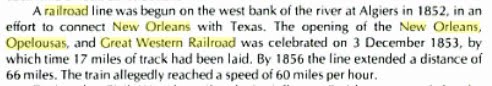
 This is a picture off of one of the company's bonds. I know exactly where this was drawn. The railroad was stuck in Morgan City because of the lack of funds, I think. Bonds were sold to help raise money. Morgan got it done.
  "In 1869, steamship operator Charles Morgan bought the NOO&GW and began operating it as owner. In 1878 he organized his railroad property as Morgan's Louisiana and Texas Railroad and Steamship Company, and it eventually became part of the Southern Pacific Company's main line". I know a lot of historical text is hard to stomach in large lumps without some pictures. I haven't done the photo shots between Algiers and Raceland yet, so the track maps will have to do until then. They will at least give you an idea about where I'm speaking . My ride came from the west. The rails were built from the east. I've chosen to go with them and fill in this page later. I want Al to come with me as I'll be entering a congested urban area and will need someone to watch my back. Here are the maps. They are cutups taken from the SP maps that go with the trip we'll be taking. They were made prior to the Huey P. Long bridge being built. The rails crossing the river measure over four miles, at the time a world's record. The red arrow points to the eventual location of the rail ferry. You can see the location of Algiers on the right and the large "yard" associated with the railroad. The green line are the rails going west. Shortly, we'll be taking that trip.
  The green line is US 90 this time. The orange is the NOO&SW. I probably should have used a topographic map. This area is very swampy. That later.
  Below, US 90 and the railroad remained the same colors, yea. The red arrow points to LaFourche, important for the CW battle that occurred there and the bridge across Bayou LaFourche you'll get to see if you hang tough. Remember, these rides are not solely about the rails, but the land and history they ran through and to which they contributed. This ride report is going to be a very long one. More, there were branches . The purple lines going south, I think, were eventual Southern Pacific rails. The red one going north to Thibodaux was the Texas and Pacific (yes, I followed it into Thib) and the one going north from Thib may have been the Missouri Pacific, but that's another story which I've lightly covered in the "Bayou Lafourche Reconnaissance" ride. You can verify the rail owners there. Wow, what was that whish? Did you all exit at once? BTW, "Thib", say "tib", is the local nickname for Thibodaux, or Thibodeaux, the other spelling. You know someone they call "Tib", cher? He's probably a Thibodaux or Thibodeaux. Leave out the "h" sound, it's useless in South Louisiana.
  Again the RR and US90 retain their pigmentation, yea. The red arrow points to the end of the line and Mr. Morgan's home for a while, thus Morgan City.
 Though I don't have the date on this map, I see it as a proposed route since the crops were dated as "1853" and we know that the railroad was stuck in Morgan City until at least 1869. I had guessed 1873, or later. The red arrow is Opleousas. Gold is Vermillionville/Lafayette. Green is New Iberia. Purple is Franklin. Blue is Berwick/ Morgan City was the end of the line, at least on this page, for now.
  I needed to get you to Morgan City so you can place this next story from the Civil War. Here is an early ride report on the railroad. This was submitted by some yankee to the yankee paper, the NYT. No prejudice from me, I lost my capital "Y". Of course, as today, bias was the name of the game and no Confederate slant was written. Possibly this was due to the paper's hostility toward people who believed in state's rights? One of the passengers was that twerp, Weitzel, locally know as Weasel Weitzel. I wish I had a picture to make my point. Read on. I'm glad he didn't get to have a blog. NEW-ORLEANS, Friday, Aug. 14, 1863. In my last I mentioned that the New-Orleans, Opelousas and Great Western Railroad was again ready for travel, and an hour after my letter was mailed on board the Columbia, yesterday morning, I found myself, by invitation, at the Algiers Depot, one of a select party to make the first excursion trip, which was of importance enough to merit a description....... The train consisted of only one passenger car, a baggage car and an engine, the latter gaily floating the American flag. The party got together by the indefatigable Captain E.A. Morse, A.Q.M. and Superintendent of of the road -- to whom, indeed, we were indebted for the whole day's pleasure -- consisted of Brig.-Gen. GOLFREY WEITZEL, F.F.F.F, (which is understood among the initiated here as meaning "first in fight, fun or frolic.") Capt. E.A. Morse, Capt. J.W. McClure, Quartermaster; Maj. H.O. Brigham, Chief Paymaster of the Department; Maj. Nicholas Vedder, Paymaster; Maj. H.K. Lawrence, Paymaster; Capt. Chas. S. Bulkley, Superintendent of Military Telegraph; Capt. R.P. Dunham, Aid-de-Camp of Gen. Banks' Staff; Capt. A.K. Bowles, of Gen. Shepley's Staff; Lieut. E.E. Graves, of Gen. Weitzel's Staff; Lieut. H.B. Fitch, of Gen. Weitzel's Staff; Ensign Sidney S. Beck, of the gunboat Sciota; C.W. Greene, Assistant Superintendent of the road. The press was represented by Mr. Ripley, of the New-York World; Mr. Fairfax, of the New-Orleans Era, and your humble servant. By 10 o'clock the whole of the invited guests had arrived at the Algiers Depot, and a few minutes afterward the engine was whirling along one of the gladdest parties I ever saw assembled. The occasion was one of jubilee; the right men had been got together to celebrate it, -- the weather was lovely though intensely hot, and I don't know but that the latter qualification made ten times more enjoyable the piles of iced luxuries with which Capt. MORSE -- that prince of caterers -- had so bountifully supplied us. No wonder if time flew among us rapidly as the champagne corks that kept up their incessant volleys, or the screaming and bounding engine that seemed to have entered thoroughly into the sport. Such a scene of genial and untrammeled enjoyment I have seldom entered into since my schoolboy days, and it was all the more relis[???]able because partaken with men who have ever been -- and are yet -- ready, at a moment's notice, to forget all levity and serve their country at the cannon's mouth. With the brave WEITZEL as temporary "Lord of misrule," what man present could have dared or even wished to play the stoic? STATE OF THE ROAD. But our merriment did not prevent us from attending to the main object of the trip, and examination of the works on the road, and these were really of a nature to excite not only the admiration but astonishment of all present. As we successively crossed the bridges over the Bayous Alemand, Lafourche, Boeuf and Ramons -- stopping at each to examine them -- it seemed scarcely credible that so enormous an amount of labor could have been performed in so short a time. Having, in my last letter, given you the statistics of these bridges, it is unnecessary to repeat them here, but will merely state that in thirteen days, Capt. MORSE, with the aid of his assistant, Mr. C.W. GREENE, of whom he speaks most highly, has succeeded in building a total of 1,675 feet of very heavy bridging, and some thirty culverts; the lumber for all these bridges having to be hauled to the mills, sawed and prepared. One or two of these bridges are built upon, to me, an entirely new and most efficient plan -- and they all, and indeed the whole road, are now in a far more substantial condition than before the rebels paid us this last visit. We are therefore all the better for the little house-cleaning they forced upon us. BRASHEAR CITY. We arrived here a little before 1 o'clock, having made the quickest running time ever attempted on the road. At Brashear City {Morgan City} but for the fact of having heard and read so, and but for the two or three cannon shots pointed out to me at the depot building, the telegraph station, &c., I could not have supposed that the town had gone out of and been won back to our possession since I was last there, everything seemed so precisely as I had left it. May I respond? Well, not exactly like you left it, butt breathe. Taylor's navy completely outfitted their little army with all of your supplies. Please forgive, sometimes I transition time and space. It's a gift. Another apology: Sorry, I lost the source of the info below. Give me an "F". Won't be my first. All of the New Orleans based railroads had been seized by the Federals. In 1862, shortly after the capture of New Orleans, a company of Confederate Rangers from St. Martinville captured the train at Bayou Boeuf (near Amelia). The Rangers steamed the train as far as Jefferson Station, near Avondale, tore up a portion of the tracks and returned to Berwick's Bay, burning bridges behind them. (this guy uses the term "Ranger" as if they were an organized bunch. I don't hink they were. I don't think there was much organization until Taylor rode in.) By July, the yankees resumed control of the eastern portion of the rail line, and for nearly four months the railroad operated a unique kind of joint control. The union forces operated between Algiers and Des Allemands, while the Confederates operated from Des Allemands to Berwick's Bay. The black line reflects the Rebel's portion, the red the yankee's. We use to get stuffed crabs in Des Allemonds. Germans settled here.
  In November the federals sent out a train with cannons mounted on flat cars. They captured the entire rail line. The Confederates retreated, but not before destroying buildings and a bunch of stuff. Below is an excerpt from somewhere? Oh, the SP, cool.
  We'll get to Lafayette, eventually. It's a shame that "Sabine" won't be there, though I do know some Sabines, whoa, their Al's friends. For the whole story of the battles that occurred around the railroad, CLICK HERE . This is some good stuff.
 .jpg) And, I'll show you a little leg to get you to page 2, coming soon.
And, I'll show you a little leg to get you to page 2, coming soon. .jpg) This is the rail bridge over the bayou and La.308. I have to go now. Here's the second page of my trying to fill in this old write with my pictures and commentary. I'll probably add a lot to this page later, but not now. So, while you are waiting for CSI to come on, take a look. ZOOM your browser window larger (in) to make reading this easier. It works. On this page I've chosen to leave most of the ancient history behind and jump right into the trip as howls from the readership have forced me into a corner. Actually, only one or two of the people who I consider associates cared to comment on my last effort and only they are getting this page with my good graces. So, if you are not reading this masterpiece, you know why. If you are reading it and did not comment on the last page, I consider you salvageable but not of prime quality. I found this report on line. I haven't read it yet, so I'll be taking notes and dissecting it as we go along. It is a USGS (US Geological Survey) report. What I find interesting is the railroad aspect of it. The geological stuff will bore you to tears. It was written in the 1930's which makes it appealing to me. Knowing that there is something older than myself is comforting. So, what I'm going to do is cut it down to what I find palatable. I am not picky so proceed at your own risk. I'll include the link to the full volumn so you can read the entire thing if you want. That will be when we get to Lafayette, a long, long ways away. I will augment as I can with pithy comments and a trillion pictures. After all, what's a trillion here and a trillion there, right Stinky (BO)? Below are the writer's words. What I add will be in brackets. It's easier than hitting the quote button for every paragraph. {That I found debatable. I know where the quote keys are.} Of note, the write starts in Algiers, West Bank, Greater New Orleans. There was no Huey P. Long dual purpose bridge there at the time of this writing. In 1935 there would be. Though not a part of this trip, here she is, a true wonder of t he world and it was somewhat duplicated in Baton Rouge a few years later.
This is the rail bridge over the bayou and La.308. I have to go now. Here's the second page of my trying to fill in this old write with my pictures and commentary. I'll probably add a lot to this page later, but not now. So, while you are waiting for CSI to come on, take a look. ZOOM your browser window larger (in) to make reading this easier. It works. On this page I've chosen to leave most of the ancient history behind and jump right into the trip as howls from the readership have forced me into a corner. Actually, only one or two of the people who I consider associates cared to comment on my last effort and only they are getting this page with my good graces. So, if you are not reading this masterpiece, you know why. If you are reading it and did not comment on the last page, I consider you salvageable but not of prime quality. I found this report on line. I haven't read it yet, so I'll be taking notes and dissecting it as we go along. It is a USGS (US Geological Survey) report. What I find interesting is the railroad aspect of it. The geological stuff will bore you to tears. It was written in the 1930's which makes it appealing to me. Knowing that there is something older than myself is comforting. So, what I'm going to do is cut it down to what I find palatable. I am not picky so proceed at your own risk. I'll include the link to the full volumn so you can read the entire thing if you want. That will be when we get to Lafayette, a long, long ways away. I will augment as I can with pithy comments and a trillion pictures. After all, what's a trillion here and a trillion there, right Stinky (BO)? Below are the writer's words. What I add will be in brackets. It's easier than hitting the quote button for every paragraph. {That I found debatable. I know where the quote keys are.} Of note, the write starts in Algiers, West Bank, Greater New Orleans. There was no Huey P. Long dual purpose bridge there at the time of this writing. In 1935 there would be. Though not a part of this trip, here she is, a true wonder of t he world and it was somewhat duplicated in Baton Rouge a few years later. _(320_x_240).jpg) Below the author speaks of Jefferson. It is the location of Oxchner Hospital and where the "SP745" is kept. Now that's another story. Click below to read easier.
Below the author speaks of Jefferson. It is the location of Oxchner Hospital and where the "SP745" is kept. Now that's another story. Click below to read easier. 
 Here he goes. Imagine a 1930's railroad documentary film. HISTORY OF THE RAILROAD {The Southern Pacific's this time. Remember his viewpoint is the mid '30's.} The railroad from New Orleans to Los Angeles is part of an extensive system with many individual members, of which the Southern Pacific Co. owns all or very nearly all of the capital stock. The line from Algiers, La. to Lafayette, La., now known as Morgan's Louisiana & Texas Railroad & Steamship Co. was incorporated in 1852 as the New Orleans, Opelousas & Great Western Railroad Co. It reached Morgan City (Brashear ) in 1857 and Lafayette in 1880. It was operated by the United States during the Civil War and owned by Charles Morgan from 1870 to 1878. {This speaks of west of Lafayette, more than I am willing to deal with at this time, thought I've ridden it all.} The Louisiana & Western Railroad Co. was built from Lafayette to the Sabine River in 1881, and the Texas & New Orleans Railroad Co. was constructed from Orange to Sabine River (Echo) in 1878-81. The latter was operated as part of the Louisiana Western Railroad until 1900. The Sabine & Galveston Bay Railroad & Lumber Co., later the Texas & New Orleans Railroad Co., built a line from Houston to Liberty in 1856-60 and from Orange to Liberty in 1859-60. It was dismantled by the Confederates in 1865 and restored in 1870. {The write goes on to explain each stretch west. What follows are general statements and descriptions.} The Southern Pacific Railroad from New Orleans to Los Angeles, a distance of about 2,000 miles, passes through a region exhibiting a great variety of geographic and industrial conditions. The climate, especially the amount of precipitation, is the most influential factor in causing this variety. The low Coastal Plain of southern Louisiana and eastern Texas, with ample rainfall and thick rich soils, is a province distinct in configuration, human occupations, and products. There are extensive swamps, prairies, and wooded areas, but a large part of the land is under cultivation, with sugarcane, cotton, and rice as the principal crops. The streams are wide and slow, the winter climate is mild, and the summer heat is tempered by breezes from the Gulf of Mexico. Flourishing towns occur at short intervals, and some of them are growing rapidly. The entire region is underlain by a great thickness of sand and clay of alluvial origin. Figures given on mileposts in Louisiana indicate miles from Algiers, a Southern Pacific freight terminal on the south bank of the Mississippi River opposite New Orleans; they are about 1-1/2 miles less than the distance from the Union Station, New Orleans. {I'm cutting the flowery description here.} {The trip begins. Note the mention of the ferry and the proposed Huey P.} {This ferry was regarded as a "temporary expedient".} Leaving the Union Station, New Orleans, the Southern Pacific train uses the tracks of the Illinois Central Railroad as far as Harahan Junction, a switch station on the north side of the Mississippi River. Thence the line crosses the river flat in a southerly direction and in 2 miles reaches the levee, over which it passes on an incline. Here on the bank of the Mississippi the entire train, divided in sections, is placed on a huge steel barge (The Mastodon) to be ferried across the swift current to Avondale, on the southwest bank, a distance of nearly a mile. The floats are adjustable for different stages of the river, for there is considerable variation in the water level consequent on floods and droughts. {You can click these photo/paragraphs to see them better.}
 This is the Mastodon.
 .jpg) This was the SP track and yard layout on Algiers Point. I believe the article said it was built in the late 1800's and torn town in the 1950's. I see large buildings where the green arrows point. And, I see some I missed.
This was the SP track and yard layout on Algiers Point. I believe the article said it was built in the late 1800's and torn town in the 1950's. I see large buildings where the green arrows point. And, I see some I missed.  And the guys at the roundhouse.

 CLICK HERE for the Algiers site. Things were not always good.


 Avondale. Elevation 8 feet. New Orleans 13 miles. {Reminder: these are distances from Algiers} At Avondale, not far south of the ferry, the train reaches the Southern Pacific tracks coming from Algiers, the terminal on the south side of the river opposite New Orleans, used only for freight. The land is low behind the levee, and most of it is too swampy for economical cultivation. In this area will be noted many cypress trees, water hyacinths, and other plants typical of the swamps and lowlands of the South. In wet places there are scattered palmettos with their clusters of fan-shaped leaves. Most of the larger trees are festooned with the parasitic Spanish moss. {Spanish Moss is not parasitic} Des Allemands. Elevation 9 feet. Population 400. New Orleans 33 miles. To the small local settlement at Boutte the railroad proceeds along the natural embankment of the river and then follows a low ridge through the woodlands to Des Allemands, where Bayou des Allemands is crossed. This name is derived from a small settlement of Germans founded in colonial days, but the population now consists mostly of people of French origin living in primitive dwellings along the water's edge. For many years there was a sawmill here which cut cypress lumber from the adjoining swamp lands; now the supply of this material is practically exhausted, and the main resources are fishing, crabbing, and the trapping of muskrat and other fur-bearing animals.
  {I'm inserting a borrowed picture here as filler until I can take my own, next trip. Exploring Des Allemands and Boutee, along with Paradis, will be something new.}
  {I'm also inserting a little Civil War here to keep Rosco Smith happy.}
  In midsummer the water bodies in this region are spangled with a beautiful growth of the purple flowers of the water hyacinth. {Some may not appreciate the plant as you do, sir.} Bayou des Allemands empties into Barataria Bay, an inlet of the Gulf of Mexico, which was at one time the headquarters of the pirate Jean Lafette. {Jean would make you walk the plank for spelling his name incorrectly. His only excuse would be to claim he was a blogger or e-mailer.} Formerly some of the district about Des Allemands was reclaimed for agriculture by ditching and pumping. Now the first signs of extensive cultivation begin near Raceland Junction, where there are fields of cane supplying the large sugar refinery at Raceland, a short distance south. This refinery, which presses about 150,000 tons of cane a season, draws part of its supply from more distant sources, some of it brought down the near-by Bayou Lafourche in barges. An interesting industrial development in the sugar industry in Louisiana is the utilization of the cane residue (bagasse) after the sugar-bearing juice has been pressed out. This material compressed into bales is shipped from many refineries to a large factory at Gretna, across the river from New Orleans, where it is pressed into sheets of building board known as celotex. In some of the cane fields at Raceland experiments are in progress to ascertain the results of using Chilean nitrates as fertilizer. Bowie siding is in the midst of cane fields, and there is a sugar refinery not far south of it.
  Between La.1 and La.308 is Bayou LaFourche. {The walls of our home in Houma were made of celotex Since he mentions Bowie and Raceland, lets look around. Bowie was my reason for coming here. It was a red cypress lumber mill town. It was out at the end of that road. The land tilts here away from Bayou Lafourche and toward Des Alemans.}
 .jpg)
 {Panning to the south, the sugar mill comes into view.}
 .jpg) {It is a big one.}
{It is a big one.} .jpg) {Raceland Sugar, 1892. I don't know if Dixie Crystals are still marketed.}
{Raceland Sugar, 1892. I don't know if Dixie Crystals are still marketed.} .jpg) {This the "big house" on the property.}
{This the "big house" on the property.}  {Next, I followed the spur into Raceland. If you want to visit the location of the depot, just ask where the post office is.}
 .jpg) {Places where depots were seem to leave a scar. Some not only physically.They were the center of many communities.}
{Places where depots were seem to leave a scar. Some not only physically.They were the center of many communities.} .jpg) {Beauty is in the eye of the beholder.}
{Beauty is in the eye of the beholder.} .jpg) {The only contemporary building was this one. A passerby starred as I took its picture? I always yell, "Look there"!}
{The only contemporary building was this one. A passerby starred as I took its picture? I always yell, "Look there"!} .jpg) {I went back out to the sugar mill to check out what rails went where.}
{I went back out to the sugar mill to check out what rails went where.}  {These tanker cars, below, are sitting in the bend south near the depot. Notice "Bowie" and the siding mentioned. I should have worked harder at getting back there, but it looked private? The mill is probably closer to town, also, inside that bend between "Depot and "3199". I've walked around on the grounds of Valentine Mill, at the end of the spur which goes down the east bank of the bayou and had no idea of the weight of the moment. Next time back I won't miss as much.} {Here's Valentine Sugar Mill (rip). (map above)}
  {Here are the cars in the Valentine spur curve going south. The track going straight, west, would go to the Raceland depot, rip. Understanding this is terribly important to me. Do I have a dislodged since of value?}
 .jpg) {Then he goes into a rant about Jean Lafitte but doesn't mention his name at first. Raceland Junction is where my last trip ended. This write will feature more of my pictures from this point on. I include this spiel because there is a section of the Jean Lafitte Cultural Center at Thibodaux. I was too worn out and short on time to go in. That happens way too often. Ok, here he goes.} This notorious person, {LaFitte} about whom center hundreds of colorful legends of this region, ran a blacksmith shop in New Orleans in the early days of the nineteenth century (at 810 Chartres Street, just off Canal Street). At this time privateersmen in the Caribbean Sea were preying upon the vessels of countries that were hostile to the countries that hired them, and Lafitte became the agent through whom they disposed of the captured cargoes. In time he became the leader of a fleet of licensed privateersmen and established a fortified post on Barataria Bay. He trafficked extensively in slaves, at one time selling 450 negroes at public auction. The proceeds of these sales and his piratical booty buried for safe-keeping are still the object of treasure hunts in the bayou country. For his loyalty to the American forces in the War of 1812, his earlier outlawry was overlooked. He resumed his piracy in 1817 and moved his headquarters from Barataria Bay to Galveston Bay, where his fortifications continued until he was driven out in 1821. Apparently he was finally lost at sea. {Now he's back to his present. The abrupt change in agricultural conditions at Raceland is due to the presence of a ridge of alluvium built up by sediments spread by the overflow of Bayou Lafourche. Alluvial uplands of this character are of great economic importance in many parts of the great valley of the Mississippi, for although not wide they have rich soils and are sufficiently high to afford good drainage, roadways, and places for settlement. On them are the principal farm lands in this part of Louisiana. The mound of Bayou Lafourche extends from the Mississippi River at Donaldsonville nearly to the Gulf of Mexico, a length of more than 100 miles. Its height for most of the distance is only about 15 feet, and its width is from 3 to 4 miles. Bayou Lafourche is the narrow stream crossed by the railroad just beyond Lafourche station. {A tidbit of historical info gleamed from above. Lafourche Station was on the east bank of the bayou. Want to see the bridge? I have pictures, senior. I had come down La.1 from Thibodaux on the west bank. I saw the over pass. I stopped at a gorgeous old house that was a bit away from the tracks as it offered the only safe parking. I could not get a good shot from the shore as it was too thick with brush, so I did what I do and climbed the fill. }
{Then he goes into a rant about Jean Lafitte but doesn't mention his name at first. Raceland Junction is where my last trip ended. This write will feature more of my pictures from this point on. I include this spiel because there is a section of the Jean Lafitte Cultural Center at Thibodaux. I was too worn out and short on time to go in. That happens way too often. Ok, here he goes.} This notorious person, {LaFitte} about whom center hundreds of colorful legends of this region, ran a blacksmith shop in New Orleans in the early days of the nineteenth century (at 810 Chartres Street, just off Canal Street). At this time privateersmen in the Caribbean Sea were preying upon the vessels of countries that were hostile to the countries that hired them, and Lafitte became the agent through whom they disposed of the captured cargoes. In time he became the leader of a fleet of licensed privateersmen and established a fortified post on Barataria Bay. He trafficked extensively in slaves, at one time selling 450 negroes at public auction. The proceeds of these sales and his piratical booty buried for safe-keeping are still the object of treasure hunts in the bayou country. For his loyalty to the American forces in the War of 1812, his earlier outlawry was overlooked. He resumed his piracy in 1817 and moved his headquarters from Barataria Bay to Galveston Bay, where his fortifications continued until he was driven out in 1821. Apparently he was finally lost at sea. {Now he's back to his present. The abrupt change in agricultural conditions at Raceland is due to the presence of a ridge of alluvium built up by sediments spread by the overflow of Bayou Lafourche. Alluvial uplands of this character are of great economic importance in many parts of the great valley of the Mississippi, for although not wide they have rich soils and are sufficiently high to afford good drainage, roadways, and places for settlement. On them are the principal farm lands in this part of Louisiana. The mound of Bayou Lafourche extends from the Mississippi River at Donaldsonville nearly to the Gulf of Mexico, a length of more than 100 miles. Its height for most of the distance is only about 15 feet, and its width is from 3 to 4 miles. Bayou Lafourche is the narrow stream crossed by the railroad just beyond Lafourche station. {A tidbit of historical info gleamed from above. Lafourche Station was on the east bank of the bayou. Want to see the bridge? I have pictures, senior. I had come down La.1 from Thibodaux on the west bank. I saw the over pass. I stopped at a gorgeous old house that was a bit away from the tracks as it offered the only safe parking. I could not get a good shot from the shore as it was too thick with brush, so I did what I do and climbed the fill. } .jpg) The premium members got the whole ride and what I found going over to the east bank. You just get the La.308 perspective of the bridge.
The premium members got the whole ride and what I found going over to the east bank. You just get the La.308 perspective of the bridge. .jpg)
.jpg) This was not the bridge in the Civil war, but the location.
This was not the bridge in the Civil war, but the location. .jpg) Originally this bayou was an outlet for part of the flow of the Mississippi River and was extensively utilized by freight boats, but to avoid the floods that occasionally came down the bayou, the connection at Donaldsonville was dammed off in 1903, and the navigability of Bayou Lafourche was greatly reduced. However, it is still used for traffic into the Mississippi River, with which it is connected by locks, and part of its lower course will be followed by the Intracoastal Waterway now projected across the lowlands, some distance south of the Southern Pacific lines. {Here's a look at what the bridge crossed.}
Originally this bayou was an outlet for part of the flow of the Mississippi River and was extensively utilized by freight boats, but to avoid the floods that occasionally came down the bayou, the connection at Donaldsonville was dammed off in 1903, and the navigability of Bayou Lafourche was greatly reduced. However, it is still used for traffic into the Mississippi River, with which it is connected by locks, and part of its lower course will be followed by the Intracoastal Waterway now projected across the lowlands, some distance south of the Southern Pacific lines. {Here's a look at what the bridge crossed.} .jpg) {Here's the Civil War historical marker.}
{Here's the Civil War historical marker.} .jpg) History insert:
History insert: 

 {That's the other side's account, by the way. The "4 mile away depot" was probably Thibodaux.} Lafourche. Elevation 25 feet. Population 60.* New Orleans 53 miles. OK, I'll show you trainees what I found north of LaFourche Crossing.
 .jpg)
.jpg) The Davenport is in front, the Plymouth is to the rear.
The Davenport is in front, the Plymouth is to the rear. .jpg) The Dav.....
The Dav..... .jpg) The Plym.......
The Plym....... .jpg) Visitors were everywhere and it was a weekday. Nice place. La.308, south of Thibodaux. Laurel Valley Store (Laurel Plantation){Last check, I think we cleared the rail bridge over the bayou. The writer seems in a hurry. I think he wrote way too much about the flora and geology of the region and now he feels pressed. I know the feeling. Green is me on my last route through here. I took a side trip to Thibodaux.} The reference to "T&P w.Bank" is wrong. There was no T&P w.Bank until Nepoleonville and above. I may be wrong there, what you want for cheap?
Visitors were everywhere and it was a weekday. Nice place. La.308, south of Thibodaux. Laurel Valley Store (Laurel Plantation){Last check, I think we cleared the rail bridge over the bayou. The writer seems in a hurry. I think he wrote way too much about the flora and geology of the region and now he feels pressed. I know the feeling. Green is me on my last route through here. I took a side trip to Thibodaux.} The reference to "T&P w.Bank" is wrong. There was no T&P w.Bank until Nepoleonville and above. I may be wrong there, what you want for cheap?  {You may want to click on the map to read it better?} {The green line is my route.} {Below is the author's homage to Thibodaux.} Three miles northwest of Lafourche Crossing, but not visible from the railroad, is the town of Thibodaux (population 4,400), an old village of French origin, with important agricultural and commercial interests. {That's it, out of here?} {Nope, not us. Thibodaux is Louisiana's best kept secret. Or, at least La. kept it a secret from me for a long time. I'll use a tourist pamphlet word, "charming". If you are "charmed" by the anviance of the French Quarter's history and beauty, but not it's sordid Bourbon St. profile, Thibodaux's old town is your ticket. Plus, it sits on a lazy bayou and has a Jean Lafitte Cultural Center extension very close to where the Texas & Pacific RR crossed the bayou and the SP went to a mill. I am impressed with Thibodaux. The author, I surmise, was solely focused on the Southern Pacific's main route. Thibodaux was a Southern Pacific and Texas & Pacific town. I don't understand the slight by way of only 3 lines he gave to this important community. Honestly, I have not done her justice either, having only made 2 short visits there, each with the promise that I'd be back. And, I will when I get those pictures around the West Bank. The best link I can offer can be accessed by CLICKING HERE. Look at that link and then come back and take a look at my few pictures of town.}
 .jpg) {Above as seen from the Jean LaFitte Museum. The good stuff is very central.}
{Above as seen from the Jean LaFitte Museum. The good stuff is very central.}  {French Quarter, no, Thibodaux.}
  {Mayberry, maybe?}
 .jpg) {No, the hotel across from the courthouse where Huey P. probably stayed while courting his wife.}
{No, the hotel across from the courthouse where Huey P. probably stayed while courting his wife.} .jpg) {Important?}
{Important?} .jpg) {Pretty much. }
{Pretty much. }  {Historic?}
 .jpg) {I'd say so.}
{I'd say so.} .jpg) {But, still Old South stately.}
{But, still Old South stately.}  {You bet.}

 {And one of the best cemetery shots I've taken.}
 .jpg) {You should click the map below. I just had to change it out as incorrect information was about to tweak the Keepers of the Grail a bit. The S&P had a branch going north from Thibodaux Jct. It was called the Napoleonville Branch as it ended, sorta, at Napoleonville. I had thought both sides of the bayou were Texas & Pacific. No, the T&P must have come south from Donaldsonville and taken the bridge east over the bayou at Napoleonville. I have a shot of that bridge which is now a pedestrian walk. Then the T&P dove south stopping at the sugar mills, ending up at Thibodaux where it jumped the bayou again. I had a pitiful picture of the Thibodaux station at one time. I may have deleted it because it was so bad. Feeling despondent, I found a reference to it in a La.GS book, "The station (a test station) is on the north side of Bayou La Fourche in the lot just west of the house of Judge Beattie. This house is opposite the bridge from Thibodaux and near the Texas and Pacificdepot. } {So, the depot was on the east side of the bayou which was considered T&P country.} I also found another write that describes the SP Napoleonville branch. Since I've stirred this ant bed. I'll show the pictures I have . The first is the T&P bridge at Napoleonville.}
{You should click the map below. I just had to change it out as incorrect information was about to tweak the Keepers of the Grail a bit. The S&P had a branch going north from Thibodaux Jct. It was called the Napoleonville Branch as it ended, sorta, at Napoleonville. I had thought both sides of the bayou were Texas & Pacific. No, the T&P must have come south from Donaldsonville and taken the bridge east over the bayou at Napoleonville. I have a shot of that bridge which is now a pedestrian walk. Then the T&P dove south stopping at the sugar mills, ending up at Thibodaux where it jumped the bayou again. I had a pitiful picture of the Thibodaux station at one time. I may have deleted it because it was so bad. Feeling despondent, I found a reference to it in a La.GS book, "The station (a test station) is on the north side of Bayou La Fourche in the lot just west of the house of Judge Beattie. This house is opposite the bridge from Thibodaux and near the Texas and Pacificdepot. } {So, the depot was on the east side of the bayou which was considered T&P country.} I also found another write that describes the SP Napoleonville branch. Since I've stirred this ant bed. I'll show the pictures I have . The first is the T&P bridge at Napoleonville.}  Below is Napoleonville explained. Green is T&P, red is SP. Where you see "1" is the bridge above. The black arrow shows where the SP and T&P may have met way way back. Unfortunately, the ride visiting both sides of the bayou and showing the remnants of those rails and the mills they visited is sleeping in my computer. Maybe I'll wake it up some day.
  Below Napoleonville, at Madewood, or thereabouts, there was this in the water. No telling?
  . On that trip, I exited town on the east, going down La.1.
  {Brown is the T&P. Light green is the SP (above). Dark green is me.} Again "T&P w.Bank" is incorrect. It should read "SP w.Bank". When I came into town the last time. I looked for old industry that might have been served by the RR. Most was gone, I presume. Here was Louisiana Cane Mfg. Inc. It was south west of down town.
 .jpg) It was getting hot and the Lafitte Historical Museum was a nice break, though like I said, I stayed in the parking lot.
It was getting hot and the Lafitte Historical Museum was a nice break, though like I said, I stayed in the parking lot. .jpg) This is the view looking upstream from their river walk. That may be a warehouse previously serviced by the T&P over there. Dern, why didn't I check the other side? Oh, I still needed to get to Bowie, LaFourche and Raceland. On this ride I had aimed high at the West Bank but I started feeling trippy at 3:30 in Thibodaux. I knew US 90 would have to be the ticket home.
This is the view looking upstream from their river walk. That may be a warehouse previously serviced by the T&P over there. Dern, why didn't I check the other side? Oh, I still needed to get to Bowie, LaFourche and Raceland. On this ride I had aimed high at the West Bank but I started feeling trippy at 3:30 in Thibodaux. I knew US 90 would have to be the ticket home. .jpg) Schriever. Elevation 17 feet. Population 50.* New Orleans 56 miles. That's next.
Schriever. Elevation 17 feet. Population 50.* New Orleans 56 miles. That's next. .jpg) But, we'll have to go though this to get there. Suggested Reading Click Here. That's the write on the SP I found. {Leaving Thibodaux, it's a short 4 miles down to Schriever.} { Update note: I recently rode back over to Raceland and resumed following the tracks east. I knew this was going to be a long one, and maybe the last one in this area for a while, so I was going to be as thorough as possible with the time I had left after the long trip over. Coming up La.20, I stopped for a break and while out by the tracks I saw a light approaching. I laughed as I assumed the place to be private. Private places are scarce on the road these days. Anyway, here comes this light. Mercy me, it was the the Sunset Limited. I stumbled down the embankment and ran to Mz Guzzi, vaulted upon her back and spurred her hard. Evidently, the train had been given the reigns, also. I couldn't catch her without asking for a ticket. I am the guy that will get one as I'm a ticket magnet, so proven in my younger years. At Schriever, she stopped at the depot. Passengers were disembarking. Instead of stopping and zooming in the camera, I attempted to get closer to catch an engine shot back to the old depot. That would have been a classic. As the last passenger's foot hit the ground, she pulled out of the station. No shot. Ya can't always get what ya want, but............and we all know the rest of that line. Nevertheless, I would get what I needed all down the line. A few pictures of the rest of that ride will follow as it will be for the late comers. The premium members have already read that whole ride in full. You've been offered an opportunity to sign up for these emailed ride reports and I received zero applications which left me feeling unwanted, unloved and vindictive. So, you get the short version. Touchet, mon amis.} {The trainless depot shot on the ride before the last ride.}
But, we'll have to go though this to get there. Suggested Reading Click Here. That's the write on the SP I found. {Leaving Thibodaux, it's a short 4 miles down to Schriever.} { Update note: I recently rode back over to Raceland and resumed following the tracks east. I knew this was going to be a long one, and maybe the last one in this area for a while, so I was going to be as thorough as possible with the time I had left after the long trip over. Coming up La.20, I stopped for a break and while out by the tracks I saw a light approaching. I laughed as I assumed the place to be private. Private places are scarce on the road these days. Anyway, here comes this light. Mercy me, it was the the Sunset Limited. I stumbled down the embankment and ran to Mz Guzzi, vaulted upon her back and spurred her hard. Evidently, the train had been given the reigns, also. I couldn't catch her without asking for a ticket. I am the guy that will get one as I'm a ticket magnet, so proven in my younger years. At Schriever, she stopped at the depot. Passengers were disembarking. Instead of stopping and zooming in the camera, I attempted to get closer to catch an engine shot back to the old depot. That would have been a classic. As the last passenger's foot hit the ground, she pulled out of the station. No shot. Ya can't always get what ya want, but............and we all know the rest of that line. Nevertheless, I would get what I needed all down the line. A few pictures of the rest of that ride will follow as it will be for the late comers. The premium members have already read that whole ride in full. You've been offered an opportunity to sign up for these emailed ride reports and I received zero applications which left me feeling unwanted, unloved and vindictive. So, you get the short version. Touchet, mon amis.} {The trainless depot shot on the ride before the last ride.} .jpg)
.jpg) {Its location in relation to Thibodaux Junction.
{Its location in relation to Thibodaux Junction.  {Schriever was the axle for all the short branches that emanated from it. Houma was one.}
  {Lockport was another.}
  {Napoleonville was another. I'll have to find that one in my stash.} {And, some old business from the last page, Thibodaux was not named for Boudreaux's friend.}
  {He was the Captain of the LaFourche Volunteers who fought alongside General Jackson and Jean Lafitte at the Battle of New Orleans. The dude was a dude.} {And, I found this picture of an old bridge spanning the bayou at Thibodaux.}
  {I don't think it would have supported rail traffic. But, the T&P had to jump the bayou some way, and my trusty Garvin Topo said it did.} {Ah, and a teaser to go back and reread a prior page of this ride.}
  {I'll tell you when that the last ride's pictures have been dissected from the group and placed in the appropriate places along the line coming out of the West Bank. They are not there yet!!} {Now, back to our 1930's tour director:} An alluvial ridge extends southward along Bayou Terrebonne through Schriever, and another, extending along Black Bayou, is followed by a branch railroad to Houma. {The author is not clear here. There was no SP railroad down Bayou Black which is west of Schriever at Gibson. The Houma branch dove due south from Schriever . It went along Quishi Bayou and Little Black Bayou into town. Back to his spiel.} At this old town {Houma} there is a large sugar refinery and an extensive business in oysters and other gulf products. Much sugarcane is raised in this part of Louisiana, and formerly there were many small sugar refineries, some of which are still visible. {the smoke stacks were left} Potatoes have lately become an important product, and considerable corn is raised. Between the alluvial ridges the land is low and swampy, but in places it can be drained by pumping; one notable reclaimed area of this kind southwest of Raceland is yielding large crops of corn. In the swamps cypress, tupelo gum, and other trees flourish. Lumbering has long been an active industry, but many years of vigorous lumbering has greatly reduced the amount of timber available. {The rape of the red cypress forest is evident. Unlike the reforestation of pine country, when it was gone, it was gone, thanks to mills like Bowie. Replacing 400 year cypress is like replacing the Sequoias.} There was formerly a sawmill at Chacaholua, and at Donner a large mill is in operation on logs brought by rail and in "booms" rafted through the great system of waterways traversing the lowlands to the north. Donner. Elevation 11 feet. Population 900.* New Orleans 65 miles. Donner is in the large lowland area that was covered by the great flood of the Mississippi River in 1927, when in the lower places the water was from 6 to 10 feet deep for several months. The flooded district extended far to the north and northwest over the lake region and the country traversed by the Grand and Atchafalaya Rivers. The bayou ridges described above (p. 14) were not covered, but the water extended far up their slopes. During the flood thousands of residents on the lower lands were driven out by the water, and there was considerable loss of crops and effects. The railroad embankment near Donner was slightly submerged, and parts of it had to be protected from the flood waters. In this region the roads are surfaced with oyster shells, which make an admirable road metal for light traffic. Shells are also burned as a source of lime. {This, I believe, is a great old "tourist court" at Donner. Donner and Chacaholua blend together. I'm assuming there was a depot here and that the court serviced those passengers. It may have been a resort for those interested in hunting and fishing. The larger building is a full service gas station of old. It is now a tire repair shop, opened only on certain days. This area was remote.
 .jpg) These places are on the rail side of the highway. Whether they predate the Great Flood, I can't say.
These places are on the rail side of the highway. Whether they predate the Great Flood, I can't say. .jpg) It's 3:45 am, must be time for another entry. This is the 5th page and I'm so far ahead of myself and behind on what I wanted to include it is troubling. Of all the new over used words in our vocabulary, "troubling" is the most troubling. The fact that I recognize a new vocabulary is likewise troubling. What isn't troubling is the fact that we, as a society, have eased up on "awesome". "Awesome" is usually used in expressions of happiness and glee. That may explain its demise as a commonly exercised exclamatory. Nevertheless, I'm tempted to use "awesomely troubling" to describe this morning's situation. I'm going to dedicate this page to catching us all up. I could have gone back and inserted the awesome pictures I have into their appropriate pages, but the thought of that drudgery is indeed troubling. The only way to get started is to get started. You can only sweep the garage floor so many times. You can only check your email so many times, but this time was worth it. An old friend just quoted the Kinks in an off the wall (y) comment which was pretty awesome and troubling. All right, no more A&T, back to work. I need to get the forgotten maps posted. I'm a mappy and I know that there are a few others out there. These are old. They go well with the motif here. Green line is the railroad, orange line is US 90.
It's 3:45 am, must be time for another entry. This is the 5th page and I'm so far ahead of myself and behind on what I wanted to include it is troubling. Of all the new over used words in our vocabulary, "troubling" is the most troubling. The fact that I recognize a new vocabulary is likewise troubling. What isn't troubling is the fact that we, as a society, have eased up on "awesome". "Awesome" is usually used in expressions of happiness and glee. That may explain its demise as a commonly exercised exclamatory. Nevertheless, I'm tempted to use "awesomely troubling" to describe this morning's situation. I'm going to dedicate this page to catching us all up. I could have gone back and inserted the awesome pictures I have into their appropriate pages, but the thought of that drudgery is indeed troubling. The only way to get started is to get started. You can only sweep the garage floor so many times. You can only check your email so many times, but this time was worth it. An old friend just quoted the Kinks in an off the wall (y) comment which was pretty awesome and troubling. All right, no more A&T, back to work. I need to get the forgotten maps posted. I'm a mappy and I know that there are a few others out there. These are old. They go well with the motif here. Green line is the railroad, orange line is US 90.  Somethings drive me crazy. I do all the leg work finding stuff and then don't write down an itinerary or even enter way- points into the GPS. I go back to the maps and realize I forgot to check out my all imported points of interest, like the location of the old train ferry. That's a 300 mile mistake. I was there and blew it. The river bent to meet the road and me. How easy would that have been? I will rationalize that the spot was probably deep behind some high fence, accessible only at night with the right Mission Impossible gear, which I have used and am not afraid to use again. Despite my short falls, fate has not given up on me and she does supply. I found a road to the beginning of the rail ramp to the Huey P.Long dual purpose bridge over the Mississippi River. There was no NO TRESPASSING sign and I was completely unmolested. That would have been enough. The kicker is that there was a train in perfect position for a shot, stopped on the bridge. I was shaking knowing something would foul up, the camera would die, the train would move before I could set up, like at Schriever, something. But, no. It stayed right in that place and posed.
  What purpose this little building serves I can only guess. Actually, I may have figured it out as a control for a yard which is or was past the entrance to the bridge. Or, possibly it serves no purpose now. No one came out and yelled at me which is almost an expected occurrence. I think I felt a void at its absence? You can see the "keep out" sign's edge. At this point I realized I was OK and not in jeopardy not having passed some objectionable point. If it was the bridge keeper's house, he surely must stand in high regard amongst fellow bridge keepers.
  The long gone ferry was at Avondale, the location of this.
  I know you are all rushing to your dictionaries. Stop. The core word is mode. All it means is that different ways of transportation are used in the same journey, ie, trucks and rails in this instance, possibly even water with the river so close by, wouldn't you think. OK, Premium Members, here come some repeats, but you know that eventually I hand over the goodies to the general public though they have done, and likely will not do anything to deserve it. Since Paradis is on this map I'll show you a little of what the PMs got to see. Paradis is much more than it's US 90 face. That face still has a few classic buildings which have served this important highway for a long time so I'm not diminishing that area. But, back streets and back roads are my gig. I haven't an idea of what this building was. I do have an idea of what the bike "was".
  This is an old Episcopalian. My bet is it is very old, possibly pre-Civil War. The lines are right. You must remember, this is the Old Spanish Trail, or close to it. In Des Allemands the actual location is noted. I can only say that there is so little dry land at that point, the exact position of the old road can't be far off.
  Moving west along the railroad road, you come to this gorgeous spot.
  Across the rails was this one.
  I'll have to close now as I am getting a bit sleepy. At this point my writing and organization becomes a little disjointed. And you say, "You must be sleepy all the time". Point taken. Whoa hoss. I forgot to download my GPS tracks, you'll find them awesome, if not troubling. Here's a look. You can click it and it does get bigger. "Yard 1" refers to the west entrance to the Intermodal Facility. "HPL" is the Huey P. Long Bridge. "Train on HPL" is where I shot the train on the HPL. Notice, it's a long way from the water. The rail bridge is 4.5 miles long with a 1.5% grade. The top is flat unlike most bridges that arc. Now you know and most don't.
  Below: Heading west. I had taken the river road back as US 90 was making me crazy. Finally I figured I had escaped the worst of it and rejoined the 4 lane. My ride in would be next to the rails. The ride back would be on the big road, down and dirty and not near as fun.
  {This is something new. I suddenly have more than 3 people looking at these entries. I don't know if I can handle the fame. I may have to get a manager, Al, you busy? To the new 2 I say, "welcome" and too bad you caught us in the middle of a documentary instead of an actual motorcycle ride to exotic places. Instead, I've let this guy, who I've never met, and most likely won't since he rode this route in 1935, lead us from the Wes' Bank (a real place across the Mississippi River from New Orleans), to Lafayette, where we get off as he continues westward. The last five pages can be accessed from the Start Page of this write and all pages are linked together in ascending order. If you haven't read them first, none of this will make any sense and you'll move on to the weather channel almost immediately.} {Solid ground gets narrow after Schriever. There's only one way in and one way out, the old route of US 90. Des Allemands is an outpost town built along the alluvial overflow of Bayou Des Allemands. It is a true marsh / bayou town fit for any movie or book background. I really like the place. Maybe it's time to let our guide take over. As I have said before, imagine a 1930's documentary or maybe one of those movies your teacher showed in school when she had no lesson plan. When I was teaching, I became proficient in the operation of projectors and slide machines. Actually, I had to have one of the kids set them up. And, the { }'s denote my words since this is his article. I find quotation marks mundane and I figured you could deal with a little spicing up in this one.} {Hang on, his spiel gets energized}. {Whoa, hoss, I have to add this little bit of CW history. Remember on Page 1 that I mentioned this. Sure you do. This is a reminder to the recollectionally challenged.} "September 1862 The town of Des Allemandes is the scene of numerous skirmishes resulting in capture of an entire detachment of Union soldiers on September 4. A Union train with sixty men ambushed at the Boutte station by a Confederate force of Louisiana militia and volunteers on September 4. The train escapes to New Orleans. Fourteen Union soldiers are killed and twenty-two wounded in the skirmish. " {Ah, I went looking all over Paradis for that historical marker. It was at Boutte. I guess I'm "challenged". But, I did remember there was one, so there.} {OK Rosco, the floor is yours. Orange is US 90 (old) and green is the RR.}
  Des Allemands. Elevation 9 feet. Population 400.* New Orleans 33 miles. To the small local settlement at Boutte the railroad proceeds along the natural embankment of the river and then follows a low ridge through the woodlands to Des Allemands, where Bayou des Allemands is crossed. This name is derived from a small settlement of Germans founded in colonial days, but the population now consists mostly of people of French origin living in primitive dwellings along the water's edge. For many years there was a sawmill here which cut cypress lumber from the adjoining swamp lands; now the supply of this material is practically exhausted, and the main resources are fishing, crabbing, and the trapping of muskrat and other fur-bearing animals. {Primitive dwellings?, I hope that fella kept going before one of the dwellers caught him at the bar.} In midsummer the water bodies in this region are spangled with a beautiful growth of the purple flowers of the water hyacinth. Bayou des Allemands empties into Barataria Bay, an inlet of the Gulf of Mexico, which was at one time the headquarters of the pirate Jean Lafette.{sp} Formerly some of the district about Des Allemands was reclaimed for agriculture by ditching and pumping. Now the first signs of extensive cultivation begin near Raceland Junction, {Once again, he can't spell the name of a historic fig your.} {Click to enlarge. See, it's almost an ismus. Don't hear that word much these daze. Spell check freaked out. Our children know nothing but computer games.}
  {The last ride report to New Orleans was done in email format. It was sent to the 3 followers of this website. If you are one of the 3, then you have seen some of the following, but not all. Brace yourself (s).}
  {This is what the engineer sees if he has to get down off the engine and immolates my position.}
  {If he walked over to the old US90 bridge, this would be his view.}
  {If he fell down the fill, like I did, he'd see this.}
  {If he looked at the below sea level underpass, this is what he'd see.}
  {If he looked at the street sign............}
  {If he walked out to the old highway...........}
  {He'd know he had left Ascension Parish and entered La.Fourche and wondered what that "History Hunts" was and who the heck is that "Steve" who deserved such a nice welcoming sign.}
  {Then he'd look at the ugly new US 90 bridge and probably think that it was ugly, too.}
  {I'm going to cut Rosco short on this one. I have to make up my mind how to approach the next set of towns. As I have alluded, this route has been followed twice in the very near past and written up in one form or another. I have to get organized. The rest may be limited to a set of links for the two new guys. Oh, speaking of. I know this one included too many bridge pictures. That's because I, and HH, are partially funded by the OFRRBPS. Unfamiliar? It's the Old Flippin' Railroad Bridge Picture Society. They send me 5 dollars a year and some brownies. The brownies are the best part. They are really really far out good. In fact I'm eating some right now, Groovy, ladies.} {Paulette just checked in and said she'd been enjoying this little documentary. She also told me about their ride over to Alabama and the beach. They stopped at Fort Pike on which she gave a healthy report. I was glad to hear that since, I guess, my last visit there was in 2006, the year after Katrina. One side was bulging out. It was closed and the future looked bleak. Someone, or group, should get credit for fixing it. Bush? Anyway that's an update, visit there, it is awing. We are very lucky to have such a fine historical site within our borders. Pity poor Fort McComb and the Old Spanish Fort in Lake Vista. They are not as celebrated.} {And, thanks to Michael Dwayne for the great Super Bowl winners, The New Orleans mf'n Saints, team picture he sent to me and duh daughta, very nice!!} {Back to the book now that the local news is over.} Gibson. Elevation 11 feet. Population 60.* New Orleans 67 miles. {Back to me. Gibson sits at the intersection of La.182 and La.20, the road to Thibodaux. What the state now calls 182 is old US 90. Renaming the road that was wrong. There's too much long term history associated with it to make following the "trail", the OLD SPANISH TRAIL (OST), difficult for future generations. Instead of naming it stupidly, 182, why wasn't it called the OST, reverting to its earlier name while creating a tourist attraction? Because bureaucrats are dumb and don't give a .....} {I yelled about that back in 2005. I guess I can't let it go.} {Anyway, here we are at the intersection. I'll let our narrator run a few lines and then I'll come back because, though he says that there is no significant structure here, there is stuff. Extreme beauty is just a bit off the road, that is if you like lazy bayous with shrimp boats tied to the banks under sheets of Spanish moss and significant structures if you use my gage? Ok, Bernie...} Gibson is a small village on Black Bayou, a waterway of some importance. A quaint old church is about the only feature of special interest. Gibson was formerly an extensive lumber-milling community, drawing on the rich supplies, now mostly depleted, of cypress and other trees in the great swamp country to the north. This swamp vegetation is still a picturesque feature along the railroad in places, especially the drapery of Spanish moss on many of the trees. {2 points for you, Bernie, you do get it.} Spanish moss is extensively utilized for making mattresses and other cushions at moss "gins" at many places. The moss is cured by moistening and airing to decompose the living portion, then dried, carefully worked to remove dirt, sticks, and other undesirable materials, and thoroughly washed. {I feel obligated to stop here and and dredge my lake of photos for local shots. I could hang out at the gas station at Gibson and watch traffic, catch a few passing trains and absorb the aun viance of the place. That's a Fr. word? Maybe 2, spell check can't figure out.}
 .jpg) DL, still new.
DL, still new. .jpg) The bridge turns to allow boat traffic through. At one time a full time employee was required. What preceded the 1946 bridge? Now there's a good question.
The bridge turns to allow boat traffic through. At one time a full time employee was required. What preceded the 1946 bridge? Now there's a good question. .jpg)

.jpg) {Swamp, nic nic bugs., there you go George E. BTW, do you identify with Jack Nicholson while watching ER? Not that ER, Easy Rider. Is that show still on? Hopefully not. What is it with watching hospital TV? A lot of people like that stuff. I can't figure it out. Oh no, I watched Ben Casey, M.D.}
{Swamp, nic nic bugs., there you go George E. BTW, do you identify with Jack Nicholson while watching ER? Not that ER, Easy Rider. Is that show still on? Hopefully not. What is it with watching hospital TV? A lot of people like that stuff. I can't figure it out. Oh no, I watched Ben Casey, M.D.} .jpg) {What did you expect, "Johnny Lafitte's BB Marina"? He would have called it "Breaux's BB Marina", but Breaux is a common name, so he chose "Bob". Not many Bob's, no.}
{What did you expect, "Johnny Lafitte's BB Marina"? He would have called it "Breaux's BB Marina", but Breaux is a common name, so he chose "Bob". Not many Bob's, no.} .jpg) {February in Louisiana. We have a great ice fishing season.}
{February in Louisiana. We have a great ice fishing season.} .jpg) {Mason du Masons}.
{Mason du Masons}. .jpg) {Just what you'd expect to find nestled against a dark La. bayou, a beer parlor. Someone really has a sense of humor.}
{Just what you'd expect to find nestled against a dark La. bayou, a beer parlor. Someone really has a sense of humor.} .jpg) {Back in '05 there was this rare open spot on the bayou as you approached Houma. The country is getting filled up and we are letting more and more, some that plant bombs in our largest city, into this country. Get rid of the politicians that are allowing that. They are doing it to add to their supporters at election time and to add to the dependent class where big government is the the provider and boss. Big government supplies only what it steals from us. In return they get more control over our lives and a terminal loss of our liberty.} {There is no reasoning with this arrogant tyrant and he's getting stronger with each bill passed by the likes of Charles Melancon, Pelosi's gigolo, and our own Hillary look alike, the likewise arrogant, Katrina Mary Landrieu. Over 60% of Americans thougth that "health" thing was BS and he has ignored us. That is arrogance. Same goes for our "machine" politicians that practice Chicago politics just like their northern counterparts.} {"B.O.", aka, Stinky , kiss my butt. Can I still say that?} {You better believe it."}
{Back in '05 there was this rare open spot on the bayou as you approached Houma. The country is getting filled up and we are letting more and more, some that plant bombs in our largest city, into this country. Get rid of the politicians that are allowing that. They are doing it to add to their supporters at election time and to add to the dependent class where big government is the the provider and boss. Big government supplies only what it steals from us. In return they get more control over our lives and a terminal loss of our liberty.} {There is no reasoning with this arrogant tyrant and he's getting stronger with each bill passed by the likes of Charles Melancon, Pelosi's gigolo, and our own Hillary look alike, the likewise arrogant, Katrina Mary Landrieu. Over 60% of Americans thougth that "health" thing was BS and he has ignored us. That is arrogance. Same goes for our "machine" politicians that practice Chicago politics just like their northern counterparts.} {"B.O.", aka, Stinky , kiss my butt. Can I still say that?} {You better believe it."} .jpg) {You might click this map to make it larger. That's the railroad. You can see 20 and it taking off to Thibodaux and US 90 headed south. There is no new US90 on this map which really makes it nice. The blue lines signify swamp}
{You might click this map to make it larger. That's the railroad. You can see 20 and it taking off to Thibodaux and US 90 headed south. There is no new US90 on this map which really makes it nice. The blue lines signify swamp}  {This is now. There is no swamp, no bayou, only sterile "US 90". The railroad remains. Check out the road labeled as "Old Spanish". Continue its curve to the next road and I'll bet that's the old route. Ah, I cut it off, too bad.}
  I'm cooling it for the night. That rant wore me out. The pictures are going to get thick from here on since we are now within my afternoon ride radius. Checking this outing's shots I see I didn't stop to take any in this area due to the fact that I already have them. Finding and orgainizing them are my next tricks, so hang in there. Getting through the Boeuf, Morgan City and Patterson area is going to be fun. {Leaving Gibson on old US 90, headed to Boeuf.}
  {I hated to leave Gibson.} {Moving west, click the map to get a better look. It is much larger}
  {This...}
 .jpg)

.jpg) {...was once traversed on this...}
{...was once traversed on this...}  {....an old piece of US 90....which ran through this and still does..... Kerr-McGee pioneered off shore oil exploration here.}
 .jpg) Boeuf. Elevation 13 feet. {not the bridge, it's higher} Population 300. New Orleans 74 miles. ...now the road rides on this....
Boeuf. Elevation 13 feet. {not the bridge, it's higher} Population 300. New Orleans 74 miles. ...now the road rides on this....  {Before I'm going to let Willy resume his spiel, we're going to look around. I am in no hurry to cross that bridge. Going north from US 90 and the railroad is Lake Palourde (pau lure). This is where Bayou Boeuf leaves the lake.}
 .jpg) {This may be on the Boeuf. I really like this one.}
{This may be on the Boeuf. I really like this one.} .jpg) {Climbing up on the bridge..............}
{Climbing up on the bridge..............} 
 {and down...}
  {I went under it to catch some water level shots.}
.jpg) {Ok, Willy, take it away.} The small old settlement of Boeuf is on the bank of an outlet of Lake Palourde, one of the water bodies of the widespread swamp region to the north {The Atchafalaya Basin}. From Boeuf to Morgan City the railroad follows the north bank of Bayou Boeuf on a ridge of alluvium built up by overflows. In this general region the deposition of this material has also developed a series of islands of sufficient elevation for farming. They are not high, and in places the fields have to be protected from overflow by dikes. The soil is rich and mostly under cultivation in cane and other crops. Many scattered cypress trees remain in the swampy areas. The extensive swamp lands in the Mississippi Valley in Louisiana are mostly useless for settlement without expensive diking, but they are valuable for growing cypress and other lumber. Some areas in the midst of the swamps that are high enough for cultivation are utilized for small farms, but even these are subject to overflow at times of high water. Morgan City. Elevation 18 feet. Population 5,985. New Orleans 80-1/2 miles. Morgan City, on the right bank of a bay-like expansion of the Atchafalaya River, is a commercial and lumber center of considerable importance, as it has waterways of moderate depth into many parts of the cypress swamps as well as into the sugarcane country. The wide river here is the outlet of a series of large shallow lakes and numerous bayous occupying the area known as the Atchafalaya Basin. It receives the water of the Red River mixed with some overflow water from the Mississippi River, which joins the Red River by way of the Old River near latitude 31°, 50 miles above Baton Rouge (130 miles above New Orleans). In the great flood of 1927 a large part of Morgan City was under water for two months.
{Ok, Willy, take it away.} The small old settlement of Boeuf is on the bank of an outlet of Lake Palourde, one of the water bodies of the widespread swamp region to the north {The Atchafalaya Basin}. From Boeuf to Morgan City the railroad follows the north bank of Bayou Boeuf on a ridge of alluvium built up by overflows. In this general region the deposition of this material has also developed a series of islands of sufficient elevation for farming. They are not high, and in places the fields have to be protected from overflow by dikes. The soil is rich and mostly under cultivation in cane and other crops. Many scattered cypress trees remain in the swampy areas. The extensive swamp lands in the Mississippi Valley in Louisiana are mostly useless for settlement without expensive diking, but they are valuable for growing cypress and other lumber. Some areas in the midst of the swamps that are high enough for cultivation are utilized for small farms, but even these are subject to overflow at times of high water. Morgan City. Elevation 18 feet. Population 5,985. New Orleans 80-1/2 miles. Morgan City, on the right bank of a bay-like expansion of the Atchafalaya River, is a commercial and lumber center of considerable importance, as it has waterways of moderate depth into many parts of the cypress swamps as well as into the sugarcane country. The wide river here is the outlet of a series of large shallow lakes and numerous bayous occupying the area known as the Atchafalaya Basin. It receives the water of the Red River mixed with some overflow water from the Mississippi River, which joins the Red River by way of the Old River near latitude 31°, 50 miles above Baton Rouge (130 miles above New Orleans). In the great flood of 1927 a large part of Morgan City was under water for two months. .jpg) When the Mississippi River is low and the Red River is high the slope in the Old River is reversed and some of the Red River water flows through it into the Mississippi. No doubt the Red River flowed into the Mississippi River originally, but the gradual growth of a natural levee on the west bank of the big river forced the Red River to find an independent course to the Gulf down the channel now called the Atchafalaya River. This river and the Grand River have long been thoroughfares, and in earlier times many flatboats were used for freight transportation, going mostly by way of Plaquemine Bayou and locks to the Mississippi. {The Old River Control Structures above Simmesport hold Morgan City's life in its hands. If New Orleans is threatened and no other fix works, MC gets the ax. Not a likely scenario. But, next week the docks at MC will be flooded, a reminder of their precarious condition on the Atchafalaya.} Morgan City (originally Brashear, later renamed for Charles Morgan) is near the head of tidewater and from 1850 to 1869 was the terminus of the railroad from New Orleans. At that time there were extensive boat connections in all directions by the rivers and bayous, and by way of the Gulf of Mexico to Galveston. The United States Government took possession of these communications during the Civil War. Charles Morgan, who had controlled most of the boat lines, purchased the railroad in 1869; it was extended west to Lafayette in 1880. Formerly the city's lumber business was extensive, but now the principal occupations are agriculture, shipping crabs, and preparing shells for chicken feed and other uses. The shells are brought from the large reef of Pointe au Fer in Atchafalaya Bay, 30 miles southwest of Morgan City. One of the water routes of commerce in the region now is by the Grand River and a 7-foot canal through Plaquemine Lock, which enters the Mississippi River 20 miles below Baton Rouge. {Morgan City's wealth is directly related to oil. When oil prices go down, the sidewalks roll up.} Charles Morgan is regarded as one of the most important influences in the development of southern Louisiana. He was born in Connecticut in 1795 and died in New York City in 1878. He inaugurated various early coastwise steamship lines, mainly to places on the Gulf of Mexico, developed the railroad from New Orleans to Cuero, Tex., and dredged a steamboat channel through Atchafalaya Bay. In 1836 he founded a great iron works in New York, and in the same year he sent the first vessel from New Orleans to Texas, stopping at Galveston when that place consisted of one house. The projected Intracoastal Waterway is to follow Bayou Boeuf into the Atchafalaya River at Morgan City and thence go westward through Wax Bayou. This waterway is being built by the Government to provide an inside channel along the coast from New Orleans to Corpus Christi (at a cost of $16,000,000) and, eventually, to the Rio Grande at Point Isabel. The bill passed by Congress in 1927 provides for a canal 100 feet wide to carry 9 feet of water. Many natural water bodies are to be utilized, some of them, however, requiring deepening and straightening. For much of its course it is from 10 to 20 miles south of the Southern Pacific lines. {Thank you, Willy, that was very nice. Here are some shots to add. Morgan City once languished under a terrible reputation as a rough place, but Mr. Charles Morgan saw it fit for his home and base of operations. I'm backing off that. "Base of operations" is correct. I don't know if he ever lived there. I've searched for evidence of Morgan's home. He died in New York, so maybe he was a carpetbagger. Charles Morgan, Morgan City's namesake. I'm sure there are better links to his bio. I'm cheap.
When the Mississippi River is low and the Red River is high the slope in the Old River is reversed and some of the Red River water flows through it into the Mississippi. No doubt the Red River flowed into the Mississippi River originally, but the gradual growth of a natural levee on the west bank of the big river forced the Red River to find an independent course to the Gulf down the channel now called the Atchafalaya River. This river and the Grand River have long been thoroughfares, and in earlier times many flatboats were used for freight transportation, going mostly by way of Plaquemine Bayou and locks to the Mississippi. {The Old River Control Structures above Simmesport hold Morgan City's life in its hands. If New Orleans is threatened and no other fix works, MC gets the ax. Not a likely scenario. But, next week the docks at MC will be flooded, a reminder of their precarious condition on the Atchafalaya.} Morgan City (originally Brashear, later renamed for Charles Morgan) is near the head of tidewater and from 1850 to 1869 was the terminus of the railroad from New Orleans. At that time there were extensive boat connections in all directions by the rivers and bayous, and by way of the Gulf of Mexico to Galveston. The United States Government took possession of these communications during the Civil War. Charles Morgan, who had controlled most of the boat lines, purchased the railroad in 1869; it was extended west to Lafayette in 1880. Formerly the city's lumber business was extensive, but now the principal occupations are agriculture, shipping crabs, and preparing shells for chicken feed and other uses. The shells are brought from the large reef of Pointe au Fer in Atchafalaya Bay, 30 miles southwest of Morgan City. One of the water routes of commerce in the region now is by the Grand River and a 7-foot canal through Plaquemine Lock, which enters the Mississippi River 20 miles below Baton Rouge. {Morgan City's wealth is directly related to oil. When oil prices go down, the sidewalks roll up.} Charles Morgan is regarded as one of the most important influences in the development of southern Louisiana. He was born in Connecticut in 1795 and died in New York City in 1878. He inaugurated various early coastwise steamship lines, mainly to places on the Gulf of Mexico, developed the railroad from New Orleans to Cuero, Tex., and dredged a steamboat channel through Atchafalaya Bay. In 1836 he founded a great iron works in New York, and in the same year he sent the first vessel from New Orleans to Texas, stopping at Galveston when that place consisted of one house. The projected Intracoastal Waterway is to follow Bayou Boeuf into the Atchafalaya River at Morgan City and thence go westward through Wax Bayou. This waterway is being built by the Government to provide an inside channel along the coast from New Orleans to Corpus Christi (at a cost of $16,000,000) and, eventually, to the Rio Grande at Point Isabel. The bill passed by Congress in 1927 provides for a canal 100 feet wide to carry 9 feet of water. Many natural water bodies are to be utilized, some of them, however, requiring deepening and straightening. For much of its course it is from 10 to 20 miles south of the Southern Pacific lines. {Thank you, Willy, that was very nice. Here are some shots to add. Morgan City once languished under a terrible reputation as a rough place, but Mr. Charles Morgan saw it fit for his home and base of operations. I'm backing off that. "Base of operations" is correct. I don't know if he ever lived there. I've searched for evidence of Morgan's home. He died in New York, so maybe he was a carpetbagger. Charles Morgan, Morgan City's namesake. I'm sure there are better links to his bio. I'm cheap. .jpg) And here's the prize of the entire article. It is listed as "Rose Garden" on the Morgan City website. That is irrelevant to me. It's the depot and water tank for the T&NO RR. or priors.
And here's the prize of the entire article. It is listed as "Rose Garden" on the Morgan City website. That is irrelevant to me. It's the depot and water tank for the T&NO RR. or priors. .jpg) Remember, Willy said that Morgan City was the end of the line. To go back, the railroad built a turnaround, the loop below. I've seen what is left of it. Above, you can see the loop leaving the station area and going south. The inclusion of the water tank in the picture causes me to get a little giddy. I had read that it was near the bridge, but this seals the deal. A turnaround was real luxury. Other ways of doing it would be a wye (Y) and a turntable.
Remember, Willy said that Morgan City was the end of the line. To go back, the railroad built a turnaround, the loop below. I've seen what is left of it. Above, you can see the loop leaving the station area and going south. The inclusion of the water tank in the picture causes me to get a little giddy. I had read that it was near the bridge, but this seals the deal. A turnaround was real luxury. Other ways of doing it would be a wye (Y) and a turntable.  That's it, enough excitement for one day. There will be many more pictures of Morgan City coming on the next page. You won't believe what a beauty spot it is if you have never gotten down on the streets around the old town. Wrong, more excitement. I had to teach my ## something wife to drive a 4 speed standard shift, no power brakes, no power steering, 1973 British sports car... gas clutch, gas clutch, stay on your side, the motor is not running, you are too close to the ditch, you are in the wrong lane, oh, the turn signal lever just fell off.....? I'll signal, which way are you going? Why do I ask? There will be no "{}" used on this page due to all the words here are mine except for a few from Mark and a few from Michael Duane. A correction also has to be made. Mike said, "By the way, my name is Michael Duane with a "u". Like Duane Allman, Duane Eddy. No "w". That's like Dwayne Hickman. Dobie Gillis". Sorry, Mike. I was thinking about Dwayne Fontenot. Some people you can't forget. Speaking of..... Mark just wrote and said he agreed with me about Morgan City being a beautiful place. He did add, "once you get away from all the oilfield junk" left from years of occupancy. I lived in an older, but far from the oldest areas in New Orleans. In the old downtown and neighborhood part of MC, I had the feeling I was back in New Orleans. There is even a seafood and snow cone place that was once owned by some Italians from NO. This young couple has it now and are preserving it. It's on Railroad Street east of the docks. I gotta show you this place. Go there. The store is New Orleans, 1958. I'll testify to that. I almost asked if they had any sliced ham scraps, free, or giant red hots, 5c, both regular treats where I stopped in as a 10 year old.


.jpg)

.jpg)
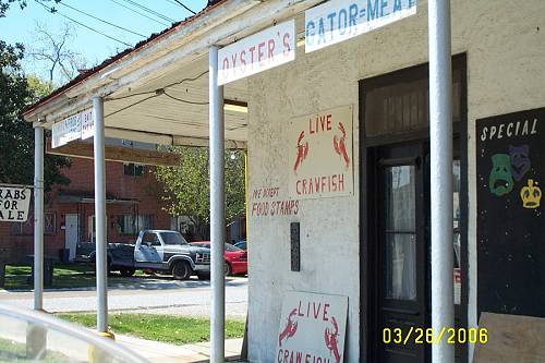
.jpg) I didn't write anything due to the fact that you either get it or you don't. I'm sure there are those who can put the old New Orleans feeling into prose, but I can't. Like an old buddy of mine, Mike, says, "It was a magical place". Continued at the bottom of the page... INSIDE: Poseidon, God of the Sea. Also a great New Orleans Mardi Gras parade if it still runs. I think the crews were forced to be "equal opportunity" and that smacked of government control which some simply said, again, "kiss our butt if we can't have a private club".
I didn't write anything due to the fact that you either get it or you don't. I'm sure there are those who can put the old New Orleans feeling into prose, but I can't. Like an old buddy of mine, Mike, says, "It was a magical place". Continued at the bottom of the page... INSIDE: Poseidon, God of the Sea. Also a great New Orleans Mardi Gras parade if it still runs. I think the crews were forced to be "equal opportunity" and that smacked of government control which some simply said, again, "kiss our butt if we can't have a private club". .jpg) Louisiana: Have a Bite
Louisiana: Have a Bite .jpg) We ain't no damn Saints Fans. I can imagine the scene in this place at the end of the Superbowl.
We ain't no damn Saints Fans. I can imagine the scene in this place at the end of the Superbowl. .jpg)
.jpg)
.jpg) And Stuff.
And Stuff. .jpg) Oh, do you wonder what that picture is? That's what you call a Louisiana Work Around. When government tries to reign us in, we slip the bit and away we go. One drink policy? Sure. Make it 4 gallons. And, "kiss my butt".
Oh, do you wonder what that picture is? That's what you call a Louisiana Work Around. When government tries to reign us in, we slip the bit and away we go. One drink policy? Sure. Make it 4 gallons. And, "kiss my butt". .jpg) That's just one place down by the tracks. The waterfront is blocks long with all kinds of businesses there. It reminds me of Decatur in the Quarter. The seawall is on one side. It's a working port and a vibrant area. This is the district that was once famous for its rough bars and rowdiness, shrimper and oilman enjoying each others company. Then the shrimpers learned that the shrimp liked to be around the rigs. At least the movie went that way.
That's just one place down by the tracks. The waterfront is blocks long with all kinds of businesses there. It reminds me of Decatur in the Quarter. The seawall is on one side. It's a working port and a vibrant area. This is the district that was once famous for its rough bars and rowdiness, shrimper and oilman enjoying each others company. Then the shrimpers learned that the shrimp liked to be around the rigs. At least the movie went that way. .jpg) 1912
1912 

.jpg)
.jpg)


.jpg) Post Office
Post Office .jpg) City Hall
City Hall .jpg)
.jpg) Downtown looking toward the railroad.
Downtown looking toward the railroad. .jpg) Below, looking into downtown from the port's sea walled gates. They will be closed this weekend due to the river being "up". I'll bring pictures back next week.
Below, looking into downtown from the port's sea walled gates. They will be closed this weekend due to the river being "up". I'll bring pictures back next week. .jpg) The new bridge looms high in the sky and reminds all that this is a big river town.
The new bridge looms high in the sky and reminds all that this is a big river town. .jpg) And that parking is sometimes tough.
And that parking is sometimes tough.  The water tower marks City Hall.
  1938 Shrimp Boats Are a Comin'.
  Continued from above. ............................................................He also feels that after 1960 it changed and by 1980, NO was no longer very special. You can't have cancers like New Orleans did and call it special. Harsh as it sounds, the flood was NO's last chance to clean up. The scum politicians sure did miss their supporters and did everything to get them to return to the welfare projects, slums and gang hideouts, but those people got set up by the federal government in new digs. Y'all in Houston, Dallas and Atlanta enjoying our expatriates? I told you all that dark stuff to emphasis how great it was to be taken back to 1958 by the old neighborhood store in Morgan City, and how much I resent the fact that I can't go back to my neighborhood because it is still a dangerous area. That's PC code for a place that is so racially prejudiced that a white person would not dare step in. We left Gentilly in '59, 2 blocks ahead of the "wave". The scourge from Central America and Mexico were already there. One stole my radio. What are you going to let them steal from you? You better rail against the Democrats in November. They want those 12 million illegals' votes to seal the deal for their vision of what real power can bring them. More looking around MC later and then over to Berwick for something that's still "special" and a grinner to a few. These days you have to hunt. Sometimes, like at the old store and the historical part of Morgan City, you bag a few.
  I want to tell you something before we get started on this page. Morgan City and Berwick are two of the best locations for an amateur photographer. You can't take a bad picture in these places. Well, you can if don't try to avoid power lines, but aside from that, it is photo heaven. This picture is here because I liked the red building which is a historic lighthouse. This stuff just shows up, pop, take a shot.
  I've backed off any commitment to reaching Lafayette and I may go no further on this project as it is getting very redundant though the rides that make any future coverage redundant are gone from the public eye. But.......some house cleaning first. Y'all know Al. Al likes his picture taken and I can't deny him because if he doesn't see himself on these pages once in a while, he mopes and then has to go off to S. Abbeville to get a spanking to sharpen up his attitude a bit. That's all I have to say on the subject, so hold your e-mails. Hey Wally, remember Bruce at SCS went down there for the same reason? You never know what little joys some people dig. Different strokes for different folks, pun intended. George, didn't you go with him one time? I never got a report. I noticed you ginning and standing a lot. You did, didn't you!! Here you go Al, save the trip. This was Al when he claimed for Spain all of the lower Atchafalya, including Berwick and Morgan City, Amelia, Patterson, Tiger Island and beyond. It was January, no coats were needed.
 .jpg) Which was too bad because Al really likes to wear the red fancy one for these pictures.
Which was too bad because Al really likes to wear the red fancy one for these pictures.  But, alas, he's been warm natured ever since he got that electric jolt at work.
  And, there are two things that really irk him, one, putting down the USA, you wussy liberals......
  and, two, making fun of his recent weight gain and eyebrow hair.
  Oh, this is his "Post the Muslim Terrorist" Crusaders outfit. {btw, "post" means to strike a blow, to hit, hurt or damage an opponent or enemy". It's a 1950's New Orleans thing. You'd have had to have been there.} Say that 5 times fast. He has a matching sword. Oh, Berwick, sorry to stray from the official straight and narrow academic format which I yearn to maintain. Again, this is the old depot picture from the MC website.
 .jpg) This is my copyrighted copy of a picture I originally took which is below this protected version. The red arrow points to where I think the water tank and depot were.
This is my copyrighted copy of a picture I originally took which is below this protected version. The red arrow points to where I think the water tank and depot were.  The yellow arrow points to where I think the turnaround began. If you repeat that without permission, I'll tell Al. Do you want to "go there"? To the left there are 2 stop signs. Remember the further one. How was "stop" spelled? Just checking.
 .jpg) There is a 2 story house to the left of it. I think the original rose garden /depot picture was taken from there on the second story toward the river, but not all the way.
There is a 2 story house to the left of it. I think the original rose garden /depot picture was taken from there on the second story toward the river, but not all the way. .jpg) Remember the stop sign? It is to my left. See the raised area. It's the fill for the turnaround. That's the levee ahead. I almost said "sea wall" thinking it was a wall which it is but there is no sea, only one bad to the bone river on the other side.
Remember the stop sign? It is to my left. See the raised area. It's the fill for the turnaround. That's the levee ahead. I almost said "sea wall" thinking it was a wall which it is but there is no sea, only one bad to the bone river on the other side. .jpg) There it goes going east.
There it goes going east. .jpg) Here it came right by these buildings (going east). Now it's used by the gravel road. I wonder if there's any latent seismic rumblings there.
Here it came right by these buildings (going east). Now it's used by the gravel road. I wonder if there's any latent seismic rumblings there. .jpg) This is a picture of the next depot down by sixth street.
This is a picture of the next depot down by sixth street.  I didn't take it and do not claim it or anything. I don't know how that picture got here? Here's GE's shot with my white trail of the TA. We in the railroad world like to use initials. Keith Richards once wrote a song about T&A, might not be the same. My TA means "Turn Around" or condensed, it can be spelled, "Turnaround". Your choice, depending on it being a noun or imperative verb.
  Here's Garmin's: Ya got the train bridge, the new 90 bridge and the old 90 bridge, going bottom to top.
  I can't leave Morgan City w/0 saluting the shrimp boat, Spirit of Morgan City. See!! Shots everywhere.
 .jpg) And the Oil Industry.
And the Oil Industry.  I'm going to have a showing of my MC/Berwick bridge photo art at some point. I can't here because this page has gotten too large. So, forget it for now, I can't worry about Al roaming S. Abbeville so I had to display a few of his old shots to maintain his sense of purpose. He just wrote me that he's bought 3 more Lt. Dave Robicheaux books to help with his deteriorating ego. Now, all I have to worry about is him roaming west New Iberia and forgetting to call him Lieutenant. Al and I found ourselves on the Berwick side north of the old 90 bridge.
  That one. Magically, we moved south of the car bridges but still north of the rail bridge.
  I don't know if he or I took this one, but it's pretty good of the rail bridge. No date, probably Al's. The inclusion of the 3 yellow blocks make it. Seriously.
  This is the bygone Berwich Depot. I want to credit the guy who actually gave me permission to use it. I will at the bottom of the page to make it look like a footnote. Naw, I will here, or I'll forget. Bert Berry is his name. CLICK HERE to go there. Great stuff.
  Its location is where these shots were taken. Again, these are Al's shots. He had stationed (pun unintended) himself here, the side track to the station and to the area between the sea wall and river. You can see the incline to cross the levee and approach the bridge.
  When suddenly, what should appear?
  The Sunset.
  It was a moment.
  But wait. I was closer to the bridge. Mine and more on the next page. Later. Rosco just called and wondered why I'd left out his narrative. I explained that this was not a real page and it was all in his imagination. But you can't fool a ghost and surely Rosco is a ghost since he wrote this in 1935. But maybe not, medical science being what it is today. Anyway, Rosco didn't have that much to say about Berwick. I'm going to quote him as I was getting tired of the previous arrangement and you don't want to mess around with no ghost. From the USGS Survey book: Berwick. Elevation 14 feet. Population 1,679. New Orleans 82 miles. After crossing the Atchafalaya River over a long bridge the train reaches Berwick, a companion town to Morgan City and sharing with it the river trade and crab industry. In the region west of Berwick much of the land is under cultivation in sugarcane, but some woodland remains. An abandoned sugar mill (Glenwild) is conspicuous north of the railroad 3 miles west of Berwick. A typical small sugar plantation may be seen just north of the tracks 2 miles beyond Patterson (near Calumet siding), with groups of whitewashed houses for laborers and many very large, handsome moss-hung live oaks. That's it. Tomorrow I will exhibit all of my bridge pictures, including my version of the train crossing the lift bridge. You'll need to take a pill because it will get exciting.