At Lottie I again saw the huge "hump yard" the Union Pacific has there. After chasing rail ghost for hundreds of miles, I decided to chase a live one. I'd follow the Union Pacific down to Grosse Tete on I-10 where it takes off across the swamp. Then I'd loop around and find where it reemerged. On the way I'd catch what I could where this rabbit led me. Along the way is La.77, a truly wonderful road connecting US190 to Plaquemine. I was further driven to investigate the reemergence by a story Mike Wilson had told me. There had been a railroad related tragedy near that point when the line was run by the Texas and Pacific RR.
This one is going to go slowly. I don't have the stamina for many hours of writing at one time anymore, especially after a long hot ride.
I'm cutting the ride track map into tiny pieces to reflect the short pages.
You're getting onboard just east of Krotz Springs. There is always something new to see in KS, but first I had to visit Old US 190, the road of my youth. Remember, all the maps and pictures are just thumbs. Click them and they enlarge, hit the back arrow on your browser to return or open them in new windows to avoid that.

.jpg)
This is a board road. It is used to allow heavy machinery to cross soft land. There is a pipeline being built nearby. 190 is mid picture.
.jpg)
.jpg)
Over the levee the old road stretched out.
.jpg)
You are looking at some very old cement.
Off to the sides of the many bridges are hints of what this road was called to conquer.
.jpg)
I returned to the back road into Krotz Spings.
.jpg)
At the time I was just shooting stuff. An old fire truck seemed a good subject.


Pretty cool.
I crossed the Atchafalaya and then the 6 mile bridge arriving in Lottie. I immediately got off of 190 onto 81 which goes through Blanks.
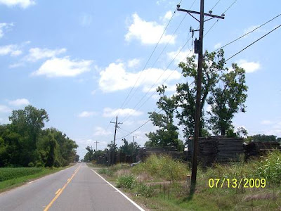
I saw the stacks of wood on the south side.
.jpg)
At the hump ahead was this.
.jpg)
The railroad hump in the road was not to what the sign referred.
Humping in railroad lingo is where a rail car is pushed up a little hill and then allowed to roll down the other side. Its route is controlled by switching rails from one track to another. If it gets going to quickly, there are brakes along the way. The process is used to assemble freight trains.
This is the entrance to the yard. Oh, what about the stacks of wood? It's a wood product company. How am I suppose to know? I'm just a clueless amateur photographer.
.jpg)
81 ends at 77. I took 77 south paralleling the rails and yard. Along the way, an old sugar mill stack still stands.
.jpg)
.jpg)
The lines of cars can be seen off in the distance producing a thin border between land and sky. I found that poetic, you?
.jpg)
So that train with no engineer wasn't a ghost train!
.jpg)
I entered Maringouin (mear OH guin).
I have never spent any time there and since I'd canceled the circumnavigation of the Basin, I felt like I had plenty. I'd look it over.
This is coming into town. That's Bayou Maringouin down there. I will learn how to spell that word. It means "mosquito" in French. I wonder why they'd name a place that? Wait until dusk.

.jpg)
That's all natural, no landscaping.
.jpg)
I crossed the bayou and rolled into town.
The tracks, fresh from the hump yard, lay in front of me.
Continued from page one:
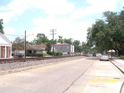
After crossing the bridge over Bayou Maringouin, the rails lay ahead. I started seeing old buildings, a signal that promises good history hunting lay ahead. This little town, nestled between two bayous, the other being Bayou Grosse Tete, has not been leveled to make way for "progress", preserving historic evidence. It amazes me that I did not shoot a main street scene, or if I did, it didn't work. That's it, the camera didn't work. I did shoot some shots of the aforementioned old buildings near the tracks. A warning, I may have been suffering from RR tunnel vision early on this ride. I don't remember if it subsided or not? Picture One.
.jpg)
If it has "Lone Star Feed" on it, it gets shot.
Oops, we need a map, one, so you'll know where you are, and second, I'll know where I was. I made up a map on the old software, then noticed something wrong, so I made up another one with more up to date data. It didn't answer the question that I'll get to later, but it did show how things have changed. It's priceless as it doesn't cost me anything, but beyond that, it's just another map.
Here's the old, then the newer. Gleam what you can from them, and later, when we get to the depot I'll present my interrogative observation. The yellow lines with dots are my tracks.

Now the newer, something's missing.

Maps will set you free. Now all I have to do is post the shots since you know where they were taken. The next ones are of the metal buildings. The place looked "oil field supply" in nature. The rails would be to your right, east. Orientation is very important to me on several levels.
As some of you know, I have a thing for roof vents. These are pretty neat. When in a panic for a special adjective, use neat. "Special" is another adjective that's pretty neat. I've seen this type before. Repeat sightings, for me, are a mellowing experience. Familiar objects are placed on an elevated shelf. I guess that goes without saying and maybe I shouldn't have said it at all. Done deals are done deals, let's move on.
.jpg)
Here's a second metal building, it is not as neat and said nothing to me besides "red" and is that toxic waste behind it?
.jpg)
I kept moving south and came to what I believe was a juke joint. Google "juke joint". Juke joints may not seem important to you, but they were to many. Mr. Martin had a juke joint his black clientele frequented, just a side note. Visit him on Irish Bend Road, Franklin La. He's 96, so maybe soon. Ask him to show you the "club".
.jpg)
Coming back up the tracks and crossing them I saw the old cafe/store.
.jpg)
You can see a little of the north side of the main street in it.
Below, you can see a little of the south side of the main street.
Now I know why I didn't shoot the main street. I've seen so many old main streets, my memory, even recent memory, melds them all together. Sorry I blamed you Mr.Camera.
.jpg)
I'm glad these pictures are speaking for themselves.
I've never been on a Railroad Drive. But I was now. I'd cross the main street and run the rails south.
.jpg)
A sign of lumbering times was ahead. Red Cypress comes to mind since Cindy had recently mentioned it.
.jpg)
That's shaved wood and sawdust. I should have gotten a sample. The fact that the pieces looked so "intact" makes me believe that it is Red Cypress, the only wood that will naturally stand up to Louisiana. *[email Cindy if you disagree]. Look, I've got a lot going on during these rides. Self preservation is a top shelf deal. Checking wood scraps lies beneath that. I was thinking "preservation" a lot here.
.jpg)
I saw this guy weed eating in his front yard. I parked the bike and approached him. He cut off the machine and frowned at me. Good start. I could see it in his eyes. "What you want white boy"?. I made nice and asked him where the old depot had been. His reply, "There ain't nothing there". I replied that I expected as much but could he tell me where it was. His aggravation was redlining. He told me it was by the tracks. My aggravation was redlining. I finally got him to say where. I thanked him graciously and there was no reply. Had I been part of a strained interracial moment or one more personal, an interruption in a weed eating dance. If the latter, I can relate, if the former, it's time to get over it, but his brand of attitude ain't helping. Further down the line, I stopped and asked some black guys picking up garbage where the next depot had been. They were so helpful and friendly I had visions of us all sharing Diet Dr.Peppers discussing the need and supply of valuable historic knowledge. Returning from where they sent me, I passed them with a big thumbs up. They waved back obviously enjoying our communal victory.
After my visit with Mr.Frownie, I rode straight back to the main street and there on the west side was the obvious location of the depot, gone 30 or 40 years ago, according to him as he sneered.
.jpg)
Out on the tracks was the home town sign.
.jpg)
I looked up the tracks past the tower. Mercy, there was the old depot side sidetrack.
.jpg)
I rode the bike across the field and shot back toward the depot location.
.jpg)
I am terrible at historic forensics, ask Al, he finds all the good stuff. But, I did notice a raised area next to the tracks. We report, you decide. BTW, I did not get off the bike for most of these shots. Such is the tool that I ride. Editorial: I say this was a foundation for something.
.jpg)
While we are looking as mystery stuff, here's one more:
.jpg)
This stuff was piled up at the tower. I should have dug around in it but I was feeling a little pressured by time and exposure.
.jpg)
The next shot shows a rail perpendicular to the others. Looking at the picture, do you see an exposed rail tie beneath it? Was there a cross track here?
.jpg)
We will leave Maringouin with this parting shot:
.jpg)
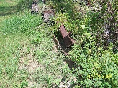
If I told you what I surmise, you'd ask me why I took the time? So I won't. OK, twist my arm, the rail and connectors have been cut together. Must be one hell of a saw.
That was the little hamlet of Maringouin. The first of many. There are 20 pages left. More later.
Oh, what had I noticed in comparing the two maps? In the old map it shows the sidetrack joining the main tract on the south end. In reality, the sidetrack joined the main track on the north end of their coexistence. What's the story? You decide. I just looked again. The present side track lay next to the main line rails. If you look at my tracks on the old map, you see that I was between 2 sets of tracks, an impossibility with today's layout. The old software also shows a road crossing the sidetrack, there was none. There had been, if Mother Garmin is correct, another arrangement prior this this one. I'll go with M.Garmin being wrong. That's the easy fix. But, with the addition of the road crossing the second side track, there's too much data for it to be a fluke.
Old

New

Possibly I should not be writing right now since I have so much on my mind, but it's 2:10 and not the time for uncivilized activity.
continued from page 2:
Finally done with Maringouin, I exited on La.77 bound for Rosedale riding along Bayou Grosse Tete, another beautiful waterway where man has not abused it. Feeling the last barrage of railroad stuff might have been overkill, I stopped and shot this steel building. Notice the sugarcane harvester (yellow) to its side.
.jpg)
Next was West Oak Lane.
I found nothing there but the obscure rear view of this plantation, one of my favorites. This picture was taken on an earlier ride.

And this green pool. I considered a swim.
.jpg)
La.77 is as good as it gets for countryside riding.
.jpg)
Next, an all important map if swimming is on your mind.

I rode through Rosedale. Rosedale has a lot going on. I ended the ride here and that will be covered then. We have a ways to go.
I crossed under I-10 into what is considered the Village of Grosse Tete.
I'm posting both old and new maps as I had done for Maringuoin. sp?
Here's the Grosse Tete map. This is where I met up my co-historians.

And the present day mundane map. Notice something missing? You do get the street names with it to make it easier to get around.

After turning away from the bayou into "downtown" Gross Tete, Gene's Hardware is about it for historical buildings. "Scardino Building, 1932" is the on the front. Sounds like a name out of Godfather II.

And here's the trestle guiding the train to the wilderness.

Now for the story line.
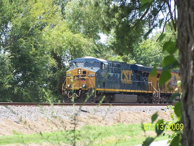
I came into Grosse Tete and went down the east bank thinking I'd get a picture of the trestle. Then I remembered I had one. I came back to the bridge and crossed over into down town. I saw what you see on the old map and headed for the rails along that long side street. There I first saw the Trio. Actually, I'd seen them leaving the yard back at Lottie/Levonia.
.jpg)
They moved out. Had this been the location of the station? I figured I'd never know.
.jpg)
I moved on down 77 a little and saw the sanitation workers on the side of the road. One fellow had a gray beard. I pegged him for knowing stuff. He did and he had a chorus agreeing with him. The street where the depot had been was one block from where we were. I went down the dead end expecting nothing as they had warned me. I parked for a shot. Here they came. They must have stopped to throw the switch, giving me time to set up.
.jpg)
.jpg)
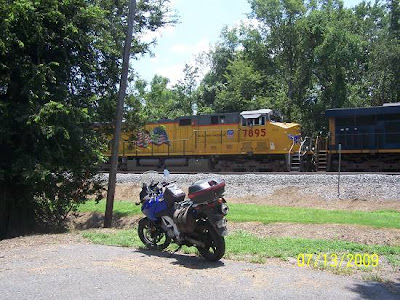
Then I quickly panned to the left.
.jpg)
.jpg)
.jpg)
.jpg)
I returned to my advisers, cheering as I passed. The only regret was that I was too slow to catch the Trio crossing the trestle. But, I can't complain.
Next is a map that will keep you hanging on. Notice the rails crossing the swamp. Notice the yellow track line meeting it. Yes, it was a moment. Stay tuned. More below.

The road down Bayou Grosse Tete is pretty interesting if you realize your surroundings.
I crossed the bayou headed toward Plaquemine along Plaquemine Bayou. I needed gas and this was the only available station. It seemed that all the stations were now government owned, like in Mexico, and this was the price I'd have to pay. A 10 ounce Coke was 5 bucks. The manager pulled me to the side explaining that cameras were everywhere and he feared Big Brother. He said that it was all linked to "Cap and Trade", the plan where Al Gore and the Democratic cronies were positioned to make millions and had. Why don't you ask Senator Landrieu how she feels? She's a kiss butt Pelosi / Obama loyalist whose vote is for the party and not her state. I'll continue after a while when I can escape reality one more time. Much more later.
CLICK HERE TO GO TO THE NEXT PAGE
.jpg)

La.77 continues to be a fine road from Bayou Grosse Tete to Plaquemine . The road on the opposite side of the bayou is also very "interesting". I pulled into Plaquemine. Plaquemine is a very old town. There are hints of French Quarter New Orleans everywhere as in Thibadeau and the other Bayou LaFourche towns. I've covered Plaquemine to a degree on other rides so I won't here. I was at the point where tunnel vision was coming on strong. I fantasized about meeting that Trio coming from Grosse Tete. Did that sound stange? It did to me and I find it troubling.
I looked at the GPS and saw Depot Street on the south side of town. I rode right to the building. I'm sorry, but it had no personality. It appears not to be that old and is now a store of some kind. Where "Plaquemine" was on the end of the depot is now a "Depot Market" sign. Tacky. I looked in the window and I could see no depot-like stuff. I'll show you a few shots to cover the requirements.
The rail side:
.jpg)
The station master's bay windows:
.jpg)
The street side:
.jpg)
The luggage wagon. I'm sure there is another name for it. I'm not sure about the originality of the roof structure.
.jpg)
There was another one out on the street. Roofless.
.jpg)
I turned my attention to following the rails through town. The set up was exactly like New Iberia.
I'll post the pictures as they were taken.
Corner of Depot and Main.
.jpg)
The street and railroad were separated by a curve, just like in New Iberia. This is no industrial zone. This is downtown, at least the historic downtown.
.jpg)
.jpg)
Mercy me, that sure is a fine building.
.jpg)
It's the City Hall.
.jpg)
With the appropriate Confederate Memorial. I'm betting the City Hall was built around 1915.
.jpg)
Plaquemine saw Hell in the Civil War. The Union's worst inhabited its streets.
Past City Hall, I saw this branch coming off the main line. My old software doesn't show it.
It could have been for anything.
.jpg)
Exiting town I went into Turnerville. I saw a sign from the road mentioning "Historic Homes". I think I missed them or these were the attractions. I did see a bed and breakfast offered, but it was on a street whose inhabitants were walking around aimlessly and I didn't want to become a target.
.jpg)
.jpg)
Now we are going to do the Bayou Plaquemine Bridge which is very near the old locks. Both are massive and must sees.
Before I had stopped at the depot I pulled over and started the series.
.jpg)
.jpg)
The counterweights are huge.
Here are the locks before I forget.

Massive. Bayou Plaquemine did connect to the Mississippi. The Port Allen Canal at Baton Rouge now links the Mississippi with points west. We'll see that, too. Why massive? It was a plug in the levee that, if broken, could wipe out south La. during a flood and alter the route of the Mississippi, so it was built not to move. It is now levied off as a further insurance policy.
Back to the RR bridge. I took this one while sitting at the light.
.jpg)
These three were taken from a visitor's parking lot. I wanted to get a full picture of the little rectangular traffic bridge that serves the south bound lane of La.1. It seems like a tiny relic. Don't get me wrong, I think it's great that it's still there. I'm wondering if there wasn't more to it at one time when there was river traffic? Of course, there is none now. Bayou Plaquemine shrinks just west of town and then regathers itself as it approaches Bayou Grosse Tete/Port Allen Canal.
.jpg)
.jpg)
.jpg)
And, you couldn't miss the huge old brick warehouse.
.jpg)
There could probably be 4 more pages. If you are enjoying these rides, let me know. I write them as a gift. If it's too much for you to write "thanks" once in a while, then it's too much for me to continue. Steve
I headed north on La.1 in pursuit of the first point where a train could be seen coming south from Grosse Tete. I noticed a freight stopped on the tracks pointed south. I took out my camera to take the obligatory shot when a real laugh occurred.
.jpg)
The next pictures are not very good. I was shooting into the sun and they are zoomed out pretty far.
This above picture is zoomed and cropped. Unfortunately, I could not make out the number which messes up my theory.

Here came the lead 2 of the Trio.


The pictures expand when clicked. The engine numbers are 5371 and 7895 The missing CSX engine is 5307. It had been dropped off. Was 5307 pulling the sidetracked freight? Could be.
If I had put the throttle to the stops, could I have caught the Trio emerging from the wilderness, No, so don't try it.
Needing a grin and getting one, I moved on.
Another grin was had seeing the oaks that lined La.1. Similar oaks are along US 190 coming into Baton Rouge from the west.
.jpg)
Here's the page map.

More grins were to come.
I saw a light shining from within an industry gate.
.jpg)
I was off of La.1 and decided to make the block toward the river. The river is where you find history. A familiar family's name, Levert, was mentioned on this historical marker next to the river. The Leverts own St. Johns Mill near St. Martinville.
.jpg)
I next crossed La.1 and checked out the Addis train yard.
.jpg)
.jpg)
.jpg)
.jpg)
I moved on and found this old bank, now a museum.
.jpg)
.jpg)
.jpg)
Behind it was a caboose. The museum was in the right place to pick up on a caboose.
.jpg)
High Tech
.jpg)
Handy part numbers make the job easier.
.jpg)
While there, here came another one.
.jpg)
Your Tropicana Orange Juice is on its way.
.jpg)
The highway sign reminds me, it's La. 990, once known as La.1, now referred to locally as Old 1.
The Addis yard is aligned with the tracks coming from Grosse Tete. It is possible that 5307 had been left there. I saw an engine I believed had those numbers but looked to be a different type of engine?? I need to learn to just let some things go. I hooked back up with La.1 and continued north until coming to La.989-1. I went west on it until the tracks where I stopped for this picture and where I'll stop this page. CLICK HERE to go to the next page. That will be the grand finale.
.jpg)
I was heading toward my goal, the first point a train could be seen coming from Grosse Tete. Different strokes for different folks. I traded the bike for a bi-plane, which brings me to this:
.jpg)
You Can't Catch Me/Rolling Stones
I bought a brand new airmobile
It was custom made
It was a Flight DeVille
With an outboard motor
And some hideaway wings
Push in on the button and you can hear her sing
Now you can't catch me
No, baby, you can't catch me
'Cause if you get too close
You know I'm gone like a cool breeze
Old La.1 in the wee wee hours
I was rolling slowly 'cause of drizzlin' showers
Up come a flattop he was movin' up with me
Then come sailin' goodbye
In a little old souped up Mini
I put my foot in my tank and I begin to roll
Moanin' sirens, was the state patrol
So I get out my wings and then I blew my horn
Bye-bye Plaquemine Parish, I become airborne
Now you can't catch me
No, baby you can't catch me
'Cause if you get too close
You know I'm gone like a cool breeze
Flyin' with my baby last Saturday night
Wasn't no gray cloud floatin' in sight
Big full moon shinin' up above
Cuddle up honey be my love
Sweetest little thing that I ever seen
I'm gonna name you Mabelline
Flyin' with all the things set on flight control
Radio tuned to rock 'n' roll
Two, three hours passin' by
Altitude dropped to 505
Fuel consumption way too fast
Let's get on home before we run out of gas
Now you can't catch me
No baby, you can't catch me
'Cause if you get too close
You know I'm gone like a cool breeze
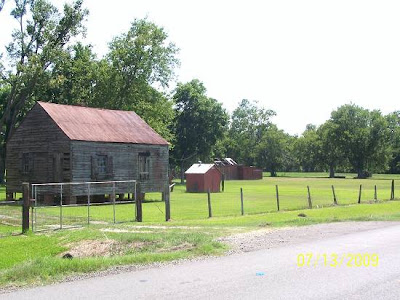
I was flying low and slow and shot these old places. Not all the shots can be rail related, Gaspard.
.jpg)
.jpg)
Landing in the small oyster shell parking lot, I took a couple of shots. I have added captions to avoid having to write an explanation.
.jpg)
.jpg)
I had called it Folks Landing, but I don't think so?
.jpg)
Now the pretty stuff that makes La. landings nirvana.
.jpg)
The fan is a must. Our heat and humidity becomes air conditioning when it gets moving.
.jpg)
Uphill parking is available if your Jeep has been submerged or caught in a 3pm monsoon.
I had used realistic brown water coming from the jeep, but that didn't put forth the vision I intended. So I went with an unrealistic blue.
.jpg)
Alright Gaspard, here are the bridge shots. This is the place where the rails exit the swamp. The waterway is an arm of the Intracoastal Canal called the Port Allen Canal. This is a correction for every time I've said "Intracoastal Canal" and forget the "arm" thing also.
I backtracked and found the road to the bridge. I proceeded slowly and quietly on foot, not knowing what I was getting into. The plane would have been conspicuous. There were trucks parked there but no one was in sight. There was a rail shed that was open with the lock hanging. Possibly a worker had taken a ride on one of those yellow deals? I, obviously had the run of the place. Soaking it, I took 4o shots.
.jpg)
I wandered around at the base of the bridge, smitten by being so close. The last time that had happened was in Simmesport.
.jpg)
.jpg)
I obeyed this warning to the tee. If a picture seems that I didn't, I did. Those pictures which look illegal were taken using mirrors and lenses.
*Mirror shot:
.jpg)
Mirror and lens shot: Looking toward Grosse Tete.
.jpg)
Mirror Shot: Looking toward Addis.
.jpg)
Non Mirror shots, one lens.
.jpg)
The AC is gone, not good.
.jpg)
I rode back to the landing to see if I could cop a shot. Yea.
.jpg)
Geezus, It's Al.
Al, watch where you going, cher.
He says he knows where he's going by where he's been. Somehow I think he has missed the exact concept which that statement would normally mean. That would only work, I keep telling him, if he only went where he's been. He replied, "Duh, And?"
.jpg)

Seems I'd been in Morley. That explains Al coming down the canal. He said his cousin, Hernando DeSoto, Jr., lived there. I'm sorry, some of you don't know Al's full name It's C. Alfonso DeLaSalle. Yes, he's related to that LaSalle. Let's not discuss what the "C." is for.
I crossed back across La.1 and headed to the river. My next target were the locks on the Mississippi River, but I'd explore Brusly and Antonio, first.
There's your church Ray.
.jpg)
And the tree at the end of the parking lot with the levee behind it.
.jpg)
A local home.
.jpg)
.jpg)
This is the first historical marker I've found with different subjects on the same marker. This was on the other side:
.jpg)
This is a house that was right down the street. How could I miss its historical marker?
.jpg)
Another HM near there.
.jpg)
Up on the levee was a "levee rider". This was a rare sighting as levee riding has all but ceased except where it is the only route, like on La.15.
.jpg)
Next was a pretty place. Again the Levert name is seen.
.jpg)
.jpg)
.jpg)
The road turned back toward La.1. I took this chance to hop on the levee myself, just for a few shots of the I-10 Mississippi River Bridge.
.jpg)
.jpg)
The La. Capital is the tall building behind the bridge. It is the tallest in the US.
The next pictures are of the second rail bridge across the Port Allen Canal, just west of the locks.
The one at Morley seems to be its twin.
.jpg)
.jpg)
A few of the locks.
.jpg)
.jpg)
I left passing an old farm or plantation. It had seen better times.
.jpg)
I rode into Port Allen and whoa, I found the depot.
.jpg)
The old building was surrounded to the point of almost being indistinguishable.
.jpg)
.jpg)
Next was a look at the caboose.
.jpg)
.jpg)
There was a broken window I stuck the camera through.
.jpg)
And a desk.
.jpg)
I then took the back way to Rosedale. West of Rosedale I stopped when the rail crossing lit up. This idiot in a pickup truck passed me and ran the warning lights. The train was moving. It had come from Lottie. It was short and fast.
.jpg)
.jpg)
.jpg) '
'It was there quickly. I counted one two three. I also considered turning around and heading back to Morley to meet it coming out of the forest. That seems like a doable deal. That's it.
Mike Wilson, the Railroader's son, after reading the Plaquemine and Back tale, sent these additions. It seems that Mike had lived in the neighborhood for 30 years and ridden various bikes all over the place. His father's range as a fireman and engineer reached down into this part of the country adding to Mike's railroading knowledge of the place. I'll read a little of his note to you.
First his explanation of the route of the Intracoastal Canal.
The Intracoastal Waterway comes up from the Morgan City area via Stephensville, Bayou Sorrell, and part of Bayou Grosse Tete. When you came down beside Bayou Grosse Tete and crossed it at Indian Village, you probably saw some tows. I believe the technical name is "Port Allen Cut Off". That loop from Morgan City up through Pierre Part, Bayou Sorrell and Bayou Pigeon and into Plaquemine would be a great ride for you.
[I've done that route. I'm presently looking for it and will post it asap]
Next: Into Plaquemine
The spur remains you saw in downtown Plaquemine went west out along Bayou Plaquemine to Marionneaux lumber yard (his couzan owns the one in Livonia at the North end of the UP yard. If you had taken a right, you could have followed the old roadbed all the way down past the 'new' jail and right to the old lumberyard.
Next: The large red brick building I pegged as a warehouse.
Across Bayou Plaquemine, the old brick building was Iberville Wholesale Grocery Supply, very similar to Church Point Wholesale. Just a little further north, the Myrtle Grove Sugar Mill spur came off the main line and went west along the north side of Bayou Plaquemine. The old Myrtle Grove 'quarters' were the site of the infamous vinyl chloride sensationalism about 5 years ago. Find out more (only slightly biased against Dow) at www.dirtydow.com. By the way, the rail yard you looked at behind the gate was only a small part of the 60 miles of track within the Dow plant site.
Next: Out to Morley and the train bridge which marks the end of civilization at that point.
The Morley train bridge was the site of a tragic accident in February, 1974. A westbound freight was coming out of Addis, and as they rounded the curve leading up to Morley, the bridge signal gave them a green light. They started picking up speed for the trip on to Alexandria. Unfortunately, the bridge was in the 'up' position, and the engines hit the concrete counterweights. Two engines and 5 cars went into the Intracoastal Waterway, and G. Morrow and R. Smith were killed. The reason the light was green was a nest of ants in the signal box that kept the red contacts from engaging.
It was the 2nd of 3 killing accidents on the Alexandria-New Orleans division that year.
At the crossing en route to Morley, (where you shot the old barn) there used to be a cane spur taking off at the crossing on the east side, and following the main line around. In the Fall of 1962, young G.Gaspard (hero of the "Love Affair on the Avoyelles Branch" story {on the History Hunts Blog}) rode in to pick up a cut of loaded cane cars. He gave the signal to pull out, and when the cars cleared the main line switch, Gerald was not on the side of the cut. They found him down the siding, [dead]. He had a wife and 2 daughters.
Me: It was this last story that brought me out to Morley. It was not the fact that there had been an accident, I wanted to see where the siding had been to a plantation. Can't lie. It might have been the tragedy. Why are we drawn to tragic places? Why do strangers leave flowers on the graves of victims? Is it just curiosity? I hope not.