Sorry for the immediate interruption. On with the ride:
Friday afternoon and it was 2pm. The M-Day weekend loomed and my wife had my name on the duty roster. If I was to get my self-pampering done, it was time to do it.
Several birds had been pecking at me. One was that I wanted to go down to Burns Point and the other was that I wanted to visit Gordy, LA. Gordy What? If you are familiar with my investigations into the Civil War, you know I got to know Captain Cornay. The Captain's second in command was Minos T.Gordy. In the quest to learn all I could about Cornay I found that there was a Gordy, LA, due south of Centerville, in St. Mary Parish. I also remember seeing on La.317, the Gordy Road, a beautiful plantation home. I'd taken pictures of it but couldn't place its location. My question was, had it been in Gordy and was it Gordy's home? Needing to know became imperative.
Those were the driving reasons for taking the ride. The ancillary importance of this ride on May 9, was that it was the first outing of the season where I brought no light jacket for a possible cool late hour return. It would be 90f and sunny. Nirvana, since I'm old and get cold easily. With my Walmart light gray t-shirt, I'd be stylishly and appropriately dressed for any hour. For the first time this year, I felt Summer was surely in play. To celebrate this moment, let us all rise, remove our hats or helmets and sing along.
Get your motor runnin'
Head out on the highway
Lookin' for adventure
And whatever comes our way
Yeah Darlin' go make it happen
Take the world in a love embrace
Fire all of your guns at once
And explode into space.
Words by Mars Bonfire. I love Mar's stuff.
Please be seated. You may replace your hats or helmets if you wish.
As I mounted the Suzuki DL650, sporting its new kickstand's non sink in the mud or sand attachment, personally fabricated, I figured it would be a good afternoon barring any attack by a lingering horde of Love Bugs. I turned the front wheel south, hopped the bayou and cruised right through St.Martinville. There my tentative memory kicked in. I wanted to see the Keystone Lock. Daryl Latchiolais, aka Daddo, famed movie star featured in "The Old Man", had told me of racing a boat down the Teche and going over the spillway which is next to the lock. Daryl is very sadly gone now, but not one of his many triumphal locations. Earlier, I had tried locating a road to the lock on the east bank of the bayou with no success. As I swung south from St.Martinville, I'd look again. I rode and rode looking closely as I approached New Iberia. I pulled over several times to let cars by who were caught behind me. I saw them looking to the east, also. There's a fun game, Creating a Rubberneck. Just a thought, don't actually do it. If people figure you are messing with them.....
Before I make your imaginations explode, here are the pictures of the mini-adventure at Keystone. I had to implore my on again, off again, skill of reading to find it. Use it or lose it.
.jpg)
Tractors involved in field work were everywhere on this ride. I thought of taking all of their pictures, but then I'd still be stuck in St.Martin Parish. The array of farm machinery would have been extremely interesting and I guess I blew it. Maybe I'll do that this afternoon. I can get Mr.Barronett** to assist me in tool identification.
**Spelled incorrectly on purpose. That really bothers him.
.jpg)
Don't get impatient, we're going to the Lock.
That's the fine old house where the Lock Master lived.
.jpg)
I'm going out on a limb here and say this is the back of the house, the front, facing the bayou. I say that because the cistern, for household water, is located there in most cases. I really need to do some research into this place. The area is called Keystone. That is not some made up Corps of Engineers name or maybe it is. I have read that the lock is closed because of three possible reasons, no bayou traffic, the lock is broken and parts can't be found, it being an old oddball design, and no one wants to sit here and wait for a boat??? Those reasons are real or fictional.
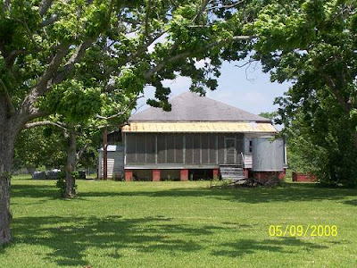.jpg)
Oh, I forgot to tell you, these pictures were taken through the wire in a chain linked fence as the lock is locked up. With full zoom, this is as close to the lock as I could get.
Starring at the fence at the lock, I could hear Daddo's 230 horsepowered 17 foot flat bottom approach and smiled.
.jpg)
As I turned to leave, the tree lined driveway struck me as a potentially good shot. Then I realized the tractor that had been parked down near the highway was running and had a fella sleeping in it. I guess it had ac and he was chilling while his pardners ran the rows.
.jpg)
Continuing toward New Iberia, La.31 is a thing of beauty. I got emotional and had to pull over.
.jpg)
I turned east onto La.86, the road to Loreauville and back. It makes a loop following the Teche as it does a crazy coil out into Sugarland. Yesterday, the previous day to the day of this ride, so you won't get confused, I'd met a gentlemen here from Wisconsin. His intended campground, Belmont, was closed. and he was lost. I ended up taking him to Lake Fausse Point St.Park, a place not on his GPS. The fellow was so lost he didn't know what a crawfish was. Neither does this spell check. Ignorance is such a problem in the rest of the United States.
A side note: My wife just put on Beau Jacque, loud, a fitting start to any Saturday.
She rides her exercise bike to Sir Beau. Iron Woman.
The net result of meeting this lost son of the north was that I needed to check out what happened to Belmont Campground on the Teche, near where the Teche does her bend east and his intended stop.
He was right, no one was camping. What a setting.
.jpg)
.jpg)
I need to say this before I forget. I came up with the History Hunts title for this blog because that is sometimes what I do. There is no hunting required in Louisiana. It is in the air you breath. Maybe I should have called it "History Investigated"?
Oh well, it's a done deal and there's no going back, but looking back is always available.
Down the road from the campground is the location of the old plantation which was here. The new place isn't bad.
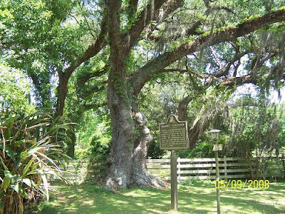.jpg)
.jpg)
.jpg)
The place burned some 61 years ago. Don't ask me how easy that math was.
I took Daspit south to Troy Rd and crossed over to 344 which I took south, to Northside (Teche) Road, where the big sugarcane mill is. This shot is pretty good, if I do say so myself.
.jpg)
Oh, well, you should see the larger version.
.jpg)
I would cross Bayou Teche yet again. Another Kodak moment.
.jpg)
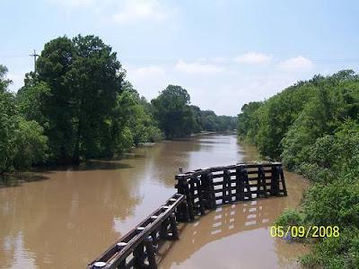.jpg)
At this point I want to show you the Teche's route from Belmont to where it finally exits the New Iberia area and heads east to Olivier,the end of the drawn route. I don't think the locals fully understand it. I know I don't. This is a big map. Click on the map's picture thumb below and it will open. Hit your back button to return. All the pictures are similar.

The shot above was taken on the second crossing where it says,"Northside". I was now on 320 headed to Olivier, the bottom of the drawn bayou route. The bayou makes a visit to downtown New Iberia where there is real nice river walk next to the Shadows Plantation. Now there's a spot.
Oops, almost forgot a shot. Right where 320 crosses 86 on its return from Loreaville, having followed the Teche to that fair city and back, I spied this air boat. There may be some people out in less knowledgeable (almost said ignorant) areas that are not familiar with air boats. This is a small one, a regular sports car of the marshes and swamps. Once we went to the Stenis rocket testing facilities in Mississippi. There was a Redstone rocket motor mounted out front of the main building. It's conical shape (air boat cowling shape) brought two words from my wife's mouth, "air boat". I cringed, knowing she had lived with me for much too long. A very nice driver stopped so I could take this picture or he could have wondered what the hell I was doing. I'll go with nice.
.jpg)
Being very late, 3:15, I took a rare run down the interstate coming within a few mph of the speed limit of 65. That was exhilarating. Then the speed limit raced ahead to 70 and I did not pursue, falling back, determined not to miss anything. There actually are a few shots to be taken out there on the raceway, but doing so would mean becoming a target on the shoulder. Nope. I arrived at the Centerville exit at 3:45 or so?
Glad to be off the raceway, I turned down 317 and heard a joyous noise. A train was blaring her whistle in anticipation of crossing the highway. As I sat there, in the prime train viewing position as vehicle Number One, I reflected on the statement I had made in the Bonnet Carre' ride report, "It is rare to see a train pulling cars that are all alike". I counted 325 similar cars while I sat in my beloved Louisiana heat, swatting the few lingering Love Bugs who had tracked me from Breaux Bridge. It really takes a long time for a train to gather any speed pulling 325 cars of carbon black. How lucky can a guy get to see all the same cars twice in his life!!
I know the entire railfan community monitors this website, so far them I'll include these pictures. For those who do not enjoy train pictures that much, you can just endure the wait as a normal person and relish your normality.
.jpg)
.jpg)
.jpg)
A nice house was next. I don't ask any questions, I just take pictures and go.
My moto, "Keep it simple, stupid". Or "stupid simple", both work.
.jpg)
From this point on the map, roughly US 90 and La.317,
I want to list the name of every community along the
way down to Burns Point.
Bayou Sale (sally)
Balco
Clausen
Maryland
Todd
Johnson
Gabot
North Bend
The Intracoastal Waterway
Midway
Ellerslie, where the pretty old home is.
South Bend
Gordy, the location of the protection levee.
Wetlands
Burns Point
What grabs you about those names?
Below is a map of the road. Click it for its larger version. Return with back button.

The next shots are along the way south.
An old building at a sugarcane farm.
.jpg)
.jpg)
The road and an old graveyard.
.jpg)
I couldn't decide which one I liked better, can you?
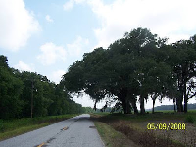.jpg)
.jpg)
And, there she was at Ellerslie, the location that bares her name.
.jpg)
I still don't know the history. I should have knocked.
.jpg)
.jpg)
The mystery continues. I have other sources besides just going there, I know I must?
Just down from Ellerslie was this home.
.jpg)
The fence appears to be the same. It must be on the same property.
I don't keep good records.
I almost cut the tower out but decided to keep it.
I see several contrasts in this picture.
.jpg)
Here's the old store and an old house that I would return to on the way back up.
I would be looking for old cemeteries that had Gordys in them. An old cem was shown as being here.
.jpg)
.jpg)
I was where it said Gordy was located. I saw this sign and a bunch of posted signs but took those as meaning to the side of the road. I was checking this out. If stopped, I'd tell them I was with the Zebco Team or something. Wasn't the fishing tournament here?
.jpg)
I had truly arrived. Why a pumping station?
.jpg)
.jpg)
The water seemed much higher on the Bay side. I couldn't figure out an angle to show you that. Here's looking out the pumping station canal. Those are crew boats out there near the bay. They take folks out on tours to Oil and Gas Platform Land, not a part of Disney World though some say there are similarities.
.jpg)
.jpg)
I crossed over the levee to another world.
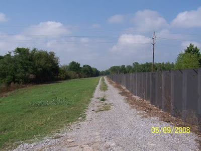.jpg)
A world that seemed to be sinking.
.jpg)
A side road said it all.
.jpg)
In all honesty, there could be another factor causing the high waster besides Louisiana losing herself, which is daily. The Atchafalaya River which empties just east of here is bringing a lot of water down, one third of the Mississippi's flow or more in this flood season.. That could be raising the water level in the bay causing this. The road looked Ok and I continued on.
.jpg)
Burns Point came quickly. I was glad as the sun was dropping.

My wife wants to watch a movie so I have to go fast. The next pictures are of panning through the campground. You are on a self guided tour.
.jpg)
.jpg)
.jpg)
.jpg)
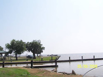.jpg)
.jpg)
Next is man's answer to being bothered by hurricanes while in a private moment.
Yes, it's built like a brick .............
.jpg)
After leaving the rec area, I came back to the intersection where the GPS said that 317 continued. It was a sometimes limestone road. There were posted signs but they were to the sides, also. I was going to see what was down there.
I arrived at the end of the road and was presented with this sign. I sat and pondered. "Safety, Think About Your Role Here" It's a shame you can't read it.
Click the pic for a bigger version.

What was that?
.jpg)
I hoped that my role did not include climbing it.
.jpg)
I mozzied over to the little landing which was closed.
.jpg)
There was a barrier float across the bayou.
.jpg)
This was looking toward the bay.
.jpg)
The ride home would commence with a stop at a tree that reflects how this place has seen a history of rough weather.
.jpg)
.jpg)
.jpg)
In the last chapter I had turned the bike around and was heading north from Burns Point. The next few pictures are of the roads off the roads which were flooded. If you can't visualize LA sinking away, these will help.
I guess we'll have to grow gills to go with our webbed toes.
.jpg)
.jpg)
.jpg)
I returned to the little house above. It is next to a location where a cemetery was marked on the gps. The woods adjoining the house were thick with a menacing ground cover. Today was not the day to encounter a snake. I passed up cemetery hunting.
Across the fields a crew was working on the protection levee, the same levee that the pumping station was on. I guess, the tilt of the land creates a basin to the west side, thus the pump.
.jpg)
The next cemetery was easier and safer because of this gang.
.jpg)
.jpg)
.jpg)
.jpg)
I am sure Froggie and the his merry group of amphibians, Myrtle and Bosco, keep the place lively for the residents. The morning and evening serenades are no doubt enjoyable events keeping the assembled spirits high. Seriously, we have the most vocal frogs in the world. You know the ecology is OK if you hear frogs. Stop hearing them and find out what the problem is, because you have one.
I lingered until the first croak telling me that all was well.
.jpg)
That was an awesome place.
I was now getting near the Intracoastal Canal bridge. I was determined to stop on top for a shot or two. I was in a precarious situation, constantly looking in the rear view mirror for an on coming UPS truck that I knew would be returning at 80mph.
These are the shots. I know the first and second are similar. For hanging my butt out on a limb with my fear of heights, you have to see them all.
.jpg)
.jpg)
.jpg)
.jpg)
.jpg)
That's where the train cars had come from.
I followed the railroad on into Baldwin and found this sitting on a siding.
What was an engine with "Mountain Laurel" on its side doing in south LA?
I have a request out for info.
.jpg)
If you are a nutzoid railfan, here are two links for you. CLICK HERE
The LDRR markings on the side are explained HERE.
Mais, that's the train that comes to Breaux Bridge. The information on that site
really answers some questions that came to me while I was counting cars at the crossing. I feel as if I've experienced an epiphany.
CLICK HERE for another picture of 1851.
.jpg)
Baldwin was a wide place in the railroad world locally, I'd say.
The house, pictured below, is painted in what I consider "railroad colors", depicting a railroad camp, possibly, at one time.
.jpg)
Ok, Greg and Jeff and Bob, this is what you wanted.
.jpg)
.jpg)
I spent an hour wasting gas looking for an imaginary bridge in Baldwin and then left. I hopped back on the interstate and came to screeching slide when I saw this:
.jpg)
It's near the Franklin exit on US 90. Its the Cajun Coast Visitor's Center. I haven't been in there but I have seen some pamphlets with their name on them. From canoeing to plantation browsing, the info is in there.
That's it for this one. Later, Steve
PS, I almost forgot about old Captain Gordy. Nope, no information or connection. There were 2 houses at Gordy. I didn't feel lucky so I didn't bother the residents with questions about an old guy that might have lived there, say, 150 years ago.
It is pretty much like this one but, actually, the pictures are better. Plus it takes you up to Garden City for something special.