In the last chapter, he was headed out of Iota going north toward Eunice on La.91. I'll be reading form his notes if possible. 91, north of Iota is a pretty good road. It gets you where you want to go, but is not a straight boring line.
I remember when he was following the old Southern Pacific Railroad right of way,east of 91, he took some pretty dusty back roads that got the job done, but were none too fun. I wouldn't have gone down any gravel.
He said that going through south Eunice, he had the luck to slightly precede the MLK parade for seven blocks. He told some politically incorrect story about that experience which I can't repeat, being, myself, politically correct. I found him quite agitated with that portion of the trip. I'm guessing that babies running into the street would be agitating.
He said that, finally leaving the parade route, he'd been bitten by the railroad bug again, mentioning that Eunice has that effect. For some reason he got it in his head that he wanted to do a better job of exploring the fields between Eunice and Mamou. Here's something about the Rock Island and the Texas & Pacific had both traveled north from Eunice to the the home of Fred's Lounge, my interest, in Mamou. He started taking pictures. First was a trestle over Bayou des Cannes, just north of Eunice. It ain't that picturesque, further exemplifying his great talent as a photographer as he sees himself.
.jpg)
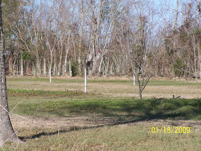
I thought that was a pretty good picture, too, I hate to admit. Steve knows where all these pictures were taken, but I have no clue. I'll look at them and if any look any good, I'll post them. I don't know where the heck he is, which is good. If he was around he'd have me post them all. He has this one in the Rock Island stack, so I guess that's what it is. I suppose it's the old bed of the Rock Island RR on the way to Mamou? A chilling picture.
.jpg)
He has this one listed as La.374, Fenris, La. He mentioned that Fenris had a station. I've been through there and I didn't see any station. It's right of3 La.13, the main highway out of Eunice headed to Mamou if you want to look at a road patch.
.jpg)
Then he has this map with the other railroad line on it, the T&P, the green line. I don't get it, but that's what he's into.

He told me that he was all excited that School House Road followed the old T&P line. He said he found a Katrina era RV campground. All the water lines were still there. Oh, you might not know this, but the displaced residents of New Orleans lived everywhere land could be found for trailer parks. This dusty road in the middle of nowhere, along a deserted rail bed seemed to be the place the gov wanted to put them. Good choice. I don't think it has a future as a resort. It could be turned into free housing for illegal aliens if Obama's people think of it. Please don't mention this idea, I'm just the surrogate author here and Steve will kick my butt if he finds out I said that. I don't think he's even going to read this. He's real burned.
.jpg)
.jpg)
Pretty flat out there. What is that silver thing? Looks like one of those cookie cutter water towers he was talking about back in Esterwood. Hell, as turned around as he gets, it could be Esterwood.
.jpg)
I think this is pretty useless, but he wanted these GE maps included, starting at Eunice and moving to the north, ending in Mamou. Evidently two old lines came in from the south, and two old lines left. Now you know. Don't you feel empowered?
Click them to make them bigger.
See the "TP" on the map by the yellow stick pin, maybe it was a storage yard? I doubt if Steve knew. Could I be getting interested in this junk? Doubtful. The white line is his attempt to follow whatever. The red line, he said, is the Rock Island, leaving Eunice and shadowing the T&P in green. He told me to remind you to CLICK THE MAPS TO MAKE THEM BIGGER. I never do. Then I have to click to get back. It's a pain and a waste of time.


That trestle picture was taken where you see "RI Trestle". That picture was about as good as it gets on this one, so lower your expectations if they haven't already self lowered.

Next, you see Mamou. The meandering white line is him, again. Notice a "TP" again noted on the Google Earth map where the T&P, green line, enters town. The Rock Island enters to the west and exits. The T&P comes in on Railroad Street. How far it followed the street, he has no idea. Then it stopped. Where? Who cares?

Here are a few "industry" pictures he took up and down the RI bed.
Imagination switch on? He should have drawn them in. Whatever.
This is the Rock Island coming from Eunice.
.jpg)
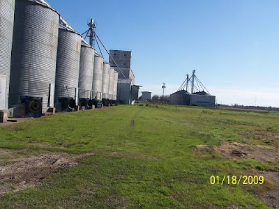
Turn around and this is what you'll see. Notice one of the old dryers is being torn down, very sad. Join me a Fred's so we can get sloppy drunk commiserating lost rice facilities in southwest La. Another good drinking excuse is to commiserate lost sugarcane mills. If that doesn't work we can talk about lost hair.
.jpg)
He's also into these tin buildings. There will be more. This one was on the RI rails. Look, I'm just reading his notes. Back off.
.jpg)
.jpg)
OK, that's it, I hope he changes his mind and comes back because writing these things sucks. But, he hired me when no one else would, so......you know how that goes. He has more boxes of pictures for me to post labeled Lindsay Downs, Lawtell and Leonville. I don't know. I may quit, too. Later, Fred.
CLICK HERE TO GO TO THE NEXT PAGE [He has a gun on me]