I'd explored Oakdale and I'd explored Elizabeth. I had realized that being mill towns there would be a lot to cover and it would take some time and work to do it.
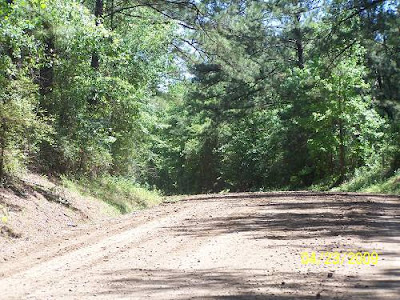
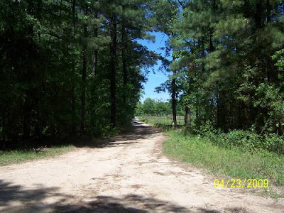
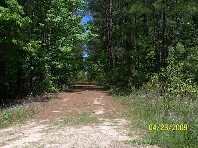
During the last write, I had longed to be rid of the heavy lifting parts of the exploration. I wanted to leisurely check out the ghost rails in the forest west of Elizabeth. I didn't want to figure anything out, just to peer down the long straights and watch the pines close in on the old right of ways. I had noticed that some of it dropped through the Vernon District of the Kisatchie National Forest. I figured that would make for some pretty riding amongst the pines. I figured right.
Then I'd have De Ridder to explore. I was hoping my route would work and it did until the end.
I've had a very hard day and this write is being done under the the influence of exhaustion, so hang in there, it could get ugly. I don't know where to start so here's this neat picture of my bike on a lonely dirt road south of La.10.

It says so much in that it encompasses every emotion I've ever experienced.
Fred, it's just an overexposed picture. Get real.
Oh, geezus, Fred is back.
I left the house. I drove up some neat roads and landed in Oberlin. US 165 is bout the only way north out of Oberlin to Oakdale. There are others but I'd still be riding those dusty dirt and gravel roads. I needed to make time because I had to get to Texas going the scenic route. I cruised into the south side of Oakdale and saw this:
.jpg)
Don't start drooling on yourself expecting me to stop the ride and give you a bunch of information on this engine. You'll have to wait to the end for that. I just made a note so I won't forget. Oh, and don't try to skip ahead by looking in the page list, I'm hiding the end page in another universe.
Pumped with my discovery and packing 2 spikes found during the inspection, I hoped back on the bike and turned west atop the old J&E RR. La.10 sits on it for a brief stretch heading west from its intersection with US165 in Oakdale. Not everyone knows that.
I felt a release as I passed the Oakdale mill. I was on the hunt with new stuff to find. Soon I saw a previously missed chance to visit the ROW shortly after crossing the Calcasieu River. I guess I was still stuck in the old rides. There are those among us who live for these shots. You want those people occupied, so play along for a while. Consider it a service to your community.
.jpg)
Speaking of "those people", I wanted to show Everett where OLD Main line hooked up on the Oakdale end. Like he didn't know. I had made it to R1 and it was closing in on 12 noon or after. I'd have to hustle but I was not going to blow off my chance to see it all.

The next pictures are R2, R3, R4 and the community of Dido. Look at the road configuration. What's going on there? Looks like a subdivision but it ain't.

I was riding along and had to stop. I needed to be up on the ROW. I visualized another La.465 moment like I'd experienced on the RR&G. That was magical. This one fell a little short. It might have been the lighting.
There's the elevated ROW back 60 or more feet from the road.
.jpg)
Climbing the fill, what did I see!!
.jpg)
The ROW was overgrown so I won't waste your time. That's the road down there.
.jpg)
La.10 almost looks like a road in Arkansas or the Carolinas at this point. I love mountain streams.
.jpg)
R3! You believe that?
.jpg)
Here's the highlight of the La.10 section of this ride (past Elizabeth). Best be seated.
.jpg)
This one was taken on a road south of Dido.
.jpg)
Next stop would be Pitkin. I talked to a cute lady there who told me that what I was looking at was not an old building. She was right.

Railroad street, just off La.10, is on the south side of the J&E.
.jpg)

I forgot to ask her what that was. It was right on the rails. There was a siding in Pitkin.
.jpg)
Pitkin didn't spring up yesterday.
.jpg)
I saw something written on the front of the building. I took the shot hoping to be able to pull the letters out digitally. I failed.
After Pitkin the "rails" started dropping away from the highway. Webster Maricle would take me back down to them and give me a chance to see if I could reach Nitram (Martin spelled backwards). Oh, I don't know any Webster Maricle, I should have put Webster Maricle Road. I'm sure he is or was a good person, I just don't know him, OK? I know nothing about Nitram, either, besides that it was on the line. I was just trying to find it. Got a problem with that?
The pictures that look like old railroad right of ways, are. I perceive a little attitude problem at this point. I may have to put this aside or get an adjustment.
.jpg)
I fully expected an out of control log truck to come around the corner. This was basically a dirt road. I was probably riding it the first day the mud was gone.
.jpg)

There might be other trucks. Or bigger.
.jpg)
That farmer's road would take you to Nitram. I didn't feel like asking.
.jpg)
Where have you seen that picture before?
.jpg)
Next up would be Cravens and Sugrue. I saw nothing shoot-able south of Cravens. Down Johnson Road, I did. Again, there was a siding between Cravens and Surgue

I was now approaching the National Forest.
.jpg)
That's the ROW. There was also a no trespassing sign. I at first thought that was a National Forest sign, but it isn't.? Oilfield, maybe.
.jpg)
That was looking west, this is looking east at where the siding was.
.jpg)
The rails were dropping into the National Forest. (I think I said that already?) I was headed to Drakes Fork Cemetery near where I'd find the rails. Can you imagine the ride those guys would have? Maybe not. These trees are "new". I'll bet this place was nothing but stumps at one point or more.
.jpg)
.jpg)
When you see pictures of the bike taken from some alley, you can assume it was a pit stop. I'm only mentioning that to keep it real and to avoid stupid Guest Book questions.
.jpg)
This one was taken looking the other way. Wow!! Being there was as good as the La.465 experience. This lane was traveled by steam and diesel from the very early 1900's to the 1970's, I think the fisherman said. I was standing on some real history. Sometimes it gets spooky. As we can see, people and things leave trails, duh. But, there's more to what they leave than the obvious residue. Sometimes I don't know if what I'm looking at is real or not. Have you ever seen the movie, "Predator"? The movie makers used a technique that resembled what you see trough hot air rising. You know, the wavy looking phenomenon. The fisherman had a hat on with "Predator" written on its side. See what I mean?
.jpg)
There was some kid running a pickup fast with no mufflers up and down the road. I think he came back to check me out, but I'd hidden down the cemetery road. I didn't have time to cruise the cemetery. That's a first.
.jpg)
I retreated back to 10 and headed west to the next road. I would be leaving 10 and head through the forest.
.jpg)
This is not Obama Country. I think he'll find out that much of our country isn't.
I was headed into the NF on Marlo, aka NF402.

The rails passed Markee. I stopped below where it had been and looked up the rails, no Markee? I was now beneath the forest.
.jpg)
.jpg)
CLICK HERE FOR PAGE 2
I had reached Chuchman Rd. I think I'll take a pit stop here for the night. I was hoping to make it into DeRidder, but that ain't happening. Time for popcorn and a bad old western movie. Yea, I know, I'm a party animal.