The Jasper and Eastern RR.......Going West 4

All the maps can be clicked to enlarge, a necessity.

Here's the last page. It's a collection of stuff I should have included on the appropriate pages but was too lazy to do it. First, some added maps.

The J&E continues to Kirbyville. Now you know the source of the town's name. I will probably not trace the Texas portion to J&E Junction from Bon Weir. It's just too far out there. Or, maybe I will because it is too far out there. I need goals or nothing happens. Here's the added stuff.

Merryville is an interesting place. With a little research and time, there's no telling what could be discovered. I believe its history is linked to the disputed area between lands owned by France/USA and Spain.


DeQuincy is an interesting place. It has a grand old depot and the town has a yearly Railroad Festival, I think. Anyway It was a railroad center and one of the anchors of the grand design as I see it. My software shows past and present rails going into that town so I'll share what I see.


Down at Lake Charles it looks/looked like this. Everything tied together.


DeRidder was a crossroads, also. Read Block's write on Calcasieu Parish back on page 3.


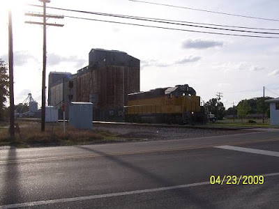
Now here's the mill engine I found at Oakdale. Of course it was no secret, sitting 50 feet from US 165 in south Oakdale. E lusted after it, but being denied gave me reasons he didn't want it. I've used that rationalization with other lust. I was thinking of fast motorcycles, Gilbert.


Here's looking at the old yard. The pictures were taken from the RROAK weigh point.


And what about that "Do Not Hump" graffiti?

Several "friends of History Hunts" chimed in.

"Just in case E. hasn't gotten back to you, humping refers to a method of shunting freight cars around in a railroad yard. Many yards were built with a slight hill or hump, and the crew would run the train until the cars were on top of the hump, and uncouple them, one by one. As they were released, gravity would roll the cars through the yard, while in the tower, someone would work the levers to throw the switches so the car would roll to the correct place in the yard (this is how they would make up new trains that would later leave the yard). You might wonder why they didn't just shunt them around with an engine - too time consuming.
Obviously this is hard on cars and contents, especially if the car picks up a bit of speed rolling down the incline. The railroads had methods of slowing the cars down, but still there would be some crashing and banging, plus the risk of derailment.
Cars with delicate contents, and especially tank cars with hazardous chemicals, would be labeled "Do Not Hump" for such reasons.
I can't imagine why the railroad would have a locomotive labeled "Do Not Hump". I wondered if the phrase was spray painted on it as a joke".

That was a wonderful explanation, thanks V.

E. did get back and offered this. It has been considerably shortened due to a lack of bandwidth in the northern hemisphere.
"....now for the engine in Oakdale. It is a 4 wheel GE diesel of the type used to switch a steel mill.... but no one seems to know anything about it. [it might belong to the parish?] No one seems to know how it got there, what it is doing there, or who it belongs to. ....it could belong to International Paper because they are the people who own Arizona Chemical....."

"The Do Not Hump refers to sending the locomotive over the hump in a hump yard, where they push the cars up on an artificial hill, and when they roll down, they are navigated to the proper departure track to get to the train that they need."

He added some tick knowledge. Now there is some useful info, especially for the likes of me. Here it is: "The Louisiana Wood Tick does not carry anything bad like Rocky Mtn. Spotted Fever or Lyme disease. Get it out clean, put lots of antibiotic ointment on it and eventually all you have left is a red spot".

Of course E was the one interested in the railroad ties seen on page 2. He asked, "Do you have any idea who owns all of the ties in DeRidder?...... I think that the railroad still belongs physically to the Burlington Northern Santa Fe, but the company that operates the line is called the Timber Rock Railroad. I wonder which entity actually owns the ties, or if they are selling them somewhere? I could still use several hundred ......"

I offered a solution but he has not responded.
That's it. I hope this article has found a place on your library shelf. If not, give it to someone, sell it at a garage sale. There's bound to be someone out there that will buy it. Oh. I want to show you what Al just found at one of those garage sales for 3 bucks.


He goes to those things at 6 AM. Now I know why. Bye.

The Jasper and Eastern RR.......Going West 3


I rolled into Merryville after dead ending Graybow at Shulz. I took Shulz south to Oneal Oilfield Road which took me west crossing Bear Head Cr.and running into Frasier which brought me into town. What a perfect vision upon entering.


Here's the back of Burke's cabin. I'll include a link later if I can find my old page on Merryville.


That's where I was when the cop showed up.

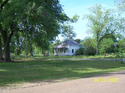
I took these pictures of the old houses across the tracks. As I've noticed the green roofed one is a classic design associated with mill towns or maybe, west Louisiana. It's style is called pyramidal, I later find when reading about Longville.


I touched base with the old theater, it still waiting for help.


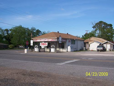
I asked a fella there where to find gas and I did on the way to Texas.


Shortly before the border I hoped to see the rail bridge over the Sabine River. It meant a lot to me but it never fails, a hunting club blocked the way with really scary treats. Having met a cretinous example of this breed up at Barbeck, I didn't push my luck.


At Bon Wier I shot these pictures. That's looking down to the Sabine.


I imagine this is where the station was.


I crossed back over the river.


I had seen a sign to the Merryville Welcome Center. I wanted to check it out. I, instead went down the wrong road which crossed the tracks. That was cool. There was a side track there.


There was a crew down the way working on it.


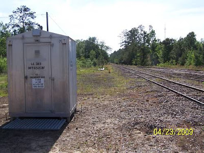
For your records, that is the La.389 crossing.

I've been working on the railroad
All the livelong day
I've been working on the railroad
Just to pass the time away

Can't you hear the whistle blowing
Rise up so early in the morn
Can't you hear the captain shouting
Dinah, blow your horn

Dinah, won't you blow
Dinah, won't you blow your horn
Dinah, won't you blow
Dinah, won't you blow your horn

Someone's in the kitchen with Dinah
Someone's in the kitchen I know
Someone's in the kitchen with Dinah
Strumming on the old banjo, and singing

Fie, fi, fiddly i o
Fie, fi, fiddly i o
Fie, fi, fiddly i o
Strumming on the old banjo

"The origins of the tune are unknown. Some trace it back to a "Louisiana Levee" song of African-Americans. Others believe it is an old hymn adapted by the Irish work gangs in the West. The verses of "Dinah" and "Someone's In the Kitchen" are later additions. The tune was also adapted by Texans as The Eyes of Texas are Upon You. Dinah may refer to a woman OR a locomotive. The horn signifies the call to lunch".

Lyrics and paragraph ripped from HERE.

I returned to 190 and tried the next road. More surprises. I found the log mill. Was it the location of the abandoned sawmill where Leather Britches had hidden out?
Read this story. It is by Block. Click Here.

This was classic. You could see where the rails had run around a lake.


This is what was left.


There might still be a small operation going on there.


I left town on La.110 which takes you to Singer, where the trouble had started.

Here's another link featuring the mill wars. We have traveled through the thick of it. CLICK HERE FOR A WIKI CONTRIBUTOR'S TAKE ON THE WARS.
.

I was on to Longville. Longville is a very pretty place due to the mill lake on La.110 A few remnants of the mill are still there. Here's a bunch of pictures. You can tell when I'm getting tired. It burned down in the '20's.


I crossed US 171 and saw the old bank. What I didn't think to look for was remnants of the old railroad, remember "Longville Railroad" that originated on the top side of the mill at DeRidder? Block's article clarifies its origin and naming. Here's the bank.


The front faced away from the present highway. The main road must have been one road east. The back was on US 171.


Further back I found this.


And this:


There was another pyramidal "Mill House". It is the same design as were those at Elizabeth.


Then I saw the store.


I think it's time for Mr.Block to explain. CLICK HERE.

It was time to boogie. I headed south to US 190, a very familiar road. At Ragley, I found this. The south Beauregard Library and Sheriff's sub station are there.


Here's where the Longville Railroad came through.


The location is marked as 190RR. Here's looking east on the Union Pacific.


Approaching Reeves, I saw quite a few of these cars sidetracked.


This stretch tugged at some old memories. We would drive from Lafayette to go swimming in the Whiskey Chitto River.

I got to Kinder and the old store was still there.


So was the rice mill. What was that light coming from the west?


More of Kinder:


These places were on Railroad and 10th Street.


Leaving Kinder on 190 I passed Slim's. Slim's looks like the definition of a road house.


I'd expect the likes of T.K. Hulin or the Boogie Kings to be playing there, not some KSMB disk jokey. Geezus.

Into Elton I rode. I was out of the pines and into the plains. Elton has some great steel buildings.


Why would a saloon have a zip code on the front of it? I bet it was the post office.

This looks like a classic hardware store. The upstairs could be for storage or more floor space or a residence.


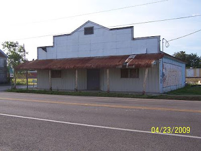
I remember the mural being pretty good on the side of this building. It was faded and so is my memory.

Ah, a Canal station. I think they used a lot of the Spur philosophy of being near the tracks for resupply. There were many Canal bulk stations.


Looming behind it was this place.


That's it. I turned south and rode fast down La.26 to Jennings. Then I did what I do only in emergencies, I hit I 10 and rode more faster. I beat the sun down arriving at 7:30. I'd been on the road since 10:30 covering 330 miles and taking 240 pictures, many of which were near duplicates. Oh, 2 more things, the Oakdale engine and the rail configuration of Allen, Beauregard and Calcasieu Parishes, sorta. Later.
PS: Plus some other stuff.

CLICK HERE TO GO TO PAGE 4