Visiting the Stores and Locks p.5

Welcome to the private viewing portion of the website. You are here because you filled out the required paperwork which granted you temporary membership. On with the ride.

On the last page, Bob had yelled that the train was coming, then he disappeared.


Then, by some electronic phenomenon, I started receiving signals from the train's forward mounted camera which probably feeds its "little black box".


As quickly as the camera had picked up the signal, it was gone. I continued snapping away in hopes that it would return.


The bridge popped up almost immediately after the last car had cleared.


Bob had gone into the store for a beer. He evidently thought that he had time.


Here's looking at the bridge from what was probably Bob's perspective.


I told him I'd take him over to Morgan City.


Next is a little catch up page.

CLICK HERE TO GO TO PAGE 6

Ever been to Ebenezer p. 5

Hi. I'm Fred. Steve told me to finish this thing before I could quit.

OK, already. Where did I leave off?

Here's the map of the next stretch of his seemingly mindless ride. He said he was done with the railroad stuff in Mamou. I failed to ask how long it took him to come to the conclusion that there is so much, and then that's it. He gets stuck in ruts and then wonders why no one reads these things. Below is the map. He said the ride wasn't doing much for him either and headed home as directly as he could. I think US 190 was the direct route and it got intolerable so he tried an alternative route but the bridge was out and he had to return to 190 at Lawtell.


Being in Lawtell, a rare occurrence, he decided to take a few pictures of the disappearing history along US 190. I'll throw up the pictures, as directed. I'm really not paid enough to do extensive diagnostic evaluations and that only results in negative feedback, anyway. When I took this job, I insisted on no goofy guest book.

Here is a what remains of Lawtell. By the way, there was a United Gas Pipeline camp where the employees lived back off the main street. I remember visiting there. He told me not to mention anything personal. I don't care, I'm quitting after this one, anyway if he doesn't pay me more.


This is a grocery store. He told me to put something. Looks like camping is allowed. So, everyone, let's pitch our tents in Lawtell.

Here's some rental place. It has a T&P generator out front. I wonder if China stole the name of that once proud railroad? Mike is not going to be happy. He's Steve's problem, I just work here.


He evidently likes old service stations. Old, rotting, disappeared stuff, what's the deal?


Across the street was a large combination service station and garage? Looks like a big workshop on the back. My guess. I'm sure I'll hear repercussions for guessing.


Down the way was a mill or something. He knows people who'd know, but tee hee, he ain't here. Hold the phone, one of his buddies just called in and said it was a lumber mill. That led to a lot of ancillary information about a museum, 3 honky tonks, wild nights in the late 50's and 60's and a discussion of the youth of today. I couldn't get her off the phone. I took notes as directed by the caller. She said if I didn't she come meet me and I believed her.


I'd say this was an old bank.


Looks like it did pretty well and they had to expand the vault.


He usually looks pretty close at these old building and tries to figure out the story on them. Either he didn't this time or has just blown off all that? Here's another of his tin buildings.


And one of his signature old houses. I didn't know there were any left that he hadn't shot yet.


That's it for my Lawtell assignment. I see I forgot to show his Lindsay Downs shots. Here they are. On the note he says this is the place he won his first and last motorcycle race and that the owner let him in since he told him that he was a past celebrity.

He told me he climbed this thing.


I don't think he climbed it too far. He doesn't really lie, it's maddening. Out there somewhere, he says, was the spot where he won the motocross race, crashing on the second one, being run over, and dragged for a full lap behind a Hondaka 2000. Damn. Hold on.


I, personally, think that's a bunch of........


So does that Longhorn, seen out there.
He'd probably thinks that about this page, too. Tough.
Steve had a box of Leonville shots. He can post them if he wants. Enough is enough.

To read the Ebenezer Ride again, from the start, if you are a masochist, CLICK HERE.

Ever been to Ebenezer p. 4

Steve got burned out. He asked me to finish it up. Don't expect much. My name is Fred. I've known Steve for a while. He says he mentions me, sometimes. He said I had to introduce myself. Why?

In the last chapter, he was headed out of Iota going north toward Eunice on La.91. I'll be reading form his notes if possible. 91, north of Iota is a pretty good road. It gets you where you want to go, but is not a straight boring line.

I remember when he was following the old Southern Pacific Railroad right of way,east of 91, he took some pretty dusty back roads that got the job done, but were none too fun. I wouldn't have gone down any gravel.


He said that going through south Eunice, he had the luck to slightly precede the MLK parade for seven blocks. He told some politically incorrect story about that experience which I can't repeat, being, myself, politically correct. I found him quite agitated with that portion of the trip. I'm guessing that babies running into the street would be agitating.

He said that, finally leaving the parade route, he'd been bitten by the railroad bug again, mentioning that Eunice has that effect. For some reason he got it in his head that he wanted to do a better job of exploring the fields between Eunice and Mamou. Here's something about the Rock Island and the Texas & Pacific had both traveled north from Eunice to the the home of Fred's Lounge, my interest, in Mamou. He started taking pictures. First was a trestle over Bayou des Cannes, just north of Eunice. It ain't that picturesque, further exemplifying his great talent as a photographer as he sees himself.


I thought that was a pretty good picture, too, I hate to admit. Steve knows where all these pictures were taken, but I have no clue. I'll look at them and if any look any good, I'll post them. I don't know where the heck he is, which is good. If he was around he'd have me post them all. He has this one in the Rock Island stack, so I guess that's what it is. I suppose it's the old bed of the Rock Island RR on the way to Mamou? A chilling picture.


He has this one listed as La.374, Fenris, La. He mentioned that Fenris had a station. I've been through there and I didn't see any station. It's right of3 La.13, the main highway out of Eunice headed to Mamou if you want to look at a road patch.


Then he has this map with the other railroad line on it, the T&P, the green line. I don't get it, but that's what he's into.


He told me that he was all excited that School House Road followed the old T&P line. He said he found a Katrina era RV campground. All the water lines were still there. Oh, you might not know this, but the displaced residents of New Orleans lived everywhere land could be found for trailer parks. This dusty road in the middle of nowhere, along a deserted rail bed seemed to be the place the gov wanted to put them. Good choice. I don't think it has a future as a resort. It could be turned into free housing for illegal aliens if Obama's people think of it. Please don't mention this idea, I'm just the surrogate author here and Steve will kick my butt if he finds out I said that. I don't think he's even going to read this. He's real burned.
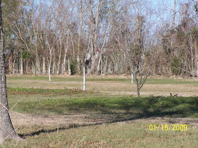


Pretty flat out there. What is that silver thing? Looks like one of those cookie cutter water towers he was talking about back in Esterwood. Hell, as turned around as he gets, it could be Esterwood.


I think this is pretty useless, but he wanted these GE maps included, starting at Eunice and moving to the north, ending in Mamou. Evidently two old lines came in from the south, and two old lines left. Now you know. Don't you feel empowered?
Click them to make them bigger.

See the "TP" on the map by the yellow stick pin, maybe it was a storage yard? I doubt if Steve knew. Could I be getting interested in this junk? Doubtful. The white line is his attempt to follow whatever. The red line, he said, is the Rock Island, leaving Eunice and shadowing the T&P in green. He told me to remind you to CLICK THE MAPS TO MAKE THEM BIGGER. I never do. Then I have to click to get back. It's a pain and a waste of time.


That trestle picture was taken where you see "RI Trestle". That picture was about as good as it gets on this one, so lower your expectations if they haven't already self lowered.


Next, you see Mamou. The meandering white line is him, again. Notice a "TP" again noted on the Google Earth map where the T&P, green line, enters town. The Rock Island enters to the west and exits. The T&P comes in on Railroad Street. How far it followed the street, he has no idea. Then it stopped. Where? Who cares?


Here are a few "industry" pictures he took up and down the RI bed.

Imagination switch on? He should have drawn them in. Whatever.

This is the Rock Island coming from Eunice.


Turn around and this is what you'll see. Notice one of the old dryers is being torn down, very sad. Join me a Fred's so we can get sloppy drunk commiserating lost rice facilities in southwest La. Another good drinking excuse is to commiserate lost sugarcane mills. If that doesn't work we can talk about lost hair.


He's also into these tin buildings. There will be more. This one was on the RI rails. Look, I'm just reading his notes. Back off.
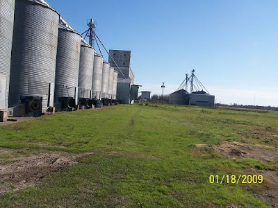


OK, that's it, I hope he changes his mind and comes back because writing these things sucks. But, he hired me when no one else would, so......you know how that goes. He has more boxes of pictures for me to post labeled Lindsay Downs, Lawtell and Leonville. I don't know. I may quit, too. Later, Fred.

CLICK HERE TO GO TO THE NEXT PAGE [He has a gun on me]

The Southern Pacific: Cade to St.Martinville p.3

Due to timing, weather conditions, and an opportunity to escape responsibility, I've decided to carry on with the ride up the Teche Valley on the Southern Pacific Railroad. Next will be a series of GE maps that review the ride from Cade into St.Martinville. I'm using this format with the sense that you believe, as I do, that you can't have too many maps, and you can't look at the same map too often. Plus they are great filler when you have nothing to say. There will be some real live pictures at the bottom of the page. You know how to scroll if you are not a "Mappie".

Here, we see B.Beyt Road, which I feel sure is the actual rail route, leaving the main line south of Cade, the true origin of this branch to St.Martinville. BTW, a reader described a link with B.Beyt Road which I found hilarious. Be careful out there, it is a small world and what you did 20 years ago can come back to bite you.


Next, we see B.Beyt intersecting with Lady of the Lake as the rails head east. Where the crook straightens is the approximate location of the beginning of the trestle that gently lowered the train over the shallows of Spanish Lake and Bayou Tortue until a point close to where you see "L" above in, "U of L Farm".


After leaving Delacroix, I believe the train continued to follow where L of the L is today, continuing along the gentle northerly bend and then leaving the road cutting across the corner of the field. This is pure speculation. It could have been anywhere between Delecroix and the Smede Hwy, La. 92. The next two pictures show the range I feel is correct.


I bent this one down a bit because of what I saw as a curve between "1" and "2". But, I see a stream which would have been avoided with the route above. Remember, we are talking about a 1920's route. The landscape could have easily changed.


This next section is right on except for the explained variances. The naming of streets, "Railroad", sure does help a track tracker.


Right up Railroad Street she went. Off to the right (east) you can see "Main Highway" if you click the picture. That is La.31 south of St.Martinville.


The rails continue up Railroad St. and cross La.96, the Terrace Highway which connects St.Martinville with Broussard. "Terrace" is pronounced "tay-ras". I believe that the terrace it refers to is the Coteau Ridge.


After La.96, the tracks bent toward St.Martinville Junction. There the train would go down a dead end track towards Bayou Teche where the depot was. It would have to back up to the junction to go north.


Below, the rails leave the junction and go to the depot. I believe that there was a spur off the south that serviced a feed store and maybe other businesses.


The humps from the old route are still easily seen and experienced in St.Martinville. See and experience them before they are gone. But, be careful, that area harbors some shady appearing characters which could be experienced, also.

Here are a few of the railroad related pictures I have of St.Martinville.

This is one I took of the GPS screen. The black triangle was my location. You can see the junction and the tracks going north to Parks and east to the depot area. The line going to the south was what got me started on this project. I wouldn't have begun it without some kind of "tangible" asset. The dark red line to the south is Terrace Road, mentioned above.


This is the view of the bed headed north to the junction from the above location.


There were humps in the road I wanted to show you but there were audiences everywhere and I didn't feel like stopping.

Here's the old sign down by the depot, east of La.31, just north of where La. 96 crosses the bayou. South of La.96 and east of La.31 is the historical downtown. The depot's location could have been associated with water born commerce.


Large semis were parked all over this open area. This had to be the location of the depot. I didn't look close enough at the cement to try to figure out what was its purpose.


This is looking from close to the bayou west to La.31.


This is the old building in the distance.


And, here is the old feed store that I mentioned might have been on a spur. You can see a semi parked to the right near the location of the depot.


The signs on the front of the building are some of my favorites.


I've inquired about being a distributor for Rooster Booster, a product that you can't have too much of. See, following old railroads can be interesting and advantageous.

Now, don't get spoiled with all those maps. So many were included because there are no articles on the Cade to St.Martinville Branch of the Southern Pacific Railroad anywhere in the world but here. I often make extraordinary statements in hopes of luring augmentations, corrections, or just to create chaos in certain circles.

Next, we ride the rails north to Parks. I have connections there and I expect some exptremely interesting information to flow from them. For instance, did you know that Parks was serviced by two railroads, the other being the Missouri Pacific which stopped at a lumber mill near the intersection of La.347, Bridge Street Highway, and La.3039, Nursery Hwy? You won't find that information, elsewhere, either, do you?

Next is the St.Martinville to Breaux Bridge stretch.
CLICK HERE TO GO THERE