(desk top size, so the text will not bunch up)
Passages found in brackets ([]) are my words.
Weight them lightly.
I've got this old mapping software that shouldn't have been for sale since it was so out of date. For a normal person, it would have been a ripoff. I have found it a gold mind which may reflect on my condition. I suspected it pictures how things were in the 1970's. I may have to roll that assumption back a few years after seeing what I have on this last outing. Since it is dated, it does not differentiate between what is still there and what is long gone, obviously. To find out is the game I play. I could research what I see on the map prior to traveling the required two 300 miles round trips it took, but that would be too logical and boring. I need a spur in the side to bolt me forth down the investigative trail. The thought of looking into a dark tunnel of an overgrown track right of way and imagining all that was associated with its disappearing history was motivation enough for what will follow here. I haven't investigated a ride to this extent since I found the roadside historic marker at Peason. This will take a while and it will probably get boring to most "normal" people. Here goes. I'll show you what got me started, first, a logical beginning, then proceed as the dominoes fell. Like always, the maps and pictures you see here are small versions of the actual pictures, "thumbs". If this size is insufficient to view easily, I suggest right clicking them and choosing to open them in a new window. Practice on the one below. You can see the two railroads leaving DeRidder at the top of the shot and going south to Lake Charles. I saw this and though that it was perfect for investigation since it was in a contained, symmetrical configuration in an area that I was somewhat inexperienced.

The 2 railroads dropped down from DeRidder and connected beneath the Calacacieu River in Lake Charles. I've never explored Lake Charles and this phenomenon was just what I needed to get me over there. After investigating the rail setup, where I had mistakenly perceived wharfs and petrochemical installations, I'd follow the eastern rails (or abandoned Right of Way?) up to DeRidder. Honestly, at first, Longville would be all I was interested in since I'd recently been there. As usual, my needs expanded when on the first ride I was unable to quite make it to Longville. I'd go back, do Longville right, and head north to DeRidder, a town which I was somewhat familiar since I'd followed the Jasper and Eastern Railroad from Oakdale, though it and into Texas to the town of Kirbyville.
I'm leaving out the shots taken on the ride to Lake Charles, a ride I accomplished without touching US 90, 190, or I-10.
RIDE ONE.
This would be an urban adventure with all the frills. A railroad right of way in an urban area is usually not the high rent district today. In the beginning they were the center of commerce and transportation. Now, they sometimes offer up a little history. I was ready to chance whatever the present situation. I had to take a look and ignore any adversity.
I entered Lake Charles from the north on US 171 after crossing Southwest Louisiana. The Premium Members got to see those photos in an earlier email post ride mailing. You can apply by using the guest book.
Here is a map of how I continued into Lake Charles. I have just found out that I was in Goosport. Get ready to learn about Goosport.

Urban exploration is best done during school hours, Rule 1.
I was there about noon, I had a couple of hours to check it out.
I came to the first crossing of a long gone railroad where you
see CR1. Even this old map does not show the rails there. It must
have come from the north. I noticed that after it crossed the street
it bent eastward. The X says "2 Tracks". From the map I have
I can't make sense of it. Let's don't get bogged down. It was either
a spur or a connector. That covers it.
.jpg)
I made a bee line to the main line. The ride down through
the neighborhood had seemed endless. I enjoyed the openness
and relative emptiness of N.Railroad Ave. Knowing that
I was in a historic place, I began looking around for some
historic architecture.
.jpg)
A few old stores and warehouse were all I could find. I
think the area had fallen into such poor repair it had been
cleaned out. Hurricane Rita might have done some of the
work. What was there was marred with graffiti. I felt
sorry for the residents who actually had any pride in their
neighborhood.
.jpg)
.jpg)
I moved west on North Railroad Ave toward where I saw
my railroad of interest meet the main line (UP).
.jpg)
That was it ahead. To the right was a robot engine.
.jpg)
Pretty freaky, eh? That was a first for me. Who blows the horn?
Now Here's the facts on the "engine" from L.McManus
You depicted in Lake Charles what you called a "robot locomotive." That's what's properly called a "slug." It's an old locomotive that has had its cab and internal machinery all removed and its body cut down and filled with concrete for weight. The electric traction motors on the axles remain. A slug operates only connected to one or more regular locomotives, from which electricity is supplied to its traction motors. Why? Well, locomotives doing heavy yard switching (like they have in Lake Charles due to tank cars from all of those refineries) will tend to spin their wheels when trying to get a long cut of cars started. One solution would be to use less power and move fewer cars at a time. Another solution would be to use a slug to provide more powered axles for more traction. It's like shifting an SUV or truck into 4WD when the going gets tough.
I crossed the tracks (are you following along on the map?)
But, first I took a good shot of the wye set up for my rails going north.
Seeing that there were rails here made me believe I'd be following a live
line. That, in some way, took a little of the romance out of the hunt. But,
hope was alive since I'd found a crossing with no rails. But, it was off track.
I didn't linger thinking about that, not wanting to get off track, also.
I wanted to get this urban part over with.
School busses would be stopping soon.
.jpg)
Another old market was across the main line. I knew this
was old Lake Charles. I saw Ryan Street which was the
historic "main street", if I'm not mistaken.
.jpg)
After a second or third look at this picture, I am either
seeing railroad tracks, or street car tracks (I've seen old
shot of the streetcar lines) or shadows from the power lines.
I'm going with "streetcar" or "rail". Please place your vote.
Riding back west to the crossing, I came to a scene that I'd
seen before in Jennings when Al and I had visited there.
Andy had sent me a picture of the Jennings spot, also.
.jpg)
Oh my goodness. I looked around.
.jpg)
I knew what I was looking at.
.jpg)
I closed my eyes and what did I see?

The last depot on that spot suddenly appeared.
This Southern Pacific depot had burned in the 1980's.
I'm guessing that it had been built in the late, late 1880's or '90's.
Railroad Ave had previously been named "Battle Row".
This from HERE:
"1960/1970 Ryan Street was the commercial and business hub of the area with continuous storefronts from Mill Street to Clarence Street. There were department stores, specialty shops, diners, theatres, drugstores, professional offices, hotels and government offices in a concentrated area downtown from Front Street (now Lakeshore Drive) to Hodges Street. In the early 30's, Ryan had supplanted Railroad Avenue (once known as Battle Row) as the principal commercial street. In Sulphur, Huntington and Napoleon served the same purposes. Each town had its urban core. As the 50's slid into the 60's and 70's, the growth of the automobile culture began erosion of the urban core".
The writer is noticeably irked as he continues:
"In Lake Charles they tore down the Calcasieu State Bank to build nothing. They tore down the Majestic Hotel (which housed every president from Teddy Roosevelt to John F Kennedy) to build nothing. They tore down the Paramount Theatre, a real movie palace, to build nothing. They tore down the Elks Home, the Weber Building, the Kress Building and Woolworth Building to build nothing. They tore down the Missouri Central Station; they tore down the Kansas City Southern Station. The Arcade Theatre (where Houdini amazed the locals, and where the St Louis Symphony played to sellout crowds) caught fire and then they tore it down. The Southern Pacific Station was torched, then they tore it down. And while they were tearing down most of our visual history, they ripped up the wharves and warehouses on the lake and filled in 64 acres of lake and built 40 acres of parking lots and a marginally attractive Civic Center. And they blocked the major north south road to construct a pedestrian mall and produced a maze of one way streets to nowhere that virtually killed down town Lake Charles".
Sorry, he's not irked, he's pissed. I would be too, in fact I am. I suspected the depot had been torched being in that area. It was a thing of beauty. Some people only have destruction in their hearts. I'm fighting a political rant as I sit here because our government is doing the same thing to our country. That was a great venting. Rants are by crazy people.
You should read his whole write, it is an insight into Lake Charles. I had no idea, but suspected that the town had had a great past, but had self destructed.
I'll continue:
I looked to the right and there were the old baggage wagons.

I blinked again and there was the first engine to come
into Lake Charles. My blinking was getting freaky.

Then a vision of the flood in 1913 appeared . Bet it was wet where I
was now standing, being so close to the lake and bayous.

Below was the first SP depot in Lake Charles. It lasted
from 1880 to 1889 when it was torn down for the one
above, maybe?

Then, a band started up.

I told them thanks but I had to go.
The Mayor, Sheriff and Deputy were not amused.
It wasn't the first party I've ruined.

I mentioned I was in what was known as Goospoint.
"Goospoint" will be mentioned again on up the line. You need to
read some stuff first. There are several articles by the W.T Block
that really make the scene come into focus. CLICK HERE
In that article is the first hint of the railroad I'll be following.
I'm just getting a handle on all the names, so don't let my confusion
slow you down The article puts in chronological order the progression
of lumber mills in Lake Charles. Below are excerpts from that write.
I suggest reading Block's complete story I was only looking for the background
on the rails I wanted to follow which were the ones from LC to Longville to De Ridder
Here, they are first mentioned, I think :
"The Bradley-Ramsey Lumber Company built and chartered its own tram road, the 36-mile long Lake Charles and Leesville Railroad, which ran from Goos Bay to Bannister, north of Longville. In February, 1906, the mills used seven locomotives and 120 tram cars between Lake Charles and the company's "log front" near Longville. In the 1915 railroad map of Louisiana, a line identified as the Lake Charles & Navigation Railroad [had they used a ferry like the LN&R had?] ran northward to Deridder, and it looked suspiciously like the same line".
Bingo.
The next step (from the same article):
"Beginning in February, 1906, rumors became rampant that Bradley- Ramsey was selling out to Long-Bell Lumber Company of Kansas City. In fact, W. E. Ramsey was out-of-town, reportedly negotiating the sale and seeking to convince the Bradley stockholders to sell out for the reputed sum of $4,000,000. Lolng-Bel already had two wholly-owned subsidiaries, Hudson River Lumber Company of Deridder and King-Rider Lumber Company of Bon Ami, the latter cutting 350,000 feet (day and night shifts) daily, making it second only to the Fullerton sawmill"
"Almost immediately, Long-Bell reorganized the two Lake Charles saw
[Whoa, I think there is an old building by the tracks with that name on it.
We'll see that later].
Much modernization went on, and:".....in 1906, Long-Bell built its large Longville sawmill, with its 150,000 feet daily capacity. That mill burned in 1920 and was never rebuilt; its planer was converted to an oak flooring plant. In 1913, Long-Bell bought out the big Ludington sawmill, along with its 65,000 acres of timberlands, and 2,000 acres of the Ludington pine trees were transferred to the Calcasieu Long Leaf stumpage reserve. By 1913, the six Long-Bell sawmills in Southwest Louisiana were cutting 1,000,000 feet daily, which leveled the company forests at an unparalleled pace. The Lake Charles Mount Hope sawmill was one of the first to dismantle. The Bon Ami sawmill cut out in 1925 and was dismantled. The Ludington mill cut out in 1928. The Longville oak flooring facility was moved to the Hudson River plant at Deridder in 1927, and Longville became a ghost town. The writer has no further information about the Calcasieu firm's Goosport mill, but he believes that cutover timberlands and the stifling of lumber demand in 1931 by the Great Depression finally forced the closing of the Lake Charles plant".
[I'm going to try to get everyone on board with the railroad history. It is best explained from a court document. CLICK HERE. I've cherry picked what I want from it below].
[The Louisiana & Pacific RR, aka, Lake Charles and Northern RR, looked like this in it's last reincarnation. (click to enlarge)]

[This explains the railroad after it had been given a new name, one the folks from Kansas City had picked. The town of DeRidder came about because of their presence. It was a "company town".]
"The Louisiana & Pacific Railway Company, incorporated under the laws of the state of Louisiana, owns and operates a tap line within that state, including approximately 80 miles of main and branch lines, its main line extending from De Ridder southerly to Lake Charles, approximately 45 miles, crossing and forming a junction with the main line of the New Orleans, Texas, & Mexico at Fulton, which is about 25 miles from De Ridder and 19 miles from Lake Charles".

"The Louisiana & Pacific connects also with the following trunk lines: At De Ridder, with the Gulf, Colorado, & Santa Fe, [aka, Jasper & Eastern RR] and the Kansas City Southern; at Bon Ami (near De Ridder),........" [Continued below].
[The KCS connected DeRidder to the north. It also branched southwest to DeQuincy and then to Lake Charles to the south. It is still in use and is the western part of the loop I saw on the map going to Lake Charles. From DeQuincy, the KCS also goes into Texas and visits Beaumont].
Below, when you see "Paper Mill", think "Lumber Mill".
I get delirious when confronted with confusing information.
The last woods industry owner was International Paper, thus, duh,
"Paper Mill". Marion is rolling at my bungling.

Continuing, from above, with the L&P trunk line connections:
"The Louisiana & Pacific connects also connects with the Kansas City Southern; and at Lake Charles, with the Louisiana & Western (Southern Pacific Company), the Kansas City Southern, and the St. Louis, Iron Mountain, & Southern".
"Located along the line of the Louisiana & Pacific are certain lumber mills, which are called proprietary mills because controlled by the same interests which own the stock of the Louisiana & Pacific".

"Some of these are at De Ridder, Bon Ami, and Longville, all of which points are north of Fulton, while one is at Gossport, near Lake Charles. At Bannister and Ragley, on the line of the Louisiana & Pacific, north of Fulton, there are non-proprietary mills".
The Lawsuit continues. I'll try to break it up a bit:
"The Louisiana & Pacific Railway Company, controlled by the R. A. Long interests,
owning a controlling interest in:
The Hudson River Lumber Company,
The King-Ryder Lumber Company,
Longville Lumber Company, and
The Calcasieu Long Leaf Lumber Company,
It consists of the following tracks, all of which were originally constructed as private logging roads:
(1) A track from De Ridder Junction, Louisiana, to Bundicks, a distance of 8 miles.
The mill of the Hudson River Lumber Company, in whose interest this track is operated, is located at De Ridder, within a few hundred feet of the trunk lines [predecessor to International Paper's owership?, shown on a map as "Paper Mill"].
Bundicks is apparently a logging camp with a company store. [We'll go there]
(2) A track from Lilly Junction to Walla [??], about 7 1/2 miles, the latter being a point in the woods where the King-Ryder Lumber Company has a commissary, and where is located a small independent yellow-pine mill, owned by the Bundick Creek Lumber Company".
[Below, I see an old ROW (green) shown and a road named "Railroad (green). Possibly this is the above mentioned route being it is toward Bundick? With the next statement I'm thinking Lilly Junction is near Bon Amis, so maybe you should ignore my guess, but maybe the 7.5 miles would get it to Walla? Walla Walla, where are you?]

"The mill of the King-Ryder Company is at Bon Ami,
a town of 2,000, located on the Lake Charles & Northern
Railroad Company (owned by SP, built by L&P, the
L&P retained trackage rights), a short distance from and
connected by it with Lilly Junction".
[I am now sure Lilly Junction is in the proximity of Bon Ami] (just added)
[Notice the Bon Ami Pond. Log mills had ponds. We'll visit Bon Ami].

"(3) A track of two miles at Longville, a town of 2,000 people,
where the Longville Lumber Company has its mill and a store,
and where also are several independent stores".

"(4) A track of nine miles from Fayette to Camp Curtis (??), a place of 200 population,
where the Calcasieu Long Leaf Lumber Company has a store, its mill being at Lake Charles".
[Fayette, though still shown on the map, is inaccessible. This area is above Fulton, the
junction of the NOT&M aka MoPacRR, We'll visit Magnolia Church, later.]

"(5) A track of one mile from Bridge Junction to Lake Charles station. The towns De Ridder,

"Bon Ami, Lilly Junction, Longville, Fayette, and Lake Charles are connected by the Lake Charles & Northern Railroad, a Southern Pacific Railway Company line, originally
built by the Long interests as a part of the Louisiana & Pacific, and sold to the Lake
Charles & Northern with the reservation of trackage rights advantageous to the Louisiana & Pacific. By means of this arrangement the Louisiana & Pacific connects with the Kansas City Southern and the Santa Fe at De Ridder, with the Frisco at Fulton (a station south of Fayette), and with the Southern Pacific, Iron Mountain, & Kansas City
Southern at Lake Charles. Its equipment consists of 22 locomotives, 6 cabooses, 41 freight cars, and 270 logging cars, and a private car used by its officers, who are connected with the
lumber companies, in traveling around the country. The lumber companies have many
miles of unincorporated logging tracks connecting with the Louisiana & Pacific at various
points. There are a number of other stations on the line, among them Bannister, where the
Brown Lumber Company owns a small independent mill".
[Bannister is above Longville. I rode to the end of the road.
There was a very old house there. There was more, I left w/o a shot
before I was shot]

[Remember the previous paragraph which mentioned Bannister? I'm sure you do.]
"The Bradley-Ramsey Lumber Company built and chartered its own tram road, the 36-mile long Lake Charles and Leesville Railroad, which ran from Goos Bay to Bannister, north of Longville. In February, 1906, the mills used seven locomotives and 120 tram cars between Lake Charles and the company's "log front" near Longville. In the 1915 railroad map of Louisiana, a line identified as the Lake Charles & Navigation Railroad [had they used a ferry like the LN&R had?] ran northward to Deridder, and it looked suspiciously like the same line".
[Bannister had been the orignal "log front", the end of the line].
It continues:
"The operation is this: the lumber companies load the logs and switch them over the logging
spurs to connection with the tap line which hauls them to the mill, an average distance of
30 miles, for which no charge is made. The tap line switches the carloads of lumber from
the mill at Lake Charles, a distance of three quarters of a mile, to the Southern Pacific;
at De Ridder, only a few hundred feet to the trunk lines;
from the Lake Charles mill to the Frisco, a distance of 18 miles [Fulton];
from the Bon Ami mill [down the to the Southern Pacific at Lake Charles, a distance of 40 miles, [I suppose down the Lake Charles & Northern Railroad, where the L&P had
trackage rights]......
and from the Longville mill to the Southern Pacific at Lake Charles, a distance of 24 miles.
The average haul for the controlling companies being nearly 20miles. By written agreement,
50% of the lumber must be routed over the Frisco [at DeRidder] and 40% over the Southern Pacific [Western La. at Lake Charles], but this is not always done. 243,122 tons of lumber, as
against 8,819 tons of merchandise, were shipped in 1910, 98% of the whole tonnage being
supplied by the controlling interests. The passenger receipts for 1910 were $473.77. A logging
train runs daily on each branch, and there is one "mixed" train, loaded chiefly with logs and
lumber, between Lake Charles and De Ridder".
I had to get all that off my chest. Now we can move north through Goosport and start
looking at the L&P's, aka the Southern Pacific's LC&N's Old Rail ROW'S as we travel north.
Here are some shots of logging crews, the first, for sure,
taken in Calcasieu Parish:


That's the first chapter. The next ones will go a bit faster if less humorous.
Check out the J&E (Jasper and Eastern) Ride in the list below.
That will hold you until I do the next page.
Continuing west on S. Railroad Ave., I came to the new Amtrak Depot.
This is a Great Page which covers the depot and others. Click Here and
then come back. Then you can go back over there, haha, and visit all the
depots.
.jpg)
.jpg)
This is an unattended waiting room bordering a rough area.
I felt a little nervous in the day time. To add to it, it is a city
bus terminal. Across the tracks the competition waited.
.jpg)
I moved north, following my GPS and the still intact rails.
.jpg)
The new depot was where you see the red "X". Where
this small tank farm and cars below are located is at the
green "X".

It was either a work car, mail car or baggage car.
.jpg)
.jpg)
I moved north. There was a very large junk/ scrap metal, yard and warehouse with box car access doors. It was located between the green "X's".

I thought this was the end of the intact rails.
.jpg)
See the large junk yard in the distance.
The rails did continue.
.jpg)
A junk truck approached. I tried to move while
positioning myself for the next picture. It was not
my smoothest maneuver . The truck driver stopped and
asked if I was "OK". I asked if he could repeat the
question. He gave me that "Aren't you a crazy old f--t" smile.
I replied with a "Yes, I am a crazy old f--t" grin.
.jpg)
I always get a little excited about trestles. I had
been in a perfect position prior to the 40 ton truck
appearing. Repositioning was a pain.
.jpg)
Obviously, I was successful. I am good. You do realize
I hardly ever get off my motorcycle. I'm also a very lazy
old f--t.
I had to catch another profile.
.jpg)
I want to thank the good folks at Southern Scrap
for not running me off. They all seemed very nice.
That's a wild guess since I only saw the truck driver.
.jpg)
An older warehouse was further north.
.jpg)
The rails continued north. Good thing I was going that way.
.jpg)
The rails passed another tank farm.
My lust was almost overcoming. If I had had a red
flag, I'd have put it on the bike. It was completely obsolete.
There was NO rail traffic this far north anymore.
Still, if stopped, there would have been an investigation
and that might have led to more serious allegations.
I wonder what's more serious than stealing a railroad
caution sign?
.jpg)
I had thought the raised area to the right was
rail fill. Now I think it is a protective levee.
Remember the flood of 1913? No? I showed you a picture.
I flippin' give up.
.jpg)
The rails were dipping to the river. A gate made me detour.
This time.
.jpg)
The red "X" marks where the rail bridge had been.
It is at the place mentioned as Bridge Junction.
.jpg)
The golden grass marks where the bridge landed.
.jpg)
This was the approach to the bridge or a levee or both.
.jpg)
I returned to US 171 and crossed the river headed
to Moss Bluff where I saw the railroad continuing.
This is where the depot was, I'll bet. Any takers?
.jpg)
The rails ran up to US 171 and crossed it. This is the
approach to the highway.
.jpg)
Another viewpoint. Don't be discouraged, it takes a trained eye.
.jpg)
The rails traveled through Belfied. Wonder where
that name came from (Long-Bel?) I'll bet. How
bout some history? Any takers?
"Long-Bell was another of the Midwestern retail lumber dealers, headquartered in Kansas City, who were seeking new sources of raw materials after the Michigan and Wisconsin forests were depleted. And it was only natural for them to follow the rails of Kansas City Southern, as they were spiked to the cross ties on the right-of-way south of Shreveport. In February-March, 1906, a Long-Bell excursion train, carrying top officials and customers, inspected all the Long- Bell sawmill plants, Bon Ami, Deridder, and Lufkin, Texas, before proceeding to Lake Charles to visit the prospective newest member, the Bradley-Ramsey mills".
.jpg)
I have mixed feeling as to whether this building
was there when the railroad came through. The
rails would have been on the back side of the building.
Adjoining it is this one. It was on the rails and the door
seems to verify that.
.jpg)
Leaving the red building this road rode the fill.
.jpg)
The rails leave 171 at Gills. At the next road I headed east to
meet them at Toups.

This is looking south back towards Gills.
.jpg)
This is looking north towards Gaytine.
.jpg)
I stopped there and shot my bike.
.jpg)
I arrived at Fulton, the junction with the NOT&M, also
known as the Missouri Pacific. I was at US 190.
Here's looking toward Kinder and Opelousas and Baton Rouge.
.jpg)
Here's looking toward Ragley and Texas.
A refresher:
"The Louisiana & Pacific Railway Company, incorporated under the laws of the state of Louisiana, owns and operates a tap line within that state, including approximately 80 miles of main and branch lines, its main line extending from De Ridder southerly to Lake Charles, approximately 45 miles, crossing and forming a junction with the main line of the New Orleans, Texas, & Mexico at Fulton, which is about 25 miles from De Ridder and 19 miles from Lake Charles".
"Located along the line of the Louisiana & Pacific are certain lumber mills, which are called proprietary mills because controlled by the same interests which own the stock of the Louisiana & Pacific. Some of these are at De Ridder, Bon Ami, and Longville, all of which points are north of Fulton, while one is at Gossport, near Lake Charles. At Bannister and Ragley, on the line of the Louisiana & Pacific, north of Fulton, there are non-proprietary mills".
.jpg)
Magnolia Church is mentioned on the last page. It
is just north of here. I just checked and I said we'd
come by here, I guess we're here. That's it. Well not exactly.
There's the Mason's Hall. I skimmed the article and I have
to tell you, I 'll have to go back and really read it. You
can read it if you read the next sentence or two.
This the Mason's Hall. I found something fairly
interesting which reflect the area. CLICK HERE
.jpg)
This was the end of the line on the first ride. I took some
other shots going home but they don't fit here. Nothing
real interesting, just the location of the Kinder depot which
is now in Ville Platte, it's new location.
I returned and went back by the church to get back in the
groove. I don't think even the paying readers have seen
those shots yet. At least they didn't say they had. That will be later.
This is page 3 of a 4 page ride report where I followed an only sometimes appearing rail bed
from Lake Charles to DeRidder. It beats sailing the Atlantic. I've now gotten a foothold on some
of the history of this railway which has allowed me to find a little more information, but still not
much as I may be the only person in the world interested in it. Understandably, I'm probably
the first person to follow it since the last train. If that's not the case, consider it so. Onward:
I found this 1919 Railroad Commission ruling on line, brought to us by Google Books. I fear
Google and know they have little robots that infect everything and that they lure us on with
their gifts, like this blog, their email, their search engines, their Earth mapping software and so
forth. What's the deal? Sadly, like with Obama, we'll find out. Until then, let's party and read
about Huey Long's beef with the Lake Charles and Northern Railroad. Zooming in your
browser helps or break down and get some new glasses or be the lazy donkey you are and get
the magnifying glass out like me. (or you can click them and the larger version of each
text/picture appears)


Now there's freedom and the American way at work. That populace SOB,
Huey Long, sure hated free enterprise, especially railroads
and oil companies. If they didn't bend to him, he'd try to ruin them.
It all started with his father's fight with Edenborn in Winnfield.
This is at the beginning of his illustrious career. We know
how it ended. Tyrants tend to share in that destiny, eventually.
If you had a railroad, or any other business, shouldn't it be
your call on how to run it as long as it didn't infringe on others
freedom? Look, I'm up at 3am. I can rant if I want as long as
it stays within the confines of the ride report. Oh, this is a ride
report, almost forgot. BTW, Obama is nothing more than a
modern Huey Long. We in La. saw him coming. We'll be seeing
Landrieu and Charlie Melancon leaving, asap. Go ahead and
vote our freedoms away you Obamaites. Revenge is waiting.
"Don't Tread on US", oops my BP is off the scale again.
Below is the third part of the ride. I followed US 171, sorta.
Not exactly, I've had to add a page.
Approaching DeRidder, I shifted over to La.27 to enter DR.
I saw where I think Lilly Junction was. I think the name comes from
"lilly pads" as it is pretty swampy below Bon Amis, the location of one
of the Long's (the Missouri Longs) mills. And, I once thought their only
mill was at Longville, which reminds me, I have several really good
pictures of Longville from the J&E adventure I'm going to post here,
but, first, we have to get to Longville. Ok, we're at Magnolia Church
or near Ragley, whatever. Let's go.

Purple arrow at bottom is Magnolia Church Road.
Green arrow above is Longville.
Red arrow above that is Bannister, the original rails end (log front).
Black arrow is where I saw the first cut through a hill.
Gold arrow is Bon Amis. ( bahn-ah-me, fr. meaning "good friend")
Purple with the green tip is the existing and functioning Kansas City
Southern RR. between DeRidder and DeQuincy and Lake Charles,
the western side of the oval loop.
I started at the bottom left and went up US 171 I was now above Magnolia headed
for Longville.
I love it when I start seeing this stuff and know what it is. It brings such an inner smile.
It's not the smile of "I know something you don't haha", it's the smile of presenting a new
born child to the world. That's as deep as I've ever gotten. I'm glad I was wearing hip boots.
Seriously, I've run many searches for this report and "further information" is scarce, that's
what the pictures are for.
.jpg)
This I plucked from somewhere? I also keep poor records.
You'll have to click it to read it. About the Lake Charles and
Northern, it has this information. It was established on 10/30/1906
and ceased in 3/1/1927. That is extensive, isn't it. I posted
the whole thing in case you see your favorite old railroad mentioned.
You do have one, don't you? Get one if you don't. You can
have one of mine, I have lots.

Was there no railroad after that?
Is it possible that these old ROW's are what's left of
of a railroad that has been gone for 83 years?
My old mapping software does not go back 83 years, well maybe,
but then it would show the line as a trail. The ROW supported steel
rails up until at least the mid to late mid-1900's. I have to get
a handle on this. Don't go searching "Louisiana and Pacific Railroad"
or Lake Charles and Northern, you won't find much. You will find a
little on the LC&N but not so much on the L&P. (now I can use just the
initials, sneaky, huh?)(I should have done that earlier).
Come on, have you already forgotten that the LC&N was owned
by the Southern Pacific. OK, I'll excuse you, it's been a few nights.
Therefore, the Southern Pacific must have maintained the rails for
a while, possibly.
It's a new lead anyway. I just verified from HERE, that in 1920, the
rails from DeRidder to Lake Charles were owned by the Southern Pacific.
We'll, we already knew that. At least it backs up the other two writes.
But I still have a problem with the Louisiana & Pacific. Did they only
work the mill spurs?
Shifting gears, this is from a World War II site. Click Here It establishes
two things for me. One is that the SP, was in DeRidder (it could have only
come from Lake Charles) and that there was an army base in De Ridder,
that covered later.
"Many of these train cars were stored on spurs all over the country, some
in the Louisiana area. When the train cars arrived, there was brush grow
ing on the decks; they were in horrible shape. So the Santa Fe [Jasper &
Eastern RR , Oakdale to Kirbyville] and the Southern Pacific brought in
work crews and supplies and wood for the decks in order to get these cars
in shape. They brought equipment with them to raise the decks of the cars
off the trucks, grease them, replace springs. Sometimes decks had to be
replaced. They did a lot of work in order that we could get this equipment
and get our troops moved to the desert. This was a massive job for the
railroads.
At that time the Government was about to take over all the railroads in the United States because of this mess. The railroads had not driven anything in six months so they were kind of jittery. They wanted to go a good job since this was the first major move.
The Southern Pacific assigned one of the top operational officers to work with us. He took a kitchen car for himself and some of the people who were working on the railroad and the spurs around Camp Polk. There must have been approximately two hundred men near DeRidder. They had kitchen and sleeping areas for the crews. They were really trying to do a good job. They knew we would be making daily reports to Washington noting their progress. The railroads were very, very careful to do everything we wanted".
Continuing, the "rails" to Longville were to the left.
.jpg)
This was headed back to an area where I'd been detoured.
It was a private road sitting on the ROW, not an uncommon
occurrence.
.jpg)
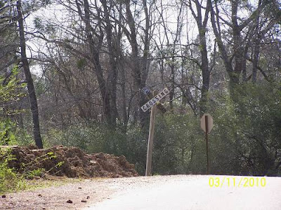
I take pictures of road signs to keep my pictures and myself straight.
.jpg)
Whoa, I'm straight. I don't like it, I'm going back to crooked.
Jordan D follows the rails then veers off meeting Longville Rd.
coming from the east. I came into Longville and immediately saw
where the Right of Way was.
.jpg)
I talked to a guy that was pulling an old ice chest around on
a rope putting dirt in it from the ditches. I figured he was
a railroad expert and approached him. I know em when
I see em and sure enough he was the local historian.
He pointed out that the depot had been in the low place
pictured above and that the house below was part of the
original mill town school. I didn't ask him what he was doing
as when I do stuff like that I don't want to be asked.
.jpg)

The plaque mentions that both railroads served the town/
mill. I think I'm seeing the sale to the LC&N as a good deal
having them keep the rails up and the Long-Bel retaining
usage rights. That's it, L&P trains ran on the LC&N rails.
So, there was dual occupancy. I knew the truth was out
there.
This is the Longville mill's pond.

One of the last 2 original mill homes.

An old store nearly covered by foliage next to the "new store".
On its side, covered by bushes, it says "Longville Store".
I wasn't ready for another mystery.

Recently Found:
The Company Store. See the rails beside the store.
Wonders a cinder didn't catch it on fire? Or did it?

The Baptist Church. It had been other denominations and
the town meeting hall. Info, courtesy of the Cooler Man.

The mill town bank.

The remains of the mill next to the lake.

I left glowing with my new knowledge. I was back on
US 171 headed to De Ridder. I went down each opened
road and checked out where they met the old ROW. This
was at a church. It looks like an old school. I could
not find a community name to associate with it, immediately.
.jpg)
Tulia is the closest community. It may have come from there.
L. McManus adds more:
Your photo of a old building (at a church) north of Longville is indeed an old rural two-room school. This one was called the Broadlands School. It's on its original site and belongs to the adjacent church. See
Your photo of a old building (at a church) north of Longville is indeed an old rural two-room school. This one was called the Broadlands School. It's on its original site and belongs to the adjacent church. Click Here for its history. There is another similar (though not identical) old Beauregard Parish school building called Shady Grove on LA 26 just a bit over five miles east of US 171. See its picture Here
for its history. There is another similar (though not identical) old Beauregard Parish school building called Shady Grove on LA 26 just a bit over five miles east of US 171. See its picture Here.Tulia is on the ROW. I went there and got my boots muddy
taking the picture below. From that mud originated the
title for this ride report. If you just read that, now you know.
.jpg)
More ROW.
.jpg)
More ROW and a suspicious rail tie.
.jpg)
A close inspection detected that it was an used one.
.jpg)
The rails had ridden though a deep cannon, much like
the Royal Gorge in Colorado.
.jpg)
Getting very close to Bon Ami, in fact, I was traveling from
US 171 to La.27, I found the ROW with a gate on it.
.jpg)
Looking across the gate. Well, wouldn't you?
.jpg)
I soon arrived at the KCS rails ( they are still) and La.27
and looked both ways.
.jpg)
Here is an example of why Louisiana ROW following is
so easy. All of our railroads have to be elevated. When
the rails are picked up, removing all that elevation is a pain.
But, today's rr's use expensive fill, so if they are abandoned,
I'll bet Bubba will be doing his driveway with RR bed if the
railroad doesn't move fast. (I wouldn't put it past Bubba
to do his driveway in fill even if the railroad hasn't been
abandoned)
.jpg)
I rode up to where the road to Bon Amis turned east.
I think I passed Lilly Junction as the rails ran very close
together for a short while. Map below.

I crossed the KCS and found the LC&N. This had been part of
a road bridge across one of the two ditches that paralleled
the tracks. This being a low wet area, the ditches were required.
.jpg)
There's the ROW looking south toward the location of the
Bon Ami Mill. Check the map above. The Bon Ami Pond
marks the mill's location.
.jpg)
There's the crossing. The next road resurfacing, it will be
gone.
.jpg)
This blew me away. It is where you see "signlb" on the map.
I don't know what it sells now. Clearly it says, "Established 1875".
That phone number may be from earlier, less complicated times.
.jpg)
Who knows, this house might have been around back then.
.jpg)
More used railroad tires. I checked.
.jpg)
Another mind blower. Whoa. There was this RXR sign
where it shouldn't be. The rails surely were not there.
They were. Look on the map where I have "nline". This
was where the old line lived again. It actually ended where
some tank cars were stashed and a spur left it and went
into a chemical plant. Remember a chemical plant being
mentioned? I vaguely do.
.jpg)
There it is. A loco was working the yard. You can see the
tank cars in the background. This company makes perfume.
Lots of perfume. Well, other stuff, too.
.jpg)
Near the entrance was this old building. I think it was
a guard house for an army installation. In the write
about the railroad and the army, DeRidder was mentioned
having 200 soldiers there. An investigation is forthwith.
Added: OK, there was an Army Air Corps field across La.27 toward
Merryville. I'm saying the Army owned this too. I can't prove
it right now. But I was wrong.
.jpg)
I'm telling you that sign is on the post's old sign's pedestal.
You can Google MeadWestvaco. It is a huge company.
.jpg)
The road surface smacked of Camp Claiborne's construction.
The army had developed a fast drying cement that was super
hard for their WW2 posts. That road had never been repaired.
The secret to its formula is hidden at Area 51. Yes, it was found
on that UFO which was brought to Camp Claiborne in 1951. Mark
has the documentation and can take you right to the door of
the laboratories. Please do not spread this information, I do not
want to be causing riots around the world. If it got out, the road repair
industry would be obsolete. Instead our roads are obsolete in
3 years. More later.
I'll repeat since after the last info, the previous info may
have been forgotten:
There was an Army Air Corps base at DeRidder. It was
across La.27 on the back road to Merryville situated along
the Jasper & Eastern RR. Saying that it stretched over the
highway to this point is just that, a stretch, but, there was an
Army presence in DeRidder. This could have been an addition
to that facility. I know my concrete. It smacked of "Alien".
Lowell added the facts about this place and more.
The MeadeWestvaco tall oil refinery at De Ridder was never a military facility. (If you don't know what tall oil is, see http://en.wikipedia.org/wiki/Tall_oil .) The De Ridder Army Air Field, now the Beauregard Parish Airport, never stretched nearly this far. This plant opened as a turpentine distillery in 1946 and belonging to Crosby Chemical Company. Everybody called it "the stump plant" because it took in the huge heart pine stumps that were the last evidence of the original virgin forests after the early-20th-century sawmill frenzy had passed. I remember when I was a little kid, my dad sold the stumps on our land southwest of Leesville, and they were hauled to Crosby at De Ridder. You must remember that the virgin pines had been cut down with two-man crosscut saws.
Beauregard Parish is simply beautiful. Now's the time of year to go see for yourself.
Below are tweaked excerpts from the Beauregard Parish Site and information I got from reading Block, his link is down the way. For short histories featuring central, south and western Louisiana and eastern Texas, he can't be beat.
My notes from those sources. Repeat, these are my notes. I'm not taking the time to convert what may be straight quotes.
A side note on DeQuency, the town that is midway between Deridder and Lake Charles on the KCS western link. From it we see that the rails that connected Lake Charles to the DeQuency area was the CRV&S, so the KCS only had to get to DeQuency and then hook up to their ROW. (below)
In 1897 the Kansas City, Pittsburg and Gulf Railway, now the Kansas City Southern, reached the point where its main line bent toward the southwest to Beaumont and the old Calcasieu River, Vernon & Shreveport tram line, now the Lake Charles branch of the K.C.S., joined the main line and the town of DeQuency was formed. De Quincy was at this time a pine forest, no timber having been cut except on the railroad right-of-way. Two small stores, two boarding houses, and four small dwellings constituted the village.
Lowell adds:
"Your source somewhat oversimplify the easy with which the KCS predecessor reached Lake Charles by simply acquiring and hooking up with the CRV&S at De Quincy in 1897. The CV&S (as it is called in KCS history, but I can't swear that "River" was not in the name) was a light narrow-gauge logging line that reached northward from Mossville on the SP. It had to be rebuilt as standard-gauge and extended into Westlake and via a new bridge on the river to Lake Charles".
Back to DeRidder:
1897 - The Kansas City Southern arrives in DeRidder.
"The Kansas City railroad was built from Kansas City to Port Arthur and came right through Deridder about 1896. By 1898 the trains were running. The post-office was named Miersburg for the postmaster whose name was Miers. The railroad workers had used this spot for a camping place for the workmen. 160 acres of land was bought for the town site."
"Perhaps the most important thing to ever happen in Beauregard Parish was the arrival of the railroad in 1897. The first train line to serve DeRidder was the Pittsburgh & Gulf Railroad - later called the Kansas City Southern. A Dutch railroad financier, to honor his beautiful sister-in-law, Ella DeRidder, named the depot for her. Prior to that the little town was known as Schovall and DeKidder". (Beauregard Parish History)
Lowell adds a bit here:
"Your source calls the KCS predecessor the "Pittsburgh & Gulf," but it was the "Kansas City, Pittsburg & Gulf." Note that the spelling is "Pittsburg," not "Pittsburgh," because it refers to Pittsburg, Kansas. A really fine point is that it didn't "later become part of the KCS," but rather later became the KCS, when the KCP&G was auctioned by a Missouri sheriff for its debts. The KCS had been freshly formed by a new set of investors for the purpose of buying it at the auction. That was April 1900. Eight months later, the Lucas Gusher, a thundering 200-foot geyser of crude oil that ran wild for nine days just a mile from the KCS track at Spindletop on the south side of Beaumont, ushered in the petroleum age. That one well produced 3.2 million barrels of oil during its first year. Neither Texas nor the KCS would ever be the same again. Such names as Texaco, Gulf, and Mobil were born along the KCS between Beaumont and Port Arthur".
There is a discrepancy in these dates, the above 1897 or the 1902 below. The Long group bought the Lake Charles mill in 1906, so, like I said, I'm not bearing down on this right now.
The first train line to serve DeRidder came in 1902, the Pittsburgh & Gulf Railroad, later to become part of the the Kansas City Southern (KCS) Railroad. The town was incorporated in 1903.
Deridder, Louisiana, which became the seat of the new Beauregard Parish in 1913, generally owed its existence as a thriving lumber market to the arrival of the Kansas City Southern rails in 1895. Deridder quickly took its name from an official of the Dutch-owned railroad, whose name translated into English as "the knight." By 1905, Deridder also became a rail junction when the Gulf, Colorado and Santa Fe Railroad built an east-west line from Kirbyville, Texas, through Deridder to Oakdale
Here's all the info you need.
DeRidder 1904 to 1908 CLICK HERE This is a Block write so you know it's good.
You can probably credit Block for much of the info on this page. Please check out just some of his writes at the bottom of the page. It is amazing stuff.
I know this is a review:
"Long-Bell, a retail lumber dealer, was headquartered in Kansas City. It was seeking new sources of raw materials after the Michigan and Wisconsin forests were depleted. It was natural for them to follow the rails of Kansas City Southern right-of-way south of Shreveport. In February-March, 1906, a Long-Bell excursion train, carrying top officials and customers, inspected all the Long- Bell sawmill plants, Bon Ami, and Deridder on its way to buy the mill at Goosport/ Lake Charles".
"1906 - DeRidder's third railroad The Jasper and Eastern Railroad was constructed through town in 1906 and at this same time work started on the construction of the Lake Charles and Northern Railroad. This gave DeRidder three train lines". (Beauregard Parish History)
DeRidder was a mill town. When first starting this page I did a dissertation on mill towns. There were basically two types, those that paid in their own currency and the ones that used dollars. The one in DeRidder used greenbacks.
"Company towns", as they existed then, might be resented by some of today's independent-minded citizens. The company owned all the land, built the houses, the churches, the stores, and the schools. Workers were paid by the company, bought their clothes, food, and necessities at the company store, and paid their rent to the company. One such town was DeRidder, which had been just a station on the Kansas City Southern Railroad before the coming of the mill. The company built a new school, 125 houses, a store, a butcher shop, post office, hotel, and office building. The lumber from this project was milled at Bon Ami. Population was 3,600 in 1904." (Beauregard Parish History)
"The Hudson River Lumber Co. has a sawmill with a capacity of 150,000 feet daily, and it has a large acreage of standing timber... There are 625 square miles tributary to DeRidder in the way of trade. Seven large general stores bear witness to that... The fire of March 18 was not an unmitigated evil since fire brick buildings are now taking the places of the shacks that were. An elegant $10,000 school house with a corps of six teachers furnishes every opportunity in the educational line. The Masons and Odd Fellows each have fine halls and a large membership. Religious services are held each Sunday by the Methodists and Baptists...."
1912 - DeRidder houses from the sawmill days. (BP History)
"The house at 411 South Washington St. was once the quarters of the general manager of the Hudson River Lumber Company sawmill. The original staircase, window and door frames are made of "hand picked curly pine", a much appreciated wood of that day. The house at 405 Washington St. was once the quarters of a worker. It should also be noted that a goodly number of Bon Ami houses were moved to DeRidder. There is at least one on the east side of the 600 block of Royal Street".
A note on the economy:
"DeRidder was a thriving city through which four railroads operated ten passenger trains daily. The city boasted an electrical and water plant, cotton gin, two wholesale bakeries, steam laundry, bottling works and many other industries".
1941-1942 - The Louisiana Maneuvers
"The Louisiana maneuvers came to much of the old Neutral Strip - involving about 500,000 men. It was the largest maneuvers in American history. It put an endless stream of convoys on our roads, horse cavalry in our streets, brawling on a few occasions in the downtown area of DeRidder and bivouacs on our farms. But it helped the economy. Except for the brawling, local people put up with the inconveniences with very little grumbling. The maneuvers were an essential part of war readiness".
Nov 28, 1941 - The first USO was in DeRidder (now the Civic Center)
"More than 500 USO's were built for our service men during World War II - some in foreign lands. The one in DeRidder was the first to open - and the one in Galveston opened 24 hours later. It is said that 89,000 soldiers visited the DeRidder USO - 15,000 had showers there and 27,000 saw movies there".
More on the buildings:
"Oct 4, 1981 - Forty-two DeRidder buildings put on National Register
The old jail was nominated for the National Register of Historic Places. At end of the month, the commercial district of DeRidder was placed on the National Register 42 buildings in all".
"The Sante Fe is on the eve of building through here, the terminal being Kirbyville, Texas, and Alexandria, with a tap running to Leesville and south to Carson... An ice plant of large capacity is one of the industries. Electric light has been put in use in part of the town, and in the near future will be in general use. There is a bank here, which is a solid institution....
"The future of this town is assured, and that fact is appreciated by outsiders who are coming in daily with a view to investment... During the month of October (1904), 280 cars of lumber were shipped out. Considerable cotton came in today. The prices range from 9 to 10 cents a pound... The Nelson hotel is deservedly popular with the traveling public...." And on and on.

I rode to where you see office. The mill was bought by the IP Corp.
It is located on Post Plant Rd.
.jpg)
.jpg)
I suspect this was the office. Lowell verified it.
Below is where you see "crossec" This is the Santa Fe, which had come from Oakdale.
.jpg)
Following the J&E had been a lot of fun. It was also a beautiful trip.
.jpg)
On the way you can see where the Kansas City Southern,
coming from Leesville and going to Dequency, crossed the Jasper & Eastern
(Santa Fe from Oakdale/Kirbyville, TX)
.jpg)
That's the cross track. The J&E enters a business and it's end.
.jpg)
The KCS was getting a sprucing up.
.jpg)
There it goes off to Merryville and Kirbyville.
.jpg)
Here's the KCS Depot.
.jpg)
At the station the two railroad to Lake Charles came together.
Here's looking toward DeQuency.
.jpg)
Here's the stainless steel caboose at the station. These cabooses,
I think, are from the Missouri Pacific. I was wrong. Lowell adds this:
The caboose that's stuffed and mounted at the De Ridder depot is stainless steel, not chrome; and it's KCS In 1964, KCS decided that it wanted a new modern fleet of bay-window cabooses and invited designs from various manufacturers. There were submissions from established caboose builders and this one from Darby Corporation of Kansas City, Kansas. Darby was most famous for building steel LCT landing craft during WWII and had never built cabooses before; but neither had anybody ever built one of stainless steel. KCS was so impressed that it chose the Darby design and ordered 43 of them over the next 16 years. There's nothing else like them in the annals of railroading. They're all retired now (along with cabooses in general), but several survive on display and in private hands. Since they're stainless steel inside and out, they'll outlive us all! Me: There is also one at Simmesport.
.jpg)
Deridder still retains the rail connection.
.jpg)
Looking north.
The two tracks came from DeQuency, on the left.The rails to
the right came from Longville. Now they only go to that chemical plant.
.jpg)
Looking south, Right went to DeQuency, left were to Longville and Lake
Charles down the Lake Charles and Northern Railroad.
.jpg)
This building had "Calcasieu......" written on the side.I imagined
it to say " Calcasieu Lumber", but I'm a romantic.
Lowell adds:
As to the wedge-shaped brick building in De Ridder with "Calcasieu..." painted on it: I remember this sign as formerly saying "Calcasieu Mercantile Co." It was a branch of a wholesale grocer out of Lake Charles.
.jpg)
.jpg)
I saw Bundick Lake on the GPS. I headed home that way.
.jpg)
That's it. I'm out of here.
--------------------------------------------------