This is turning into an early morning nightmare. It would continue into a nighttime nightmare and back into a morning nightmare. One more try at transferring this Geocities trash. If it doesn't work it won't get done. Update: I've continued off and on throughout the day and it is going slowly. Most of the great links I had found are gone, replaced by ads, etc. This further supports my feeling that if you find a good site, download it. It may be gone tomorrow. This one possibly One more proof read. If there are mistakes, they will remain into perpetuity. At 11:23, the next morning, I'm done with it.
This is the second ride over to the Bayou LaFourche "Valley", actually a low ridge that runs from the Mississipi River to the swamps above the Gulf of Mexico. I explained all of that eloquently earlier but the html coding was so bad Blogger burped and when Blogger burps, it's bad.
I guess I could do it the easy way and screen shot the old ride which eliminates fixing any of the terribly embarrassing writing. Or, I could cut and paste, by a 2 step method that removes formatting but allows humane intervention.
I'll bite the bullet and do that, let's go. This is great. How did pictures from the August ride down to Grand Isle get into this one that stops at LaRose?. Never mind, I'll call it a tease done purposely.
Riding over I ended up on a back bayou road bypassing Houma. I think I discovered it on this, the July ride. I just remembered. I was going to do the Grand Isle Ride but decided if I did, I'd leave this one as an anticlimactic boring druge though hot Southern Hell. I reflect on a song done by some punk yankee worm. The Grand Isle ride was hotter until I got down to the wonderful Gulf. I am not pictured here. Timing,

The boat w/o the Harley.

These things make boats discretionary in our world.

In for a redeaux.

The source of the song "Blue Bayou" ?
The boat w/o the Harley.
These things make boats discretionary in our world.
In for a redeaux.
The source of the song "Blue Bayou" ?

Ok, this is the last one from the "Grand Isle" epic. I'm including it since the route is a life saver if motoring down there from points west. Either way works but I suggest the La.316 route. Houma is like a huge octopus clogged worse than any moderate sized metropolis I've ever seen. Some say it's the Indian's Revenge.

Wow, that was deflating. I was fired up to get "Thibodaux to Valentine" done.
The Polar Bear picture is hilarity when applied to where I was going.

It was ten after nine in the morning and it was 93 Fahrenheit Degrees hot.

The presence of heat and the possibility of rain factored with an early start surely meant South-South Louisiana was the ride du jour. Some say, "It's all about the ride". At this point it probably was, because it sure wasn't about self preservation.
Possibly the troubled weather would cool things down.
I went to the top of the Henderson Levee to contemplate the ride and to get any tablets that were being handed out, etc. No words of wisdom were downloaded.

Earlier this month, or later in the last, I'd written an E-mail ride account which took place, in part, between Morgan City and Donaldsonville. ("The First Lafourche Ride" in the Menu) Of course there was some riding to Morgan City and some riding away from Donalsonville also included in that private ride report. Why "private"? Because I didn't want to do all this work to publish it on Geocities. We've been over that and I don't want to discuss it further. From time to time I have to establish some authority. That was evidently one of those moments. Who knows? I have wandering hormones.
Back to that ride: Along the way I had been reinfected with Lafourchitosis, defined as a yearning to explore Bayou Lafourche, to be exact. An explanation: I had been exposed early in life to bayou country not as a native but as one who regarded "BC" as a foreign country since I was from an area so unlike it, East Texas and North Louisiana. I've carried BC in my blood since I was six. Let me tell you Cajun kids know how to play and they don't stop until life is done. The "call to arms" under the Cajun Flag is "Laissez les bons Temps Rouler". Kawasaki Motors adapted the English version "Let the Good Times Roll" as their company moto. I guess they were impressed during some visit to one of our honkytonks or carnivals, Mardi Gras or anything to do with eating anything. Heck, there's a Swine Festival which crowns a queen. How is that for having a sense of humor!!
Though I live on a bayou, it is far too far north to immolate a true South South Louisiana bayou. {check the definition of "bayou". Naming a waterway "bayou" does not make it one for its entire lenght.} At Labadieville, Assumption Parish, on the bayou, the infection overcame me. I'd had to go south. I'd just been north, anyway. What was I doing here? Bayou Lafourche offers more than just itself. It is the home of the "end of" or the "beginning of" famed Louisiana Highway One. That in itself is enough of a reason for riding way out into the Gulf. Hey, "Beginnings" and "Ends" have fascinated explorers for eons. My ultimate goal would be Grand Isle, and it remained my goal until three o'clock came around and I was fifty-five miles short or long of being there. I'd almost done an extreme crazy as you don't go to Grand Isle in the DARK and if you try to come back, you might not make it. Stuff crosses the road, a road that is at sea level. Avoiding a raccoon might mean being eaten by a gator.
Ah, but, I'm getting ahead of the story once again.
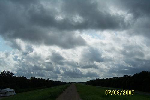
Page 2 I decided to go south on the levee. Traffic was down and the view was good.
As mentioned, the morning was young. I'd topped off my personal lubricant with two pints, one quart, of Community Club Dark Roast which made the meandering levee road pass as melancholy as a Ramones Lullaby. Soon I was at the last paved exit which brought me to Coteau Holmes. My mother's people were Holmes. I wonder, and digress. I've never given Coteau Holmes much film. Why? I don't know. I did know there were a few signs I wanted to shoot. Garlic is, of course, a staple of Cajun cooking. What is a Garlic "Braid"? Click here.

Catahoula dogs are what you use to find somehting to cook. They are wonderful animals. I've known one. What a dude he was. If I was a dog, I'd want to be a Catahoula. There's no explaining that, like most stuff around here. You need to call Gene. Get a pup or pray to be one if reborn as a dog. Read about them Here. By the way, Gov. Edwin Edwards signed a bill making the Catahoula the state dog. And, we all know that the governor knew a few things about bitches.

I had decided to take hated US 90, the new one, the four laned hot endless concrete slab.
I had spent too much time on the long scenic route from Henderson to New Iberia and needed to get to Lafourche Country, pronto. I leaned low over the gas tank, tucked my legs in for minimal wind resistance and brought the powerful machine up to the posted 65 mph. Be careful of crossroads, still (2013), on US 90.
Soon I had cleared Morgan City. If you don't think we have to deal with a lot of water, just look. I was now in South South Louisiana. What is it about this place? For me, civilization seems to be confined to outposts. It clings to the few high ridges. Nature, like in the great western expances, seems to have the upper hand. Man has changed much, but, here, Nature can always slap him down. Just the rumor of a hurricane sends Mr.and Ms. Man a running. When I roamed this area with my father back in the 50's, it really made an impression. I guess it stuck as I still see more wild than tamed.
This map did not show the extent of the wilderness that is out there.
The yellow line is my wandering.

There are famous intersections in the world. The intersection of US 90 and La.20 is one of them. US.90 at one time followed Bayou Black into Houma. It doesn't anymore. Now it is called La.182, effectively misleading the follower of this historic route. That is all covered in The Houma Ride which might not be rewritten yet but will be.
I was headed toward Thibodaux {correct spelling} Another spelling is "Thibodeaux", he's Boudreaux's buddy. They are not related which is a miracle.
Gibson is where you see "20".
The map still shows US 90 going south to Houma.

Chacahoula" means "beloved home" in Choctaw. I could see how this bountiful swamp could make a good
home for those skilled in living off the land.
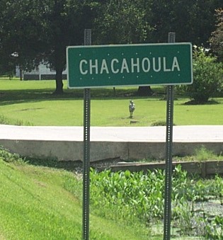
I found this link while looking for stuff on Chacahoula. Too bad it gone.. It gave you a feel for some of the history that occured here. It was church oriented. That worked because local communities often, at least early on, revolved around the church. And, the church kept records, thankfully.
Then there was Chester's Place.

This is food served on the bayou. If I have to explain it
I may cry. It is that good. I can taste it.

Chester's Cypress Inn 1995 Hwy. 20 (Donner) Phone:(985) 446-6821 THU-SAT: 5 - 9 p.m. SUN: 11 a.m. - 9 p.mThat was the old schedule. Check before going.
Donner / Chackahoula
Here came an old service station and "tourist court". These you don't see anymore and
to see them both in the same place and related to one another is awing for anyone
who appreciates history and everyone should because it's the key to knowing
what a f'd up situation our country is in now. How did that communist get elected?
Sorry, I had a moment. The answer is that our society is in a f'd up situation.
Enough addicts voted for their pusher. How quickly and quietly a civilization can deteriorate. At this point I jerked the burned out starter out of the RV just to cool down. Ahooom.

When I see pyramid houses, I see lumber mill communities. This was one, I'm sure.
The building marked "Boats" may have rented, boats? Possibly the owner was organized and liked labeling. My wife labels everything. The light switches have labels on them. We've lived here 38 years, but, it's true, there might come a day when those labels pay.

Back to Chester's place.
I was smiling. when I saw Chesters Place, aka, The Cypress Inn. Usually these great old places are in ruins. These home places, below, were still functinng just fine, also. Notice the front end paint on the one below..
That is historically correct. That was the custom. Paint on the front meant putting their "best face forward".
Paint was expensive so its use was prioritized.

Something made me get off of La.20 at Broadway Rd. I had to adjust something, maybe. I U-turned and saw "Old" in front of a named road. That I can't resist. I rode down a block or so and there it was.
That is the best picture in this write.

It was Gone with the Wind beautiful. The Thibodaux area was very aristocratic.
Sugar was king and money was plentiful.


Just down that road which bordered a busy highway was this one, still a historic residence but not fairing so well.

The stately grounds were either the Magnolia Plantation or Armatage or Southdown or... I give up. I think I can confirm it is Magnolia. We are so proud of our Live Oaks, we name and register them.
Magnolia Plantation has a forest. This Link takes you to the LDL for lots of historic Thibodaux pictures.National Register Listings
This is a list but has few links. Got to move on. Back to that road sign. "Schriever", I'm just shaking my head. You see, these days (2013), "Schriever" is fairly important to my railroading hobby.

The tracks were next and I turned around.
I didn't reali
ze that I was in the historic railroad town of Schriever.
ze that I was in the historic railroad town of Schriever.
I needed to get to Thibodaux and totally missed the old Texas and New Orleans / Southern Pacific depot.
Obviously this old write is getting some new ink on it.This has become a two day effort.It could take weeks but I'll have to draw the line. The cold rain that is pouring down makes writing it less of a guilt trip.
Page 4 (there was no 3. I probably merged them.)
If you want to go to a town's old center in South Louisiana, look for the church steeple. You will be close. Then look for the courthouse, usually the second highest building in town. That worked in Thibodaux.


This one was by the church so I'll stick it in here. An explanation is further down.

The Courthouse


I shot the historic marker caption:

But, I forgot to take a picture of the bell. A lady had asked me if she had ruined my shot. She hadn't, but she made me forget to take it. So, lady, I guess you did ruin my shot.
There, that's off my shoulders. Now I feel bad, I really just forgot. I could have told you that the bell had been removed for restoration. But, it's too late now.
In Thibodaux's old downtown, the balconies and narrow one way streets made me feel as if I'd been removed to the French Quarter. I cut the bike off and magically I heard a jazz band playing slow and low. It was a "moment" as that faithfull Louisiana sound drifted onto the street out of one of the many doorways. There are few places in the world where you can experience an instant atmosphere of history and music on such a level. South Louisiana and the Isle of New Orleans are 2 of those distinct places.

As I scanned, the feeling was reinforced. The place brought goose bumps. My New Orleans heritage and "Down the Bayou" heritage had merged.


Yes, I've emphasized this building. As the "Oil and Gas" Building, it's importance in this area was huge.
Possibly all the records were kept there?
Possibly its name was to enhance oil companies to office there.


Then I enjoyed the pleasure of walking the sidewalk with its sun blocking cover over my head. My guess is that this was the main hotel. I knew I was walking over some very famous footprints. I just watched The Life of Huey Long on DVD. Indeed, he visited Thibodaux often.
Gov. Huey P. Long, (gov -1928-32) was the son-in-law of Sallie Armitage Billiu McConnell,
a native of Thibodaux.
Notice the name "Armitage" is included in her name. She was aristocracy. How did she end up with that low life? I've heard my marriage questioned similarly.
Back out on La.20, this pretty Vicky was shot.

Below is right down from St.Joseph's. It is a funeral home. Conveniently located. Nothing like a "one stop" at the Departing Mall. Yes, you just saw this one, but I'm not fixing it.
I have one left over. It was across the street from the church. Yes, I remember I had mentioned it to Marion.

Putting this thing together has been a puzzle. So far I've only lost it once though no fault of the ride..
Page 5
I crossed La.1 and turned south onto La.308, the mirror road to La.1 as it
goes north and south. I remember that like it was yesterday. The lushness of our area is worth ever bit of the humidity we endure. Green is the color of life. I've been out west and actually suffered "Green Withdrawal" We live in "The Garden", snakes and all.

I have theories on where to find the best shots. One is the
I have theories on where to find the best shots. One is the
main road and the other is the mirror road across the bayous from the main road.. My theories are flawed.
Problem is, I follow one and it goes dead interest wise. I look across the bayou and
there's all the good stuff and the last crossing is 5 miles back and who knows how far into the future the next one is.
Then I switch sides and the stuff is on the side I came from. I should just stick
to one side and ride it out. Then come back on the other side, but stuff will have moved. It never fails. I decided to leave Thibodaux on 308. Good decision, for once.
I saw this one and U-turned.


I turned into this driveway and there was this one. I will bet this was some planter's townhouse. Notice my use of the word "planter". These guys were high brow, not a "dirt farmer" among them.

This may rank with the other plantation pictures as for as
being "mediocre good". The silver sky of humidity does not help when shooting in
South Louisiana. If I'd gone today with the north wind blowing and clear sky
it might have been better photographically . The heat index was 106 today, Seven of those degrees were pure water. We, down here have the greatest complexions.
Local News about the Rienzi Plantation
"It is rumored to have been built for the Queen of Spain. The Rienzi Plantation dates
back t the 18th century. The beautiful plantation is privately owned and is not open to tours". There's my trail. I exited east but obviously went in a roundabout way.

Please note the railroad seen above.
The line going south went to Houma. You will see a few place names mentioned in this ride report.

This from an old book speaking of the Southern Pacific RR. The main line extends from Algiers, on the Mississippi River opposite New Orleans, to Lafayette, where it connects with the line of the Louisiana Western Railroad Company. It forms an important link in the through route of the Southern Pacific Company between New Orleans, La., and San Francisco, Calif. The principal branch lines extend from Lafayette to the Mississippi River opposite Baton Rouge, from Lafayette to Cheneyville, from Breaux Bridge to Port Barre, from Breaux Bridge to Cade, and from Thibodaux Junction to Napoleonville. There are a number of other branch lines of an average length of about 10 miles, which serve the numerous sugar plantations along parts of the line. A little more since I know you were interested: The property which was acquired from Charles Morgan on April 1, 1878, had for the most part been constructed by The New Orleans, Opelousas and Great Western Railroad Company. Construction of the main,[sic] line, extending from Algiers to Morgan City, was commenced on August 27, 1852. On November 6, 1854, a line extending 52 miles from Algiers was opened for operation. The remaining 28 miles of road to Brashear, now Morgan City, were completed in sections, the last 7 miles being completed on April 12, 1857. The New Orleans, Opelousas and Great Western Railroad Company, at the time its road was taken over by the Federal Government on May 1, 1862, had also completed, as part of ist[sic] project to reach the Texas boundary, practically all of the grading on about 80 miles of road extending from Morgan City to a point near Opelousas. The Morgan's Louisiana and Texas Railroad acquired these properties on July 31, 1869, and April 22, 1870, as hereinbefore stated. On April 18, 1872, the Morgan's Louisiana and Texas Railroad sold to the New Orleans, Mobile and Texas Railroad the aforementioned 80 miles of partially built railroad. The Morgan's Louisiana and Texas Railroad constructed a branch line extending from Shriever to Houma, a distance of about 14.6 miles. Construction was commenced in April, 1871, and completed in January, 1872. The Morgan's Louisiana and Texas Railroad also purchased from the Pontchartrain Rail Road Company on March 11, 1872, about 1.5 miles of track in New Orleans for terminal purposes. The entire road of The New Orleans, Opelousas and Great Western Railroad Company was built with a gage of 5 feet 6 inches, but in 1872 the Morgan's Louisiana and Texas Railroad changed the gage to standard. During the period from June, 1874, to May, 1875, considerable sums of money were spent in raising the tracks. The property acquired by the Morgan's Louisiana and Texas from the Morgan's Louisiana and Texas Railroad on April 1, 1878, consisted, therefore, of the main line from Algiers to Morgan City, a distance of about 80.60 miles, and the branch line from Shriever to Houma, a distance of about 14.60 miles, or a total of 95.20 miles of road. The Morgan's Louisiana and Texas also acquired from the trustee of the New Orleans, Mobile and Texas Railroad Company 68 miles of road, lying between Westwego and Bayou Goula. This property was sold on February 15, 1881, to the New Orleans-Pacific Railway Company, now the Texas and Pacific Railway Company. For the full Wiki Write go HERE.
Page 6 Gee I hope this goes better. Unraveling the last page was a trip.
I left Thibodaux. I found something else I had to shoot resulting in more work now. The following pictures really need little or no explanation. That is Bayou Lafourche.

Here's a beautiful old filling station and grocery with home attached.
Gee, I hope that's not "crime scene tape".


Another one was further south. Not quite as well taken care of. They're reasons. It is very old. Look at the design on the roof line. The same design is found on the old store south of Cheneyville which Jim Bowie frequented. That would put the architecture dating at old..


What's prettier, the houses or the trees? So, I split the difference.
The better picture was from across the bayou. I tried one from the other side.
.
Only the swamp could stop the continuance of these beautiful homes
The land seems to "drop off" behind the house.

How is that for a setting!!

Here's a beautiful old filling station and grocery with home attached.
Gee, I hope that's not "crime scene tape".
Another one was further south. Not quite as well taken care of. They're reasons. It is very old. Look at the design on the roof line. The same design is found on the old store south of Cheneyville which Jim Bowie frequented. That would put the architecture dating at old..
What's prettier, the houses or the trees? So, I split the difference.
The better picture was from across the bayou. I tried one from the other side.
.
Only the swamp could stop the continuance of these beautiful homes
The land seems to "drop off" behind the house.
How is that for a setting!!
Page 7 Oh my Goodness. I took 40 pictures of Raceland. A personal story. I went to a doctor there that wormed me. That story is mercifully over. I'd been drinking out of the cistern and got the wiggles. I guess that's why I felt a closeness and presence being there.
Here's an old shot I found.


I entered Raceland from the north. The building above is old.It may at first look new but it isn't. It is the Raceland Elementary School. It's just been fixed up. A work in progress. I crossed the street to read this
historical marker.

Interesting Links Below:. Try this one. This is Great.An Insight: CLICK HEREThis place was the real deal cypress mill. It was located inside a large curve in the Southern Pacific rails headed to New Orleans from the west. Click for lager version.

Into Raceland.

Raceland has two bridges. I thought I remembered this one. No, I remembered the one below.


It was part of our Houma to New Orleans route on Old US 90. What a great road. Remember, Old US 90 left New US 90 back at Gibson [the famous intersection] where Now La.182, which is Old 90, went south along Bayou Black to Houma. This is New La.182, which was Old US 90, as it comes from Houma headed to New Orleans. If you need directions to anywhere, just write. Nostalgia now hijacks this ride report. I had to go to the old sugarcane mill.


The mill was also a landmark and the first mill I ever remember seeing. We moved in 1954 from Shreveport, north Louisiana, to Houma, south Louisiana. That pilgrimage ranks high with any of the great cultural transitions known to man or woman. Being a child, I easily acclimated. My next door neighbors had 13 children to play with. The mother was Catholic Mother of the Year two years running. Who bested her the next year? Or, possibly there are "term limitations" associated with the office. My parents, especially my father, loved the change. He was an adventurer and he had been set in the middle of a life experience. They loved to eat and the availability of all that is offered here was a culinary heaven. I remember picking up stuffed crabs in Des Allemands. He knew the hole in the walls. I remember mountains of boiled shrimp on newspaper covered tables being consumed under a long tent at United Gas company picnics. The smell was delicious and would clear your sinuses . These Texans and North Louisianians were having a heck of a good time working down here. They were learning to shed some of the reserve of their homes and to let their hair down a bit. Some couldn't handle the freedom and burned out. But, not my parents. They did it all.

The rain remained in the background. Grocery ready refined sugar must have been made here. Established in 1892. This is a baggasse mountain.

The walls in our house were made of this stuff. It insulated not only cold but noise. We had a cistern for water. It had bugs in it. As I said and didn't know I had said up there, so here's the story again, I got w--ms and had to be de-w--med in Raceland. I seem to have lost some of my reserve since the last writing. What's with the blank letters? I looked for the clinic. I think I saw it. It is now a nursing home. Wouldn't that be a life's round trip, me ending up in there getting de-wormed again. Below is the fine old house on the mill property. Is it Dutch? Garden City, another cypress mill town was Dutch. This one looks similar.


Above is more like what we lived in. No air-conditioning. We got our first TV in 1955. We could pick up WDSU in New Orleans. We bought the TV at Kirshman's Furniture Store in downtown NO. . I remember the salesman hooking it up to an antenna. Back to the mill.

Now the mill produces "raw" sugar? Mark, I think it is affiliated with Enterprise. Below is a vision out of my past. Old 90 is the road to the right.

The list of Louisiana Sugar Mills is growing very short. Page 8 I just kicked me off this write. You get a "C-" Mr. Steve. OK, I'm Stevie Ramone here to take over this ride report. Smells musty here, must be old writing. I was now past New US 90, an "equator" of sorts, heading south on La.1. Signs featuring staples of a south Louisiana table were blocked by parked cars. You can't imagine what a wonderful source of culinary delight this place must be.
.


Bananto Bros. Warehouse was next. Featuring a Barq's Root Beer Sign.
The influence of New Orleans reaches into the countryside.


Read about Barq's.Was this the Bananto home? Next was Lockport.


You may see that the file name on these pages is "Lockport". That's because I was really impressed with this little town. La.1 travels around the western edge of Lockport. The place is full of history and beauty and extreme interest, at least to me. Plus the people are friendly and extremely helpful. One fella saved my crazy butt from going to Grand Isle to late in the day. As was pointed out to me by a resident. Lockport was named for what it was. La. 1 leaves the bayou. There is a big, "Do Not Enter" sign where the road did go. That would be where I wanted to explore. I followed La. 1 to the south side of town where it rejoins the bayou. Then I turned north headed into the encircled neighborhoods. I rode with Bayou Lafourche to my right. I found the old downtown. Mercy, I was in a gold mine. I couldn't find a link to the museum but the town has a website. Check out the sidebar links, they expand into useful menus. From the towns website: " Lockport, founded in 1835, traces its history to Jacques Lamotte, who in 1790 owned a large tract of land along Bayou Lafourche. Lemotte sold a portion of the tract to Messrs. Mercier and Marcantel in 1814. In 1823 William Field purchased a parcel of the land and later donated 5 arpents of it on both banks of Bayou Lafourche to Barataria and Lafourche Canal Company. As part of the transaction, the company agreed to build a canal, which would link Bayou Terrebonne to New Orleans. Allou D'Hemecourt surveyed the area in 1835. His map bears the name Longueville. Eventually, the village's name would become Lockport. At first the canal, completed in 1847, brought prosperity to the area. Three years later locks were completed at the point where the canal reached Bayou Lafourche. Shipping along the canal was brisk until 1868. After that time, part of the waterway was no longer in use. The crevasse of 1876 partially destroyed the locks. Today remnants of the brick bulwark are still visible under a blanket of weeds".

I had to get to it.

From the locks looking toward Lake Salvador.

Looking out onto Bayou LaFourche

Looking back across the bayou away from town.

Toward town.

I wandered back into the east side neighborhood.
It was like riding into a museum, again.Those are banana plants.


I took pictures of the great old buildings when I returned to the west bank.

Recently I found it again.

A classic Ford dealership.


Then I found this beautiful little park. It is the pride of town.

A group of local gentlemen had evidently gathered to eat lunch. Seeing me, they ceased their conversation which was in French and said hello. How nice. We struck up a conversation. Before we had finished, I knew the complete history of Lockport plus where to eat. In my kind of "work", it doesn't get any better. Above is my restaurant of choice. Not a bad view. There was a 10 mph cool breeze. This was what the doctor ordered. This is what they are doing across the bayou.


Leaving Lockport
Raceland
I entered Raceland from the north. The building above is old.It may at first look new but it isn't. It is the Raceland Elementary School. It's just been fixed up. A work in progress. I crossed the street to read this
historical marker.
Interesting Links Below:. Try this one. This is Great.An Insight: CLICK HEREThis place was the real deal cypress mill. It was located inside a large curve in the Southern Pacific rails headed to New Orleans from the west. Click for lager version.

Into Raceland.
Raceland has two bridges. I thought I remembered this one. No, I remembered the one below.

It was part of our Houma to New Orleans route on Old US 90. What a great road. Remember, Old US 90 left New US 90 back at Gibson [the famous intersection] where Now La.182, which is Old 90, went south along Bayou Black to Houma. This is New La.182, which was Old US 90, as it comes from Houma headed to New Orleans. If you need directions to anywhere, just write. Nostalgia now hijacks this ride report. I had to go to the old sugarcane mill.

The mill was also a landmark and the first mill I ever remember seeing. We moved in 1954 from Shreveport, north Louisiana, to Houma, south Louisiana. That pilgrimage ranks high with any of the great cultural transitions known to man or woman. Being a child, I easily acclimated. My next door neighbors had 13 children to play with. The mother was Catholic Mother of the Year two years running. Who bested her the next year? Or, possibly there are "term limitations" associated with the office. My parents, especially my father, loved the change. He was an adventurer and he had been set in the middle of a life experience. They loved to eat and the availability of all that is offered here was a culinary heaven. I remember picking up stuffed crabs in Des Allemands. He knew the hole in the walls. I remember mountains of boiled shrimp on newspaper covered tables being consumed under a long tent at United Gas company picnics. The smell was delicious and would clear your sinuses . These Texans and North Louisianians were having a heck of a good time working down here. They were learning to shed some of the reserve of their homes and to let their hair down a bit. Some couldn't handle the freedom and burned out. But, not my parents. They did it all.
The rain remained in the background. Grocery ready refined sugar must have been made here. Established in 1892. This is a baggasse mountain.
The walls in our house were made of this stuff. It insulated not only cold but noise. We had a cistern for water. It had bugs in it. As I said and didn't know I had said up there, so here's the story again, I got w--ms and had to be de-w--med in Raceland. I seem to have lost some of my reserve since the last writing. What's with the blank letters? I looked for the clinic. I think I saw it. It is now a nursing home. Wouldn't that be a life's round trip, me ending up in there getting de-wormed again. Below is the fine old house on the mill property. Is it Dutch? Garden City, another cypress mill town was Dutch. This one looks similar.
Above is more like what we lived in. No air-conditioning. We got our first TV in 1955. We could pick up WDSU in New Orleans. We bought the TV at Kirshman's Furniture Store in downtown NO. . I remember the salesman hooking it up to an antenna. Back to the mill.
Now the mill produces "raw" sugar? Mark, I think it is affiliated with Enterprise. Below is a vision out of my past. Old 90 is the road to the right.
The list of Louisiana Sugar Mills is growing very short. Page 8 I just kicked me off this write. You get a "C-" Mr. Steve. OK, I'm Stevie Ramone here to take over this ride report. Smells musty here, must be old writing. I was now past New US 90, an "equator" of sorts, heading south on La.1. Signs featuring staples of a south Louisiana table were blocked by parked cars. You can't imagine what a wonderful source of culinary delight this place must be.
.
Bananto Bros. Warehouse was next. Featuring a Barq's Root Beer Sign.
The influence of New Orleans reaches into the countryside.
Read about Barq's.Was this the Bananto home? Next was Lockport.
You may see that the file name on these pages is "Lockport". That's because I was really impressed with this little town. La.1 travels around the western edge of Lockport. The place is full of history and beauty and extreme interest, at least to me. Plus the people are friendly and extremely helpful. One fella saved my crazy butt from going to Grand Isle to late in the day. As was pointed out to me by a resident. Lockport was named for what it was. La. 1 leaves the bayou. There is a big, "Do Not Enter" sign where the road did go. That would be where I wanted to explore. I followed La. 1 to the south side of town where it rejoins the bayou. Then I turned north headed into the encircled neighborhoods. I rode with Bayou Lafourche to my right. I found the old downtown. Mercy, I was in a gold mine. I couldn't find a link to the museum but the town has a website. Check out the sidebar links, they expand into useful menus. From the towns website: " Lockport, founded in 1835, traces its history to Jacques Lamotte, who in 1790 owned a large tract of land along Bayou Lafourche. Lemotte sold a portion of the tract to Messrs. Mercier and Marcantel in 1814. In 1823 William Field purchased a parcel of the land and later donated 5 arpents of it on both banks of Bayou Lafourche to Barataria and Lafourche Canal Company. As part of the transaction, the company agreed to build a canal, which would link Bayou Terrebonne to New Orleans. Allou D'Hemecourt surveyed the area in 1835. His map bears the name Longueville. Eventually, the village's name would become Lockport. At first the canal, completed in 1847, brought prosperity to the area. Three years later locks were completed at the point where the canal reached Bayou Lafourche. Shipping along the canal was brisk until 1868. After that time, part of the waterway was no longer in use. The crevasse of 1876 partially destroyed the locks. Today remnants of the brick bulwark are still visible under a blanket of weeds".
I had to get to it.
From the locks looking toward Lake Salvador.
Looking out onto Bayou LaFourche
Looking back across the bayou away from town.
Toward town.
I wandered back into the east side neighborhood.
It was like riding into a museum, again.Those are banana plants.
I took pictures of the great old buildings when I returned to the west bank.
Recently I found it again.
A classic Ford dealership.
Then I found this beautiful little park. It is the pride of town.
A group of local gentlemen had evidently gathered to eat lunch. Seeing me, they ceased their conversation which was in French and said hello. How nice. We struck up a conversation. Before we had finished, I knew the complete history of Lockport plus where to eat. In my kind of "work", it doesn't get any better. Above is my restaurant of choice. Not a bad view. There was a 10 mph cool breeze. This was what the doctor ordered. This is what they are doing across the bayou.
Leaving Lockport
I was now back on La.1 and needed to get on 308 since I saw stuff across the bayou.
Below might now be a church, but it was a store in the past.
This had been a mill. A large industrial business was to my right. It might have been Valentine Paper. If so, it was indeed a specialized business. All of that explained (2013) below.


You will see "Jay" on one of the maps.

The Pontoon bridge at Valentine.


The Louisiana and Delta rails had dropped down at Raceland to service Valentine.


Interesting Sites Chemical Co. In the intro I mentioned downloading sites or copying them to preserve the past. This lady's write sits precariously on the web. I am copying it here. If you do not want to read it, you know where the scroll tab is.
Paper Valentine
Staring out the window on my drive home, I stop at a red light, only to notice movement out my window. They stand tall. Thousands of stalks glow in the moonlight, slowly swaying—almost dancing—in the wind following the rhythm of slow music. It is mesmerizing, almost peaceful. Long patches of sugar cane have been common fixtures on the side of our roads for decades. From early October until December, I always look forward to the smell of burning sugar cane tickling my nose. For more than 200 years, sugar cane has been a vital part of South Louisiana’s culture and economy. Although most of us associate sugar cane with an ingredient for cooking and baking, it can also be used to make the paper products from which we eat and drink, the wallpapers on our walls, and even the pages you hold in your hands.Valentine Paper and Pulp Co. in Lockport did just that. In 1954, Valentine Sugars formed a partnership with Brown and Root of Houston, and constructed a paper mill on Valentine Plantation, 8 miles south of Lockport off of Highway 308. The building sat on 25 acres of land with only one paper machine, all of which cost $7 million at the time. For the first four years of existence, it was not a well-producing mill, says Charles Gaubert, an employee of Valentine Paper for over 41 years. The company went from producing newsprint to low-quality writing paper and printing grades, or types of commercial paper. In 1964, a second paper machine was installed. Charles says the process of making large sheets of paper required several employees and large equipment. First, the stalks of sugar cane were cut down, brought to the mill, and crushed to get the juice. The sugar was taken to Valentine Sugar, while the byproduct bagasse was taken to the paper mill. At the paper mill, the bagasse was broken up and cooked in a large container called a digester, much like a large pressure cooker. The result was an unbleached pulp. After chlorine was added to the pulp and the mixture bleached white, it went through the headbox. At this point, the mixture was 99 percent water and flowed to a large rectangular area where wires shook it to flatten and even it out. With the large sheet of paper beginning to take shape, water was drained from the mixture. When it reached the end of the line, it entered three drying stations to get rid of the remaining moisture. After leaving the dryers, it was put onto big rolls and cut to the size of the customers’ needs. The remaining water and waste mixture was disposed of into a holding pond, where it traveled through several more ponds in which the sediment sank to the bottom, before reaching back to the swamp.
Due to the cost of natural gas, Valentine Paper closed the pulp mill in 1980 and began using already-processed and bleached wood pulp, eliminating much of the processes and cutting down on production costs. Already bleached white, the process now began with breaking down the wood to liquid and completing the same process of using bagasse. Paper made by Valentine Paper was used as the base for products we have all used at one time or another, if not in our everyday lives. One of the first products made was diazo paper, also known as blueprint paper. Production also included wallpaper, surgical paper and packaging for medical supplies. They also provided the base sheets for 3-mil tape, doilies, veneer backing and heat transfer paper. Playing cards, shoebox wrapping, light bulb wraps and Golden Kraft envelopes were also created using paper produced by Valentine. The company then began creating water-, oil- and grease-resistant bag stock for food and liquid packaging. Perhaps most recognizable, they sold to companies that then sold to major food corporations like McDonalds and Taco Bell. Their paper was also used for hot dog trays, popcorn bags and bags for Godiva Chocolatier. The biggest grades that Valentine produced were for outdoor poster paper for billboards. “At one time, all billboards from 1986-2007 were made out of this paper—all our paper,” Charles says. “Since then, the industry has changed to vinyl. But, before that, our paper was used all over the country.”
Hailing hundreds of customers from across the U.S. and beyond—Maine, Florida, Texas, Colorado, Illinois, New Jersey, Mexico, Canada—Charles spent many years traveling to pitch Valentine’s paper. Although the company had multiple owners from across the country—even Germany—throughout its 53-year history, Charles says that all of its employees remained local and loyal to our area. “I was the ‘local guy’ salesman, while all of the owners were from out of state or from other countries,” Charles says. “I was the token Cajun, so to speak.” The paper business was demanding during Charles’ time at the mill. He would do extensive traveling during the week to cater to his customers and pitch sales to prospective companies. Throughout the years, Charles has seen much of the U.S. through his job. He cites New York City, Chicago, Los Angeles and Dallas as a few of the most interesting places he has visited. But when he wanted to unwind, he’d like to go to Meridian, Miss., where he says the atmosphere and people were very low-key and friendly. “I would leave on Mondays and come back home on Fridays,” Charles says. “All my family is here, so I didn’t have to worry. I told all the owners that I’d go anywhere, anytime—but I live here in Lockport.”
Besides the downside of leaving his wife, DeeDee, and three daughters behind to travel, Charles’ job did come with its fair share of frightening situations. For the 9/11 terrorist attacks, Charles was in Oklahoma City, where he says the city completely shut down. He and other salesmen from around the country gathered in their hotel lobby to discuss what to do. “As a good Catholic boy from Louisiana, I needed a church,” Charles says. “While mostly Baptist churches [were] in the area, I was able to find a Catholic church and go to noon Mass.” After being calmed by Mass, he returned to his hotel where all of the salesmen decided to drive their rental cars home and provide rides to those who didn’t have any way to get home. While most of the world was hesitant to fly again, Charles was back on a plane shortly after, traveling to sell the products of Valentine Paper Co. once again. “After airports opened again, it was really the best time to fly,” Charles says. “I flew from New Orleans to Los Angeles with only four of us on the whole plane. We all rode in first class.” In his 41 years as a salesman, Charles also witnessed the change in the way the world communicated. When he first started, he had to use pay phones to get in touch with the mill. “I knew where the better hotels around us were so that I could use their pay phones instead of on the street,” Charles says. “Then, we went to cell phones and computers.
While under its sixth owner, Karl Heinz Nicolaus of HVN Group of Germany, the mill’s name was changed to MD Valentine Paper, then later to Nicolaus Paper Inc. In the 2000s, Charles says the tone of the business began to shift. An investment company purchased the company, and the name was changed once again to Valentine Paper Inc. Charles says their idea was to “flip” the company and make a quick profit, but the paper industry was on the downside and they couldn’t find a buyer. The company was run into bankruptcy. Another investment company purchased the company in order to make a quick profit, but that didn’t work either. Valentine’s most profitable grades were soon sent for production in Michigan, where the owners had another paper company. In return, Valentine received the other company’s least profitable grades, which led to the mill closing its doors. “We saw the writing on the wall,” Charles says. “If the last two owners would have run the grades we were running, we probably would still be around today.” While the mill officially closed in December 2007, its contribution to Lafourche Parish was substantial for decades prior. It contributed to employment of the area—over 280 jobs when it first opened—and also provided part-time jobs for students during the summer. Its paper products were donated to various local schools and churches, and it was also a major taxpayer for Lafourche Parish.
Although now retired, Charles remembers the good times at the company. Every year, Charles and DeeDee would travel to New York for an annual paper convention. “We called it the Paper Prom,” Charles says, chuckling. “My wife, DeeDee, was in big demand to be danced with. We got to know customers’ families, and they got to know mine.” One of Charles’ favorite memories of his years at the company was 29 years ago, when a customer named Poncho Valdez, a native of Cuba and resident of Miami, asked Charles to travel to Miami due to an emergency. At the time, DeeDee was in the hospital, having just given birth to their youngest daughter, and Charles was reluctant to leave. But Poncho insisted, so Charles prepared for a short trip to Miami. “When I got there, I realized there was no emergency,” Charles says. “They had thrown me a surprise baby shower. I came back with all of these gifts. That is just the way customers were back then.” Charles and DeeDee have remained friends with many of Charles’ former customers, some of whom come to visit the bayous of Lafourche. When the mill was closed, the general plant manager turned over boxes of materials from the company to Marge Barker. She and DeeDee were among the original core group of volunteers at the Bayou Lafourche Folklife and Heritage Museum located on Main Street in Lockport. Marge asked Charles if he would create an exhibit based on Valentine and its production. Charles began going through the files, as well as his own, to create an exhibit, which has been on display in three rooms at the museum for the past year. It will continue to hang in the museum until early March, after which it will likely go to the Nicholls State University archives. “Looking through the boxes was like looking through our life, our own photo album,” Charles says. “There are definitely more good memories than bad.” As Charles walks through the exhibit, he points out his picture under the title “Old Timers,” which was the name affectionately given to employees who reached 25 years with the company. In a picture labeled 1992, I can easily spot Charles beaming a smile from ear to ear. “I was so proud,” Charles says, laughing. “I was the only one who wore a tuxedo.
If you want to go south from here you will have to retrace you way out. This is where I turned toward Houma after a little exploring in LaRose. LaRose is on the Intracoastal Waterway. I crossed it on this bridge. I noticed the bridge had a sidewalk at the top, but no descending sidewalks. There must be stairs. I found them. I needed to climb them to get a picture. I don't do much climbing. For a picture I will climb. I climbed the Cypremort Point bridge over the Canal once. Up we go. All the way to the top? No. I stopped at road level. Remember, speed bumps stir my acrophobia.


Intracoastal Canal

The freshwater locks below LaRose.

These are storm gates. They lock down Bayou LaFourche in case of a storm. I suppose it might be part of a salt water prevention system. I'm saving LaRose to Grand Isle for the next one. Now on to Houma and points west, the most important being home. It was approaching 3:oo PM. That is my turn around time on extended excursions. I entered LaRose with the intention of taking La.Hwy 24 west to Houma and booking it home on US 90. I lingered when I spied the church. A few more minutes would not hurt.


I read this and I saw a key word phrase, "Canal Harang".Google it. This is a start. And you can get very deep into searching. Click HereLa.Hwy24 is a good road across the swamp. It may ride a natural levee in part. I think it was built on trucked in soil in most places. There's not much along its way. The trees may obscure what's there.

The light at Bourg was a welcomed sight. The yellow home was near there.

After riding through Houma Hell, I finally reached the corner of La.182 and La.20. I had missed this sign which reflects the original name of US 90.

Big barges at road level are a common sight in South Louisiana. I read somewhere that Houma was at 12 feet above sea level. At that height, it is atop virtual mountain in the marsh.

Approaching Amelia, the old Avondale site sat south of old 90. From the shape of the grounds, it seemed like Avondale was history. Not so. The present status is not clear to me.


Entering Amelia, these are the normal roadside attractions. Huge offshore tools stand ready for dispersal.

I was hot and dehydrated after getting off horrible US 90 west of Calumet. I was delirious and saw a dirt road named "Shady Side......" and went down it as shade seemed illusive. It led to this simple church. I only saw the huge air-conditioner attached to it.


Oh, there was this old house next to it. I should have investigated that round thing by the door. It might have been a wash pot or a giant beer bottle cap. I'm delirious right now. Update, I might have been "delirious" from writing this thing, also. I'm delirious right now. "I'm Delirious", now there's a song title possibility my band might use.
I had no idea what I had discovered.
I was at Sunnyside, the old plantation and the end of the line for the Missouri Pacific Sugarcane RR.
The Southern Pacific also had a spur up from its Sunset Rt. to the mill.

I reversed and went on down La.182, Old 90, through all the little towns that line Bayou Teche. I was ragged. I stopped by Al's but he wasn't home. Or maybe he was but didn't want company in my condition.
