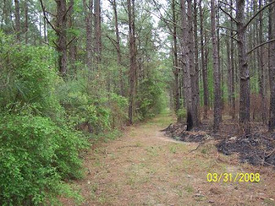
Above is an example of the maze of old railroad beds that lace the woods south of Lake Cocodrie, my recent haunts. They are too many to highlight. If you look closely, you can see the dashed lines. (click the map with your right mouse button and select "open in new window") The white line is my route from La.13 westward. I turned off La.13, just south of Turkey Creek at the brown sign for Crooked Creek Reservoir and campground. I believe it is Cypress Road. That road dead ends at Red Robert which starts on its east near Turkey Creek. I had coordinated each picture with numbers, like that was important. It was at the time, but that importance has subsided. The following will be a number of pictures of what I believed were some of the lumber train routes through the forest. I understand from the previous writings that the Shay gear driven engines were used (at Peason) because of their pulling power. This was Long Leaf's territory. Then the cars were transferred to rod type engines (familiar steam engines) which took the cars quickly to the mill. Here are the pictures of a few of those old beds. Now try to imagine:

.jpg)
.jpg)
And, along the roads:
.jpg)
.jpg)
And, when the routes have been overlaid with present day dirt roads.
.jpg)
.jpg)
After wandering around south of Cocodrie, and almost becoming a wet place in the road under a lumber truck, I headed for the oasis of all local forestry knowledge, The Southern Forest Heritage Museum at Long Leaf. I walked into the old commissary and no one was there. Everyone was out working on preparations for their big weekend coming up on April 19, 2008. Shortly, a lady appeared and I told her of my problem finding the immediate Red River and Gulf exit/entrance to Longleaf from the west. She found a gentleman who claimed not to be the authority, but he immediately found what I needed. They were both devoted to finding the answer to my question. Pay these people a visit. Their place is AWESOME.
The bad news was this. There are no rails from Longleaf to Lecompte as one website had said was proposed. In fact there is less evidence than in the woods because population, nurseries, and farms have covered them. Below is a little evidence I found along La.112 between Forest Hill and Lecompte. Pipelines have assumed old rail beds because the Right of Ways are intact and easy to access. These pipelines and power lines preserve history. Camp on one and you can hear the engines in the warm humid southern pine forest night.
.jpg)
Another road rides the previous rails.
.jpg)
.jpg)
Being a bit depressed at the lack of rotting rail ties, I rode into Lecompte. There were no humps in the road, nothing. I saw where the cross track had been, in the middle of a neighborhood yard. Should I believe the GPS? Then I looked to the right, across the bayou. There were the remains of the old trestle crossing Bayou Bouef. I heard trumpets blare.
.jpg)
.jpg)
My faith restored, suddenly the vision of of an industrial railroad district came into focus. The "rails" followed the bayou south through town, I was clicking away behind an imaginary lumbering steam and smoke belching beast as it made its way to the junction with the long gone Southern Pacific, now the main Union Pacific line at Lecompte. Below are those pictures. Did you see that puff of black smoke? I did.
.jpg)
.jpg)
.jpg)
.jpg)
The locations of the doors on the buildings told me that I was on the rails. It was a moment. Suddenly, I just had a flash of Peter Pan, saying something about "believing". I think he was onto something.
The historical marker is near the old Methodist Church on the south side of town as I exited. It is a reminder that Lecompte is not new to railroading and that the Red River and Gulf was a newcomer in town compared to Mr.Smith's endeavor.

Here's the last vision of what I believe is the confluence of the RR&G and Southern Pacific RR's. Is that switch set?
.jpg)
That's it for now.
.jpg)