The Pontchartrain Railroad {New Orleans} L.Pics
Last night the rain poured down. This morning it is cold, dark and the rain continues. I attempted to take a ride yesterday, but the winds were impossible. It may be time for me to join you in a virtual ride.
This one will take place in New Orleans, or what is now New Orleans. Reading though my research, familiar names brought a grin or two. Then there was an epiphany when an object out of my long ago past was seen in a new light.
The area of New Orleans involved in our virtual history hunt will be between the Faubourg Marigny and Milneburg. Not familiar with those places? Read the rest of this and you'll get acquainted.
You know the drill, here comes the background to this one. Don't worry, it'll be painless, one sentence, maybe two.
I sent Everett a railroad schedule. I expected him to return with a dissertation. Surprisingly, he was not familiar with this one. He seemed fairly excited about this little railroad in the same way I get excited when riding an unfamiliar road. I began the search. Suddenly, this obscure little line endeared itself to me as a thread in the fabric of New Orleans history. I've ridden my bicycle and frequented a theater on its old route. Oh, what was the theater? It was the Elysian Fields, where I saw "Bridge on the Rive Qui", a long time ago.
The railroad we'll be exploring was the Pontchartrain Railroad. It was not just a railroad. It was a facilitator. It is mentioned in articles whose subjects range form "The History of New Orleans Jazz? to "Voodoo on the Lake".
Since I knew nothing about it, this will be a presentation of those articles I found. The first will be from "Louisiana", By The Federal Writers' Project, which was a depression era "Writers' Program" done in the mid-1930's. YOU WILL HAVE TO CLICK ON THE FILES BELOW TO ENLARGE THEM. If you are at all interested in New Orleans, this one is going to be fun. This first article is a little primer in hopes of enlightening everyone a bit more. [big grin]


Now you have a little idea of the historic transportation scene. What follows are a few paragraphs on the suburbs of the city. The last section about Milneburg connects the Pontchartrain Railroad with that suburb. I've included them all so you'll understand old New Orleans a little better. It was one of the United States' true European cities.


Now you know a little about the neighborhoods. It's time to know some more. Here's its voodoo connection.

Unfortunately, the next page was not included in the review. Nevertheles, the remainder is intact.


Here's the beginning of the railroad.
.jpg)
Below is a very good history, click it.
1830-1930 ~The Pontchartrain Railroad (The Smoky Mary)
Then another good one is Wiki's, below. Redundant? Maybe, think of it as a learning tool :>)
Pontchartrain Rail-Road
From Wikipedia, the free encyclopedia
Pontchartrain Rail-Road was an early railway in New Orleans, Louisiana. Chartered in 1830, the railroad began traffic of people and goods between the Mississippi River front of New Orleans and Lake Pontchartrain on 23 April 1831, and closed down over 100 years later.
This 1836 sketch shows the riverfront terminal of the Pontchartrain Rail-Road at left.

The 5 mile long line connected the Faubourg Marigny neighborhood of New Orleans along the riverfront with the town of Milneburg on the Lakefront. When built, the majority of the distance of the route between neighborhoods at either end of the route was a mixture of farmland, woods, and swamp. The route of the railway ran down the center of Elysian Fields Avenue.
Meetings discussing building a railway between the river and lake began in 1828. The Pontchartrain Railroad was chartered on 20 January 1830. The right-of-way was approved by the New Orleans City Council on 15 March, and construction began immediately, with a pair of parallel railroad tracks. Construction of the line was completed on April 14, 1831, and it officially opened on the 23rd, with horse drawn railway carriages. The first steam locomotive, "the Shields", arrived on 15 June, 1832. This first locomotive proved unreliable; a second locomotive "the Pontchartrain" proved better, allowing the line to advertise regular steam service of 7 round trips per day (9 on Sundays) starting on 27 September 1832. "The Shields" was cannibalized, the boiler used to run equipment at the railroad's machine shop.
At first, the passenger fare was 75 cents round trip. For some years both steam and horse drawn traffic ran on the line, with steam only gradually becoming dominant with the acquisition of additional more reliable locomotives. One horse drawn car was kept on the line as late as 1861, although the line at the time also had 5 working locomotives.
For much of the of the 19th century, a significant portion of sea traffic to New Orleans came in not via the river but to Lake Pontchartrain. Thus the railway was important in transferring cargo between ocean going ships docked at the lake and riverboats. Many passenger sea ships also arrived via the lake, and the railway took passengers the remainder of the way into the city.
For decades the passenger fare was 15 cents for a one way trip, 25 cents for a round trip. The railroad had terminals at the two ends of the line; stops would also be made at a small station at Gentilly Road, about the mid point of the line, by advance request.
In 1871 the line was purchased by the New Orleans, Mobile and Texas Railroad.
In 1880 the Louisville and Nashville Railroad leased the line, and the following year purchased it outright.
The Elysian Fields neutral ground, formerly the right-of-way of the Pontchartrain Rail-Road. There is an old mile-stone. It is one of the few surviving physical reminders of the long defunct railway.
The line switches from shipping to recreation
In the late 19th century, the Pontrchartrain Railroad became less important for commerce, as ships too large to use the Lakefront routes became common and the extensive network of long distance railways grew. However at the same time, the line became more important for recreation. Especially during the long summer, excursions from the city out to the lakefront with the cooling breezes and the entertainments at Milneberg became common.
In the early 20th century rates were 10 cents for adults, 5 cents for children one way, and double for round trip.
Generations of New Orleanians fondly remembered the archaic veteran steam engine nicknamed "Smoky Mary" running on the line as late as the 1930s. The somewhat less outdated companion locomotive on the line was called "Puffing Billy".
Final years
Thanks to the popularity of recreational excursions at Milneburg, business remained brisk for the Pontchartrain Railroad through the mid 1920s. After this, however, the railroad declined for two reasons. One was less demand for short distance rail passenger service with expansion of electric streetcar routes and growth in automobile ownership. The final straw, however, was the closing of the Milneburg resorts while a land reclamation project dredged earth into the shallows of lake Pontchartrain there in the late 1920s and early 1930s. The last passenger service of the line was on March 15, 1932, the line having been in business for over a century.
Freight runs on the line continued to 1935, mostly servicing the Lakefront land reclamation project work which made the line obsolete.
Here are two excellent pages which further layer the history in which PRR was a part.
New Orleans History~~Lake Pontchartrain Page 1
New Orleans History~~Lake Pontchartrain Page 2
The Lighthouse, Ponchartrain Beach, Bali Hai, Kiddieland and more.
This is a great read on what was the lake terminal.
Wiki's description mentions the little railroad's city terminal and more, I suggest you visit it and check the links there.
Very interesting is Wiki's Faubourg Marigny Link.
And, one more link to a time line with a bunch more information. One little railroad meant a lot to a big city.
CLICK HERE
Here's that schedule. Now you'll recognize the stations.

Hanson Lumber Company Locks (*)
I'm listing this one as an "old railroad" report as it deals with a lumber company which was a big customer of two classic rail companies. The weather was perfect and I had a few rabbits to hunt. I don't go hunting without a prey.
One was "the existence of a large hole in the ground near Parks". I have lived up the road from Parks for 104 years, my wife taught in two schools there and I did not know of this crater. According to one source it was large enough to swallow the entire village of Parks, Louisiana. He compared the place to Crater Lake and ground zero at the large meteor strike in Arizona,
We, as a species, are so numb to our immediate surroundings, taking them for granted while pursuing the glitz and glamor of far off places. We see our neighborhood as mundane and trivial everyday fare. I suppose that is just fine because as we age and traveling afar becomes harder, the wonders of our immediate surroundings remain undiscovered. Guess I'm doing it all ass-backwards.
Whatever.
Before I got off on that philosophical malarkey I was telling you about this hole in the ground.
After my source had finished with his headline account he did go on to explain that it was a sand pit and that he found it surprising to find sand in our area. Without going into the one sure thing I remember geologically speaking, I'll just drop the bomb that the Red River (of Texas origin) and the Mississippi River (of Minnesota origin) both flowed where Bayou Teche now resides. There was sand deposited and I suppose J.B. Talley of Parks found an old sandbar and proceeded to make a lucrative living from its grainy deposits. Being the proverbial latecomer, I discovered it yesterday. It has a similar amusement park like the one at the Lacassine Yard, now under construction near the village of the same name minus the "Yard" part.
Of note, the pictures in this ride report that are not good are the sun's fault. The ones that are good are the sun's fault or both can be blamed on Bush if you are an idiot from Hell Obama disciple. "Disciple" is not used lightly because he must have you blindly indoctrinated. Your blindness is not caused by looking into the sun but into the pit. No, not the sand pit, The Pit.
That was cheery. Let's move on.

A large hill sits next to True Friend Road. I may scale it for a good morning shot of the lake, or it may out challenge my feeble resolve.

An elevated view of the Parks Crater might be postcard worthy. A "Parks Crater Gift Shop"?

The next rabbit was a newcomer engine to the Louisiana & Delta fleet down in New Iberia. At least I hoped it was down in New Iberia and hadn't moved to some far flung satellite base. I used my negative thinking to produce it here in the north yard at New Iberia.

Unless I can produce something special about it, I can see nothing special about it.

That is not the case with Mz Allegheny RR. She is special and the folks at L&D RR have recognized that.
They have also left Mz Utah be herself without having to go through the lobotomizing orange color change
.
.

The sterility of the new robot weigh machine sucks any remaining romanticism from the depot area air.

Moving south toward my objective south of Franklin, I had to go by Enterprise, the mill at Patoutville. You can't take a bad picture, foul sun or not.
.jpg)
.jpg)
This has got to be a sand dispenser for RR engines. The rails must be slick and sand is for the trains to gain traction. Yes, they have their old 1200. It's a beaut.
.jpg)
The steam and smoke seem similar to a Pittsburgh's steel mill's.
But, as far as smoke goes, you haven't seen anything, yet.
.jpg)
.jpg)
At Baldwin 1706 was hooked up to a long line of tankers. They could be filled with anything from oil to molasses.

That's it for the railroad stuff. If you are here solely for that portion you can leave.
The next rabbit will be the Hanson Canal Locks.
This was going to be tough. I had even printed out an explanation of the canal to give to anyone who questioned my presence. The first thing you do when approached by an aggressive jerk is to give him something. The distraction is disarming.if they can read. The two guys on "Pickers" use that tool all the time.
If they can't read they pretend they can and that works, too.
Next stop would be to go to the canal at the St. Mary DOTD. It was Sunday and I did not expect anyone there but maybe a watchman. I found the gate locked and tried going around the back of the St.Mary Parish Animal "Shelter". That was a fearful experience and I decided to bailout. Backtracking to the US 90 service road I saw a trail going back up the canal alongside it. Had I lost the ability to take it to the edge? Hell, no. Sanity be damned. I was going to find the remains of the locks.
I first zoomed way down as far down as the camera could focus. I did not see it then, but I do now.
No, not the locks but the Hanson rail trestle behind that brown pipe.
You can see the ties. But there was even more.
.jpg)
In this version you can see something in the water.
I had not seen it on location and knew I'd have to do better.
The "something in the water" and the trestle rails are evident.
They were invisible at the time.
.jpg)
It would be a challenge. This is the un zoomed reality of where I was.
.jpg)
.jpg)
What started as an open path closed in. I was hooked up. There was no place to turn around as I was riding atop the levee the builders of the canal had created. There was no holding back, no fear as .I shifted into trail rider mode, did a wheelie hanging the front wheel in a vine and flipped completely over recovering nicely still headed in the right direction.
.jpg)
I saw the concrete through the autumn bared foliage. This is actually looking across the canal.
.jpg)
Looking down at the control arm that came off of the actual doors that were hinged to this massive concrete structure. The cypress gates and mechanism were gone.
.jpg)
Looking down where the gates once were.
.jpg)
Looking across the span. This was a serious waterway.
.jpg)
Backing up a bit.
.jpg)
.jpg)
Looking down again.
I didn't want to miss anything. Falling in was not an option.
I have no idea how I would have gotten out as the walls were sheer.
.jpg)
I'll guess that this post was for a fence.
.jpg)
These pictures will be studied in detail later.
.jpg)
It was time to go.
The sun was setting quickly and if there was a problem this was not where I wanted to spend it.
I decided to go back to Franklin on the south side service road. That way I could get a shot of the Hanson Canal going south on its way to hook up with the Intracoastal Waterway.
.jpg)
These are "into the sun" shots with all that comes with that.
.jpg)
I call this collection, "Study of the Arched Pipe". Subtle differences define each capture.
.jpg)
.jpg)
.jpg)
The next rabbit would be the "Sugarcane Harvest of 2014".
I do a yearly Sugarcane Ride and I was in the right place to get that done.
I saw smoke down Penn Road. I'd ride down there to investigate.
I met it and panned back to where I'd come in.


I crossed old US 90 headed to the bayou.


Even the old stack at the Adeline Mill was obscured.


I turned back toward Old 90.


I could now take a breath.

I decided to cross the Teche at the Adeline Bridge. That would put me on La.87, a most scenic route.

The Teche is no more beautiful than in Autumn.


Lots of pictures of highway views coming. I'm wearing out so my rap will get sparse.


A hint at the grandeur of this place.


This farmer had once had his display of many items on the other side of the road. Evidently much was stolen and the remains are now behind a fence. I have pictures of the original display. Such a shame.

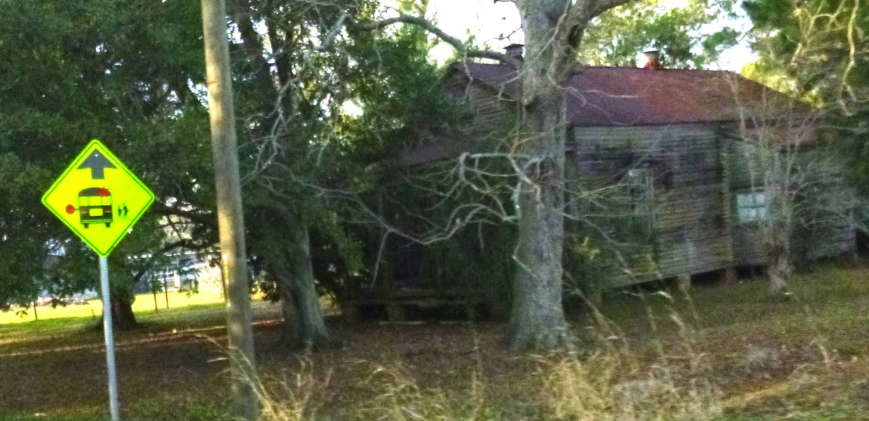
I caught this house flying by. It seemed a bit unique.

I check on my old houses from time to time. This is one of them.
The Saints Headquarters have been moved to the backside of Jeanerette.
It is now boarded up, appropriately.

This may be my future. I wonder if hanging a license on it would work? That did it for many of my bikes.

Baywood, the most beautiful.


Santa was even there or was it Edgar Allen Poe making mischief, again?


A gear from the Baywood Mill. The mill had a railroad.
I found a curved trestle in the "back" via GE. I may one day visit it.


I once had a story about this cemetery.

Loiseil Plantation's stack is down a resident's driveway, across the bayou.
I wonder if his insurance covers "a fall".

These antenna pictures are for Mark. He collects them.

This one's better.
.jpg)
I was at the LSU Experimental Station.
Captured Alabama fans are dissected here.
Catching the coach will be the prize.
.jpg)
.jpg)
LSU Road is no more. It is being grown over. The bridge over the Teche is turned open. It is sad.
.jpg)
Another grand home.
.jpg)
Crossing the bridge off La.620.
.jpg)
.jpg)
Curving into east New Iberia.
.jpg)
I could not pass up this phenomenon over the cooling pond.
.jpg)
The new mill, "Cajun Sugar".
.jpg)
Complete with rail tug.
.jpg)
Old carts out to pasture.
.jpg)
Marshall's in St. Martinville.
.jpg)
.jpg)
Others out to pasture.
.jpg)
Stretching out toward St. John.
.jpg)
Once called "The Haunted Forest" because of the large oaks that stood guard over this place.
.jpg)
.jpg)
The classic St. John approach.
.jpg)
.jpg)
.jpg)
.jpg)
The big house featured in the Burke movie.
.jpg)
The store likewise featured.
.jpg)
.jpg)
The rails came through here.
.jpg)
Want to build an old time sugar mill?
You once could with the collection that was here.
.jpg)
The old plantation church.
.jpg)
Leaving St. John.
.jpg)
Nothing changes. I was again being pursued by a rabid 4 wheeler rider.
They'll even race old men on little putt putt motorcycles.
.jpg)
Kudos on the display. Scroll down, they have it covered.
.jpg)
These are taken at a distance while going 40.
The all important Nativity Scene.

Santa's Reindeer Stable (the garage)

Rudolph

Santa with a Sidecar. I swear I've met him.

Santa riding a 4 wheeler with a low tire. Very realistic.

Snoopy on a Scooter. (A Charlie Brown Christmas).

And Felix, who will beat you to a smudge if you mess with Santa.

That's it, Merry Christmas.
And remember, there really is a Felix.